EASTERN WASHINGTON
Summary
When the days plans headed sideways, we made the best out of it and selected a new route out via Jungle Hill. We had another full body workout hauling our packs through blowdowns along the way, albeit substantially less than our previous day in and with more frequent views.
Trail Stats
Mileage: 12.63 miles one way
Elevation Gain: 2,726 feet
Elevation Loss: 4,058
Toilet at trailhead: Sherman Pass TH
Sandwich Spots: Yes
Parking: Designated Lot
Mileage/EG from Garmin watch

Trail Details
Day two of our Kettle Crest venture did not go as planned. We shall call it the day of disappointment. We awoke, nice and cozy in our tent, to a misty wonderland at our Wapaloosie Junction campsite. Last nights colossal storm left everything well saturated. Including not only our tent, but our bear bag. Which was safely hanging in its tree as expected. Our backpacks were waterlogged as well. Gross. Dang me for failing to put the rainfly on my bag. It was so nice when we retired to the tent for the evening. Lesson learned (again), never trust the weather. Mother Nature will always surprise you. Read about day one, from the Sherman Pass trailhead to Wapaloosie junction here.

Doug walked over to the trail junction, where we had perfect 5G connectivity on our T-Mobile phones, to check the forecast. Maybe I should say he stomped over. Or at least stomped back. While we were not overly surprised with previous nights lightning show (it had been forecast, just earlier in the day than actually transpired) the next two days were supposed to be cooler but rain free. Then possible showers and thunderstorms the following day. Well. Forecasts can change. Instead there were once again afternoon thunderstorms forecast for today. Yeah. But the two days after looked pretty nice. Ok. We can do that.

We chatted and debated awhile on what to do. Do we forget our plans and simply day hike from our current setup? Or do we press on and head further down the Kettle Crest trail as planned? We planned a roughly 13 mile day today, with our next camp at the Ryan Cabin trailhead. Here there was a guaranteed creek for water filtering. Then we would retrace our steps the next day to this very campsite. After waffling back and forth a bit the decision was made. We would pack up and move on. The thunderstorm wasn’t a particular concern. We have dry clothes, mummy bags and our actual tent was fairly dry. The sodden rainfly was packed separately to keep the water away from our dry things. Our main concern came in the form of blowdowns. No way would we make 13 miles of constant navigation over, under and around as frequently occurring fallen trees as we had the day before. So we made a deal. We would press on. But if the blowdowns were horrendous, we would turn around and determine our next steps.

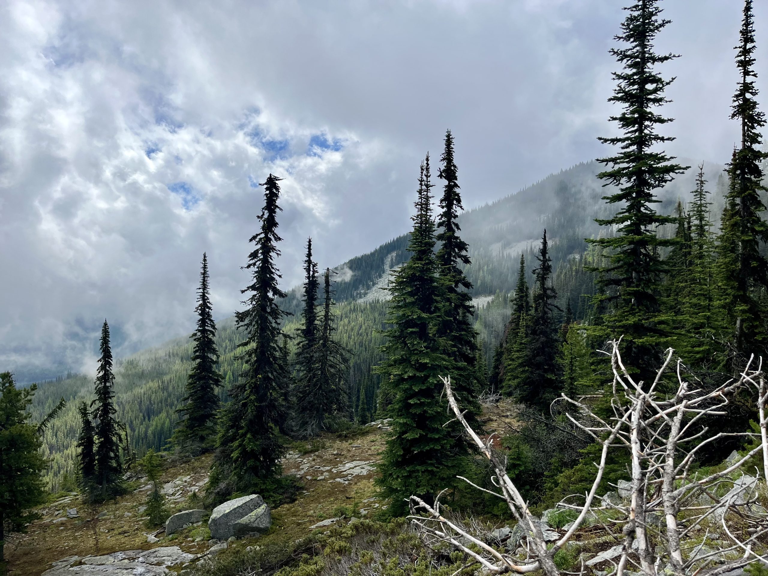
Plan in mind, we were off, soaking packs and all. Heading beyond the Wapaloosie Trail junction, the path takes you immediately into the trees. Granted, they looked pretty magical partially obscured in the mists. So pretty. Very shortly, the trail heads downhill. There were a few remaining patches of snow back here. The trail begins to switchback down the hillside.

There are large boulders along the path when the trail bottoms out before once again heading up. Where you’ll walk up and down and up and down small hills for a bit. There’s a large rock field, partially obscured by trees that we passed under. Along the trail there are quite a few giant rock slabs.

Heading uphill we came across a great view spot. The trees thinned out on a rocky surface. The mists were beginning to fade and we could intermittently see the surrounding hills. Would be a great spot for a snack if we had been hungry.

Continuing on, we headed inland again. And at 1.75 miles past our campsite we gave up. The blowdown in front of us was immense. We had just circumnavigated another massive blowdown that had us off trail for quite a bit, picking our way through the seemingly endless tangle of downed trees and then finding the trail once again. Only to promptly be presented with a big old tree across our way. Looking beyond this tree we could see innumerable downed trees. This was our breaking point. This is where we admitted defeat and turned around, shoulders slumped and hearts heavy. No one likes it when your plans are turned upside down. Forget the weather, it was those insufferable trees that defeated us.

We did not bother counting blowdowns this day. What I did not mention while describing the path was all the blowdowns. Admittedly, we are not fast hikers. But it took us just under an hour to go about a mile. And that is insanely slow, even for us. Even with intermittent stops to breathe and look around. We are not that slow by any means.

With our metaphorical tail between our legs, we slogged back through the downed trees and headed back to our Wapaloosie camp site. Along the way we debated our options. Ultimately we decided to pack out and call the trip a relatively loss. To make it less disheartening, we decided on a different route back to the car. We would head down Jungle Hill trail and the subsequent connector trail to the Sherman Pass trailhead. Yesterday we had taken the Kettle Crest trail in. At least the scenery would be different. And we would not have to go thru the same blowdowns we did yesterday on our way in. We were willing to take the gamble that this new trail would be no worse, hopefully better.

Our Wapaloosie junction camp site was notably clearer when we passed through again. The mists were well on their way out. Headed down the trial, we’d passed through the prior day section until we reached the Jungle Hill Trail junction. There’s a great camp area here. Also, there’s a spring just past here if you need water. Granted, you’ll certainly need a water filter as this appears to be a popular watering hole for free range cows as well.

The Jungle Hill trail is remarkably lovely. We walked through sage brush dusted meadows offering up stunning views of the surrounding mountains. There would be more scenic views on this trail back than we had the prior day walking along the Kettle Crest trail. Granted, the trail is in a little rougher shape than the Kettle Crest. There are weeds and grasses intermittently growing in the trail on this upper area.

Soon we headed into the trees. The trail would mostly take us downhill from here. Sure enough there were blowdowns. Bummer that. We were a far cry from shocked. Nevertheless, we passed through with a sigh.

The hillside is interspersed with frequent meadows, a frequent reward for clambering around dead fall. We passed a stand of remarkably gigantic old growth trees. Their trunks were impressive, wider than my arms pan. They had massive branches with moss clinging to them. Gorgeous trees.

A little further down we did come across what we suspect is stinging nettle. Neither of us cared to test that theory out, but as we recently got into nettle on a different hike, we have been reacquainted with the plant. Keep an eye out for it.

There’s a shocking quantity of dead trees in this area. Subsequently, there are loads of downed trees. A few of the tangles of trees required walking more than a weave and bob. Some had us climbing the hillside to navigate around them, or balancing while walking down the fallen logs to hop over to the next and eventually back down to solid ground. A few times I could nearly not make it across. Doug has significantly longer legs than I do. Sometimes I found a completely different route thru.

At some point we stopped for lunch. Settled on a nice rocky outcropping with great views across the valley. There were lovely clumps of purple wildflowers all over the place. Lunch was a Mediterranean tuna and bean salad (prepackaged and shelf stable) that I’d found in a market. Not exactly light weight but better than a cliff bar for sure. There were plantain chips as well but we munched those while on the trail further down.

Switchbacks took us down a lovely meadow with killer views. We noted a copse of birch trees to the far side of the meadow. A military jet blasted over our heads. Minus the downfall, the hike was far better than the previous day.

Somewhere in here we hit the mother of all blowdowns. There were loads of trees in one giant scramble. Beyond this massive tangle we could glimpse another, just as bad. Here we said forget it. Headed straight down the hillside like Billy goats. We’d come across the trail eventually, and if not, we had GPS to guide us back toward the official path. Our path was much more pleasant, albeit significantly steeper, as we headed straight down. We did come across the trail without any trouble. Ran smack into it.

Back on the real path we switchbacked through the forest. I’d say a “light” forest in that it was not densely tree’d. Noted quite a few piles of moose poop up here.

Then we hit a miracle. We noted downed trees seemed to be freshly sawn through. There were significantly less downed obstacles in the path. New(ish) piles of sawdust next to the cleared path. Hallelujah! A work party had made it up to this point in somewhat recent past. No idea when. From here on there were minimal downed trees to cross. I suspect there will always be downed trees out here. There are so many dead ones in the area. Even if a work party cleared the trail of blowdowns, more would surely fall the next windy day. So. Expect downed trees. But less through that lower section of trail. Which was blissful!

Theres a nice flat section through the woods to enjoy before the trail took us down a ridge. Or spine, whatever it’s called. As we walked we began to hear water. On BOTH sides of us. The trail descends at a steep grade here. At the bottom, sure enough, there were creeks on both sides of this steep spine. It would make for a remarkable water filtering spot if needed.

Around here the trail splits. To the left is the trail to the Jungle Hill trailhead. To the right is the Sherman Pass trail, which would take us back up to the Sherman Pass trailhead we began at the day prior.

There is a temporary set up here at the base of that hill. Horses and livestock cross directly through the creek to the left (north). Foot traffic continues down the path between the creeks to a small footbridge across the left (north) creek. The bridge is set just before these creeks merge into one. Once we crossed over, we were greeted with a sign. Only 3.9 more miles to our destination, the trailhead at Sherman Pass.

Within a few paces the trail once again crosses over the creek. This time in the form of a substantial bridge, that’s apparently suitable for live stock, judging by the horse droppings we dodged while crossing. We’ve never been so relieved to see horse deposits before. If horses came through, then surely someone must have cleared the trail of down fall.

The path loosely follows the creek for a while. In here it began to drizzle on us. Reminded us of hiking in Seattle between the rain and the ferns through this section. We did not bother with our rain jackets.

Shortly the trail splits once again. To the left is the Albian Hill Snowpark. Stay right to keep on the Sherman Pass trail. We could see HWY 20 in the distance. In very short time, we climbed significantly higher than the HWY. Around here it began to rain in earnest. The clouds were heavy and dark, though ironically we could see light and clear skies in the distance. No help to us. As we were walking up plenty of switchbacks, meaning we were plenty warm, we still declined to don our jackets. Nothing like being cooled down by steady rain. It rained hard enough to run down my face and drip off the brim of Doug’s hat. And there was lightning and thunder. Apparently today’s storm was early. On the upward slog we passed over two small creek crossings.

Once we reached the top of the hill the trail flattened out for a minute. Then it was switchbacking downhill with a couple creek crossings. One crossing I misjudged and water logged my boot. Whoops. Had a nice squelching quality to my gait pattern from here out. Meh. Not much further left in the trail and I had packed fresh dry clothes and shoes for the both of us in the car. Thus not caring about a rain jacket I suppose. Plus, the rain had dimmed to a slight sprinkling.

The trail dumped us out at a power line trail. At this point the rain fully stopped and the skies began to clear. There’s a rather unhelpful sign that says “trail” with no indication of where to go. Granted, we had to go UP to Sherman Pass so the only logical way was in fact up. So up we went, and a rather steep up in parts I might add. The road for the power-lines is gravel and does not directly follow under the lines. That would be a remarkably steep climb.

After a little while we noted a trail off to the left. It was not signed at all so we passed without much thought. Until the road we were on turned shortly after and headed into the trees in the wrong direction of where we knew the parking lot to be. Whoops. Back down to the unmarked offshoot trail.

This was in fact the correct trail. It will feel like it’s taking you the wrong way. Stick with it. You’ll climb around a hill and wander around it for a bit before it changes course and straight lines you toward the trail head. Shortly before the trailhead you’ll connect with the Kettle Crest South trail. Bear right for the parking lot, which is only a few steps further. And then nice clean clothes at the car. Granted, by now we were barely damp, the joys of proper quick drying hiking clothes.

While the day did not go anywhere near expected and we were disappointed with choosing to cut our backpacking trip short, we did enjoy the day’s hike. Both of us preferred the Jungle Hill trail as opposed to the previous day’s Kettle Crest jaunt. The views are more open and frequent along Jungle Hill. Plus, quite a bit of the lower trail has been cleared out of downed trees, making the walk significantly more enjoyable. If we ever venture out here again, we will likely begin at the Jungle Hill trailhead and skip the Sherman Pass connector trail. There was nothing remarkable there, it’s simply a connector trail. That being said, we were grateful for an alternate route back to our vehicle. My biggest recommendation would be to only hike through here AFTER a clearing crew has been out. Otherwise expect slow progress and unrelenting downfall. Which gets really old and tiring after about 50 for the record. Oh well. Better luck next time. We had a few hours to alternate between pouting and dissecting the trail on our drive home. If it had simply been the less than ideal weather we would have stayed out there. Those downed trees were our Kryptonite and defeated us this time.

Good news, I’d packed us popcorn for the return drive. And we love popcorn, so at least our tastebuds were delighted. Popcorn will uplift your mood. So will taking off your drenched shoes and peeling off those wet socks. Both things are great. Always have a good snack in the car waiting for you. And different shoes. Wet or not, it’s refreshing NOT being in your hiking shoes after any hike, let alone a few days.



Leave a Reply