WESTERN MONTANA
Summary
Stunning views award the trekker on this gorgeous hike in Glacier National Park. View three drainages, surrounding mountains peaks, glaciers and, frequently, mountain goats or sheep.
Trail Stats
Mileage: 10.3 miles one way
Elevation Gain: 2,480 feet
Toilet at trailhead: No
Sandwich Spots: Yes
Parking: Designated Lot/Shuttle system
Mileage/EG from Garmin watch

Trail Details
If you’ve never experienced the jaw dropping wonderment of Glacier National Park, you should. Especially if the great outdoors is your happy place. Just be prepared for the frustration that comes with Glacier. Permits that are difficult to obtain and parking lots that fill by 6:30 am. If you can put these trying inconveniences aside, the park is sure to impress.

I’ve done this hike twice. First with a group of girls and the second time with Doug. I completely forgot the first experience until I saw the entry and exit points. Then it slowly dawned upon my addled brain that, hey, I’ve done this before. Sadly, it was as I hiked that crystal clear memories of what lay ahead returned. Kind of like spoiling a surprise really. I knew the little things. Where the hillside was covered in wild chives, where there likely would be mountain goats (there were), where the only good spot to dive off the trail to relieve a full bladder was. I was correct. One side of the trail is REALLY exposed. Hardly any vegetation tall enough to hide behind. While I’m not shy, I’m not an exhibitionist. I prefer discretion to mooning the entire hillside. That aside, do remember to be responsible on the trail. If you must relieve your bladder, remember to pick up any toilet paper. I use a pee cloth that attaches to my bag. They’re reusable and beat drip drying, carrying paper out or hoping a leaf is clean. Great investment.

Back to the hike. This one is intended as a one way trail with either two cars, one at each end, or utilizing the shuttle system. Don’t be the two car guy. Parking is precious in Glacier. As shuttles are often full now, Doug and I decided to park at our exit point, Sunrift Gorge, and take the shuttle back up to Siyeh Bend. Both roadside “lots” are small. There are no toilets of any sort. BIG disappointment there.


To get a parking spot, we left our campground along Lake McDonald a little after 6:00am. The drive was well over an hour. While there were plenty of parking spots available on our arrival, the lot was maxed out within 20 minutes. After arrival it’s a waiting game. As in the first shuttle isn’t slated to run past until about 8:25am. Lame. But wait we did. In the sun. So nice and warm. The east side shuttle runs every 30-45 minutes.

Once the shuttle dropped us off at Siyeh Bend, it was finally time to hit the trail. You’ll hop onto the trail for Piegan Pass. It’s well marked, starts off by Siyeh creek and quickly diverts into the trees. There’s about a 2 mile walk through said trees. Intermittent views of the surrounding peaks provide something to look at as the trail slowly winds its way uphill. There are gorgeous meadows higher up. Wildflowers speckled the fields as Doug and I made our way through. A few determined mosquitoes and biting flies provided enough motivation to keep us moving. Luckily, they were manageable with movement and didn’t require bug spray or swinging my arms around like a crazed mad woman.

The trail splits a few times, but in all cases, was well marked. For a bit, you’ll walk along the Continental Divide trail.


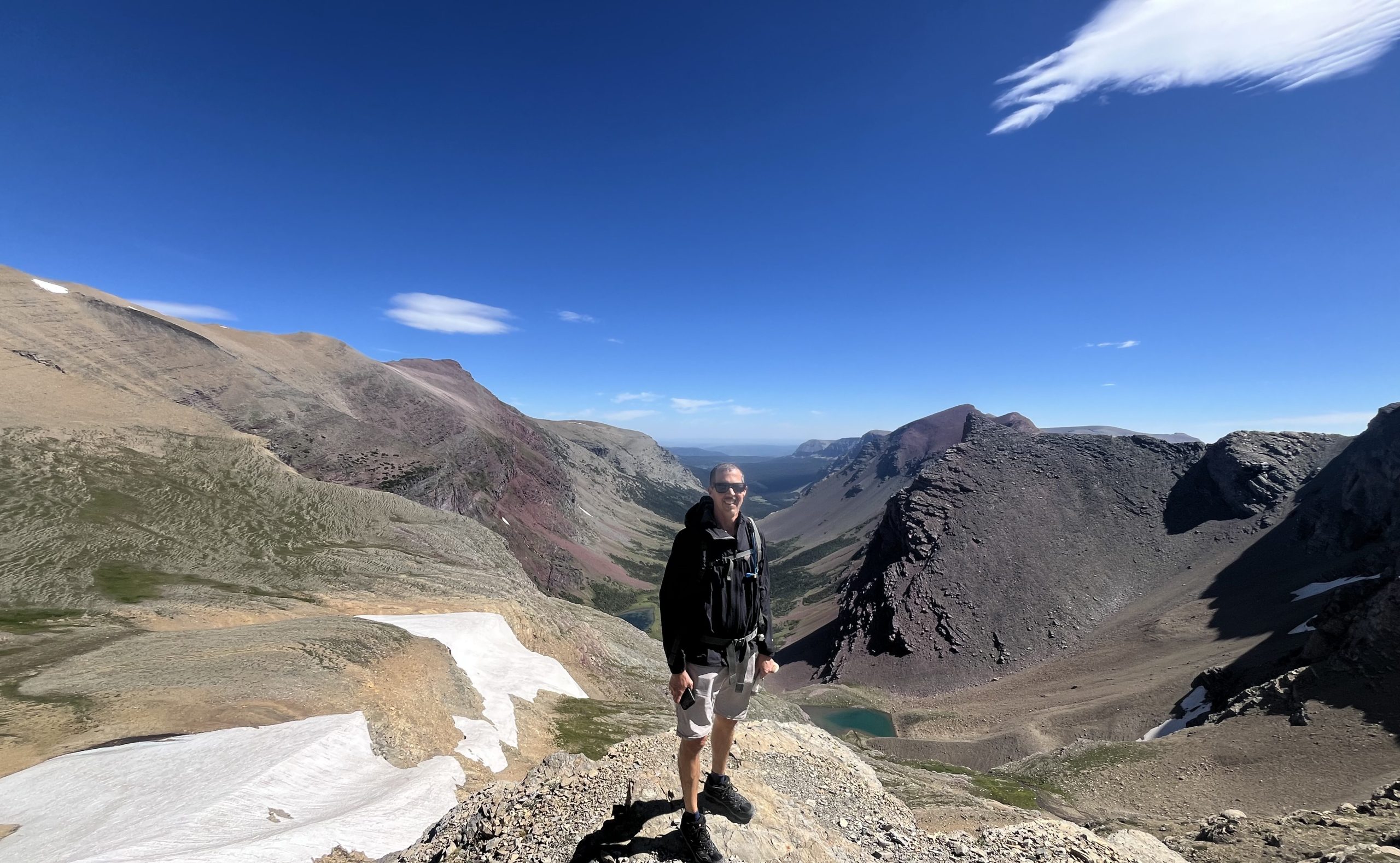
After a bit, the trail gradually curves and you’ll begin hiking up the drainage nestled between Mt Siyeh to the left and Matahpi Peak to the right. Make sure to look behind yourself occasionally, the views are stupendous. There are seasonal “lakes and ponds” along the wash, which quickly fall below you. Here’s where the elevation gain ramps up. You’ll climb up a rocky trail with switchbacks along the slopes of Matahpi Peak. Heading in an upward slog. This is one of those trails that can trick you. It will look as if you’re nearly to the pass only to find out, you are not. False hope. But, at what feels like it should be the top, there is a trail of sorts where you can take the short diversion to a snow field. The first time up, we did stop here. To play in the snow a bit and catch our breaths. Doug chose to slog on. The part from here to the pass seems to be the steepest. And this time it was exceptionally windy. As in so windy, when walking directly into it, it would steal my breath. And when it was pushing you, it felt like a blanket wrapping around my head. Not so fun. Makes it difficult to gasp for breath.

I have repeatedly been warned of bears up here. I have not seen a bear, but certainly seen scat. There are bears. Duh, it’s Glacier. I would imagine the bears want nothing to do with the quantity of people hiking up there. Nevertheless, be smart and aware. I have certainly seen Grizzlies miles out on a hike in Glacier. Mama bear had two cubs. No thanks on that. She got the lakeside picnic spot and I got the heck outta there.

Eventually you’ll round a mini corner and boom. Here’s the pass. Approaching it is a fairly wide ledge with a mighty drop off into oblivion below. Was not windy in this brief section, but immediately after the wind returned. Up here, you are rewarded with spectacular views of another drainage. Steep cliff sides decorate this one.

Doug and I chose to have lunch perched on a boulder up here. No fancy sandwiches this day. It was the last day of camping and we were down to the dredges of the cooler. But, when you’re hungry, even a boring sandwich becomes palatable.

Moving on, there’s a rock pile which I assume marks the official pass. Two marmots were busy licking rocks here. Maybe they were after minerals? Cute little fellows.

As the trail winds around, the third drainage becomes visible. You’re headed out this way, so views of this one last the remainder of the hike, more or less. Soak it in but no need to obsess. You have 5 miles of downhill to absorb its splendor. Most of the 3,632 feet of descent is completed in these 5 remaining miles.

To the right, the Sexton Glacier becomes visible. There appears to be a makeshift trail heading over to the glacier. As we were on a timeline (5+ hour drive ahead of us) we passed on this opportunity. Maybe next time.


This side of the pass is dubbed the Barring Creek side. There are frequently mountain goats and sheep here. Both times I saw goats. The last time there was a herd of them happily situated in the middle of the switchbacking trail. Had to go off course a tad to get around them without bothering them too much. I don’t need to add getting horned by an overprotective mama goat to my list of hiking mishaps. Her baby was ADORABLE though. Fuzzy little guy.

As I mentioned before, this Barring Creek side of the pass is mostly exposed. Not a lot of tall vegetation. There are however a lot of wildflowers, dependent on the season. And wild chives. A hillside of chives. They smell so good!

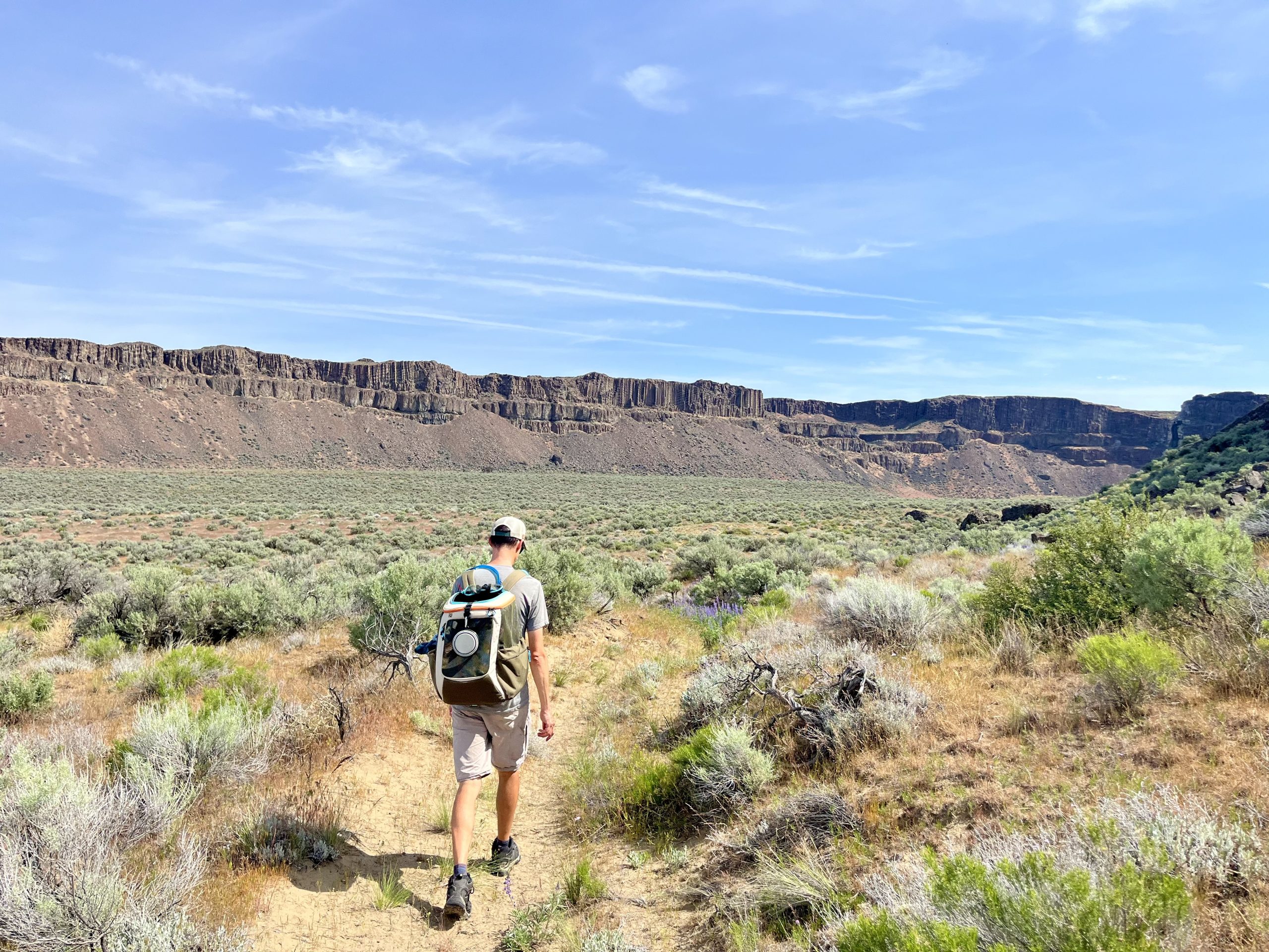
There’s a short stretch of stunted tree’s further down. This is the best coverage for the remainder of the trail, FYI. After this, you can see the trail. For what looks like eternity along the side of the aptly named Goat mountain. This last time it was made the more interesting by quite strong winds. As in I was leaning into the hillside to avoid being blown all over the trail. Quite entertaining actually.

Do remember to look behind you again. You’ll see the pass and Sexton Glacier above. Waterfalls are abundant across the valley and even impressed me. And I’m not a waterfall person. My preferences solidly lean towards peaks and alpine lakes. Doug loves a good waterfall. And these did not disappoint.

As we head downhill there are two sections of what I’ll call skeleton trees. I presume a fire or two wiped them out quite a while ago. The first section contains those stunted high elevation “trees” that look as if they were desperately clinging to the hillside. Trunks and branches were in more of a lateral trajectory as opposed to the standard vertical. Not surprising with that crazy wind. Our poor wind burnt lips and noses.

Between the dead tree sections, the trail dives downhill through a small switchbacking section. Here, Doug got all excited seeing movement below! Bears for sure! Or two backpackers slogging steadily upward on the trail below. Ah well. Could have been bears. There were loads of ripe huckleberries in this section. We passed a group of fellow hikers who were delightedly sampling those delectable bites. With a lot of enthusiasm. They were so happy. As a side note, quite a bit of berry filled bear scat was around the trail in this section. At some point, there was a very delighted bear munching its way through the bushes.

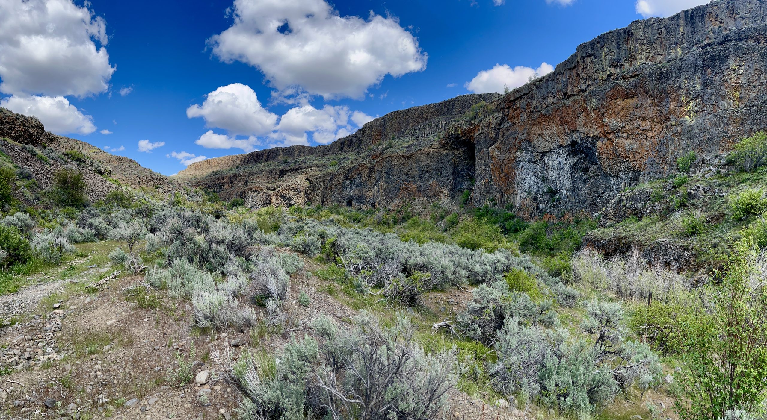
The second set of dead tree’s are more vertical. It does provide an interesting perspective looking through their remains. Eventually, Saint Mary Lake comes into view. You’re getting close now. The trail takes you through Sunrift Gorge, which is quite pretty but in comparison to what we’d seen along the trail is not as worthy of awe. At least to my thinking.


In the distance, past the far end of Saint Mary Lake, Virginia Falls is visible. More importantly, the road and parking soon come into view. Doug and I were quite pleased to see our vehicle and not wait in line for the shuttle. There were about half a dozen people waiting in the now baking sun. The first time I hiked this, we took the shuttle back up to Siyeh Bend without any trouble. And back then the shuttles were not nearly as packed. And one could still find parking at normal times of the day. Funny what a change a few years makes.

If you have the time and desire, Siyeh Pass is well worth the effort. Providing views of three separate drainages, glaciers, waterfalls and lakes, this one has something for nearly everyone. Just remember your sunscreen and the snacks!


Leave a Reply