SOUTHERN SPAIN
Summary
Our return hike after a pleasant overnight stay in Frigiliana provided sights of the surrounding valleys and into the Parque Natural Sierras de Tejeda, Almijara y Alhama. We traversed the high route out and were rewarded with relative solitude and ample panoramic views.
Trail Stats
Mileage: 10.5 miles one way
Elevation Gain: 3,484 feet
Toilet at trailhead: No
Sandwich Spots: Yes
Parking: In Frigiliana Parking Lots
Mileage/EG from Garmin watch

Trail Details
Waking up in a small Spanish town is a delight. As the sun steadily lightened the sky, we sipped our coffee, downed a gallon of water and packed up for our return hike to the Nerja caves. Not much to pack as we really only lugged in a change of clothes, basic toiletries and some snacks the day prior. All around us, the town slowly came to life. A rooster crowed. A motorcycle zipped past. People began walking by. Voices drifted upward to our rented loft. Someone stopped to lean against a building and smoke a cigarette. Eww. Could have done without that one.

Fuel For The Road
Needing a bite to eat prior to hitting the trail we walked over to La Bocateria de Nuria, which is located at the far North of town. This is a one woman sandwich shop that greatly deserves the high stars she’s received on Google reviews. Arriving to the small shop, we were relieved to find indoor seating. Because, dang it, the wind had picked up again and was howling through town. Selected a corner table, furthest away from the door to avoid any encounters with the breeze. Once seated in the cheery interior, the lady running the shop (I presume she’s Nuria herself) was quick to bring us menus and inquire what we’d like to drink, despite having a house full of local patrons as well. While she had a tempting array of coffees available we were good and opted for the better hydrating option, water. My heart wanted coffee. My body and mind reminded me that water was the better choice. Sigh.

After staring at the menu for a hot minute we selected identical breakfast toasts, whole wheat toast with avocado, tomato, a fried egg and paprika. To our delight, we were even able to order sandwiches to go. And she cut them in half for us. Even better!

Our breakfast toasts came out relatively quick and were very tasty. While I had envisioned tomato slices, we had a sort of tomato purée on our toasts that was quite delicious. I’m frequently surprised with dishes that arrive to our table in Spain versus what I visualized when I ordered the dish. Rarely disappointed, but frequently somewhat taken aback. We were very pleased with our selections here. For lunch we picked sandwiches that would travel best without refrigeration and withstand being shoved and squished in a pack. One mixed omelette sandwich and one Spanish tortilla omelette. I highly preferred the Spanish tortilla sandwich, though both were tasty.
Hit The Road Jack
Now ready to depart Frigiliana, we headed back to the trailhead for Nerja Cueva. We did not want to repeat the exact trail we’d just done the previous day, how boring would that be? We selected a partially varied route that would break off the main trail, the Gran Senda de Malaga, and would instead take us up the eastern mountainsides we’d seen the previous day. All in hopes of new views. Granted, with a load more elevation. Certainly it would be worth it.

To spare myself from describing a trail I just wrote about, I’m not going to detail the first part of the day’s hike. If you want to, read the Nerja Cueva to Frigiliana Via Gran Senda de Malaga post to learn about the trail. Except you’d be doing the trip backwards, up until reaching the point where you’ve circumnavigated the valley and are about to drop into the valley beyond. There was one significant difference to the trail. Both water crossings were quite a bit higher. I have no idea why the water levels were so elevated. Perhaps they let water out somewhere? To my knowledge it had not rained anywhere locally. The crossings were still not a problem, just had a noted variant in water levels as compared to the day prior. Also of note, is a bee colony off the trails near Frigiliana. There’s a clear warning sign. If you’re interested peak over the hill to see all the bee boxes, just keep a respectful distance.

Once you’ve arrived at the main trail junction, or crested the main ridge line following the last river crossing, there are options. While there are many choices, we narrowed it down to three. One: you may go right, to the western ridge lines. Here we’d crest a few peaks and eventually wind up a short distance from the Nerja caves. We’d have views into the valley we’d been circling all morning. Two: repeat the same path in on the Gran Senda de Malaga. Three: head up the eastern slopes of the mountains for potentially new views. We chose option three. Seemed a no brainer.

For The Sake Of A View
For this route, head down the other side on the large dirt road and when you come to the split in the road, continue straight instead of heading down to the right. This will take you toward Fuente del Esparto, which is a water fountain fed from a natural spring. Which looks like a water trough to me. When we passed, the spring seemed rather overzealous as water was cascading down the hillside and pouring down the road. Regardless, it makes for a convenient trail marker.


Further on, there’s a U-turn in the road. Leave the road and head up the dry creek bed, Barranco de la Coladilla, leading directly into the ravine. A short distance in, there’s a single track trail off to the right, which is (I believe) the Sendero de Tajo Baena. This will take you up toward the ridge line, the trail is frequently steep. The higher you climb, the better the views back into the park. More peaks slowly come into sight. You’ll climb significantly higher than the main junction on the opposing western ridge.

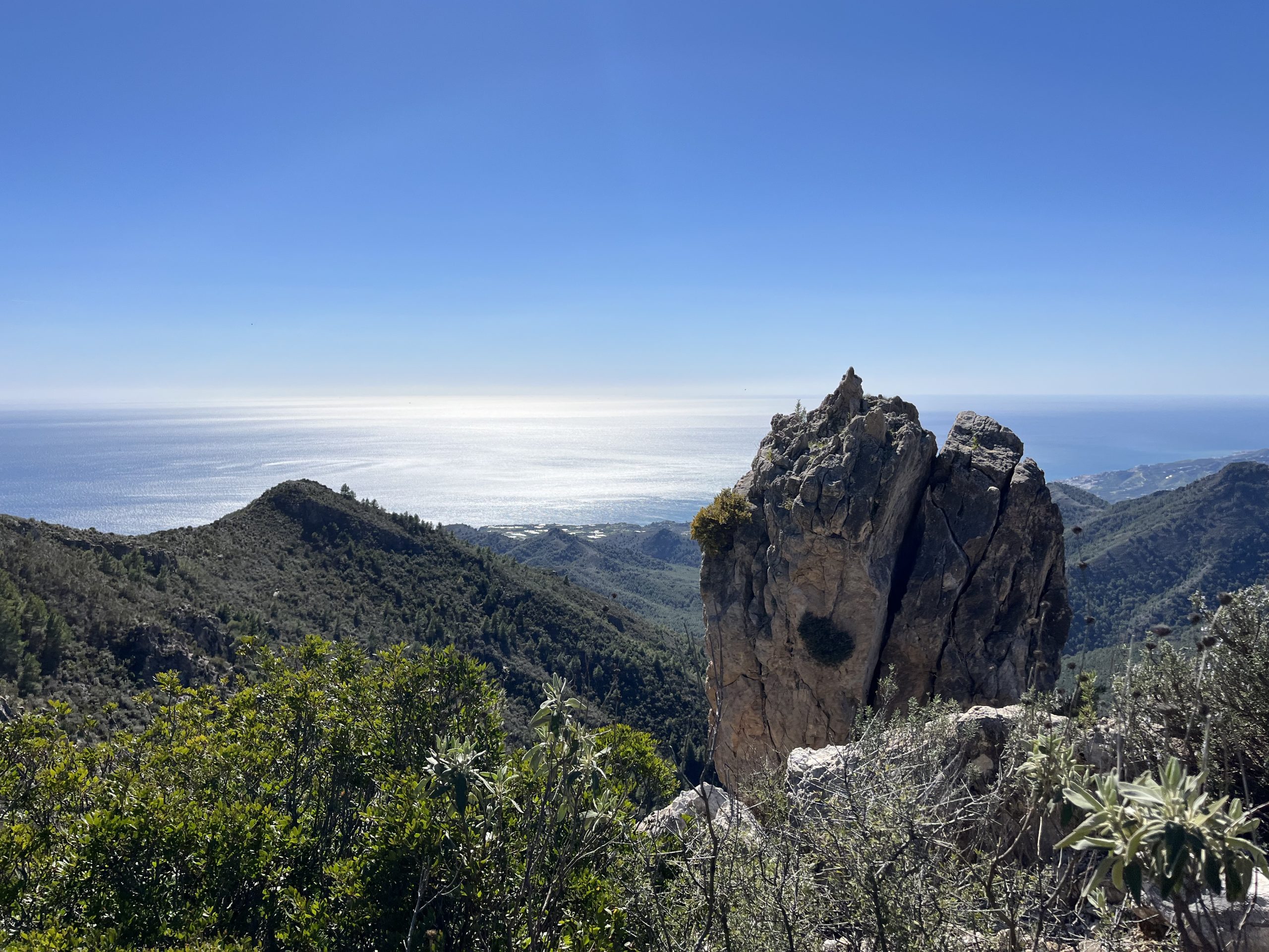
After huffing and puffing our way up, we finally hit the top of the first summit. This one has a predominant rocky outcropping. While beautiful, it did not provide a great spot to sit and eat our sandwiches. The rocks were jagged and if you sat, you’d be below the bushes and unable to gaze out. As we were not yet famished we decided to keep trekking onward, ever in search of that perfect sandwich spot.

A tad down the path we settled for a rocky perch with a stunning outlook. We could see that rocky outcropping we’d just passed, the opposing ridge line and beyond, as well as the sea. Absolutely lovely! Perfect for dreamily surveying our surrounding while munching on those bocadillos.

Back To The Grind
The only marring factor to our peaceful lunch was a deadline. We had a bus to catch at the Nerja caves. One we could not miss. And there was quite a distance between us and that bus. So, after a seemingly short respite, it was back to the trail.

Walking the ridges was amazing at first. There were frequent segments where rosemary bushes as tall as my hip lined the path. These plants were massive. The sights were gorgeous. Zero complaints there. But that clock, ever ticking down was the problem. That combined with a rugged, rock strewn path that made our ankles wobble to and fro like a Hawaiian dashboard hula doll on a bumpy road. With a trail that perpetually sank and rose with every hill and a path that ebbed and flowed. Meaning sometimes it was obvious and sometimes you were trying to follow random blue dots painted in seemingly haphazard locations. Generally on rocks. All making it rather difficult to hustle at all. Naturally, we saw a Spanish family hoofing it uphill. Baby carrier on his back. Pack on hers. At breakneck speed. Without looking remotely bothered at all. Spain will keep you humble for sure. These people will always put me to shame. Good on them.

We came to an outcropping that did leave us a mite bewildered. The trail seemed to drop to the left. Our map showed heading to the right. Were we supposed to climb up and over? Through? Down and around? It was a head scratcher. Doug stared at the GPS. I went cave girl style and climbed up. Rather peevishly I might add. I did not want to navigate that rocky spine. But I also did not want to head down the wrong trail and have to turn tail and walk back up. Both options were annoying. I did billy goat myself up there. Couldn’t see an obvious trail and pushed on a bit. Doug figured it out. We’d somehow missed a slight turn. The trail was indeed below the rocky outcropping, just on the other side. Well. Fine then. That is much better. Just had to billy goat myself back down. Why is going down so much more difficult? Rhetorical question there. Both of us were much more pleased to be on the correct trail again.

And It Goes On And On
There comes a point in nearly every hike I’ve done, where I’m simply done. Completely over it. On this particular day, after an uncontrolled downhill slide on yet more loose rocks, I was at that point. This was no longer fun. I do believe, had we not had the overhanging stress of having to be out by a certain time that it would have been the case. But, as I’m no sure footed Spaniard who can simply float over those blasted loose rocks without stumbling or sliding, having to hustle over them had lost it’s fun factor. Had we the time to saunter down, ponder our footing and sight see it would have been different. Turns out I’m not a fan of being rushed. Shocker. Turns out, neither is Doug. And he’s the patient one of the two of us.

After slipping and sliding along we came to a decision. No need to stress over the possibility of missing our bus. There was a diverting trail up ahead that would take us back down to the road we came in on. Was this lame? Yes. Did it make sense? Also yes. At this point our trail was getting progressively more faint. Looking ahead we could see all the hills we’d have to climb and descend and the ridge line slowly undulated down toward the Nerja caves. With different circumstances (ie a hotel or our own vehicle waiting for us at the end) we’d have kept to the spicy ridge trail. Instead we took the downhill path and saved our sanity. And ankles.

Both of us expected a straight downhill slip and slide experience on this connector path. We were pleasantly surprised with a moderate grade trail. And were conveniently delivered back to the road.

From here on out it was a simple walk down the road. Exciting? Not particularly. Saw a few mountain bikers headed to and fro. All with big happy smiles. People are just happy here. That’s part of the draw for me I suppose. Happy hiking, mostly happy working, casual happy chats all around. With the checker at the store, random person on the street, someone seated next to you on the bus or the bus driver themselves. It’s refreshing.
Even more happily, we made our bus. And with enough time to hit up the restrooms prior to hopping on board. We wound up next to a delightful couple from Canada. He’s a bee keeper. Fascinating couple. I liked them a lot. Found out there are bee keeper conventions. They’d been to one in New Orleans. Who knew? I adore bees and love honey so, they were fabulous company. Great couple to chat with and ended the day on a high note.

As for the hike itself, I loved it. Crystal clear water crossings, diverse scenery, drop dead views all in one package. Just make sure you have adequate time, especially if you move slowly (like me) on loose, crumbly surfaces. Otherwise, fantastic hike and I’d love to return to the area for more. Maybe with hiking poles next time.



Leave a Reply