WESTERN MONTANA
Summary
This extremely popular hike in Glacier National Park provides sweeping views of the parks valleys and peaks and is host to the infamous “Garden Wall” of Glacier.
Trail Stats
Mileage: miles 12.25 miles one way
Elevation Gain: 1,365 feet
Toilet at trailhead: Yes
Sandwich Spots: Yes
Parking: Designated Lot/shuttle system
Mileage/EG from Garmin watch
Trail Details
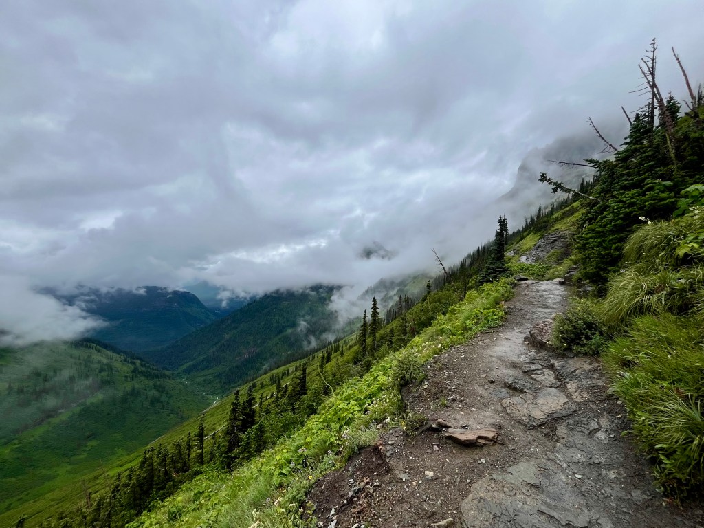
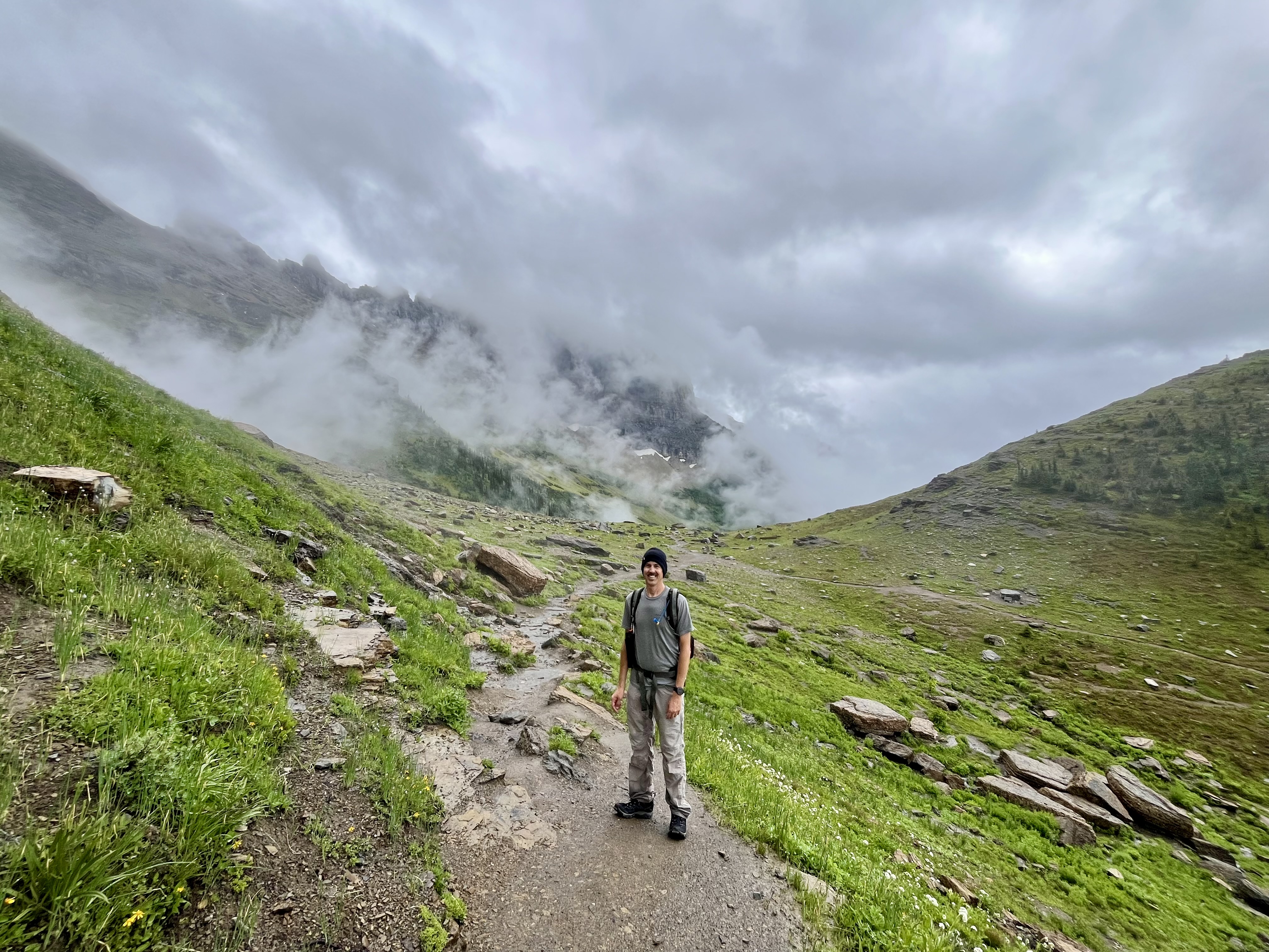
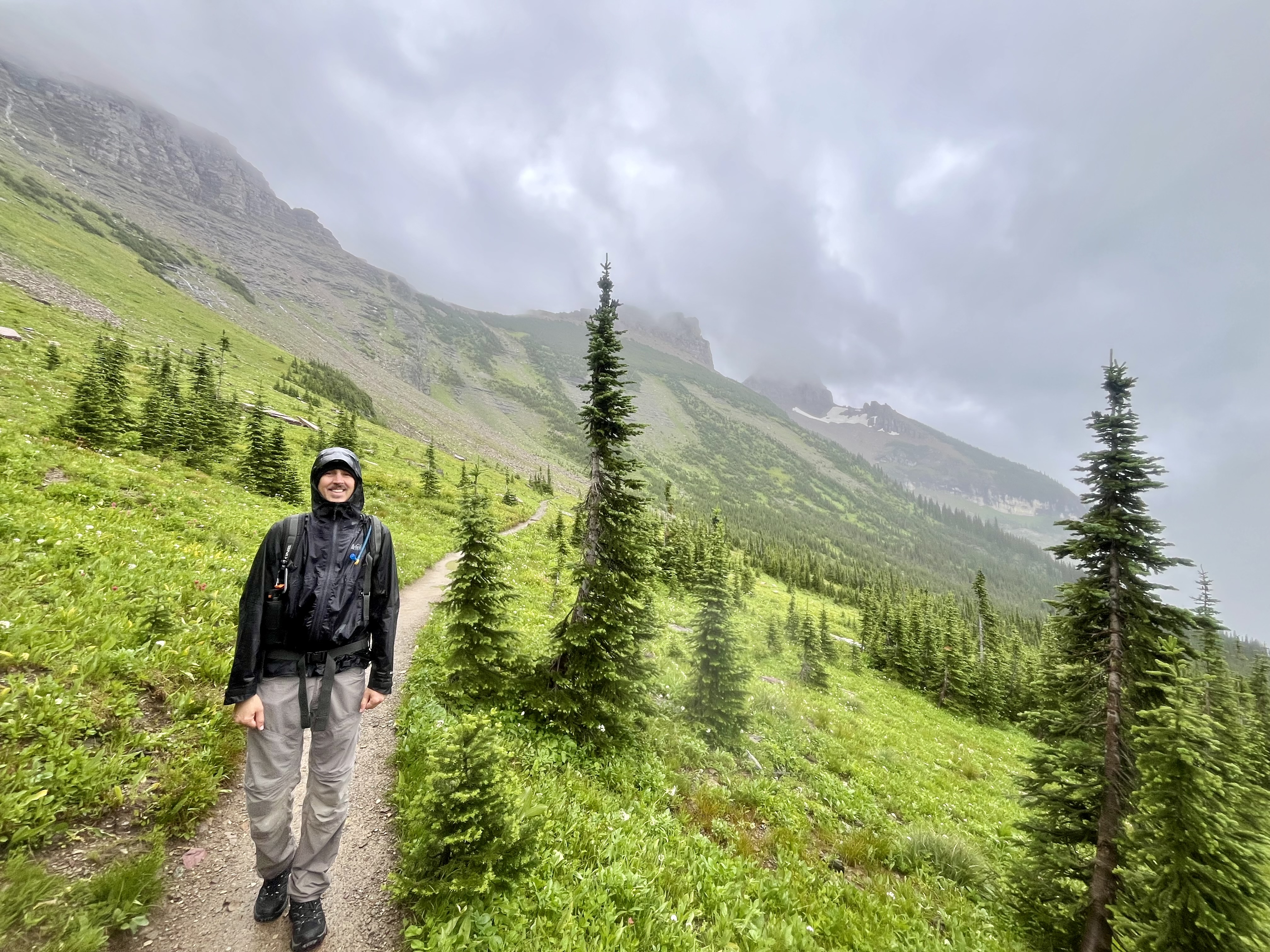
Whenever I’m asked what my favorite hike in Glacier is, Highline Trail always pops into my mind. Not to say it’s actually my favorite, that would take much more consideration. There are so many splendid trails to choose from. That being said, the trail is truly spectacular. On a clear day the wonders of Glacier are laid before you with every step you take. On a dreary dripping day, the park plays peek a boo through the mists with an occasional breathtaking visual reward. I’ve had both experiences. One sunny pristine day and one very chilly wet day. On the plus side, we had the trail mostly to ourselves and parking was easy on the rainy day.
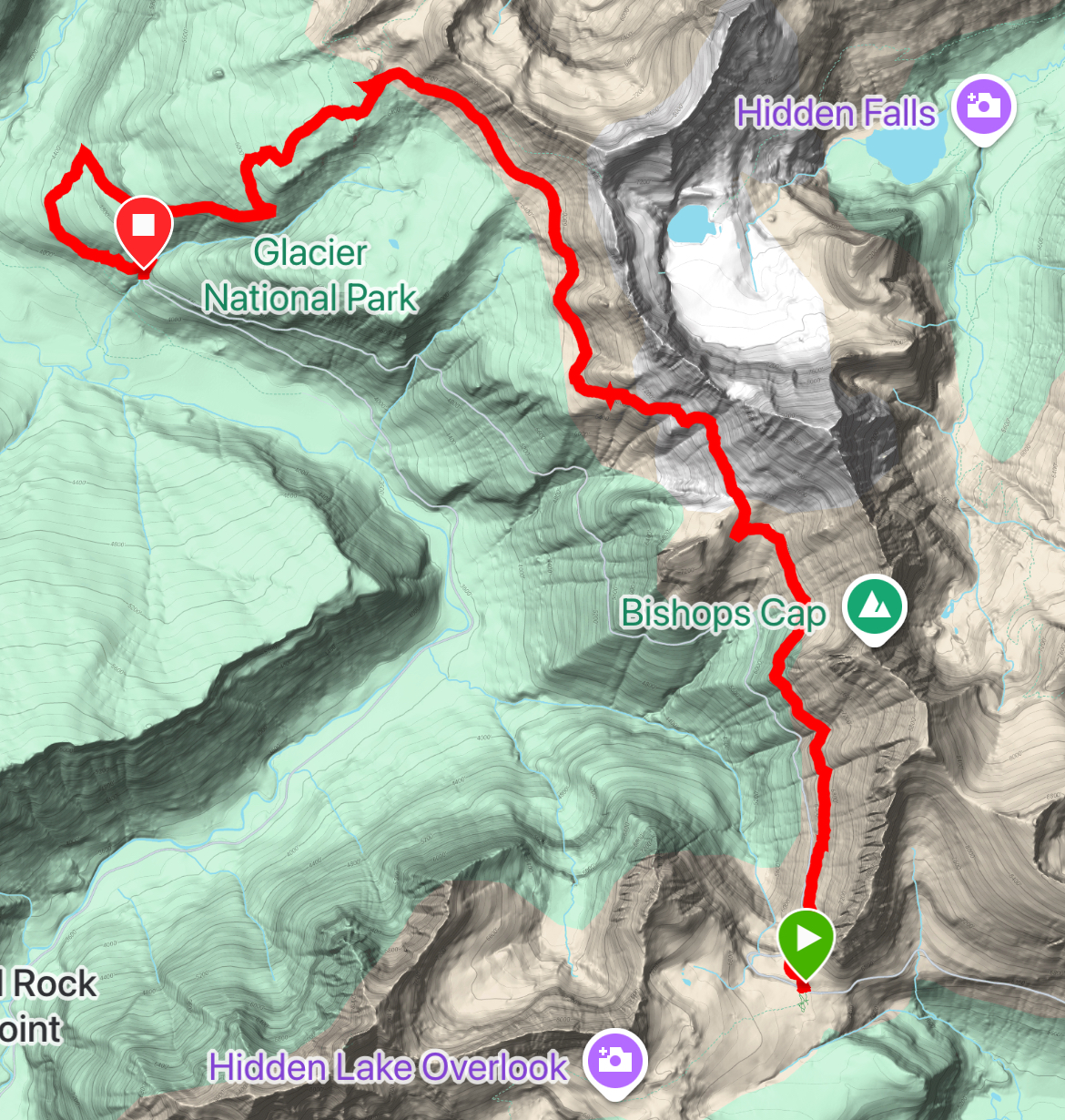
Highline trail is a 12 mile stretch between Logan Pass and “The Loop” on Going To The Sun Road. You may start at either location. Or, you can do part or all (if you’re crazy) and make it an out and back experience. Should you start from Logan Pass, the trail is moderately uphill, with 1,365 feet of gain, and quite a bit more downhill trekking (3,707 feet). Not surprising as “The Loop” is downhill from Logan Pass. If you prefer an uphill climb, start at “The Loop”. You will climb 3,707 feet up and 1,365 down. As a warning, getting onto a shuttle headed uphill can be a challenge. It’s often full. So, there is that to consider. Walking uphill might be better than watching 4 shuttles pass you by. Your call.
Both times I’ve completed this trail, we began at Logan Pass. Note the downhill preference there. Highline trail begins across the road from the main parking area. On a rainy day, it’s not that much of a problem to get a spot. On a nice day after about 6:30 am? Welcome to hell. Enjoy. At least you’ll have a long walk to blow off some steam.
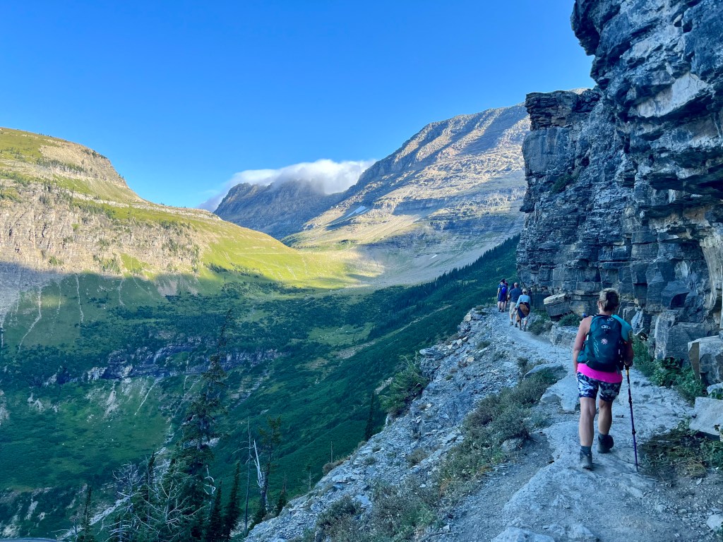
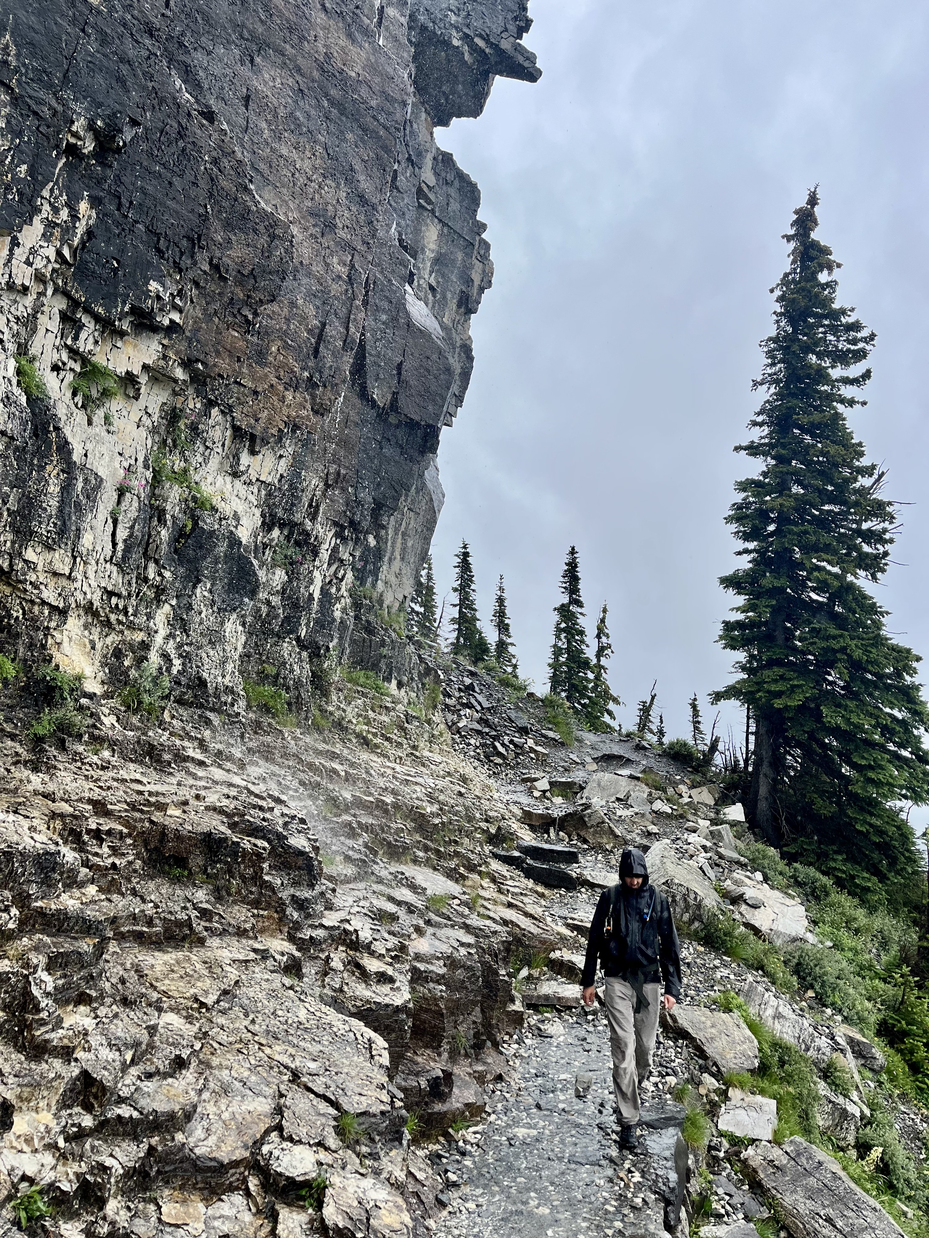
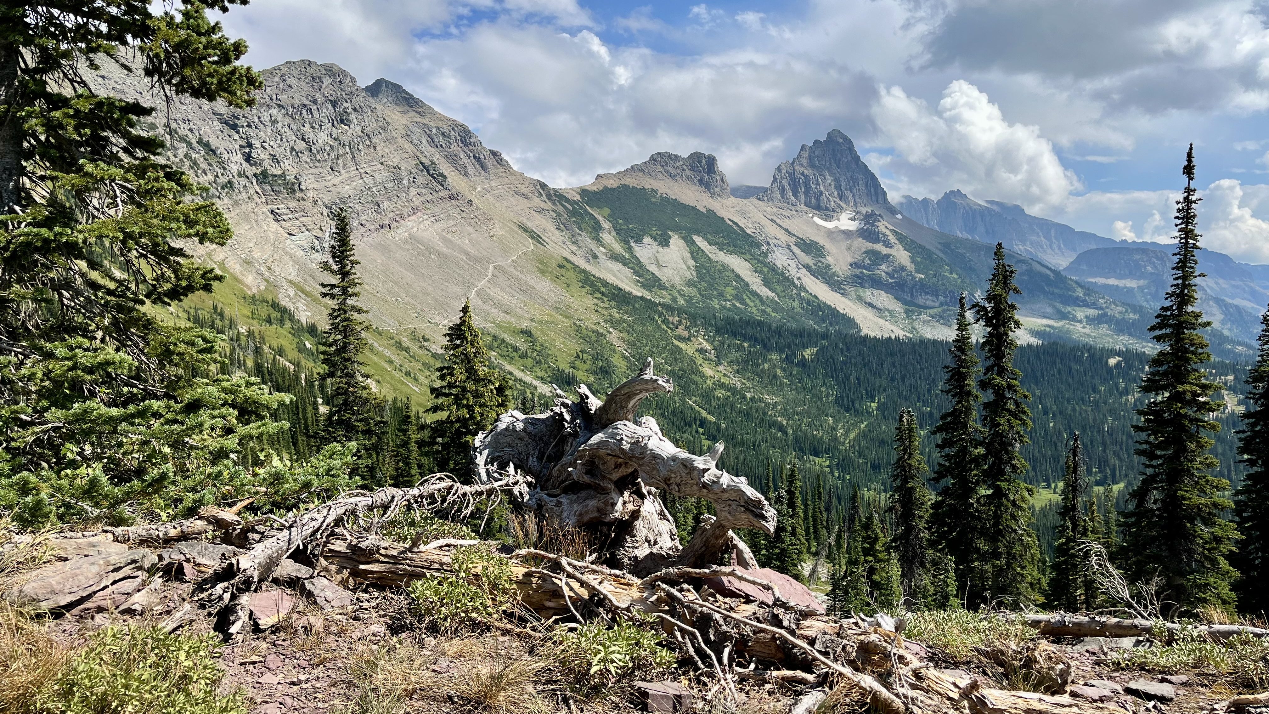
The trail dives down through some shrubs for less than a mile before you enter the most famed section of the Garden Wall. This divine walk has been carved (or rather blasted) out of the cliffside to provide us with a walkable shelf a hundred feet or so above the Going To The Sun Road. How amazing is that?!? For those with a fear of heights, yes, it’s quite a drop off. But there is a cable to hold onto, if needed, on the cliff side. There are zero railings. I like that about Glacier. They seem to have a general policy of, “just don’t be stupid.” There are minimal warnings. Except in how far away to stay from wild animals. A clue. WAAAY far back. Sometimes easier said than done.
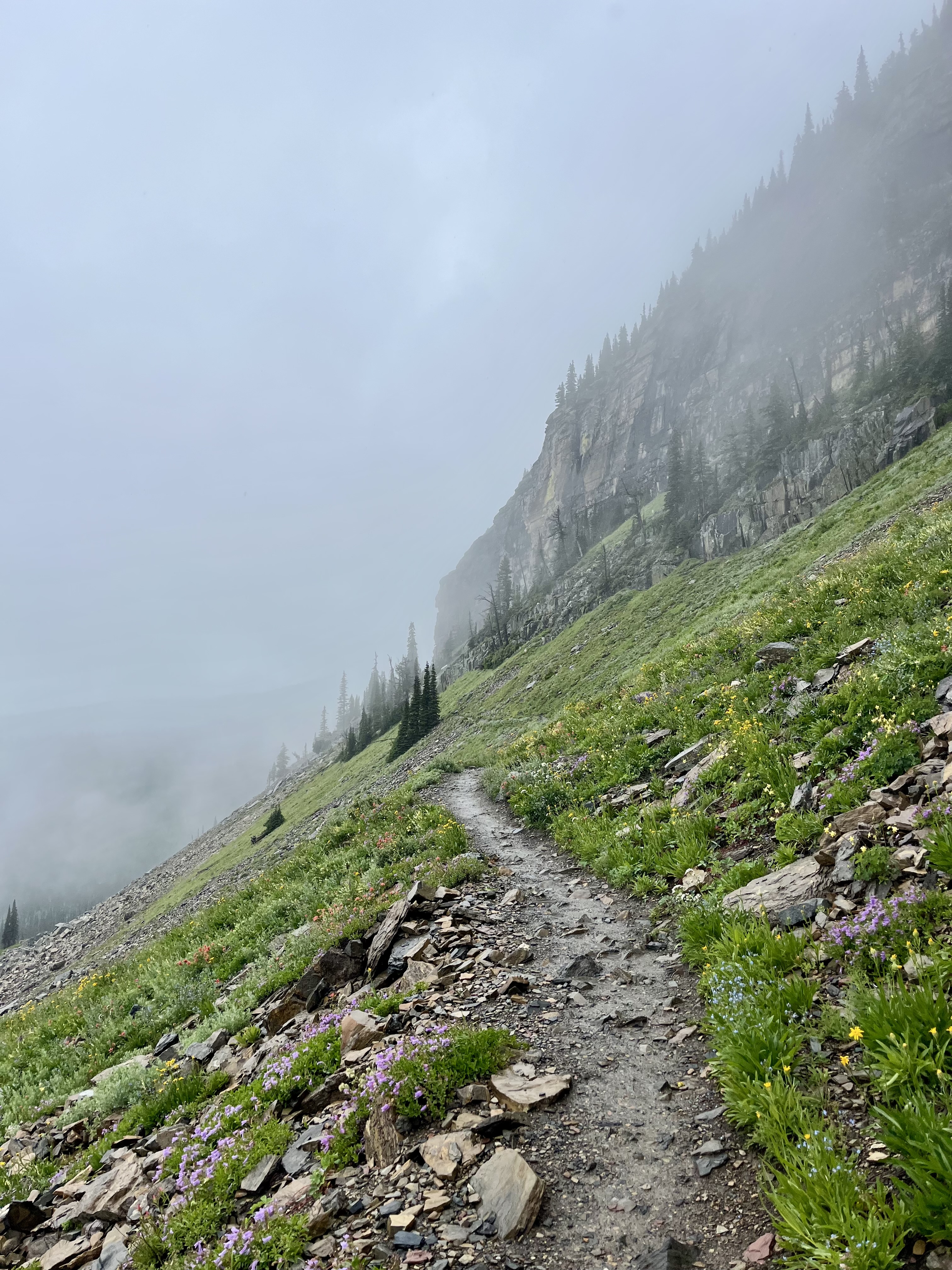
From here, the trail wraps through meadows and along the mountainside in a gradual climb. There are small creeks to cross. Most are passable with a little bit of rock hopping, should you desire to keep your shoes dry. Granted, if it has been raining these crossings are more frequent and the overall dampness of the trail will make it nearly impossible to maintain dry toes. Hopefully you’re wearing proper wool socks in this scenario. Much less miserable. Remember, cotton is rotten. It never dries and won’t keep you warm when wet. Wool is much better.
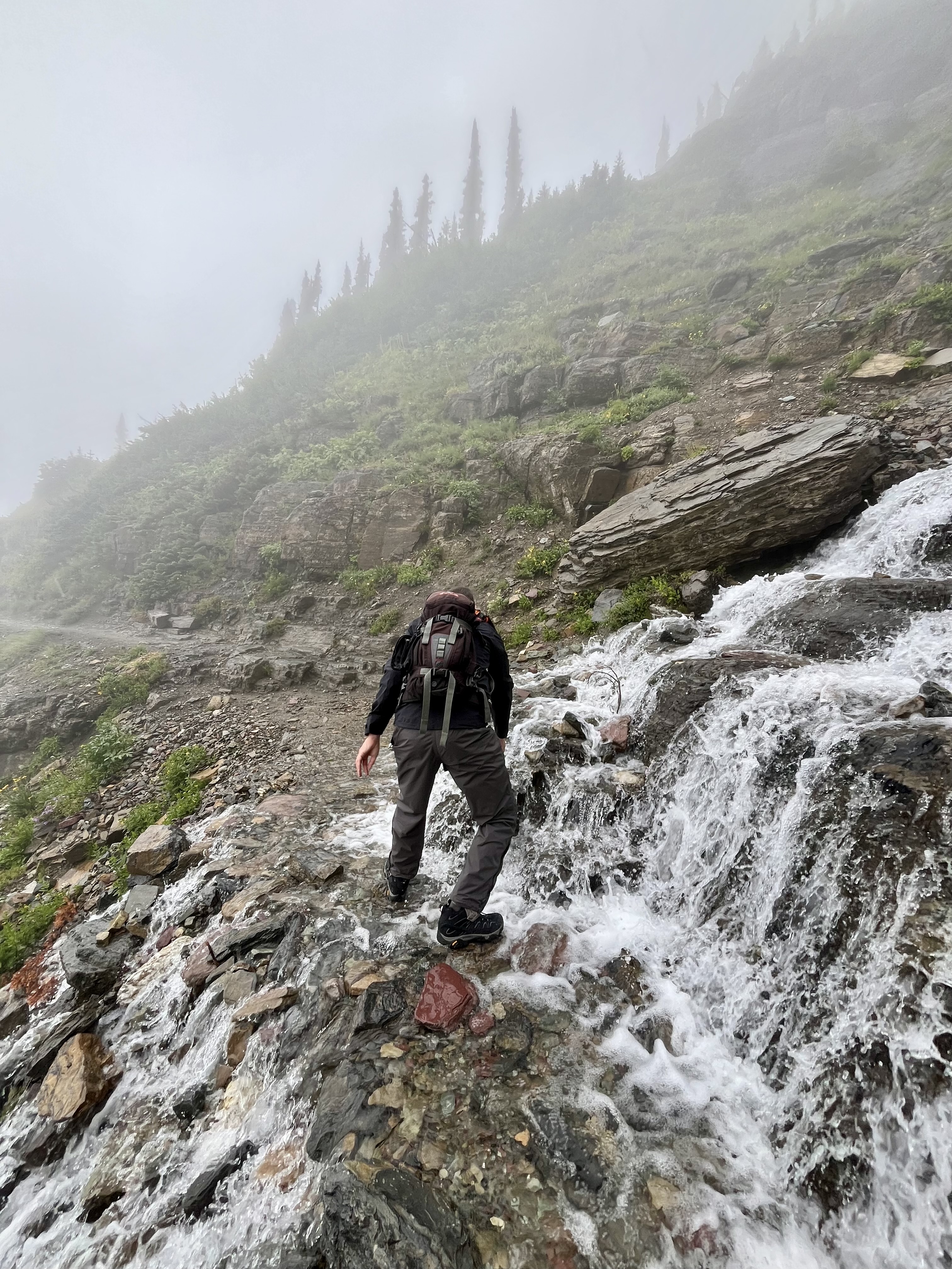
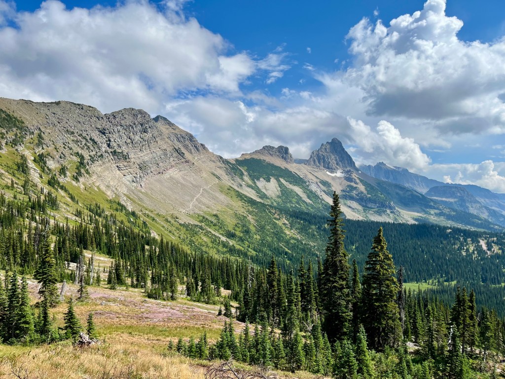
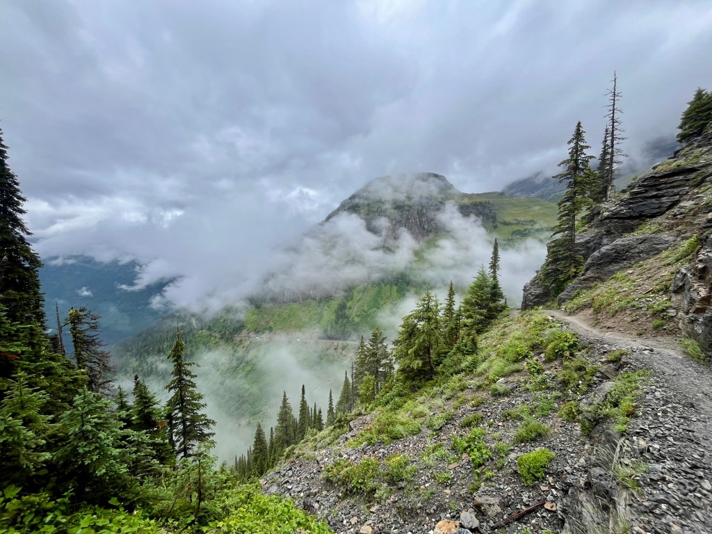
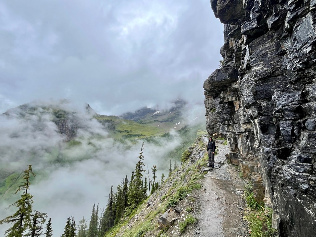
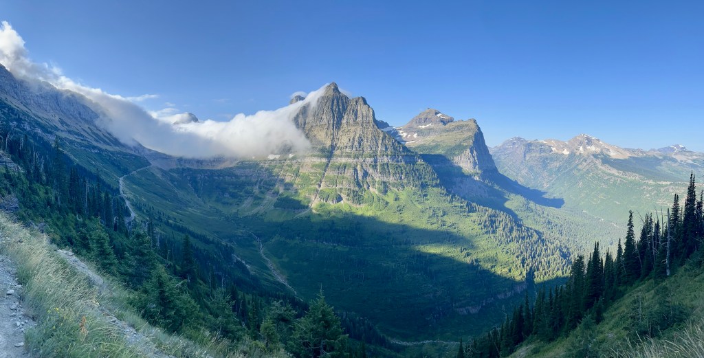
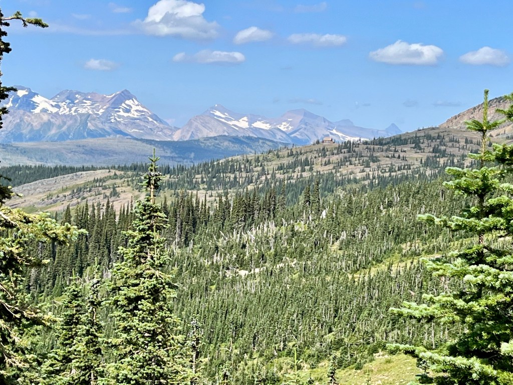
This section offers superb views of Logan and McDonald valleys, on a clear day. On a dreary day, reminiscent of our Seattle days, the surrounding peaks are mostly hidden with an occasional glimpse through the mists. Though it is fascinating to witness a hillside slowly fade away as the clouds rise up the mountainside. Something ethereal in its beauty and how the fog dances across the valleys.
There are a few treed sections along the way. On Doug and I’s trip through the mists, I saw three furry round butts ahead of us. Bighorn sheep. They seemed content to leisurely stroll along the path. I was content to casually walk behind. Though I did talk to them occasionally, for one, to let them know we were there and two, only crazy people don’t talk to animals. Granted, our forward momentum on the trail waned drastically. But who can complain when graced with the camaraderie of these graceful creatures?
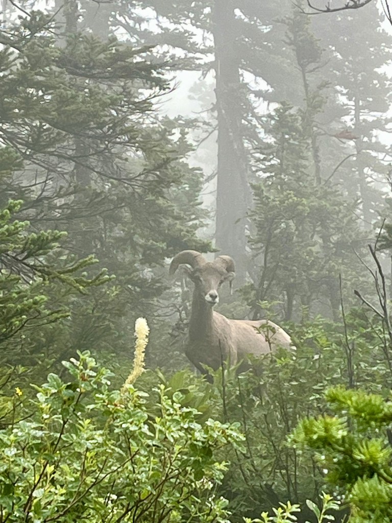
After a bit, a group of people came into view headed our way. The sheep, not liking being sandwiched between groups, darted uphill. They alternated staring at us passerby’s and ambling along the hillside parallel the trail. Which was all great and dandy until we were ahead of them and they returned to the trail behind us. And wanted a quicker pace. Nothing quite like a big old horned animal rushing you along. Though two of them lunged off trail into the meadows below to begin merrily munching away. We lost the third fellow. Not sure where it disappeared to in the fog.
Now for the steepest uphill section of the hike. A few switchbacks up to a saddle separating Mt Gould and Haystack Butte. On a sunny hot day, it’s rather warm, though the elevation gain is not particularly significant at around maybe 600 feet?

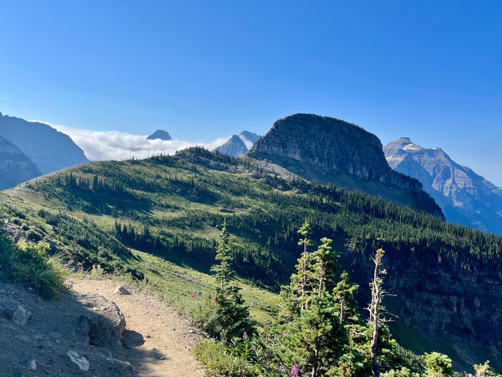
Once atop Haystack Pass there are views aplenty (if clear out) and plenty of boulders to post up on for a snack or lunch. It’s an excellent sandwich spot to gaze upon what you’ve completed, the surrounding splendor of Glacier’s valleys. Take note of all the avalanche chutes you’ve crossed and the destruction an avalanche causes.

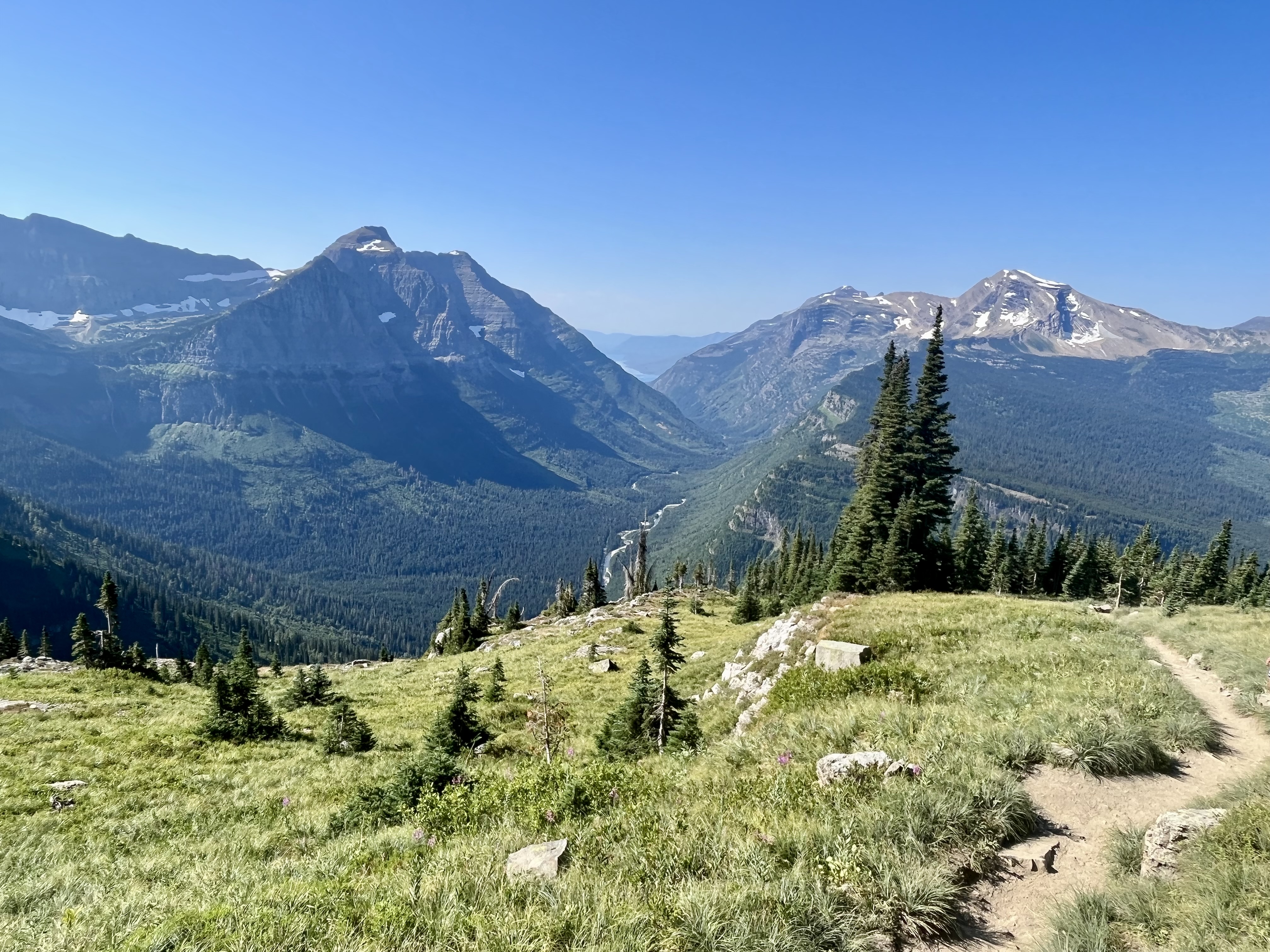
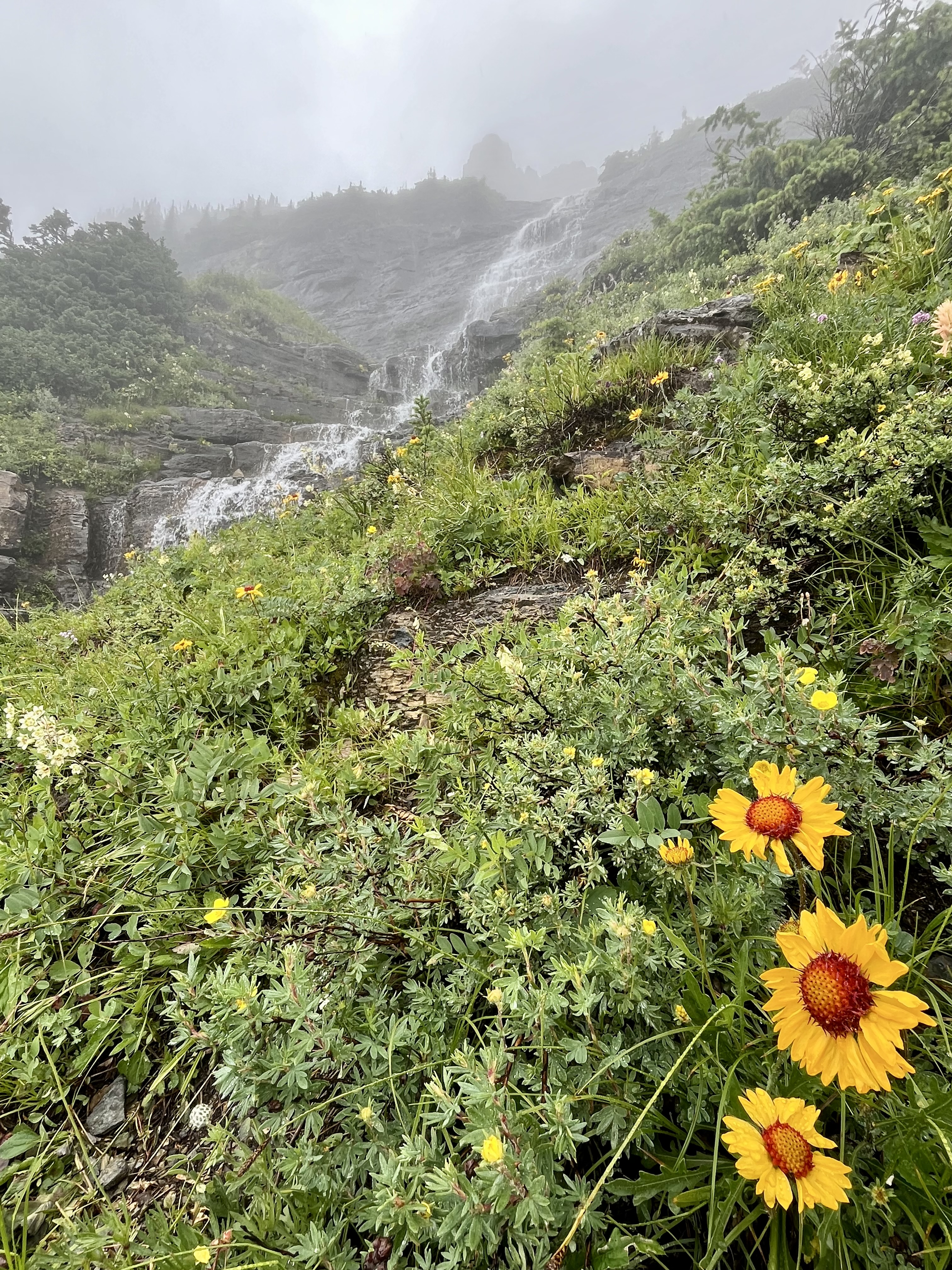
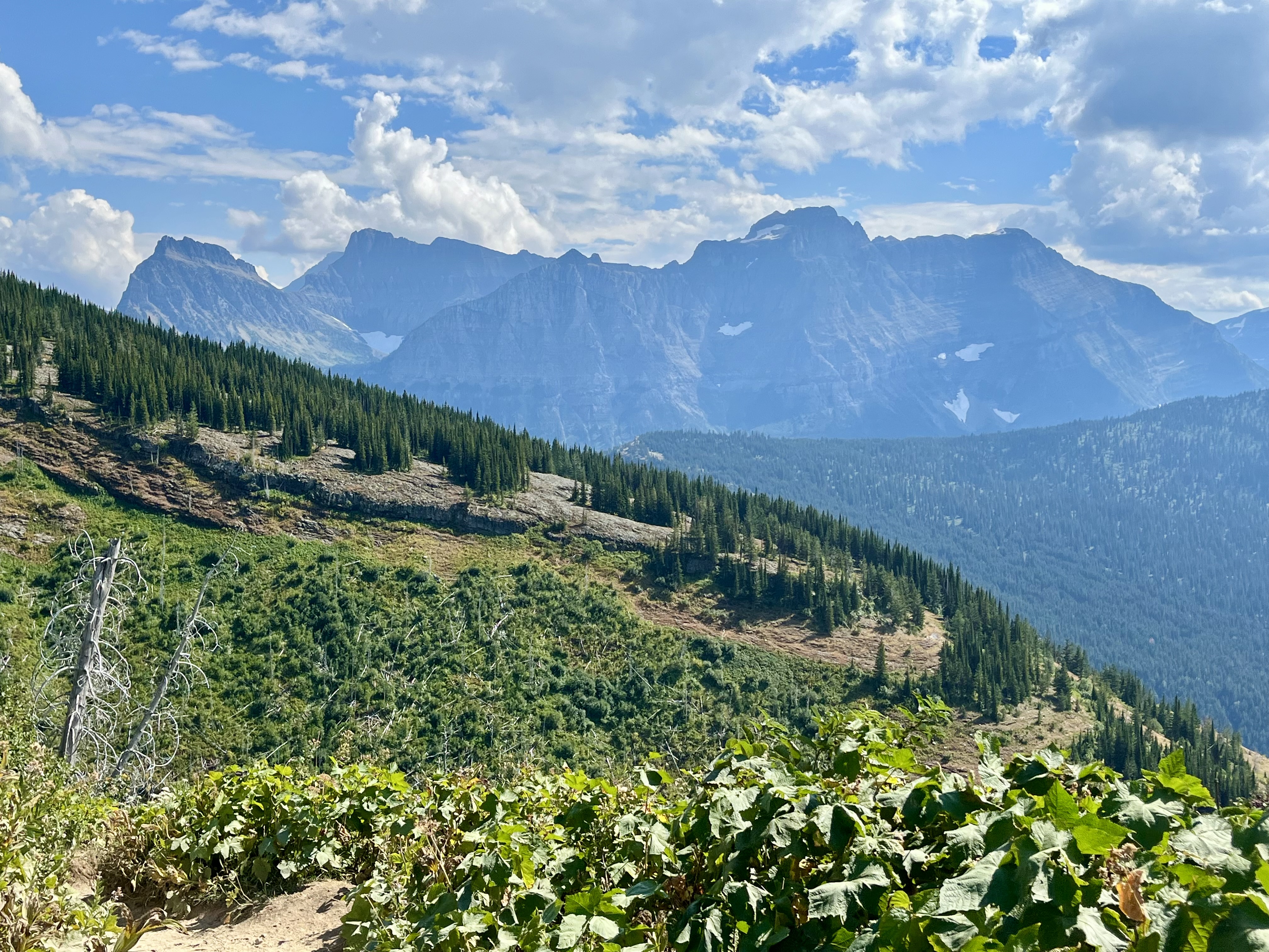
Continuing on, the trail follows along the hillside. You’ll pass through some trees, boulder fields (excellent sandwich spots), and loads of wildflowers depending on the season. Eventually you’ll come across a side trail to the Grinnell Glacier Overlook. If it’s a clear day, and you’re up for it, go. It’s about 1000 feet of up in 0.8 miles. Steep for sure. On a narrow rocky path. Way more intimidating than that Garden Wall cut out. But if you huff and puff your way to the top, and look over the other side, you’re in for a treat. Grinnell Lake and Grinnell Glacier will be on full display FAR below you on the Many Glacier side of the park. Well worth the effort. On a clear day. Doug and I declined the experience as we were in a fog bank that encompassed the entirety of the hillside. And rather wet by this point. The mists had become full on fog, complete with drizzle and intermittent rain. Lovely.

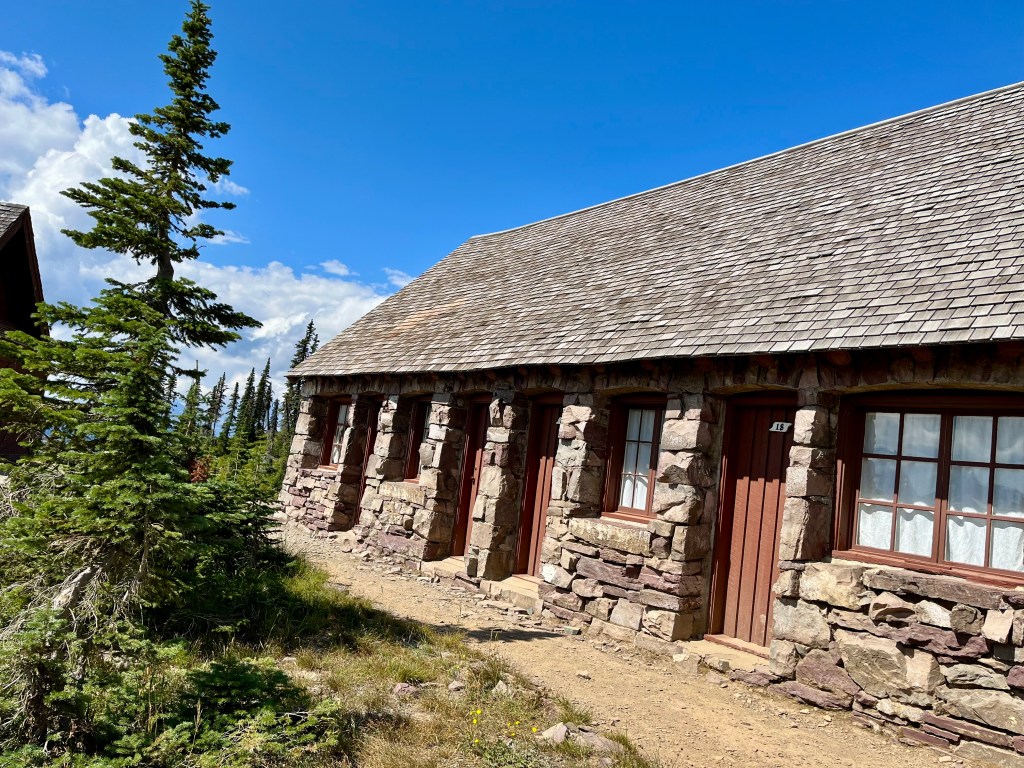
In approximately 3/4 of a mile from this offshoot trail, you’ll reach the Granite Park Chalet. It starts out as a tiny dot on the horizon and beacons you onward. Especially in the rain. Something about the promise of a dry community room when you’ve been walking in the rain is rather motivating.
Granite Park Chalet was built in 1914/1915 and serves as a backpackers hostel of sorts. One can rent a room or bed but must bring your own sleeping bag and amenities. There is an outhouse and a common room for general use. A wood stove graces the common area where large family style tables are set up. The general vibe is a rustic lodge. It’s cute and shelters one adequately from the rain.

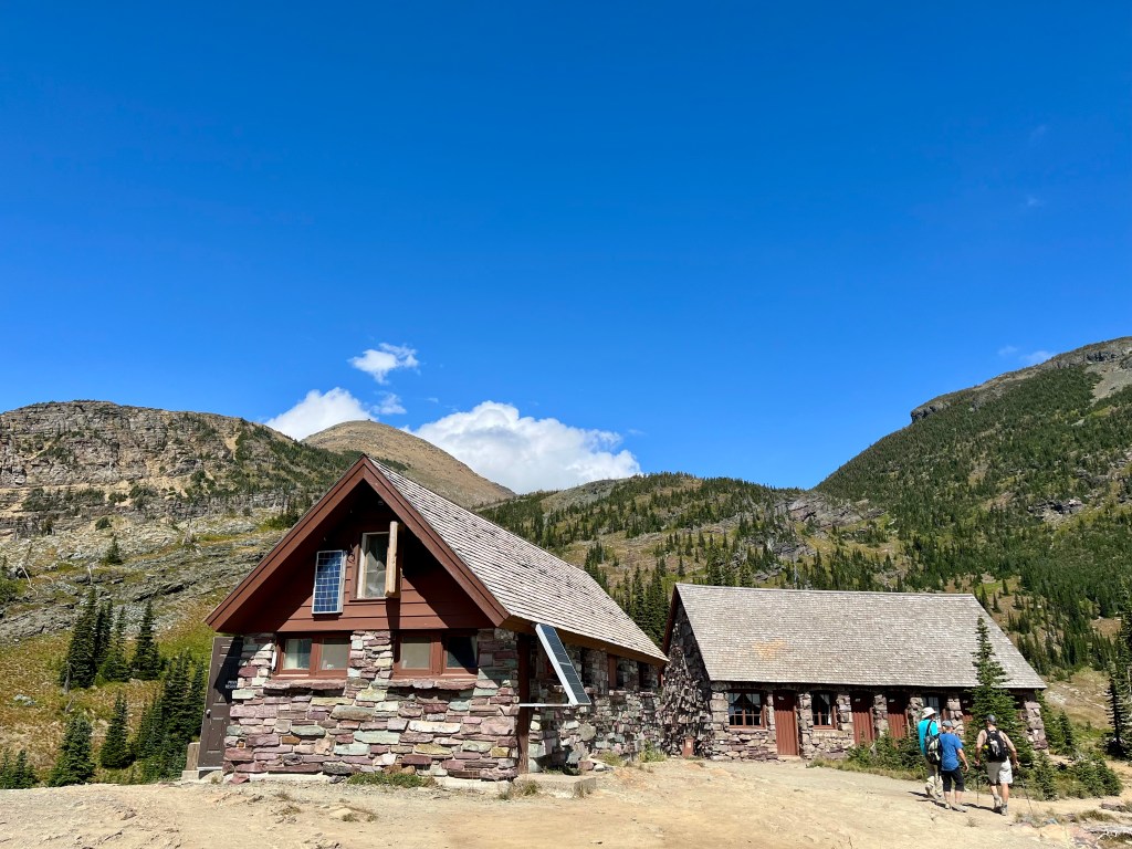
They have snacks for purchase (and even take credit card!). I will note I would have paid a pretty penny for ANYTHING warm at this point. But alas, that is not an option. Unless you brought your own camp stove. We did not. So we simply hung up our wet coats and hats along the provided clothes line by the fire and found a spot to plunk down in for rather late lunch. Tuna and white bean salad today. Pretty tasty. Granted, I would have preferred a warm bowl of soup, but beggars can’t be choosers. Plus, that’s what we’d packed in. The previous time I’d hiked this, it was gloriously sunny and we’d parked ourselves on a boulder with a stellar view for lunch. Very different experience.
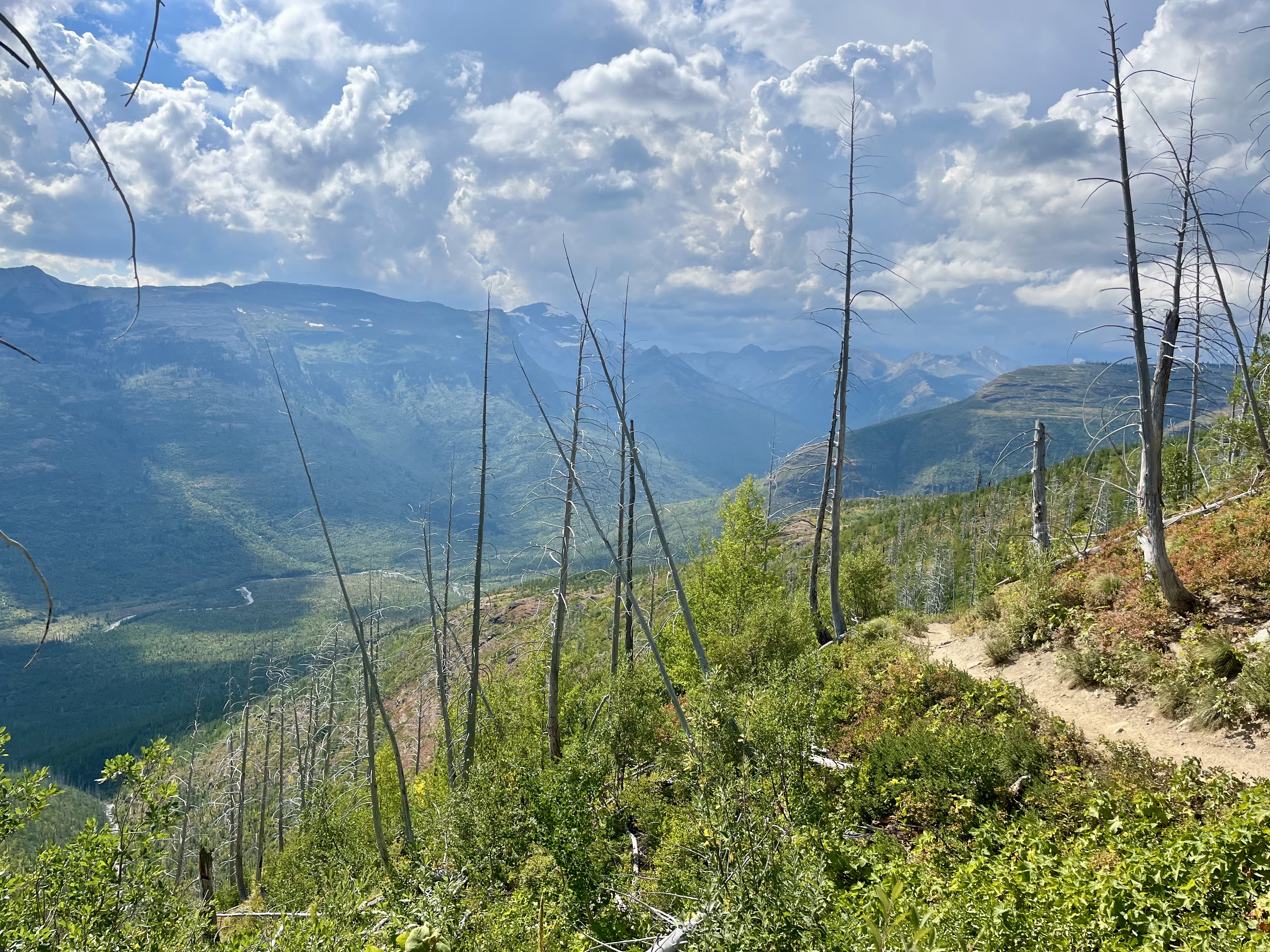
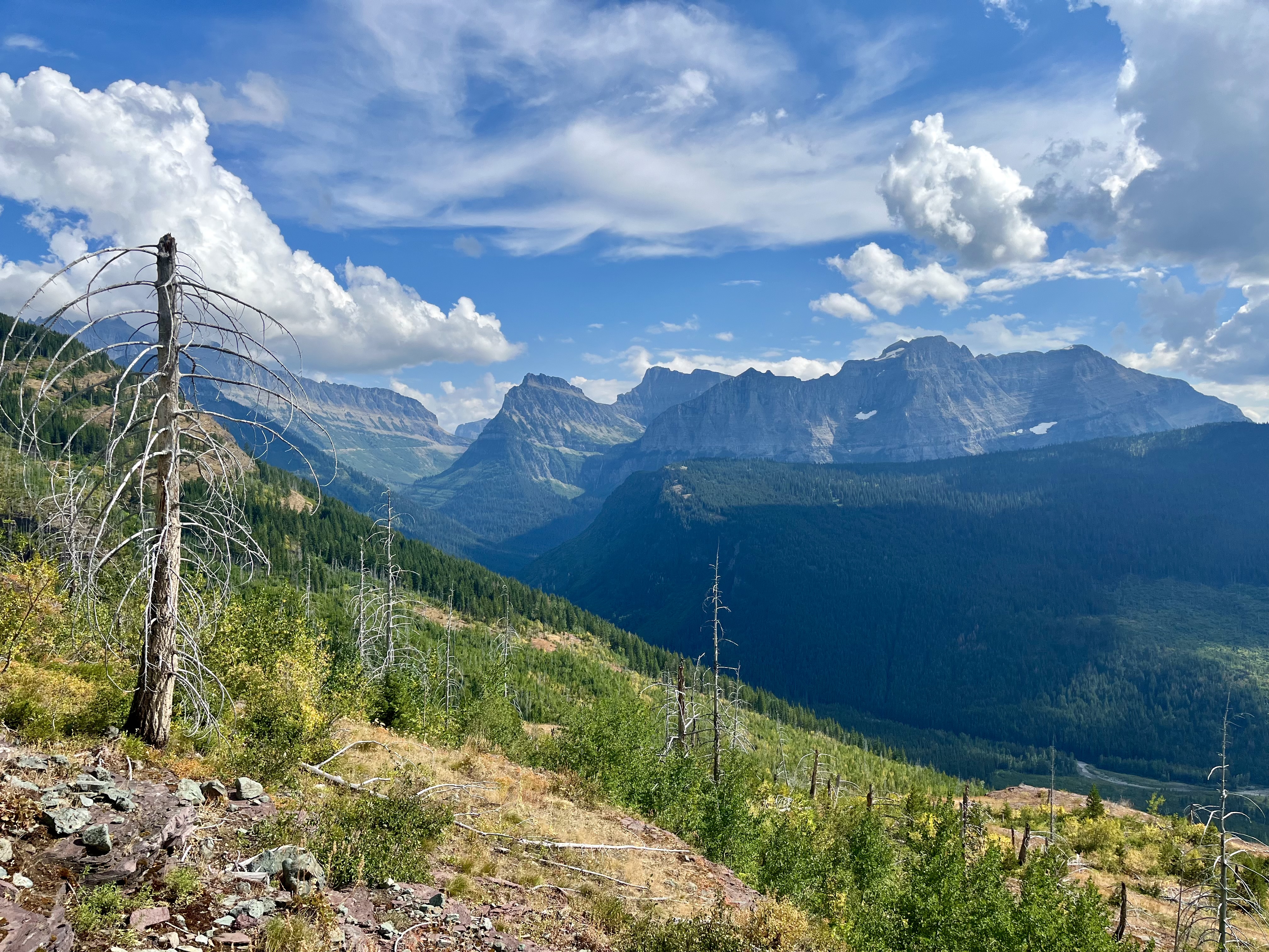
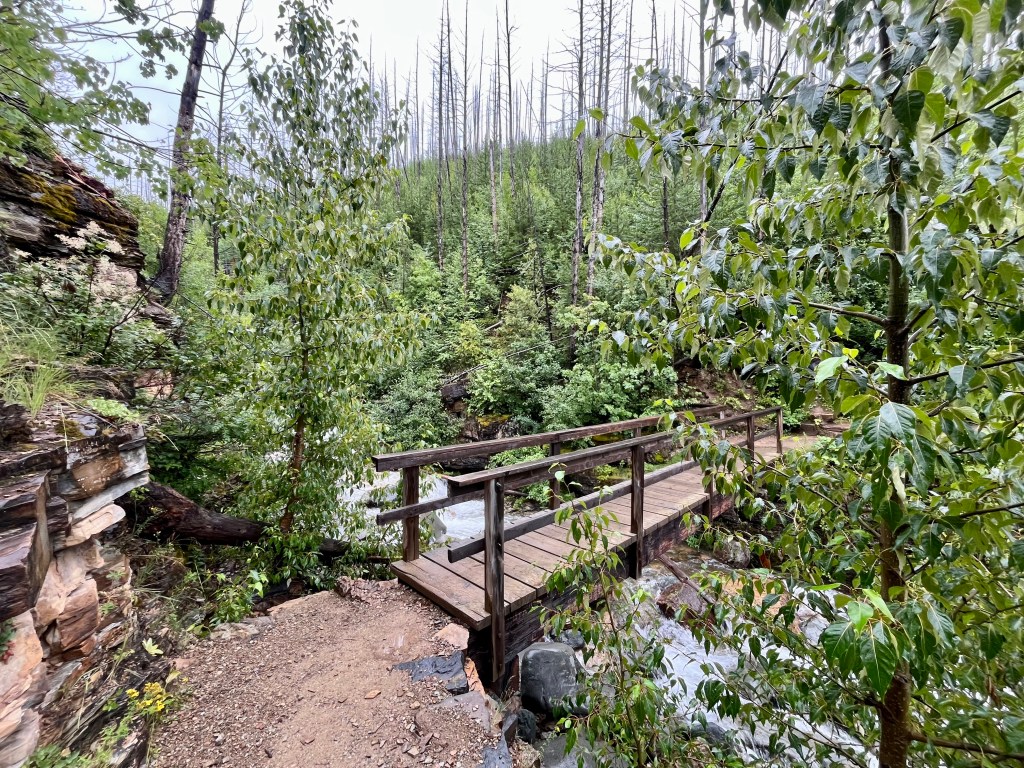
From here it’s about 4 miles downhill to “The Loop”. You’ll mostly be in a burned out forrest due to a massive fire in 2003. This one was caused by lightning strike. 2003 was a bad fire year in Glacier. They had six major fires that burned about 13% of the park. Plus side, the lack of living tree’s makes the views more prevalent. Down side is limited shelter from rain and sun. I’ve been told grizzlies frequently this section. While I’ve never seen one here, it is best to be aware. Make some noise and carry bear spray. Best they know you’re coming. I’ve generally found they want nothing to do with humans but do not like to be surprised.

Shortly before the end of the trail you’ll cross over a neatly made wooden bridge crossing a creek. This means you’ve nearly made it. Just a few more bends in the trail and you’ll pop out at the loop. From here you can take the shuttle up or down the mountain.


Leave a comment