SOUTHERN SPAIN
Summary
With sweeping valley views, it’s difficult not to love this hike. Springtime flowers adorned the hills making the path all the more magical. The monument of El Santo and Roman Ruins along the way provide a cultural and historical perspective of the region.
Trail Stats
Mileage: 8.82 miles RT
Elevation Gain: 2,080 feet
Toilet at trailhead: No
Sandwich Spots: Yes
Parking: Street Parking
Mileage/EG from Garmin Watch

Trail Details
We decided to head out early morning for the little town of Pizarra, which I kept forgetting the name of and referring to as “pizza town”. A single bus ride to Arroyo de la Miel to catch the C1 train to Malaga to catch the C2 train to Pizarra. Interesting last train ride. Half way through, a rowdy group of people, who we assumed had been out clubbing all night, boarded and grouped up behind us. They were maybe a bit trashy. Ok. Maybe a lot trashy. And reeked of cigarettes. Yuck. Definitely decked out in clubbing attire. Pretty much everyone on the train was staring at them.
After disembarking the C2, I began tracking the hike. Cheating? Maybe. But we walked from the station to the trailhead in town. For reference, I stopped my watch when we returned to said rail station.
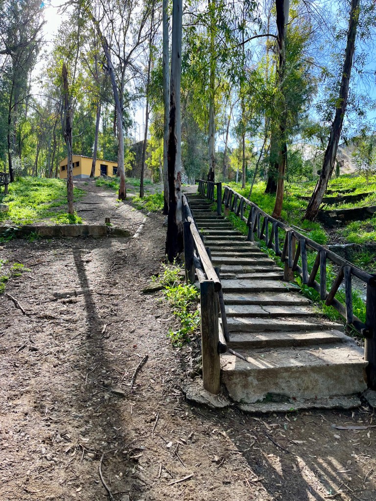
The trailhead is in a park. There are BBQ pits, picnic tables and trails leading up. Technically, there is a bathroom. But it was very much locked. As was the one by the rail station. Bummer that. Maybe should have skipped that cup of coffee in the morning.
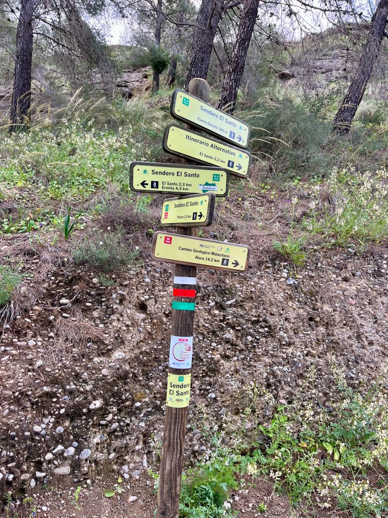
The lower sections of trail are a jumble of intertwining paths with limited to no signage to guide you along. Good luck. Oh, and there are people everywhere. Literally. Trail runners. Families with screaming children. Families complete with many generations. People walking dogs. Fellow lost tourists trying to find the way up. All really inconvenient when your bladder is full.
A good thing about having worked in health care is that I can speed pee. TMI? Meh. You work in healthcare and have zero time to eat or pee and see how fast you wind up doing either after 18 years. Bet you’d be speedy too. Plus, as a female there’s the very real chance of being caught. Best way to find someone else on a trail is to drop down to pee. You may have seen NO ONE else all day. Stop to pee. Bam. Someone waltzes around a corner. More motivation to be quick.
Doug is NOT so speedy. He nearly gave a little old lady wandering around with her dog more of a show than she anticipated on her walk. She certainly gave him a funny look and kept on walking.
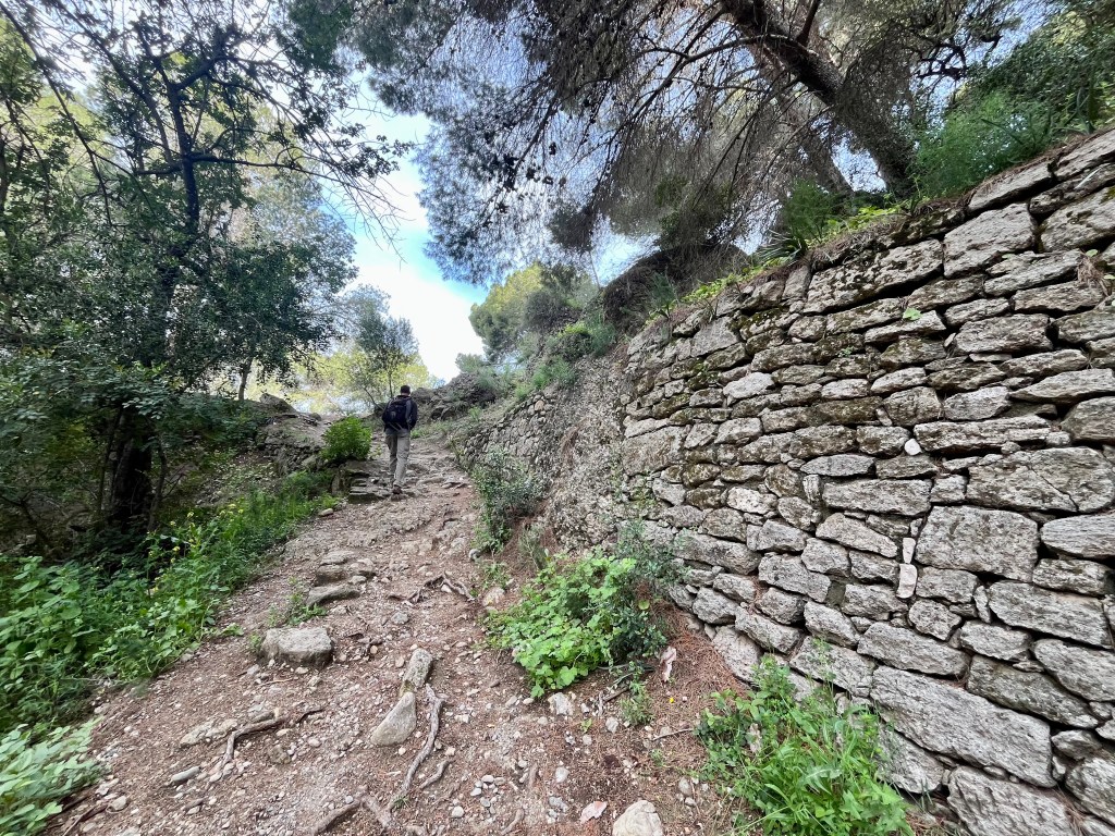
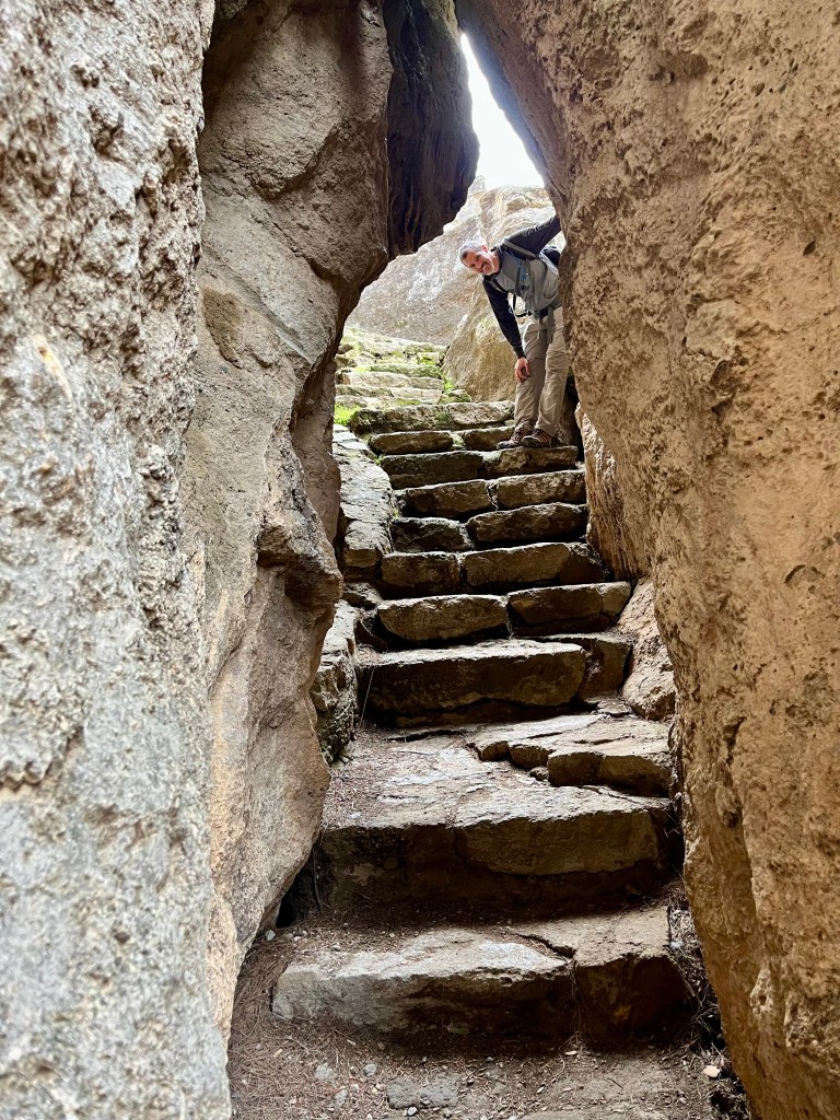
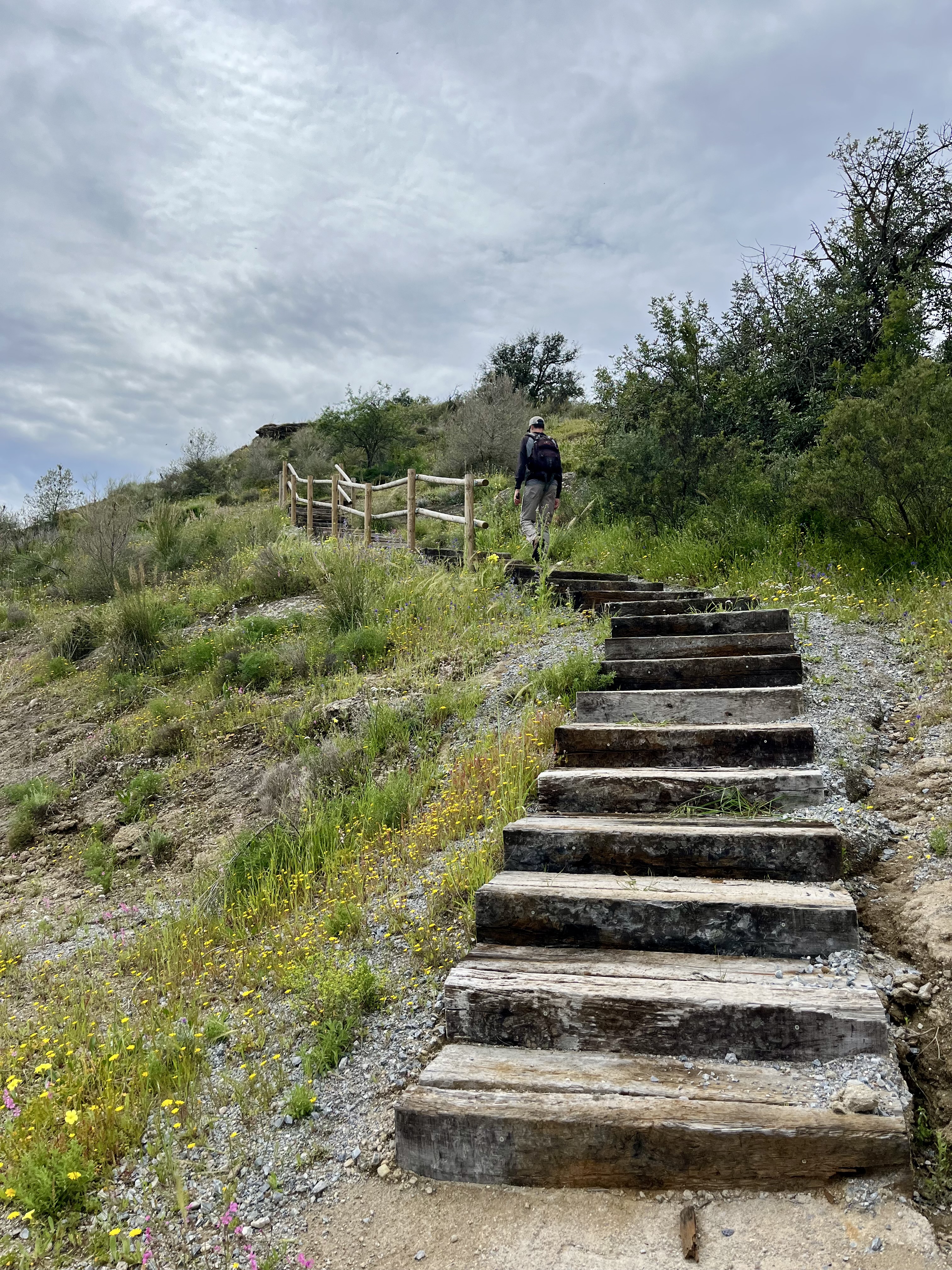
Back to the trails, Doug navigated us to a fun, though brief, section through rock crevices. Stone steps lead through giant slabs of rock. Certainly the highlight of this lower trail. Except for that grandma Doug shocked. Betcha she had quite a different story to tell.
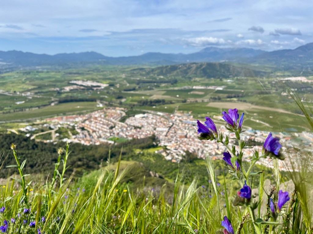
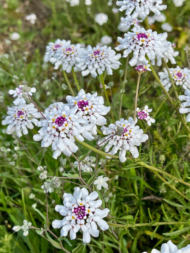
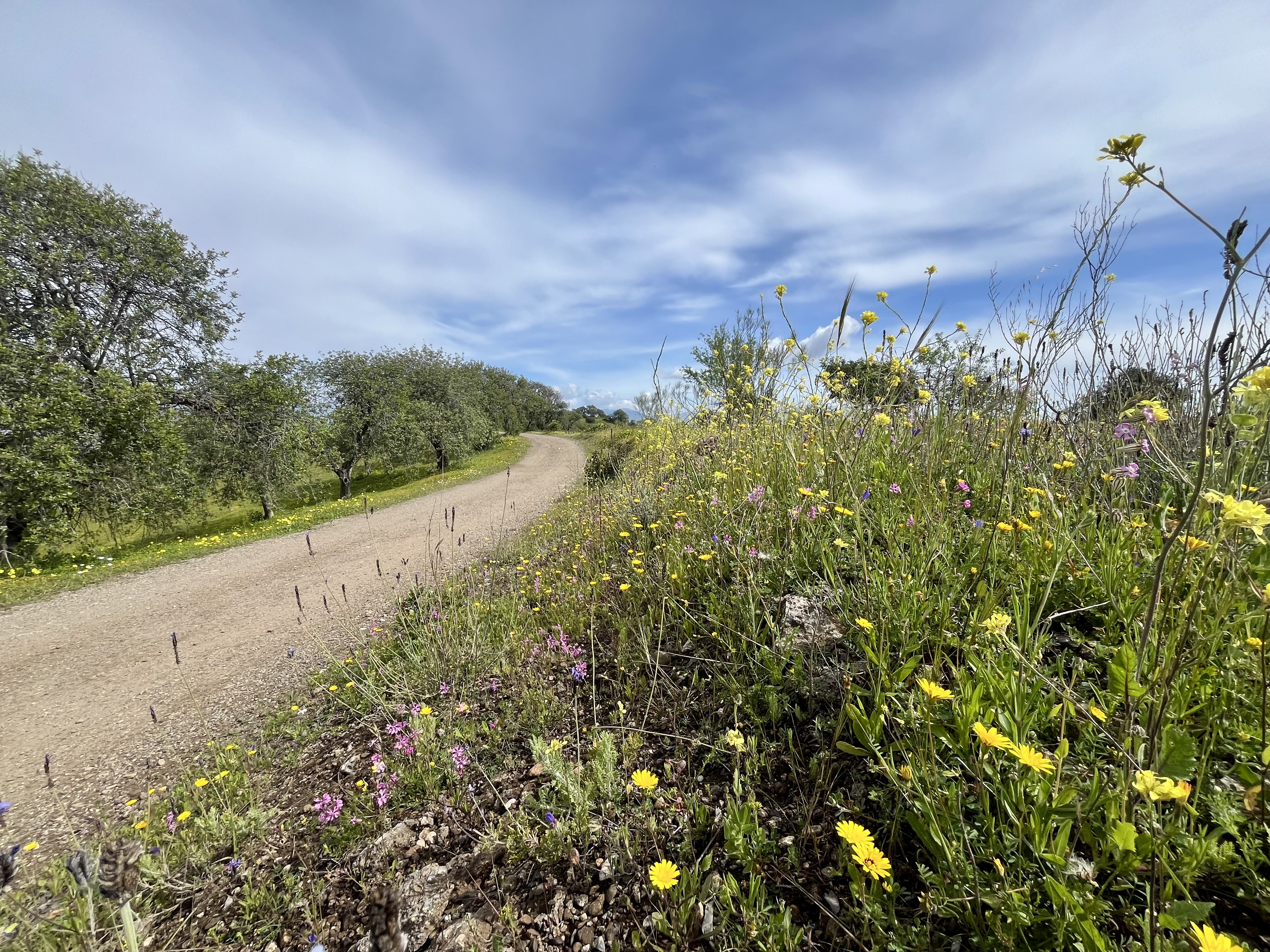
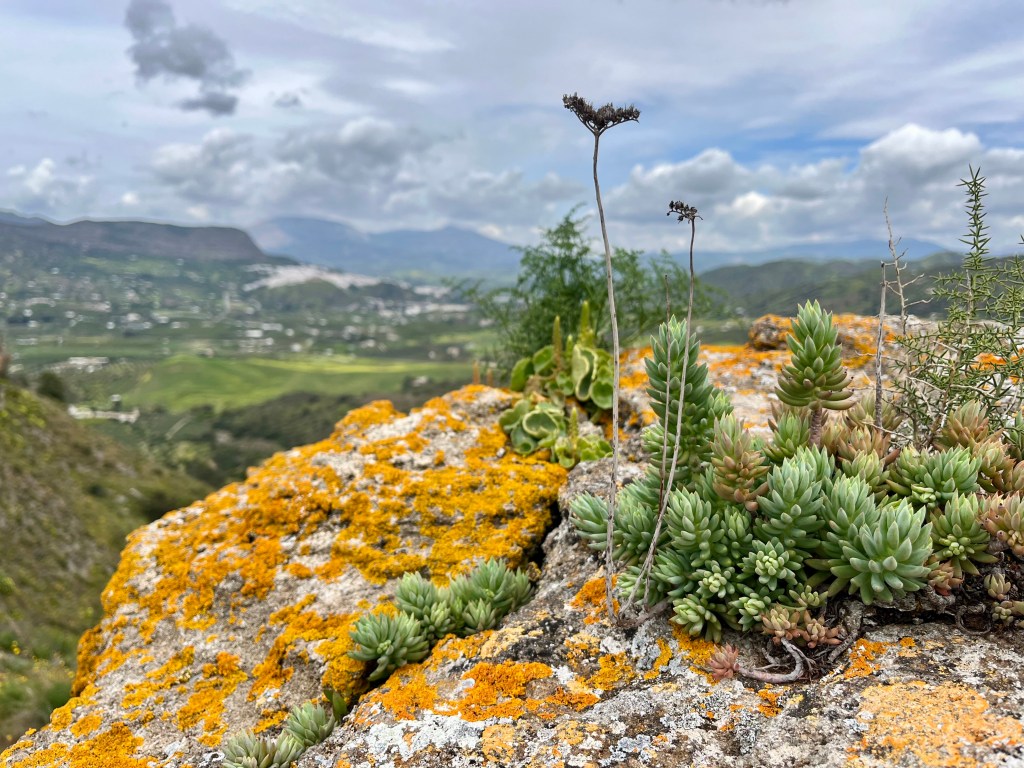
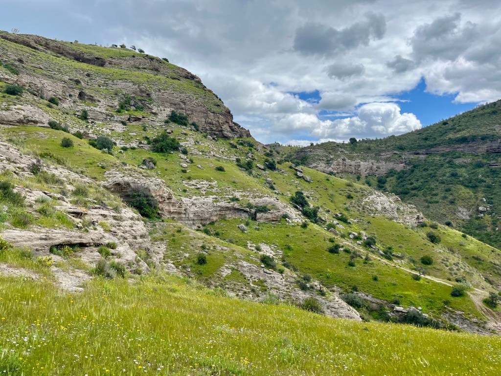
After the rocks, the trails split a few times. We mostly stuck to the left while heading up through the forest. There’s an outcropping a ways up that provides considerable views of Pizarra and the valley beyond. Signs now point you in the correct direction. Flowers dot the hillside. The trails steadily climbs upward on a well maintained, well used, wide path with easy footing.
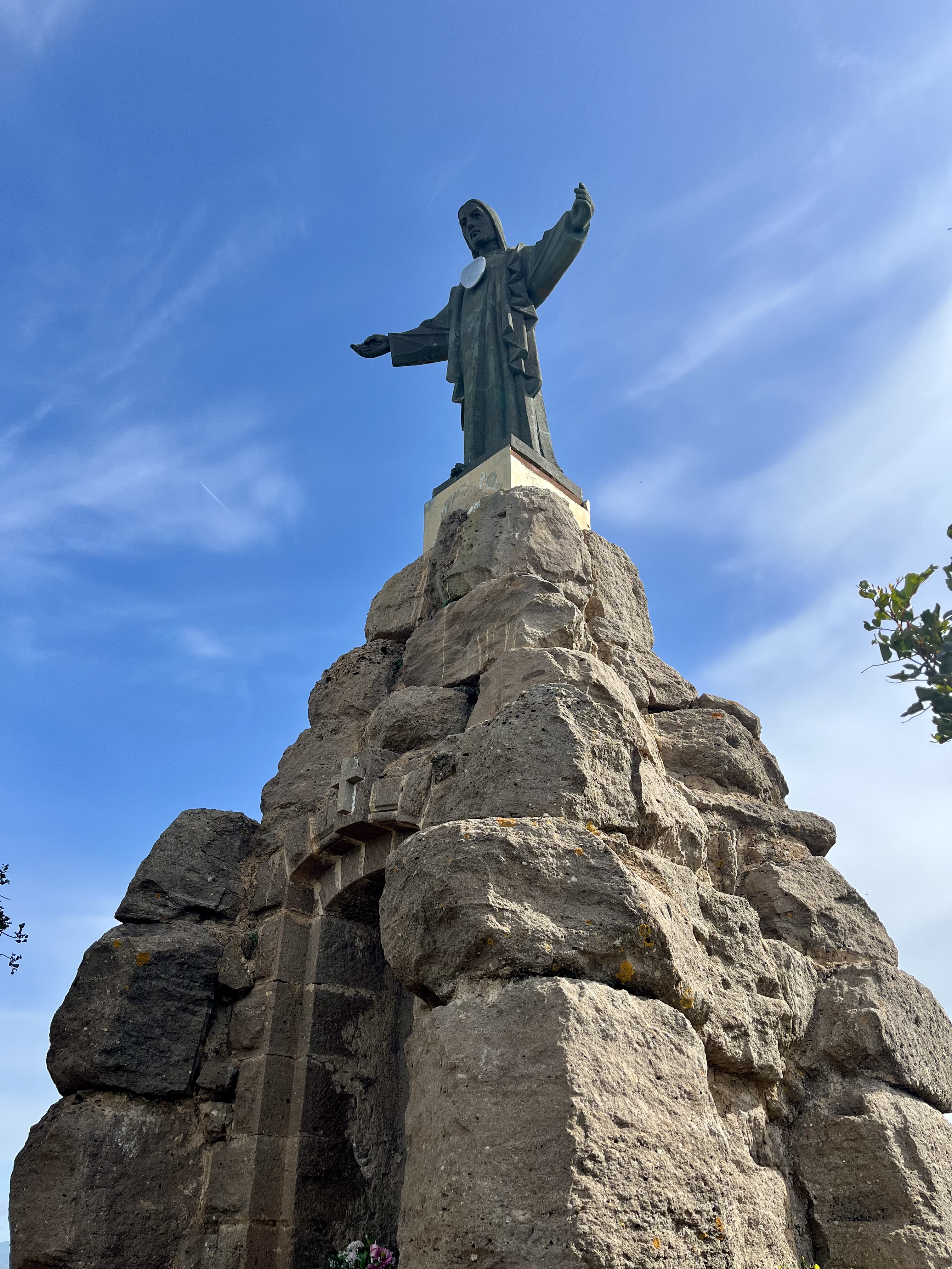
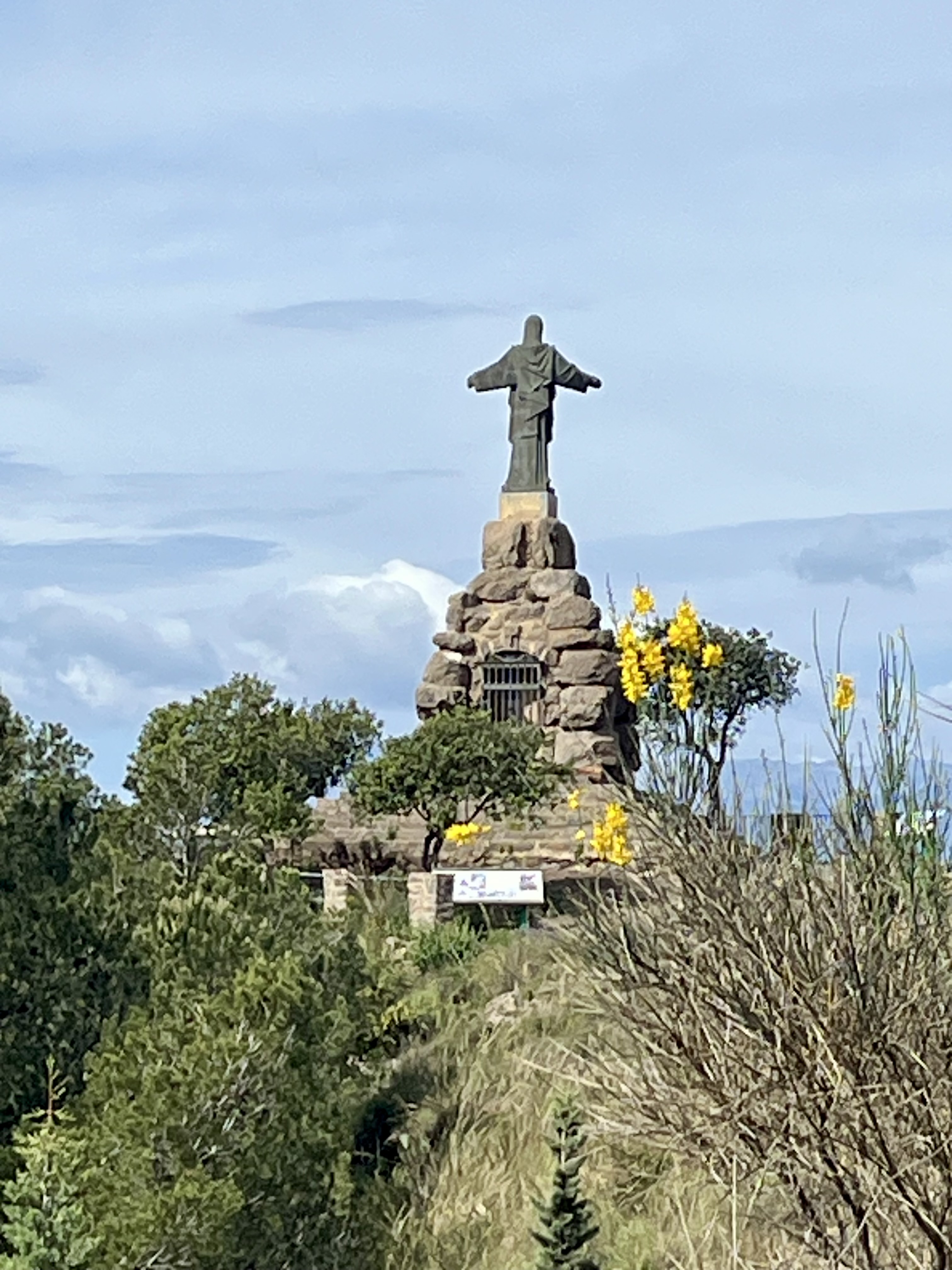
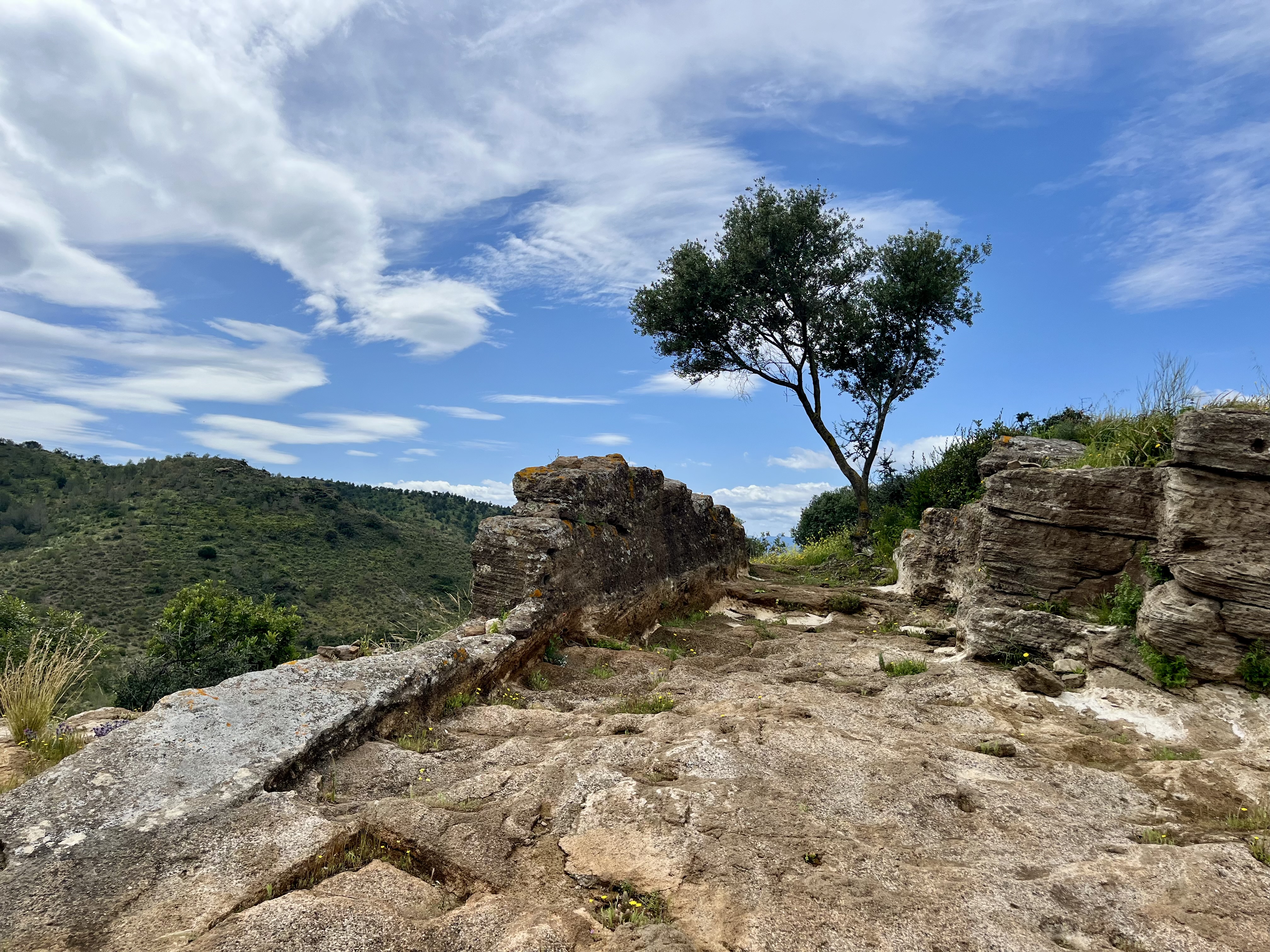
Eventually, El Santo takes on significant shape. Located atop the mountain behind Pizarra, this chapel is topped with, I presume, a giant statue of Jesus with outstretched arms. The trail snakes its way over.
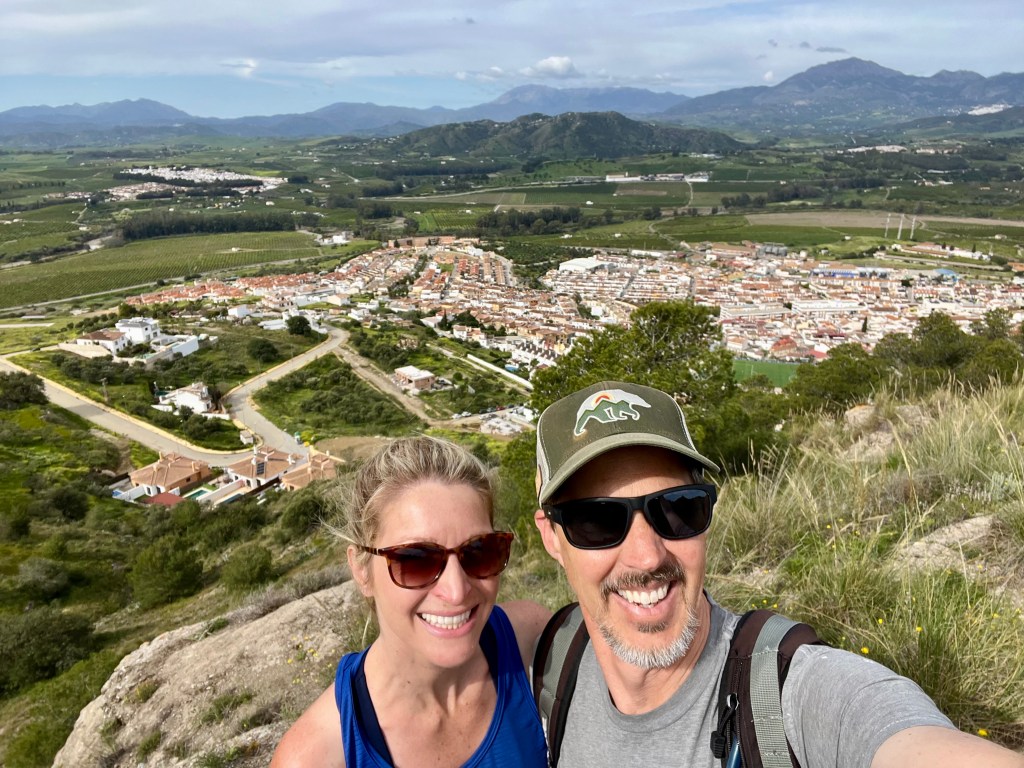
Near the peak, there are plenty of picnic tables to choose from. We bypassed and headed straight for El Santo and a very merry gaggle of Spanish ladies enjoying a day out. They were certainly having a grand ole time. Loads of laughter. No idea what they were saying. My Spanish is poor at best and they were speaking way too fast. We each recruited one another for a photo op with El Santo. Turns out El Santo is a nickname. Its true name is Sagrado Corazon de Jesus. El Santo is much less of a mouthful.
After a quick snack (roasted edamame, yum! So delightfully crunchy) it was time to keep on trucking. Down a road. Apparently you can drive to El Santo if you’re lazy. Or unable to walk. We saw a few cars. But one bottomed out so bad on that road I’m not certain they had anything left on the undercarriage of their vehicle. Whoops.
Rather quickly, we became the only ones on the road. Not sure where everyone else was headed to but we had a particular picnic spot in mind for lunch that kept us motivated.
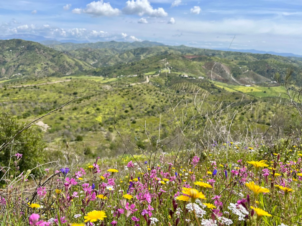
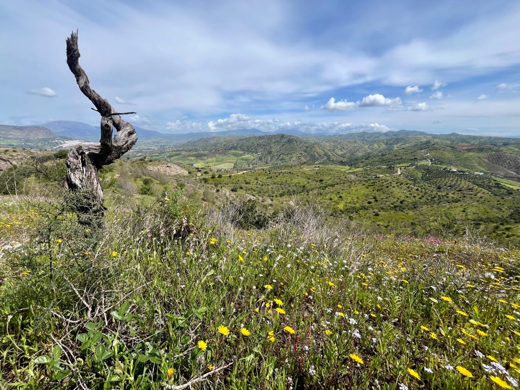
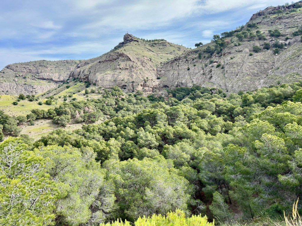
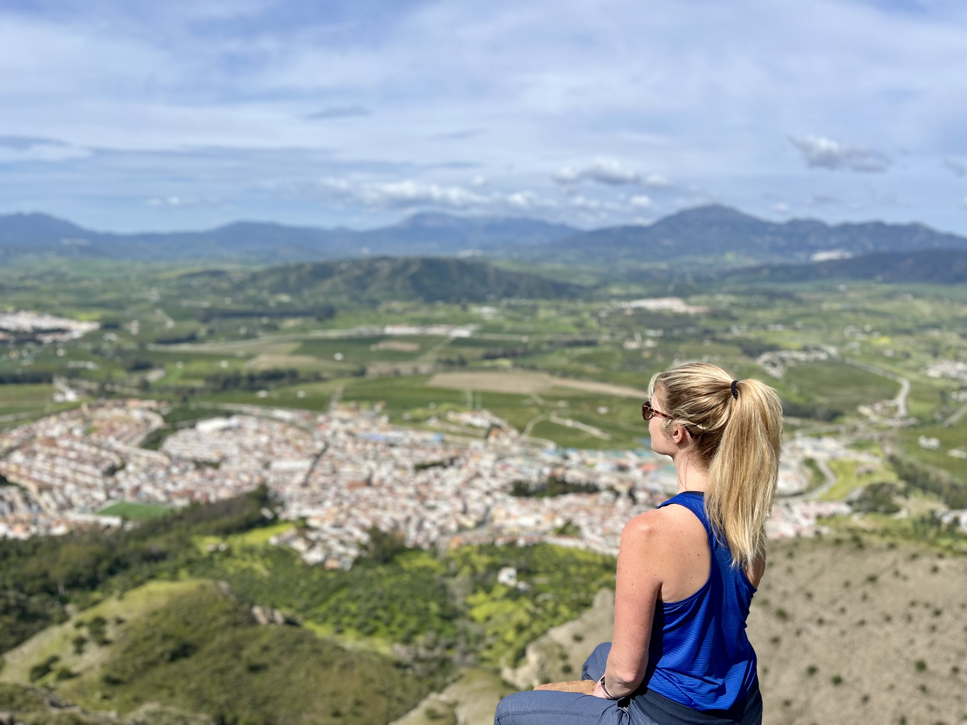
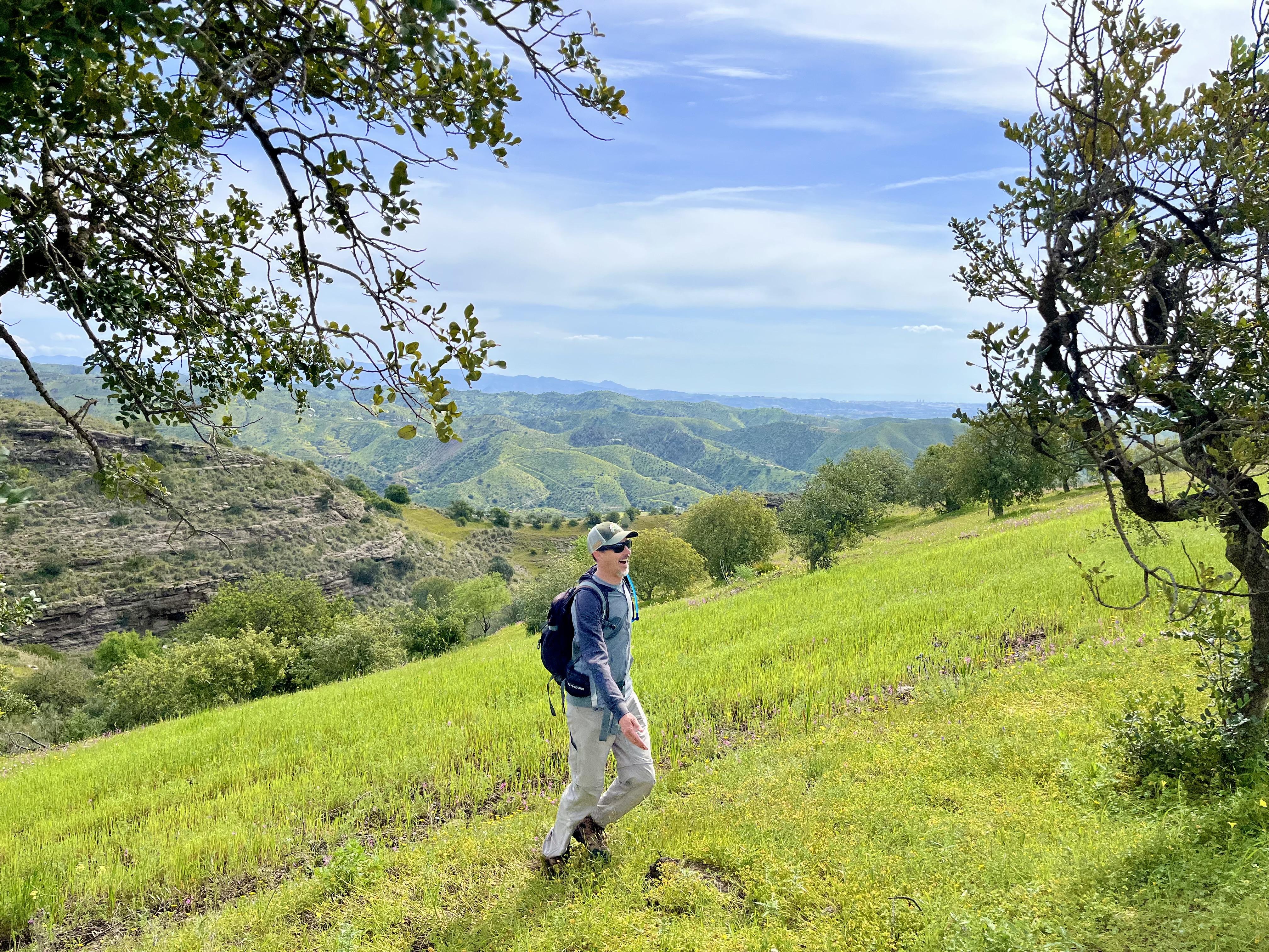
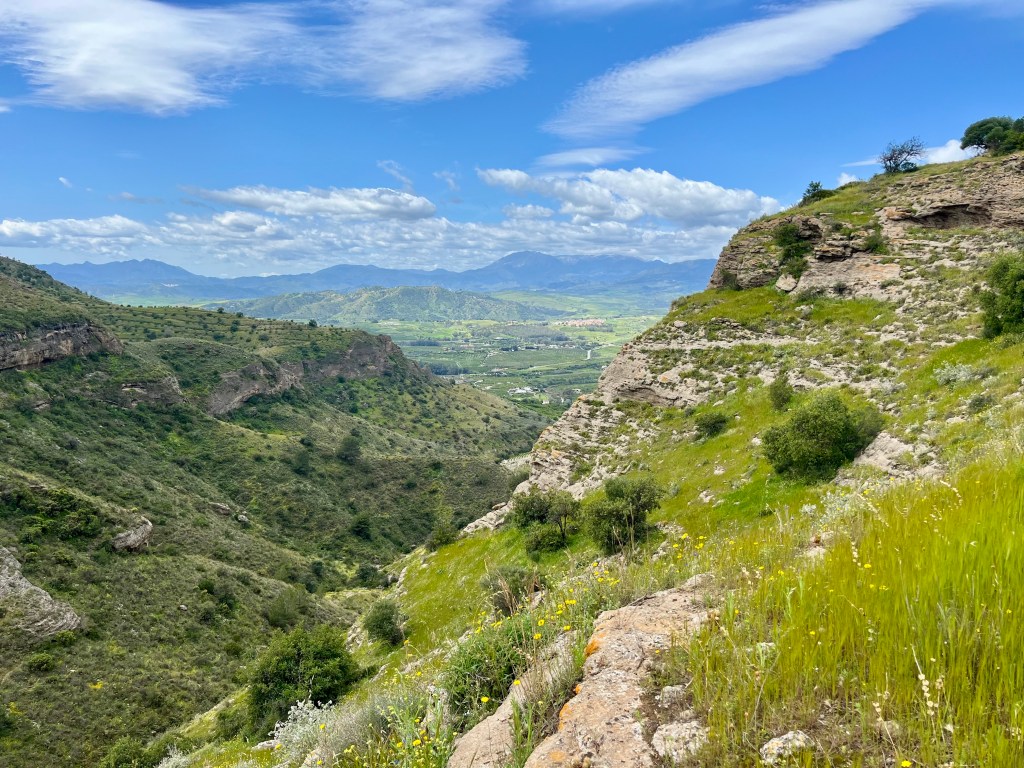
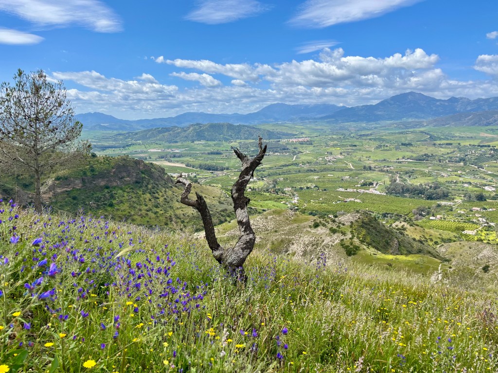
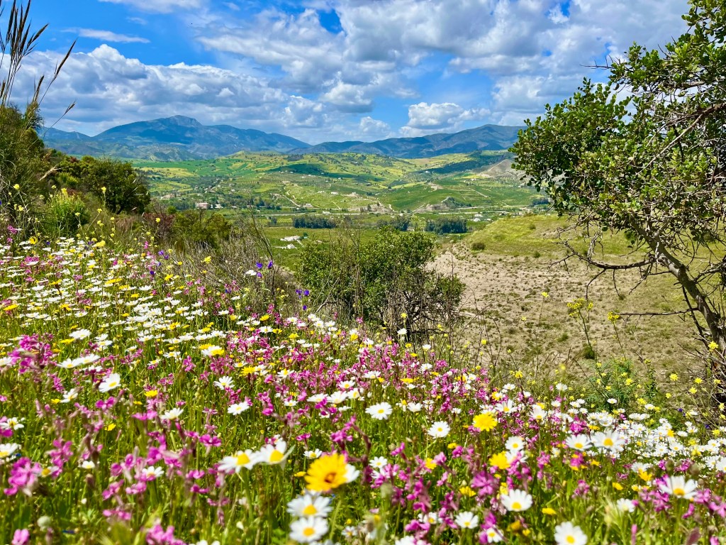
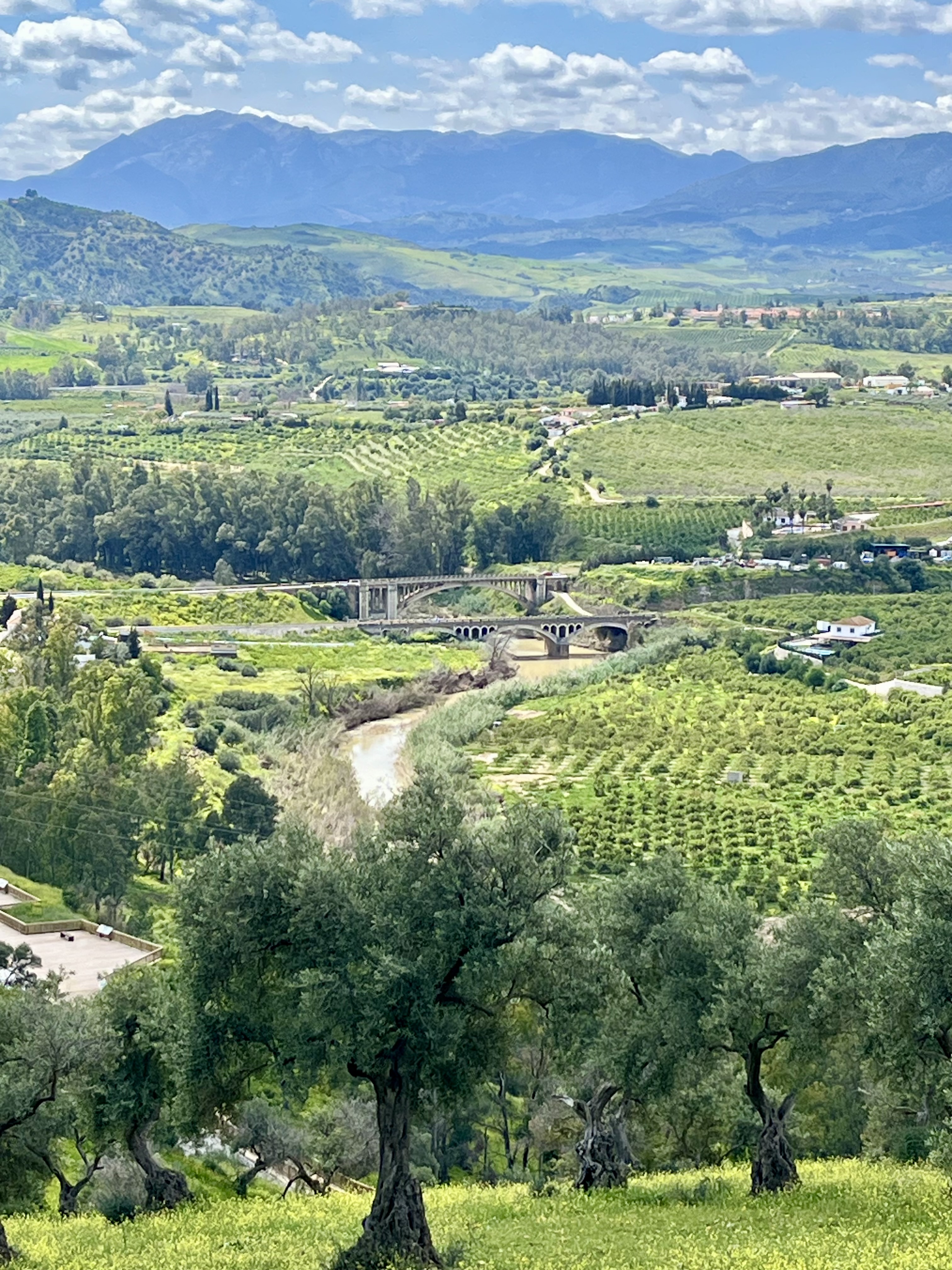
Thus far, this is hands down my favorite hike. And it has nothing to do with either El Santo or the Roman ruins. It has everything to do with how gorgeous the valley and mountains northeast of the mountain we were on is. I declared it my happy place. I’m still in love with it. It was one of those places my soul instantly felt at peace and joyful in. Stunning green. Farms and orchards with little white buildings dotting the land. Tons of wild flowers. I can’t accurately describe or express why this valley made me so blissful. It’s one of those places I shall hold dear in my heart without knowing why.


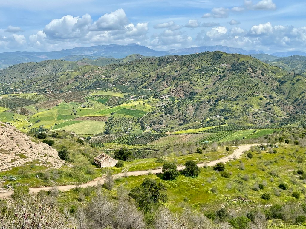
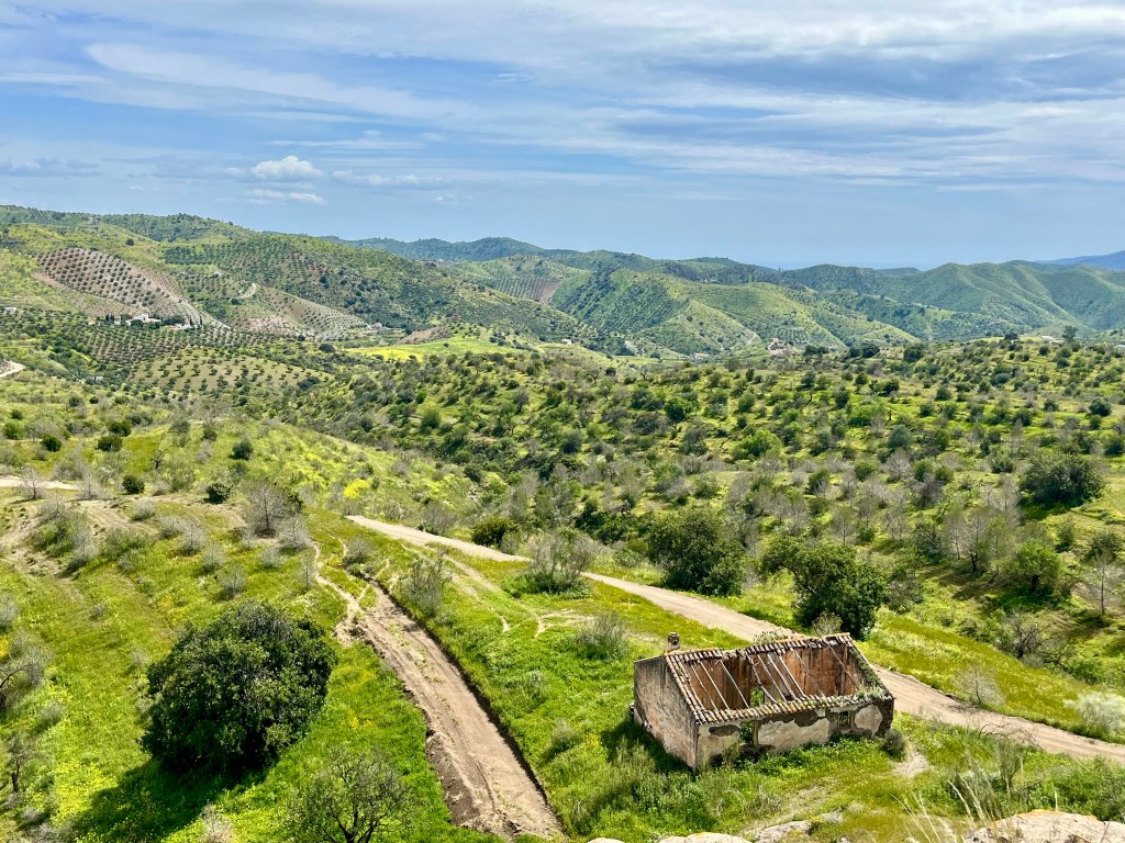
Along this beautiful walk lays an abandoned, broken down old residence. It was rather interesting to explore. One main room in front, two little rooms in back. The roof was completely collapsed and the interior was weed filled.
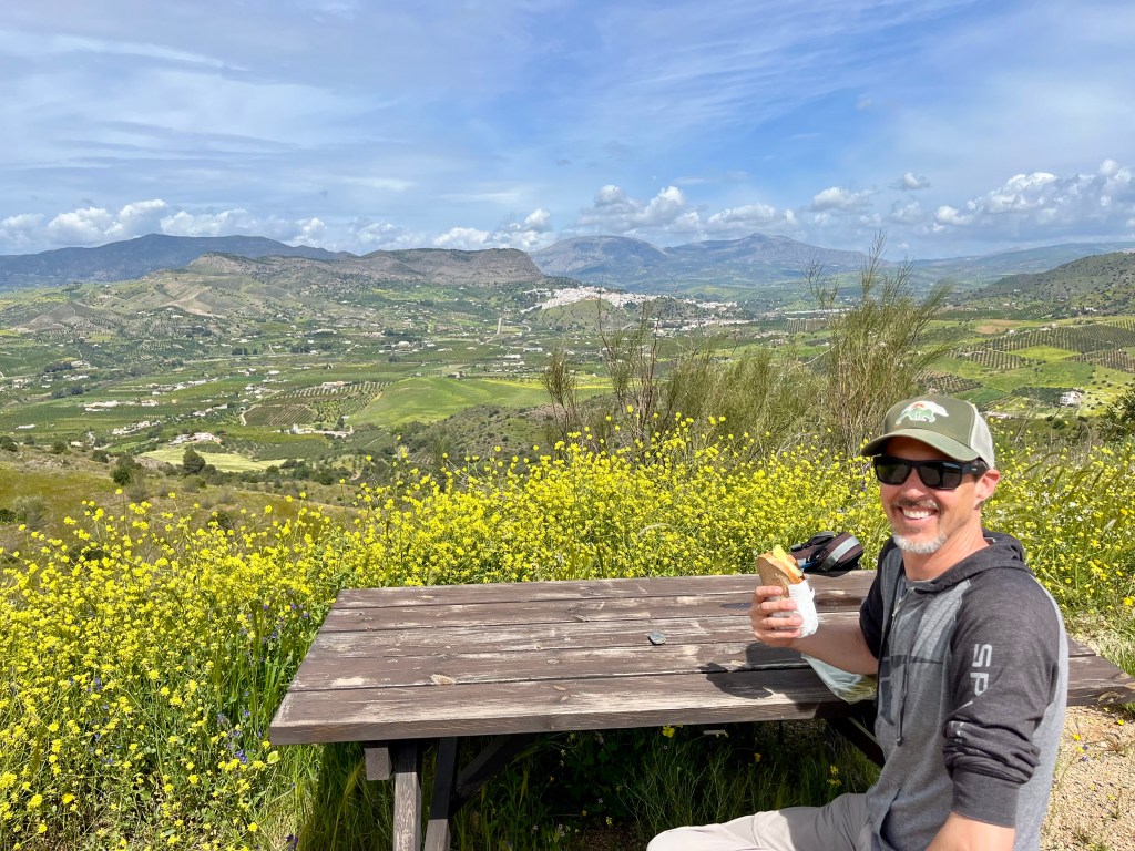
Pushing on, we finally reached our picnic spot. A few picnic tables and a small shelter on a small scrap of land jutting out toward my dream valley. The town of Alora is clearly visible. My valley was on full display. Sadly, no photo I took could accurately represent its splendor. It was simply too vast to capture in a still frame.

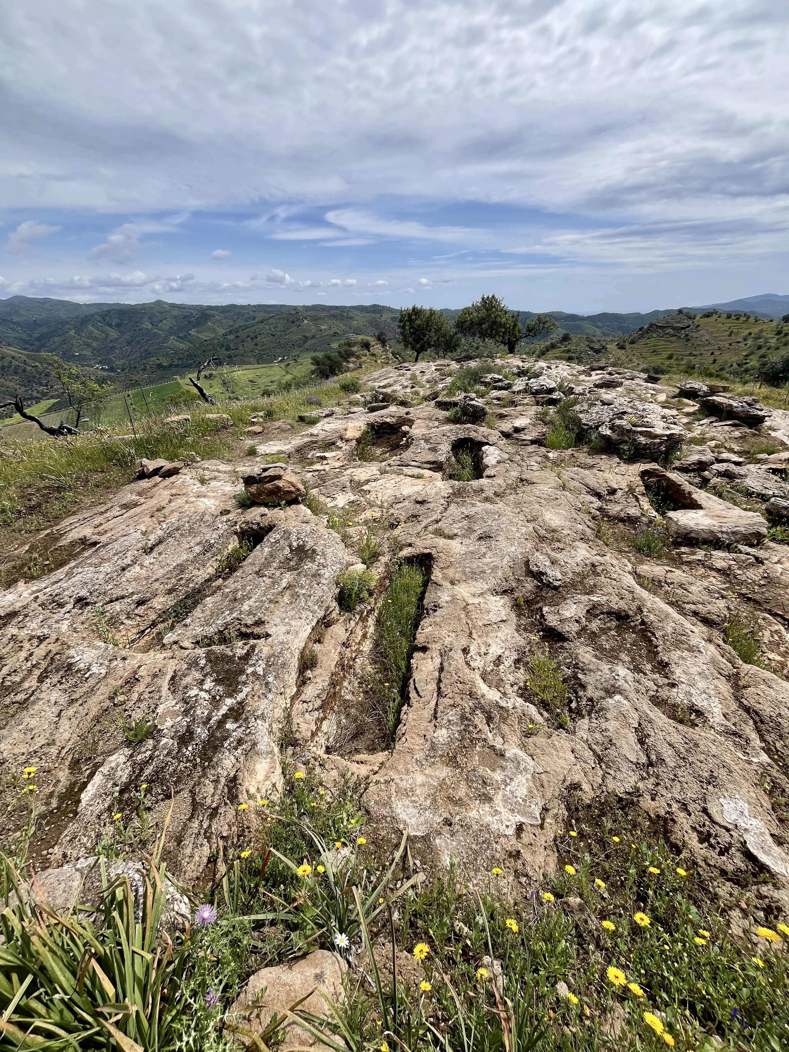
After lunch, we headed uphill to Castillejos de Quintana. The Roman Ruins up there slightly confound me. Apparently I have zero imagination. To me, the “ruins” looked like rocks and a few bricks. If I had happened upon them, without knowing, I would have thought nothing of it. Maybe noted a few odd “holes” in the rock. Chalked it up to nature is weird. Apparently said holes were carved out tombs in the rock. We think. Huh. Seems like a lot of work to bury someone.
We circled around the peak (where the ruins are) and came across a Spanish couple from Malaga. Their dog very much wanted a piece of our ankles but were obedient enough to mind their owners commands not to nip us. The gentleman was rather surprised we were out there. Apparently it’s not a common spot for tourists. He also mentioned he had never seen the mountains behind my beloved valley green before. Ever. He was middle aged. Said they were normally golden. Which is fancy talk for brown. Hmm.
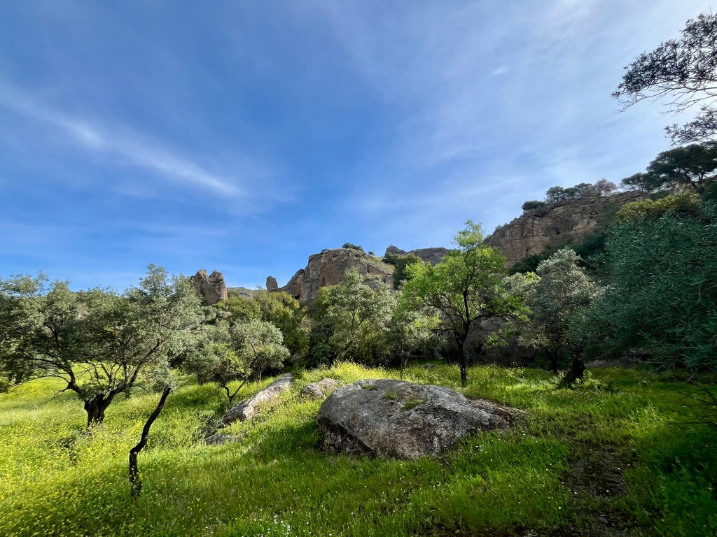
Heading back down from the ruins became an adventure. The trail became a free for all mess down a ridiculously steep slope into a channel between rocks. Said channel is a dry creek bed. We started following the creek bed due to visible footprints. Pretty soon we noted we were going to”off trail” per the Gaia app. Back up we went and onto the remarkably narrow path cutting across slope of the hillside where the ruins reside. At points, this path looked like a goat trail. Definitely less frequented than the previous trails.
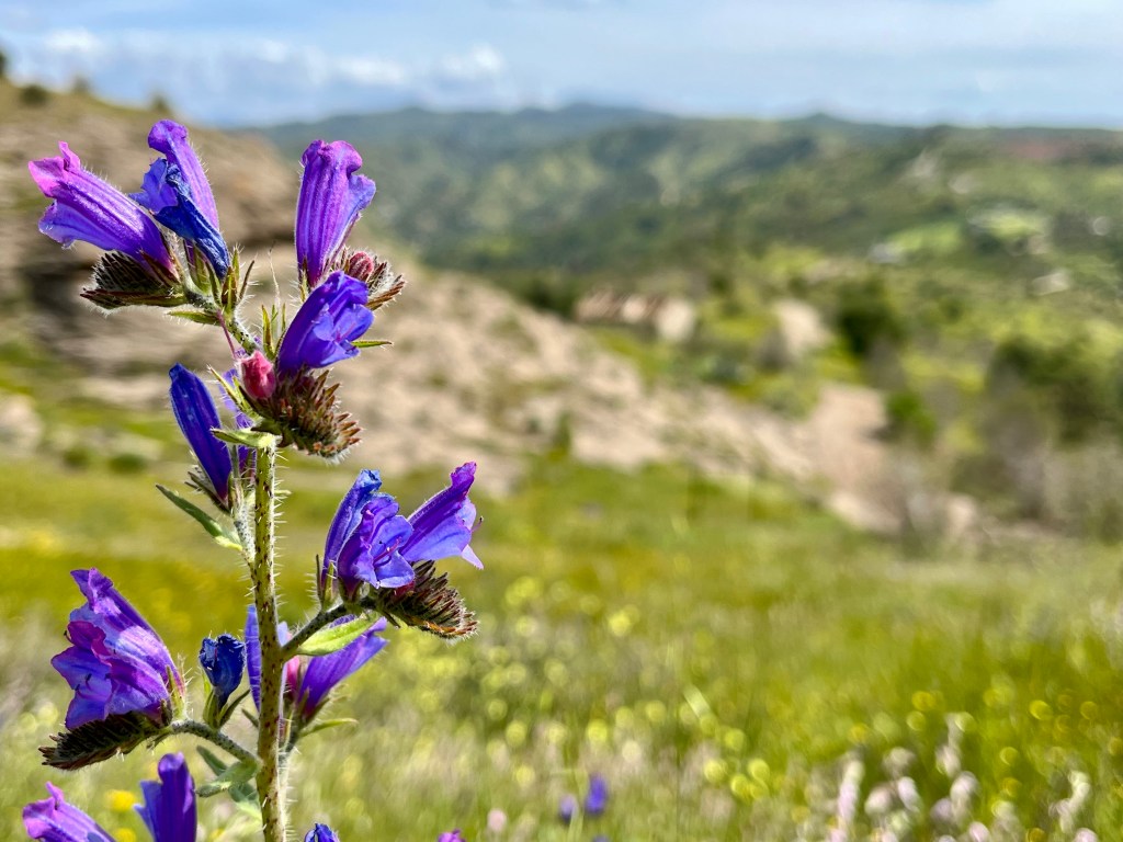
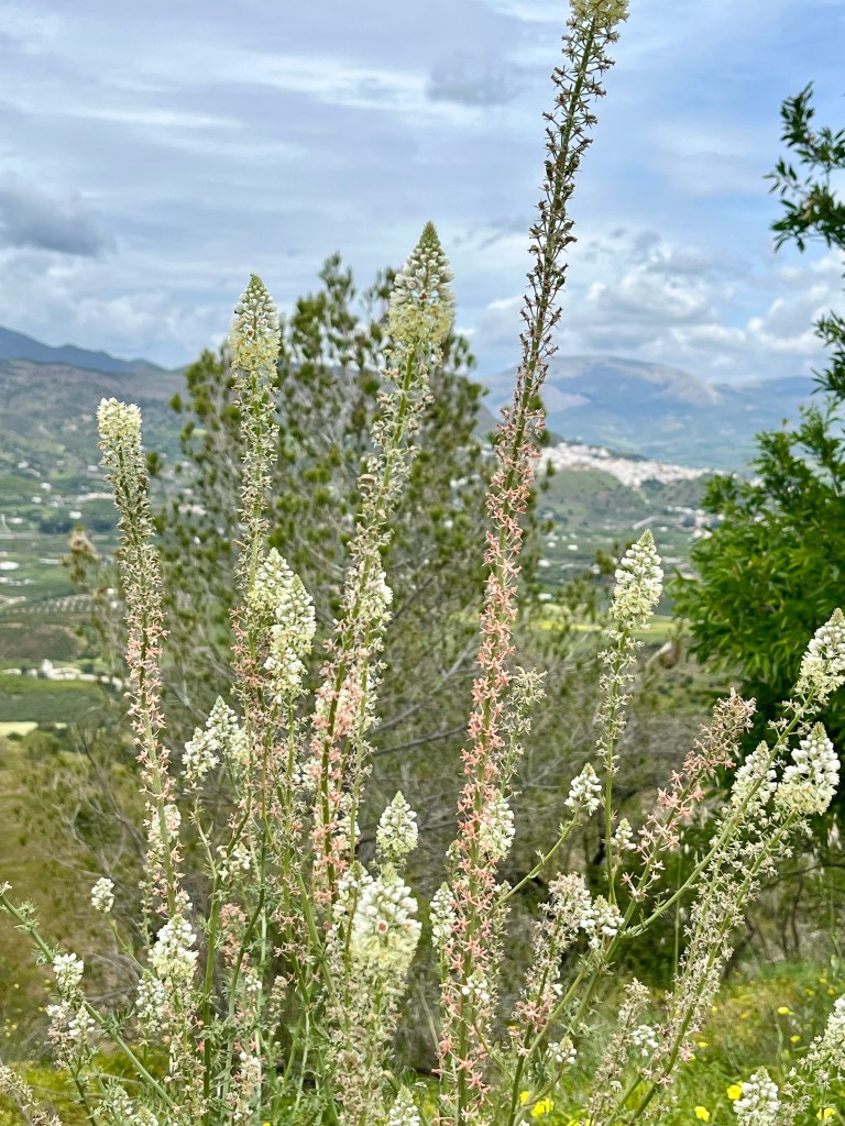
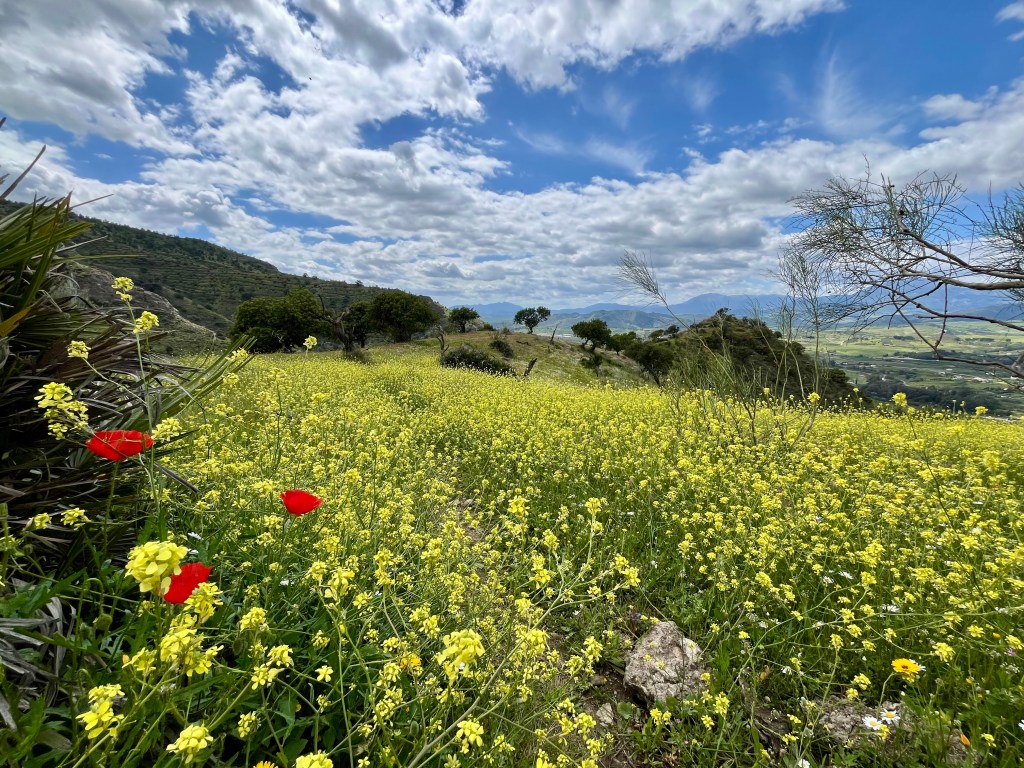
Walking around the slope provided stunning views of this miniature canyon and the valleys beyond. Wrapping around the trail we were delivered onto a ridge bedecked in millions of wildflowers. Fields of yellow, dotted with pinks, white and the occasional shock of red belonging to a poppy. It was unbelievable stunning.
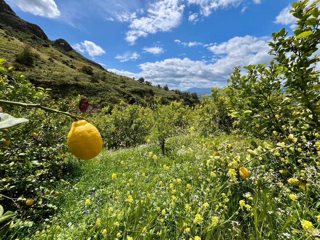
My little path took me back toward the creek. Doug, at this point, felt firmly the trail lay on the other side of a hill. Thus I found myself clinging to the side of an embankment with nothing to cling to. Fun that. But we made it to a bulldozed road that lead down. And eventually wound up in a lemon orchard. Picture branches laden with thousands of vibrant yellow lemons covering the hills. The still quite steep hills. Apparently one does not need anything close to level ground for Lemon trees.
We chose the wrong road here. Nearly wound up in someone’s back yard. Back up the hill we went. Where we eventually off roaded down a rock face into that same dry creek bed we started down way up on the hillside. Turns out we could have either continued down the creek bed (but we would have missed the flowers) OR taken my nice path toward the creek that Doug did not agree upon. That would have been the better option I think. Ah well. Next time.
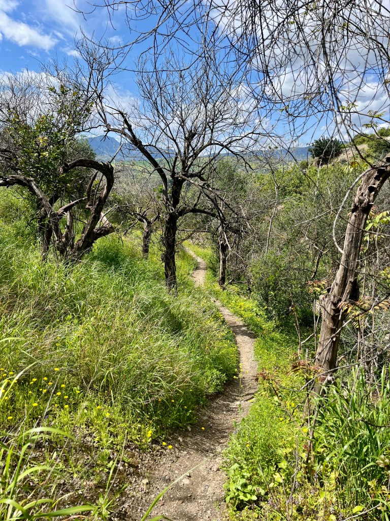
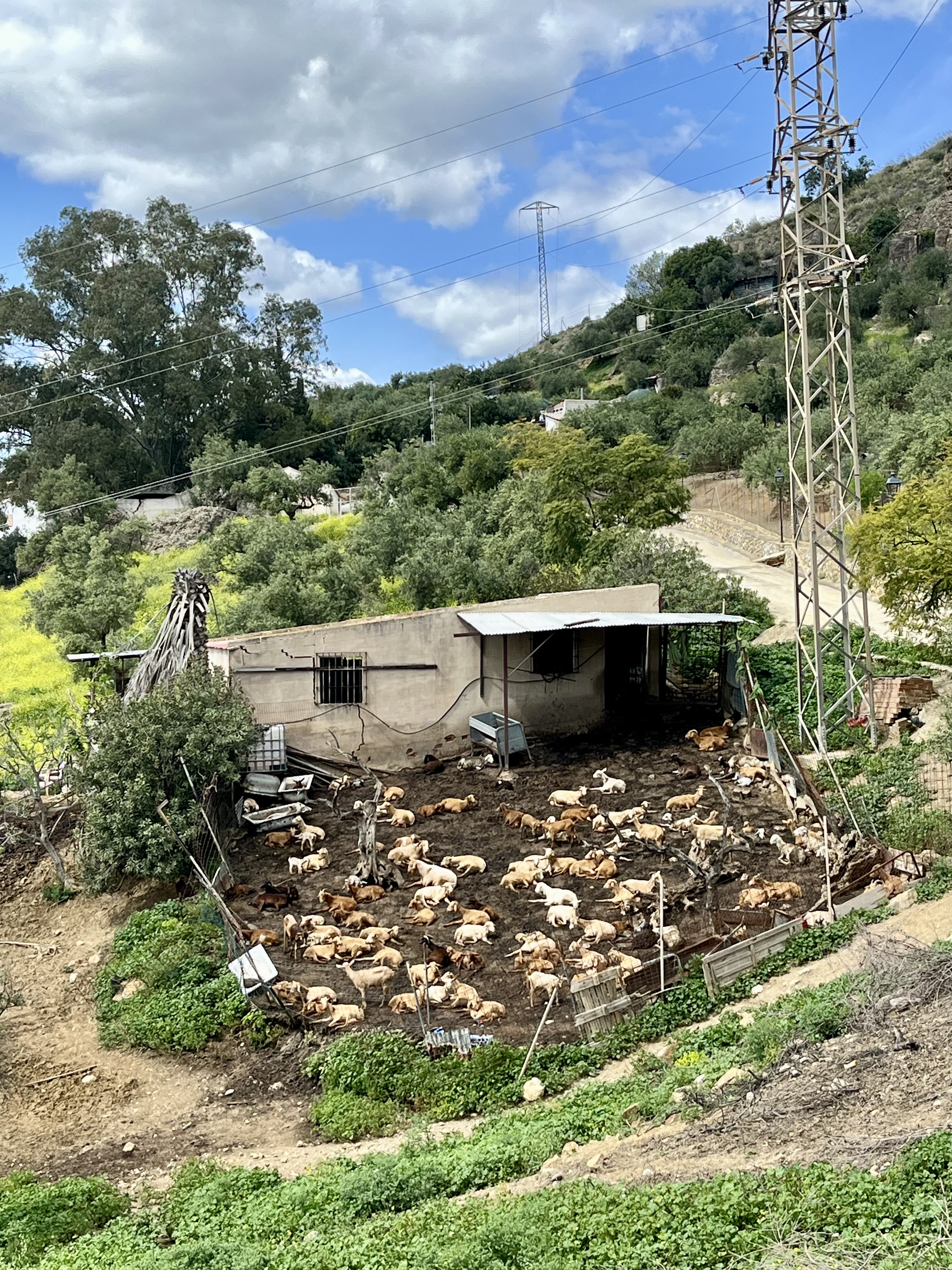
After a bit we popped out onto a road which eventually lead back into town and the train station. Along the way we saw bridges, the Ermita de la Fuensanta (which was closed and behind scaffolding as it is currently being repaired), hoards of goats, cactus, more lemons and loads of views into the valley below.


Strolling through town on a Sunday is fun. Nearly everything is closed except for a few restaurants. Here you’ll find generations of Spaniards cozied up around tables enjoying the day. Dishes flying out of the restaurant to the patio sections taking over the plaza’s and streets. Everyone looks happy and relaxed. The banter is free flowing. Nearly every passer by on the street is known and engaged with. It does make one long for such a sense of community. Though, it must take remarkably longer to do anything if you’re stopped every 20 feet by a friend and neighbor. Imagine running to the market for olive oil and getting waylaid 15 times by a friendly hello. Glorious and annoying. The introvert in me is intrigued and horrified. Things to ponder in the quiet solitude of home. Or while staring out the window of that very late train back to the Pueblo. For it was quite late. Even annoyed the locals it was so late.


Leave a comment