SOUTHERN SPAIN
Summary
Hiking from Benalmadena Pueblo, up to Mijas peak and back down to Mijas Pueblo gave rewarding views in all directions. Mountains, valleys, peaks, the Mediterranean Sea and ending in a quaint village. What’s not to love?
Trail Stats
Mileage: 13 miles one way
Total Elevation Gain: 4,341 feet
Toilet at trailhead: No
Sandwich Spots: Yes
Parking: Street Parking
Mileage/EG from Garmin Watch

Trail Details
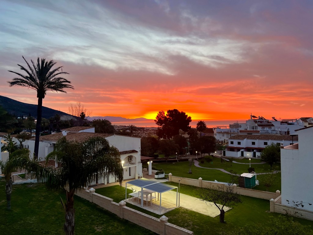
Lacing up our boots bright and early, we headed out at sunrise. Which was magnificent. Got a smidge distracted en route to the trailhead by the glowing orange horizon. I love sunrise. I adore the golden hues bringing in a new day. So beautiful.
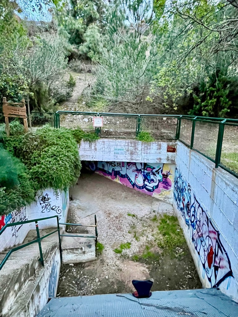
Once we made it to our trusty Luis Cernuda Park trailhead, it was through the tunnel (still ick) below the freeway and uphill. While there are many starting points one could choose, we have relied on this one as it’s a relatively short walk from our place. Perfect as we don’t have a vehicle while in Spain.
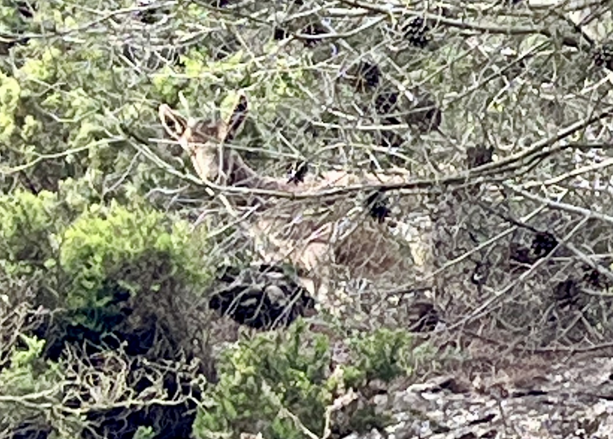
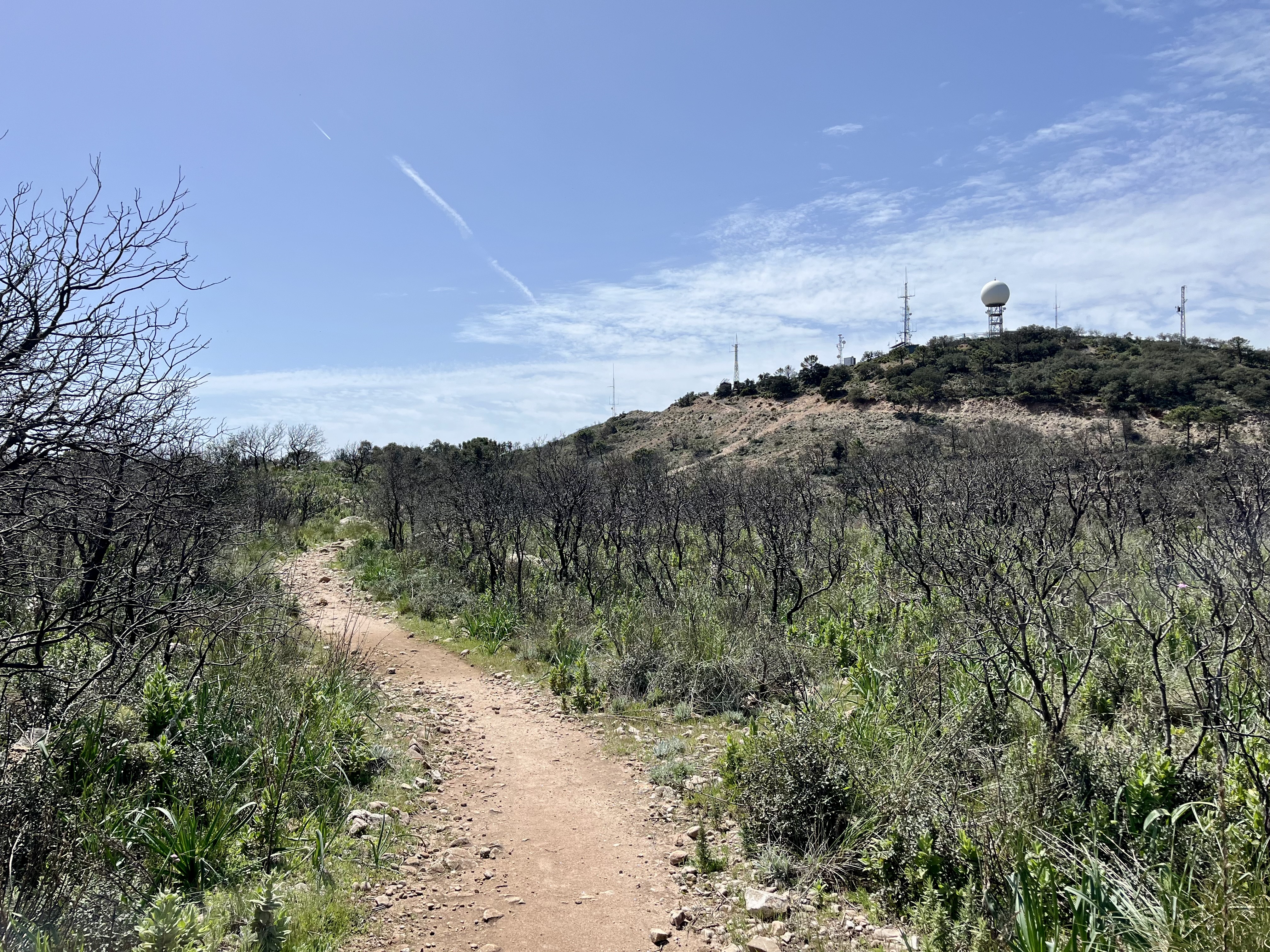
To avoid repeating myself, I’ll start off after the towers atop Cerro del Moro. The only significant difference this time around, was we briefly saw an Iberian Ibex staring at us before disappearing into the trees. Pretty neat to see wild goats.


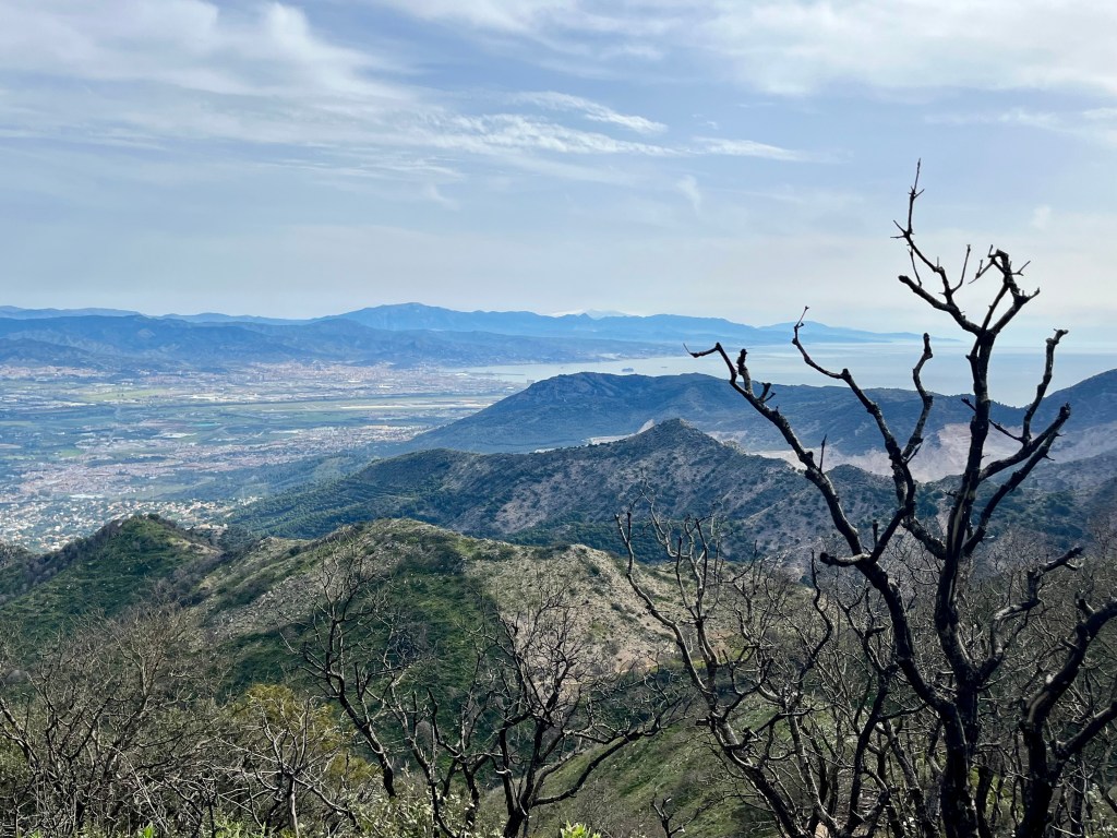
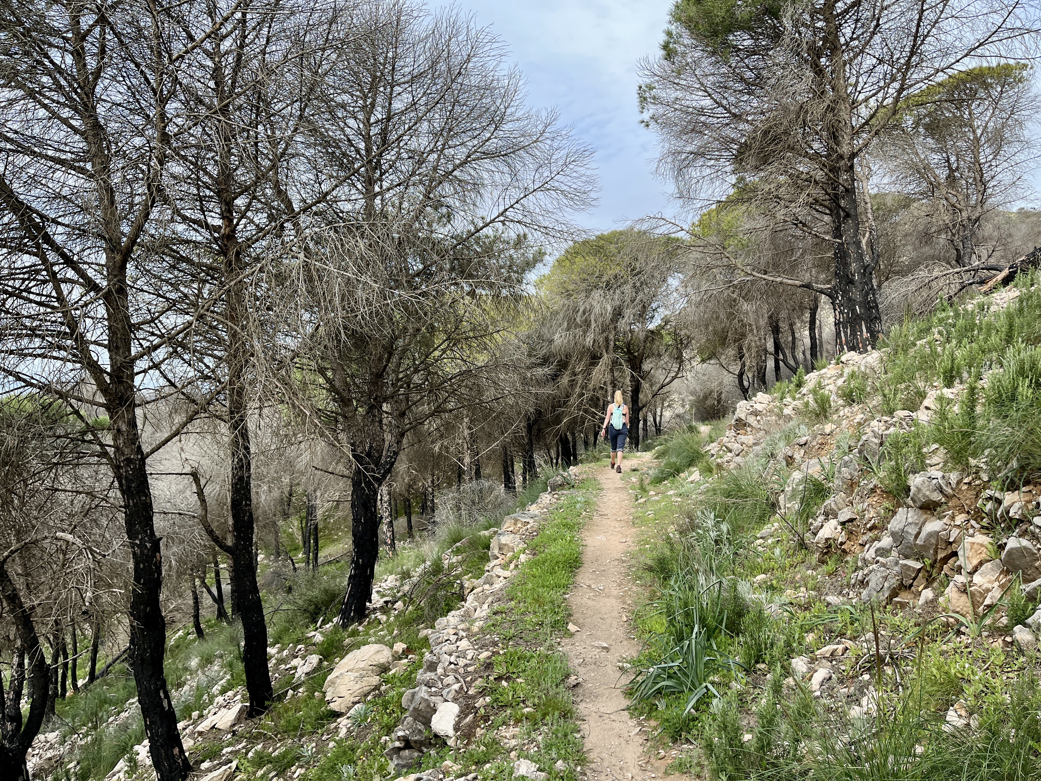
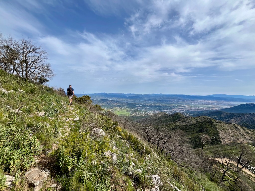
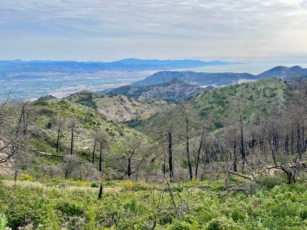
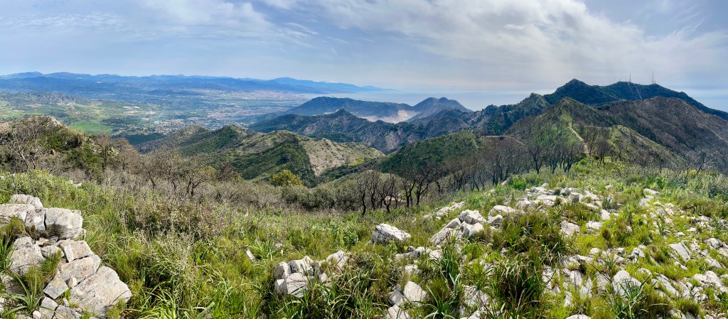
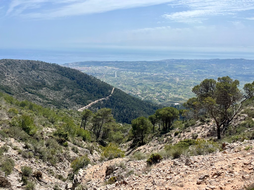
Should one want to read about the uphill climb, visit the Cerro del Moro and Monte Castilljos post. Otherwise, we’ll head down the paved road a tad before a sign directs you back onto a path to Mijas. Said path takes you into the woods and loosely follows the road below. You’ll leave the sea behind as views of the valleys and mountains beyond open up. Little white villages dot the hills. Towns spread across the valley floor, intermixed with forests, orchards and fields.
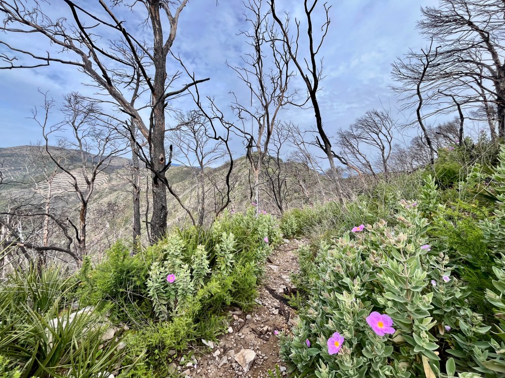
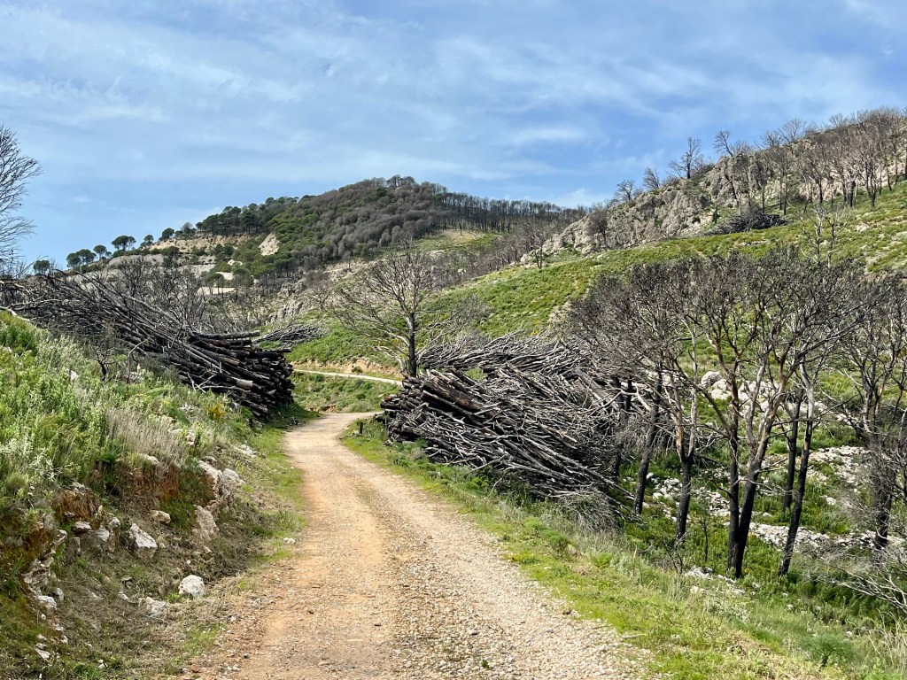
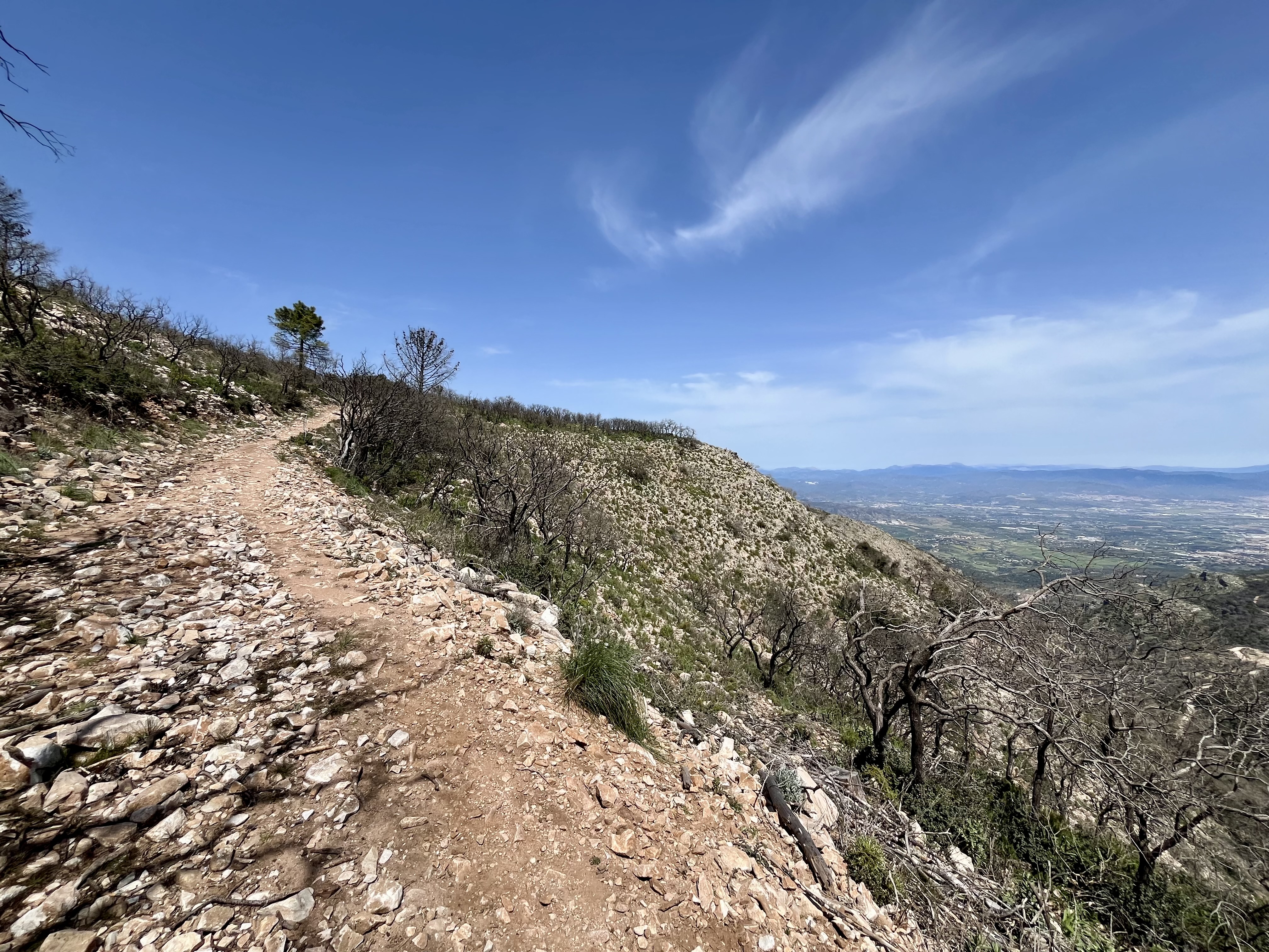
Apparently there was a rather large fire in those hills, maybe three years ago. Consequently, the hills are covered in the burnt out skeletal remains of trees. There are signs warning of extreme danger from falling tree’s as they are no longer stable. On a windy day I’d likely avoid the area. However, the day was partially overcast with zero breeze. Perfect for hiking mostly in the open. Would have been hot in full sun.
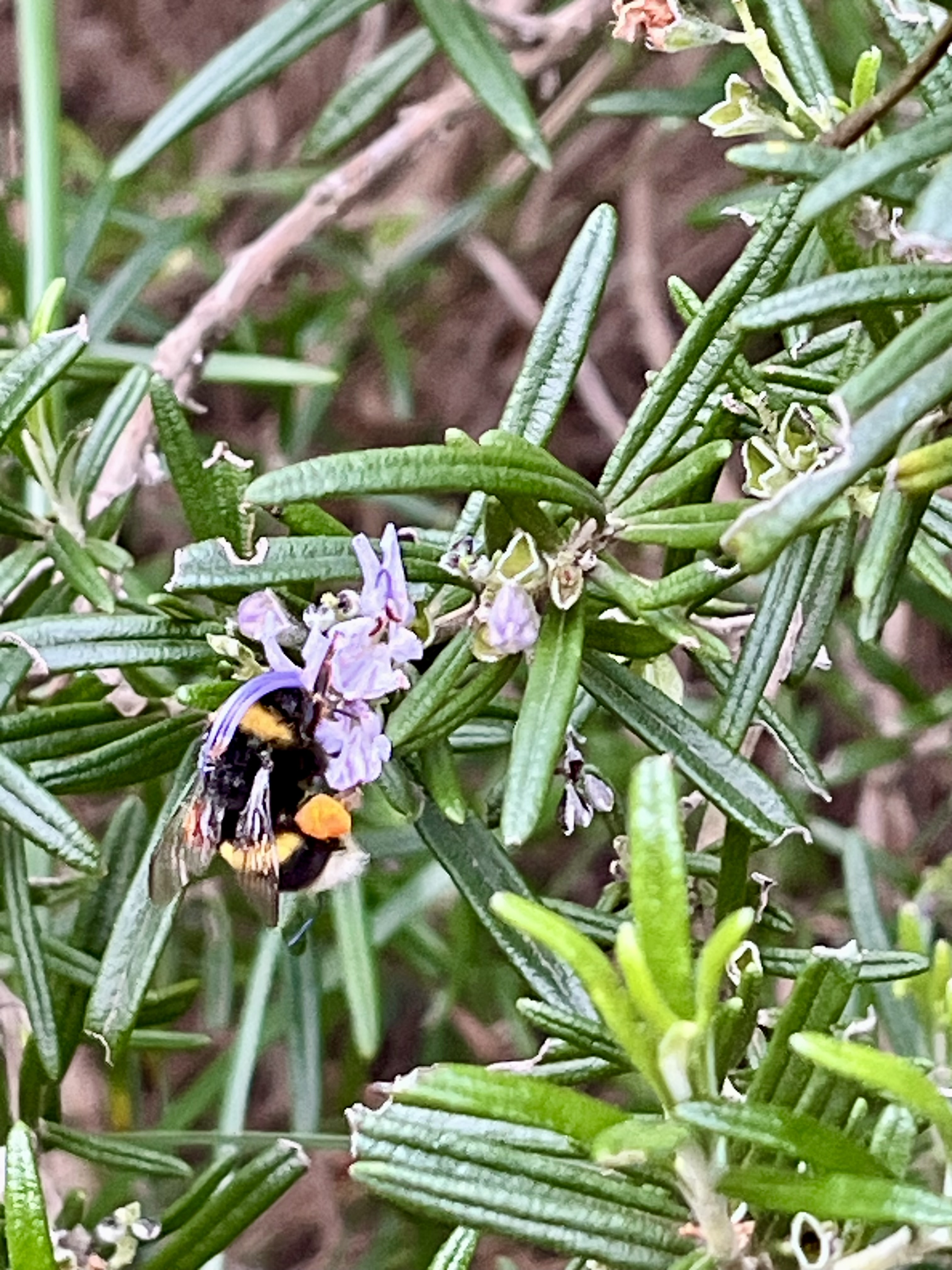
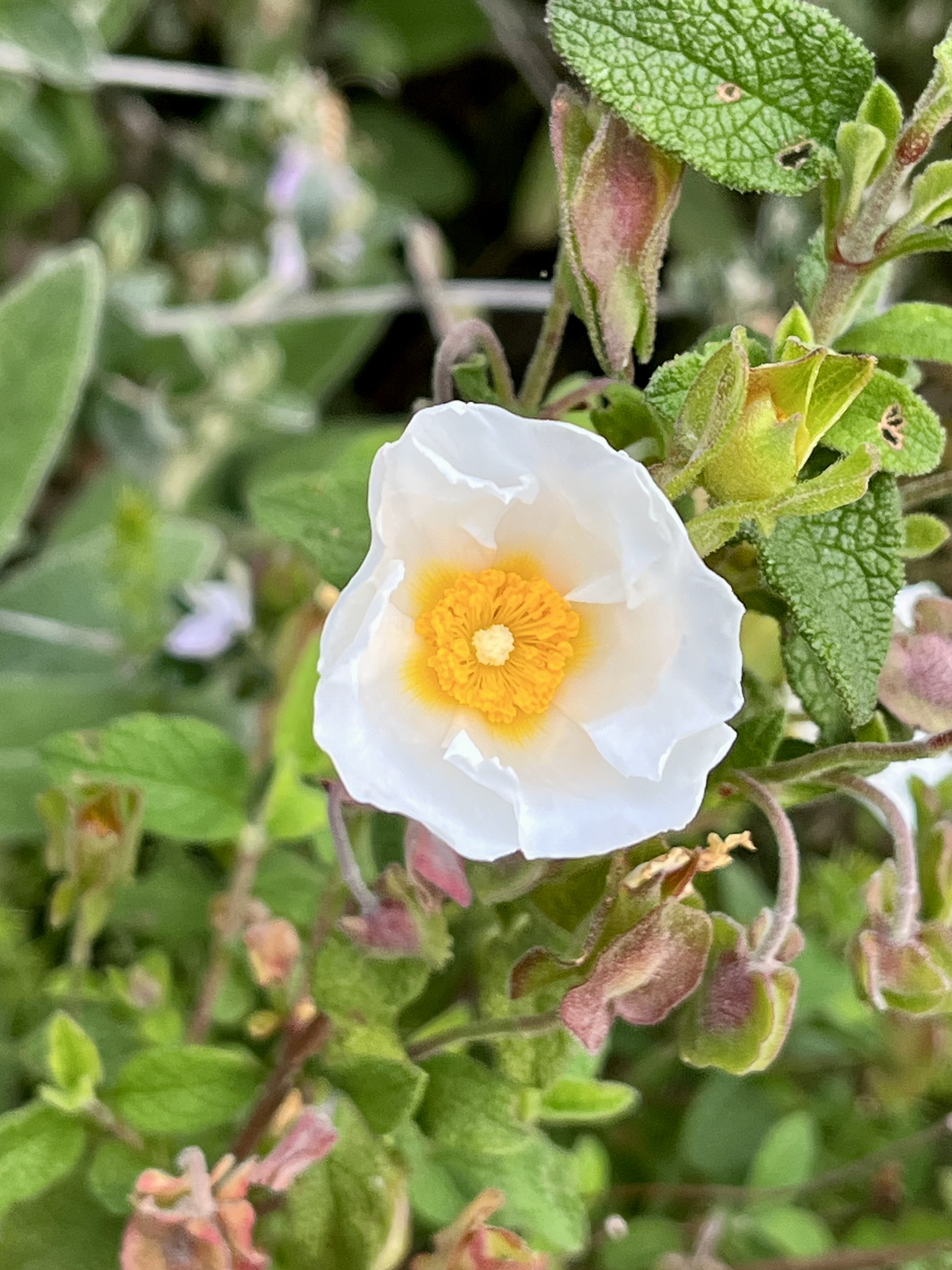
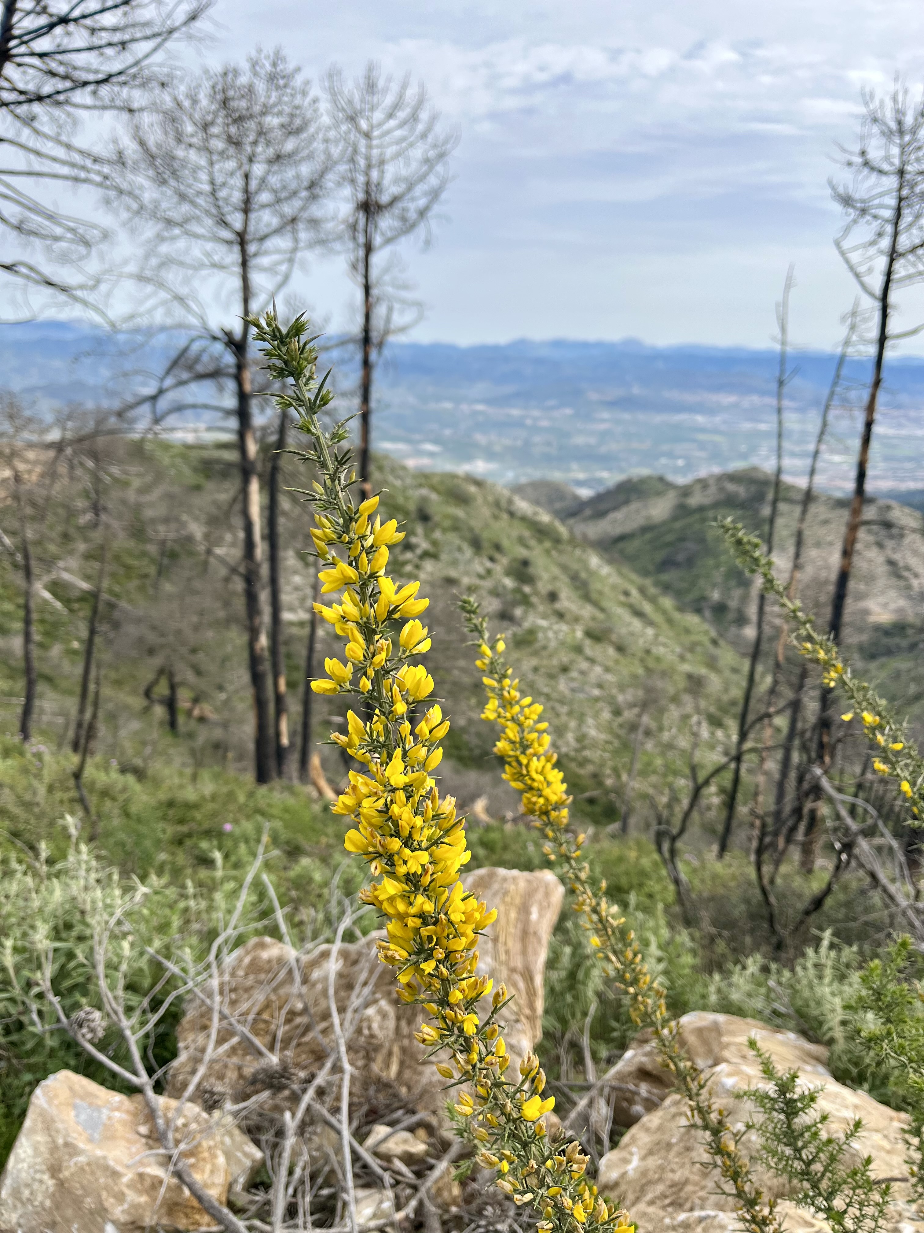
Throughout the burnt out trail, there are blowdowns to navigate over, around or under. A few times they made trail finding mildly challenging. There are large stacks of tree’s piled high in spots where clean up efforts have ensued. Some replanting has taken place. A smattering of flowers color the hills in shades of yellow, pink, purple and white. It’s all quite lovely amidst the stark contrast of blackened tree’s.
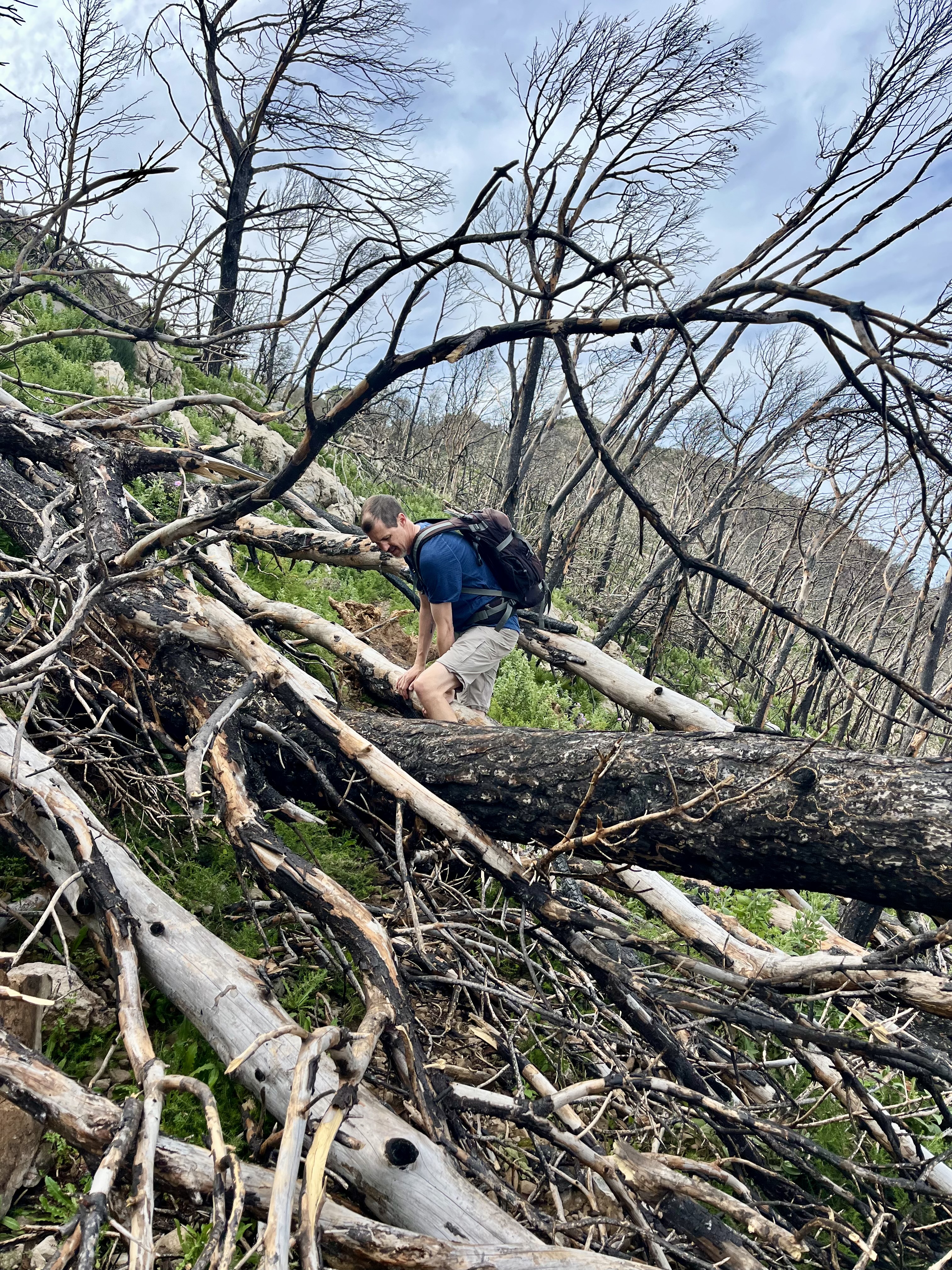

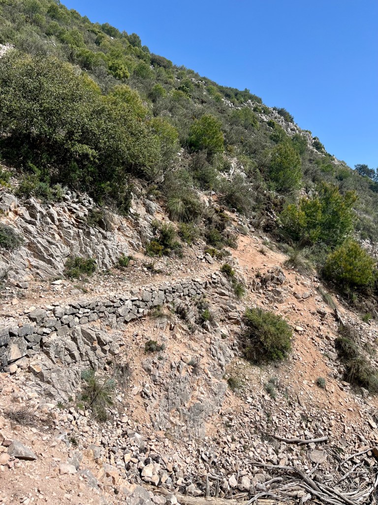
After a while the single track trail dumped us onto a dirt road. Which we happily followed until we came across a rather impressive mass blowdown and stacks of felled trees. And realized we were in fact, no longer on the correct trail. Backtracking up road, to a smaller blowdown, we hunted around a bit before finding a highly overgrown trail.
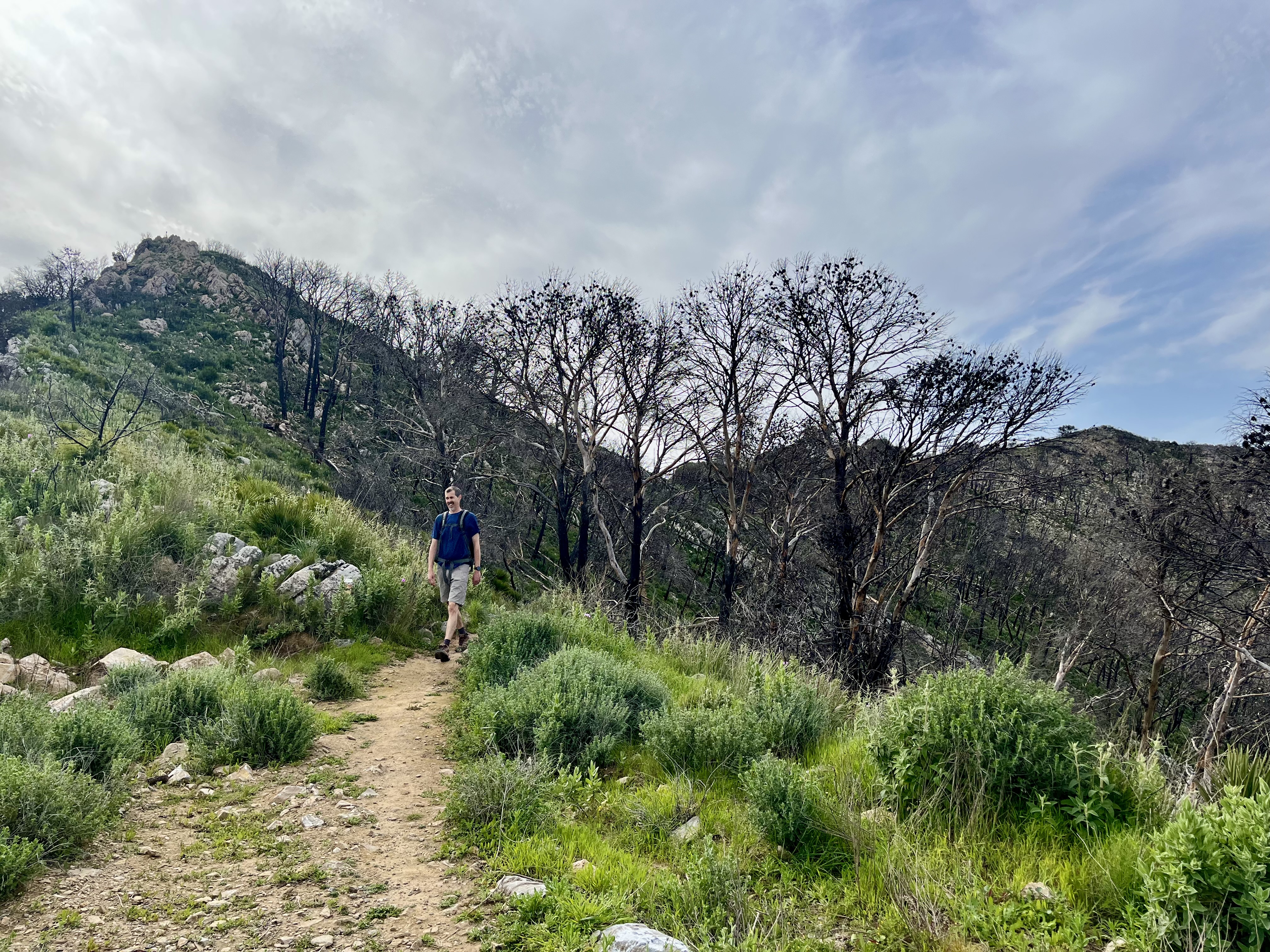
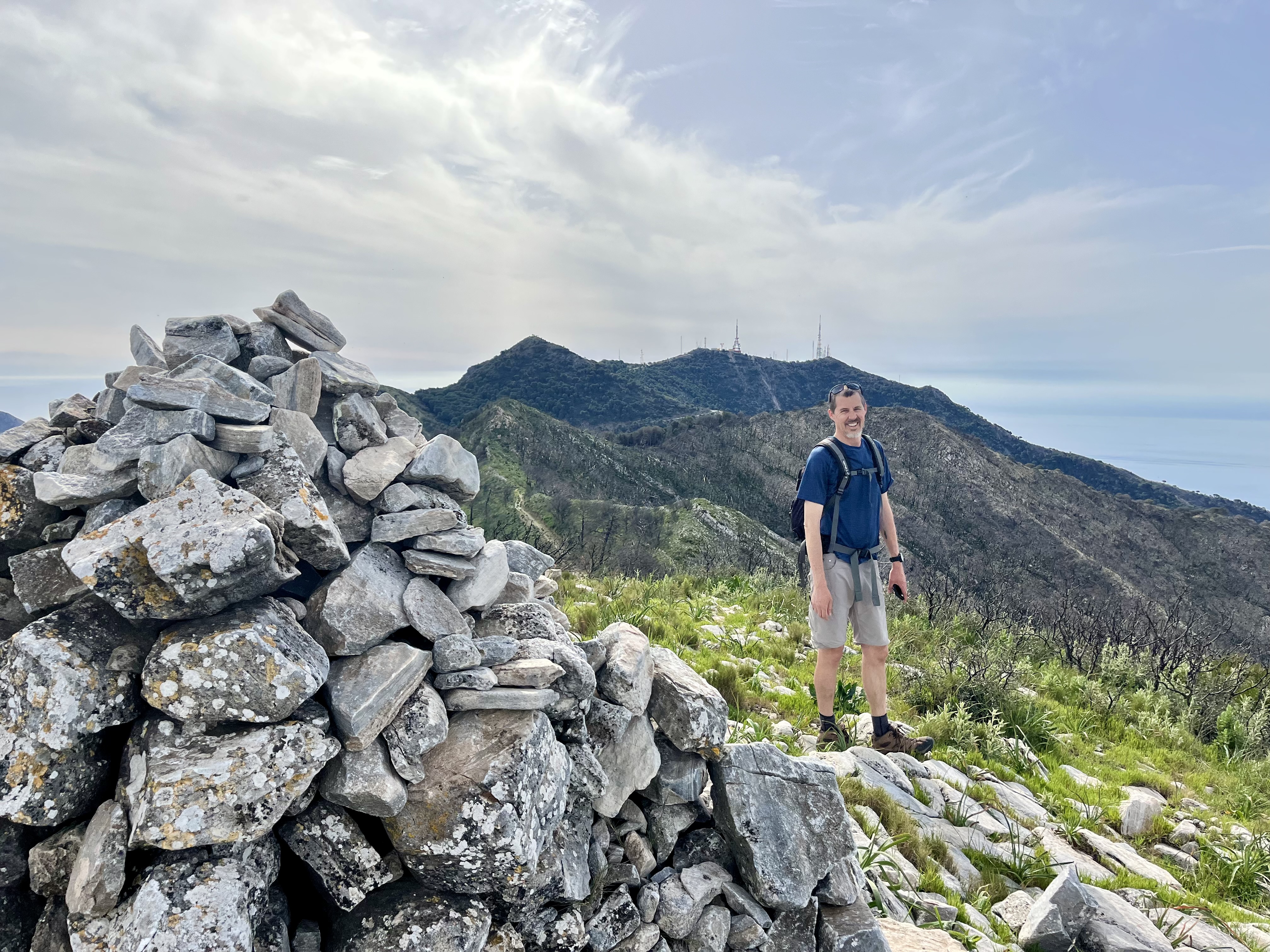
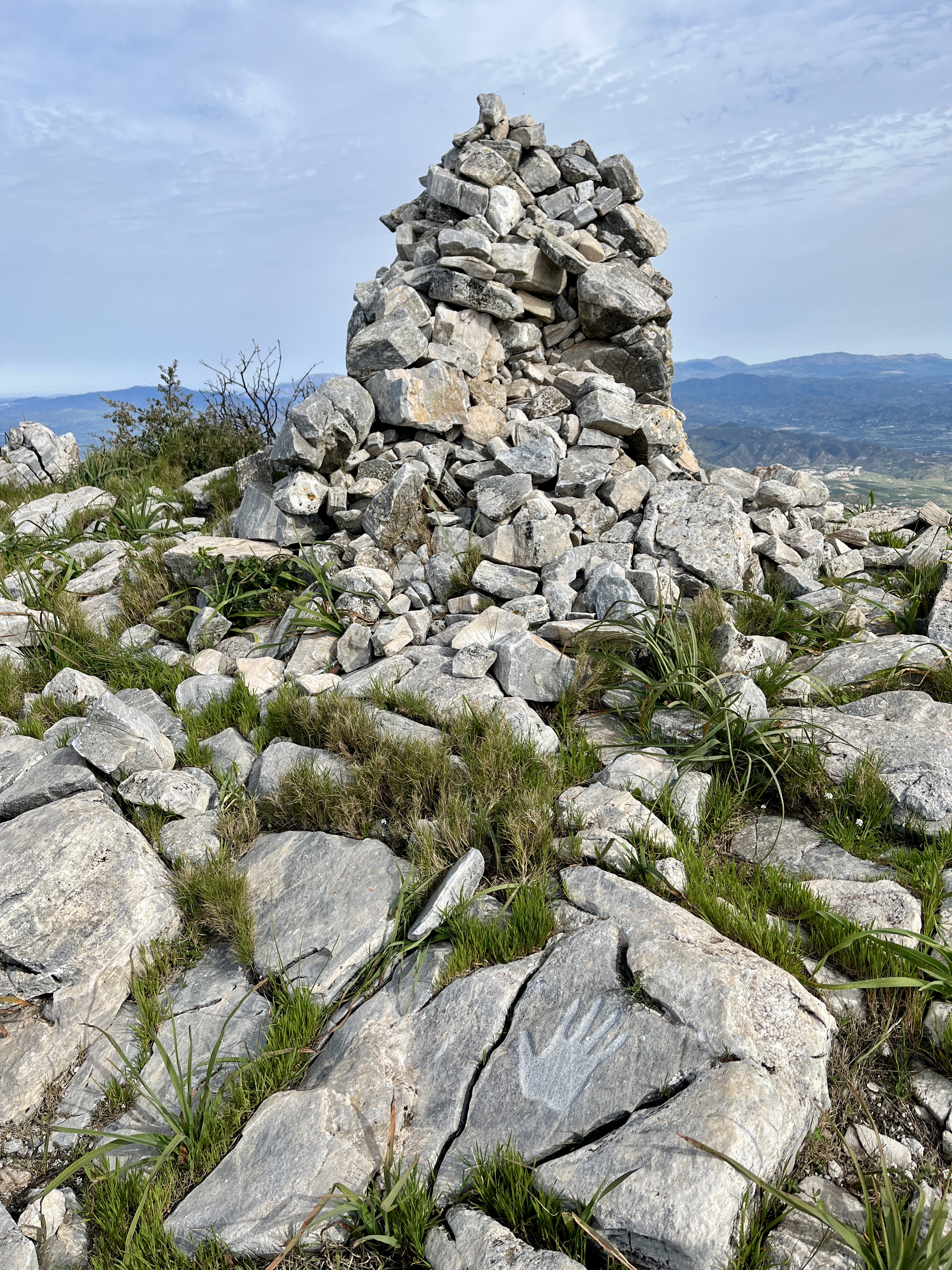
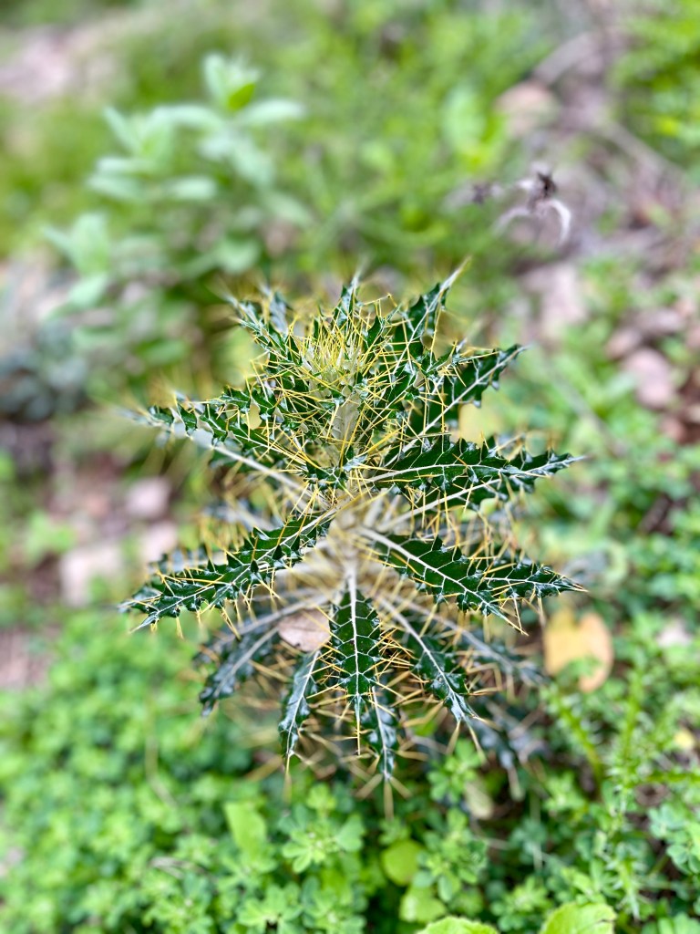
Here is where I learned Spain is full of prickly plants. Everything seems to have thorns. Even the grass has ridiculously sharp edges. All made more apparent as we half bush whacked our way uphill. This overgrown trail diverts up to Cerro de Medialuna, a small peak with a rock pile that rather resembles the leaning tower of Pisa. There’s quite a list to the side, as if a strong gust of wind just might topple it over. Regardless, the views here are superb. Fabulous spot for a snack.
In theory, there’s a trail that reconnects you to the main overgrown trail from here. We did not find it and backtracked a tad. Followed this trail for a bit. Guess where it lead? Straight to that massive blowdown area where we had turned around on the road. We missed the trail as you had to slide down a steep embankment to the road. Apparently most people stick to the road and bypass Cerro de Medialuna. Which is a shame because aside from all the prickly plants and a few massive spiders across the path, it was quite lovely.
Speaking of spiders, I should mention we had come across exactly zero other persons on the trail thus far. And I seemed to be doing a superb job of clearing the trail of spider webs. I was covered in them. While I cleared out the lower sections, Doug being taller cleared out the higher areas. With his face. Yuck. Why are those webs so impossible to get off? I could feel them across my arms and face and yet couldn’t quite seem to wipe them off. Sticky little strands.
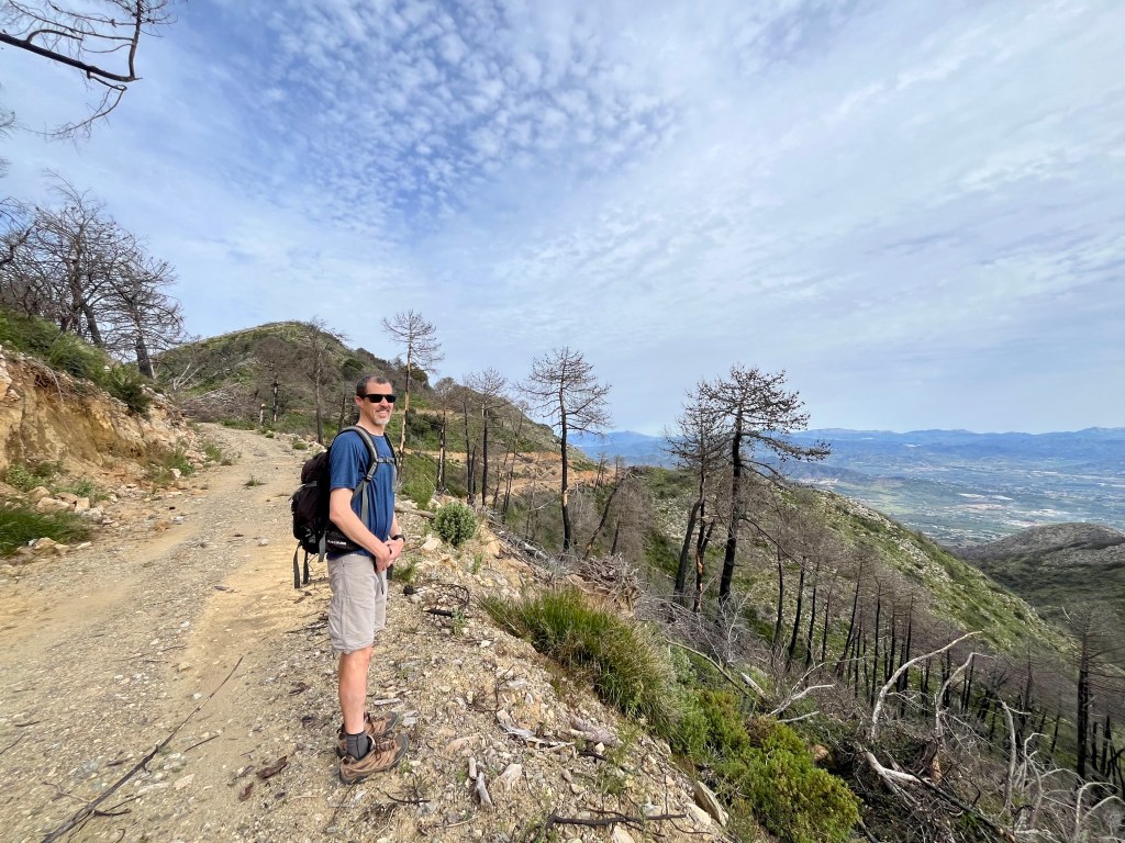
Back at the massive blowdown, we found a fairly well traveled path through (we looked in the wrong direction the first time) the jumble of tree’s. Popping out the other side, it was back to the road. You’ll stay on this road for what feels like an eternity. The views are quite vast and the footing is easy, which is quite nice.
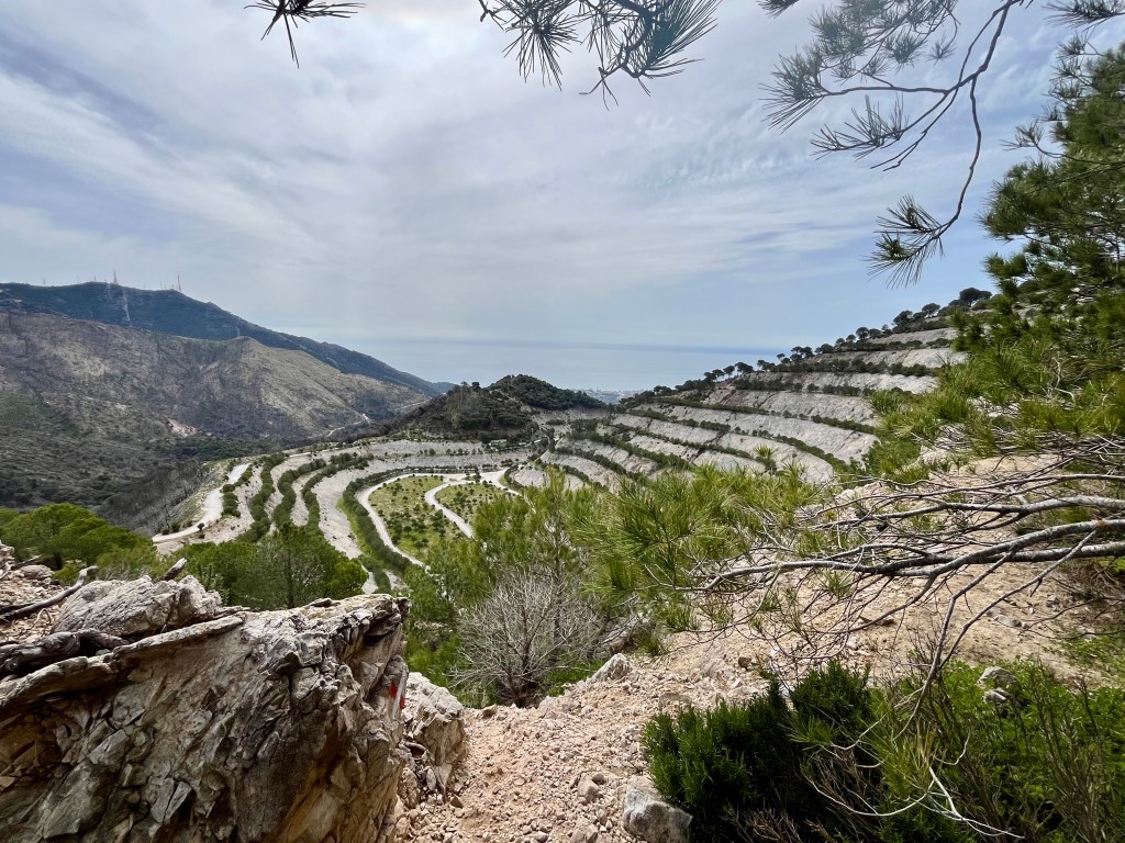
Further along, you’ll see the old quarry of Los Arenales. It’s close to the village of Mijas, technically just around the mountain bend opposite the direction we took. There are a few roads toward the quarry, one will take you into it, one offers a view and the last leads up. We went up. From here there’s a small offshoot trail that leads to a viewpoint of the quarry. The trail itself is in rough shape with a bit washed out but otherwise it leads to a great overlook. We saw four other people in the distance but never came across them on the trail. Also saw what appeared to be a park ranger slowly driving along the lower road.
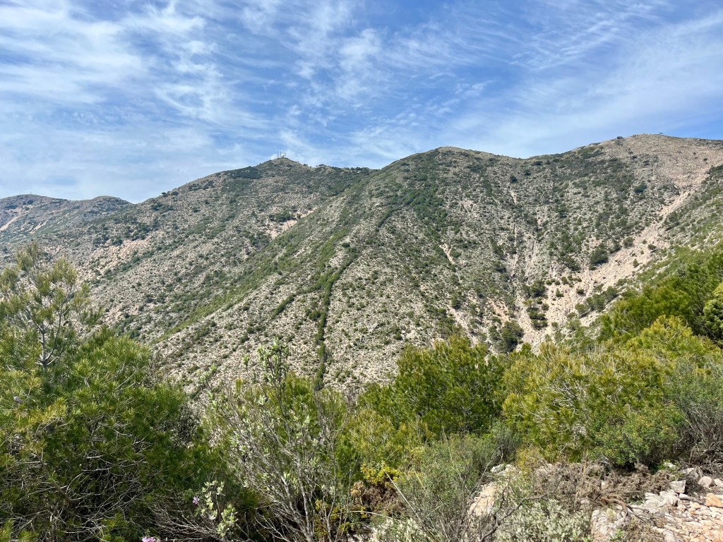
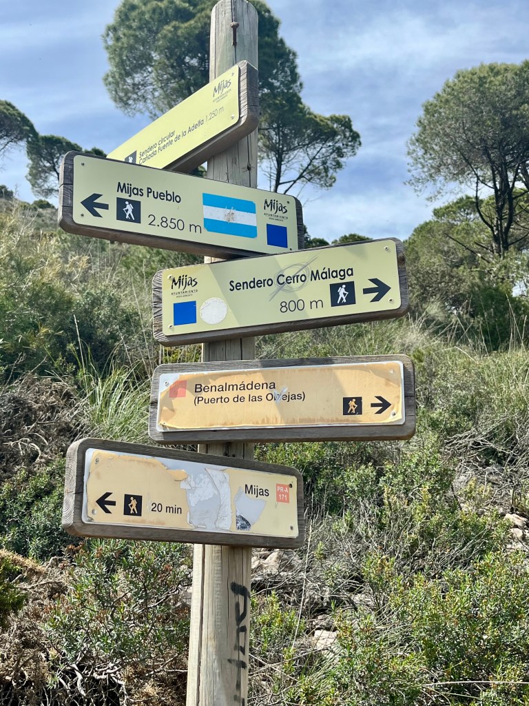
Heading up from the quarry overlook we walked along a rutted out road that met up with the road we had been walking along. You’ll follow this road for quite awhile longer. Somewhere up this road there’s a well marked single track trail leading straight uphill to one of the tallest peaks in the small Sierra De Mijas mountain range. This trail (in theory) takes you up via a very rocky trail to the summit, heads downhill and then back up to Mijas peak.
We stuck to the main road which also leads to Mijas peak, just without the extra up and down. Though we were sorely tempted. But our desire to reach Mijas peak, Mijas Pueblo, have time for a drink with tapas, AND still catch a bus back to our home base won out. So. The road it was.
Reaching a large junction of trails we stopped for a bite. In other words, ate half our sandwiches while sitting in the shade. Doug grabbed two large flat rocks and plunked them down on the hillside as impromptu seats. Mine was cozy. Muy bueno. When Doug sat down there was a bit more excitement. To the rear of his seat was a pricker bush, which he half sat on for half a heartbeat. Needless to say, he returned to an upright position with quite a lot of haste.
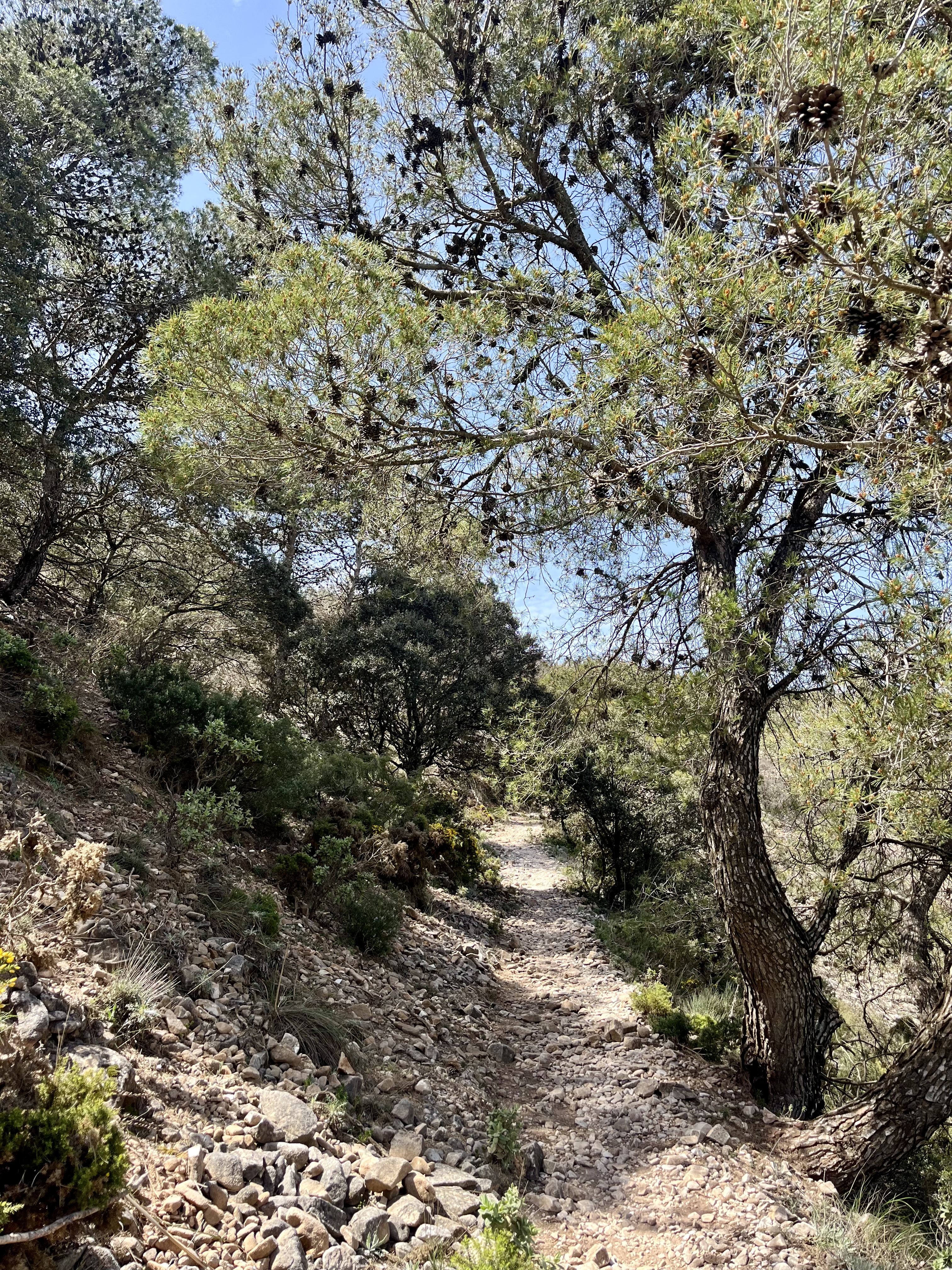
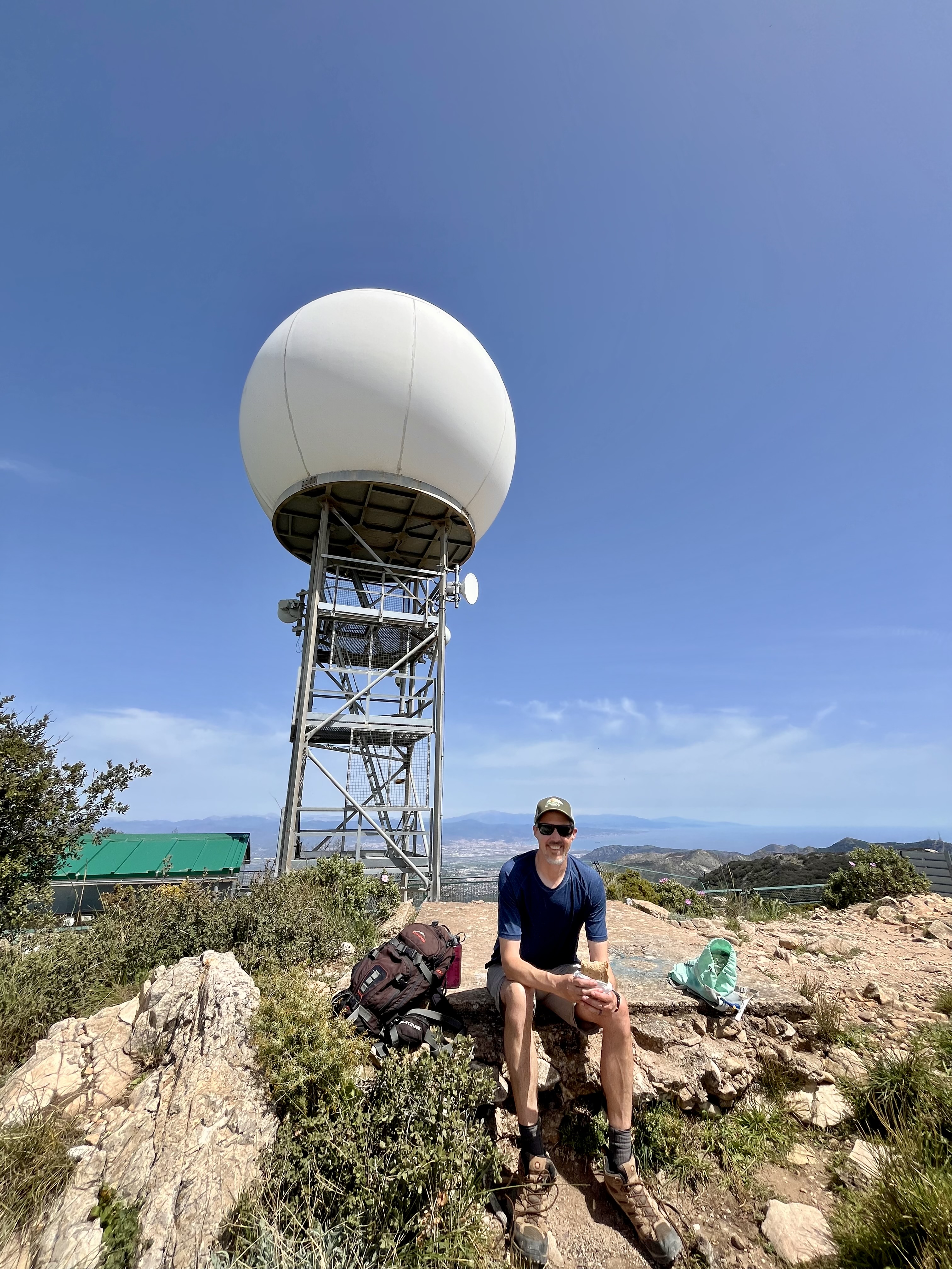
Once our bellies were satiated it was back to it. This time, at a 5 way intersection of trails, we diverted off the road onto a single track headed uphill to Pico Mijas. Strolling along this rocky trail there are some tree’s offering shade, though you’re frequently in the open. Soon the white dome that tops Pico Mijas comes into view and after a few twists and turns you’ll find yourself on a dirt road. Head toward the peak. You really can’t miss it.
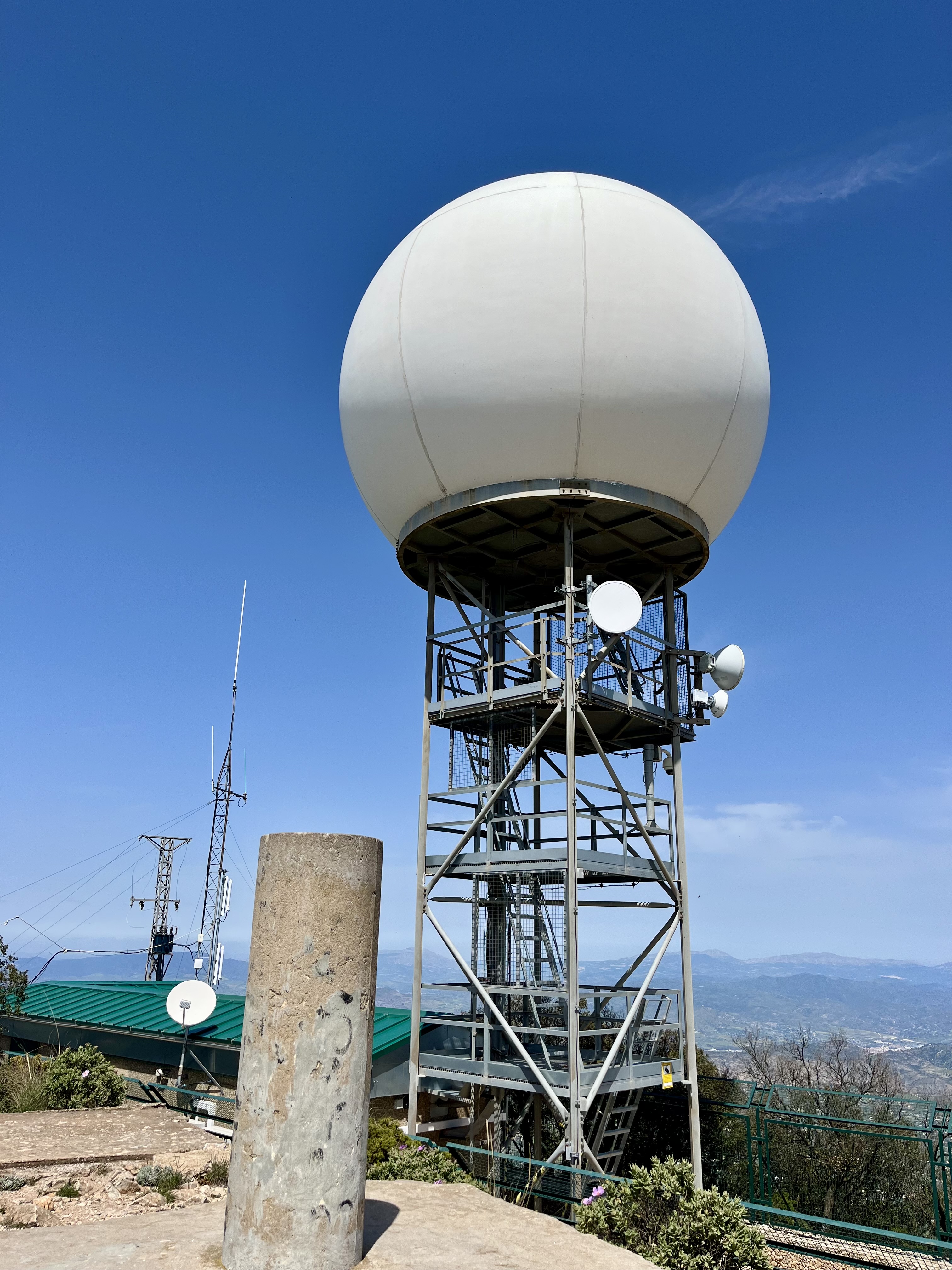
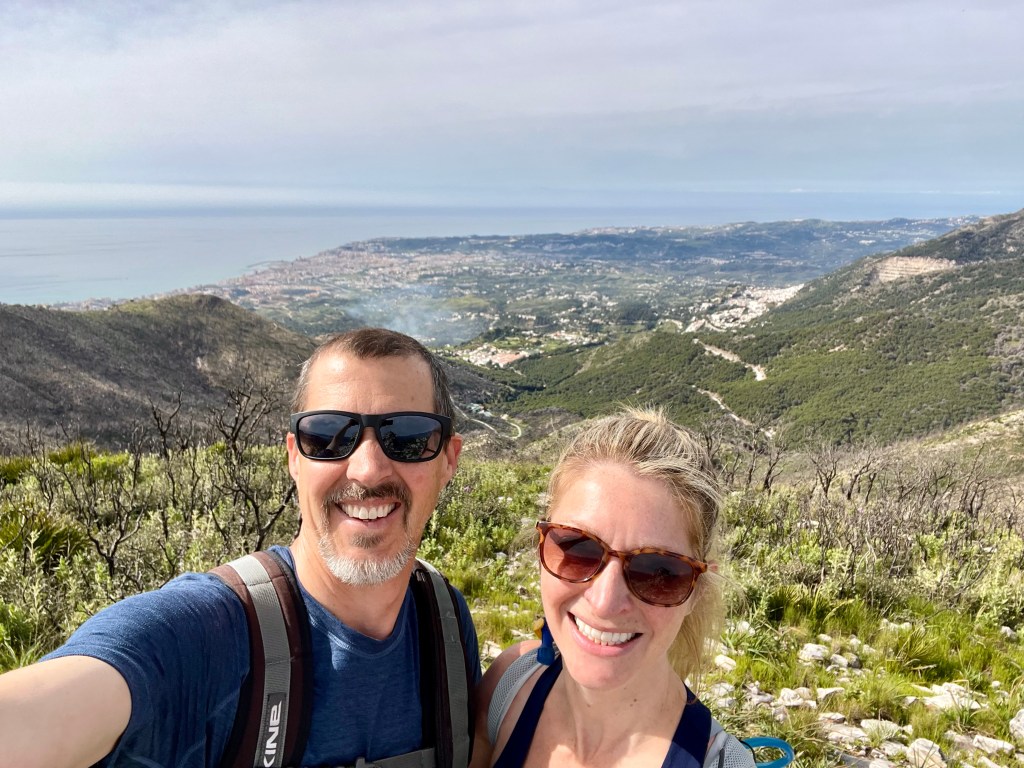
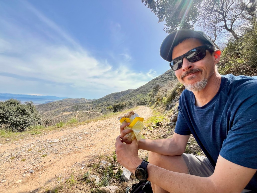
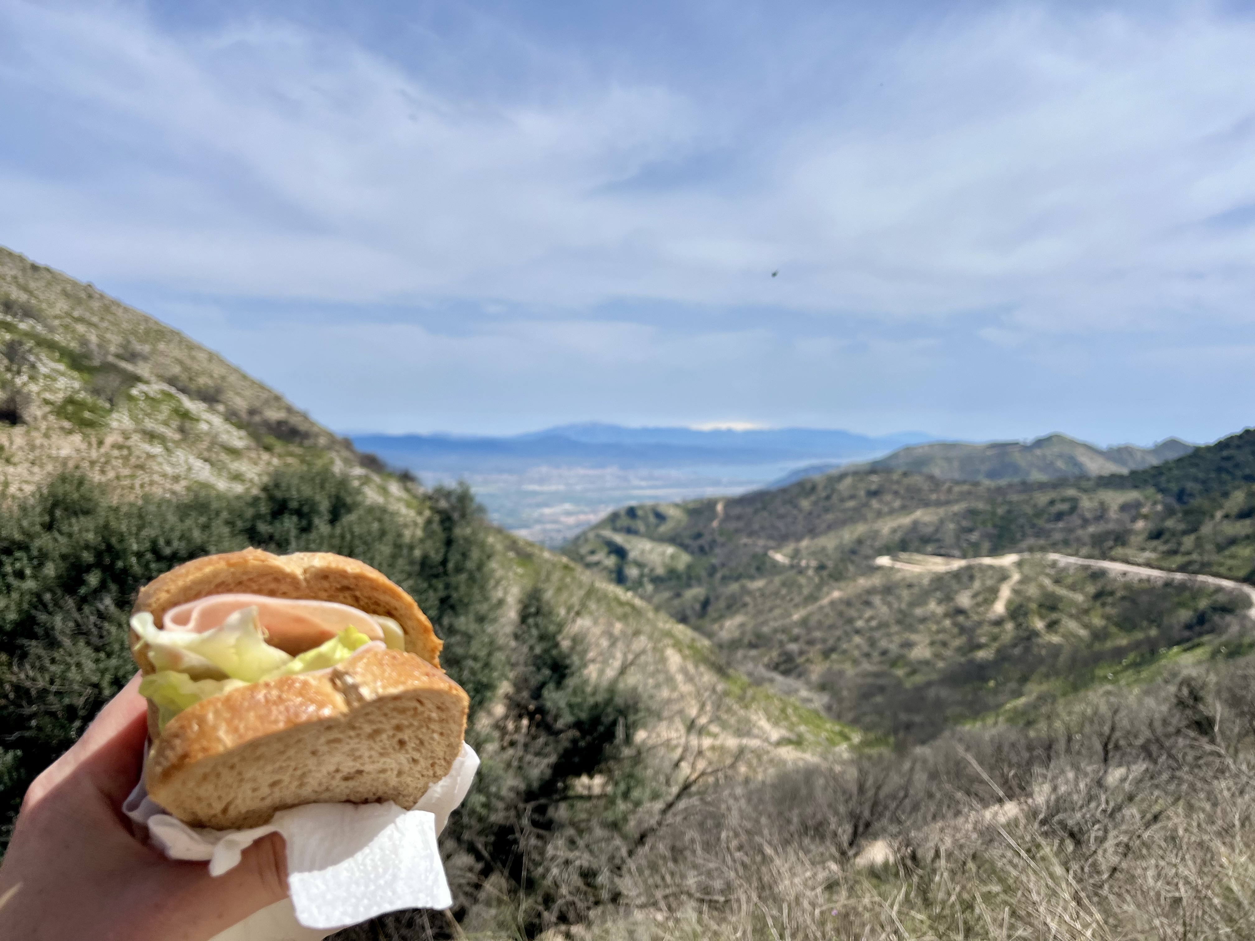
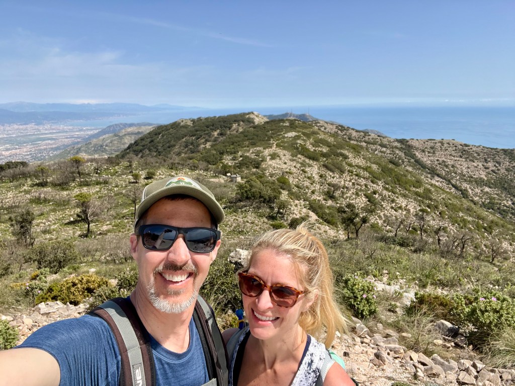
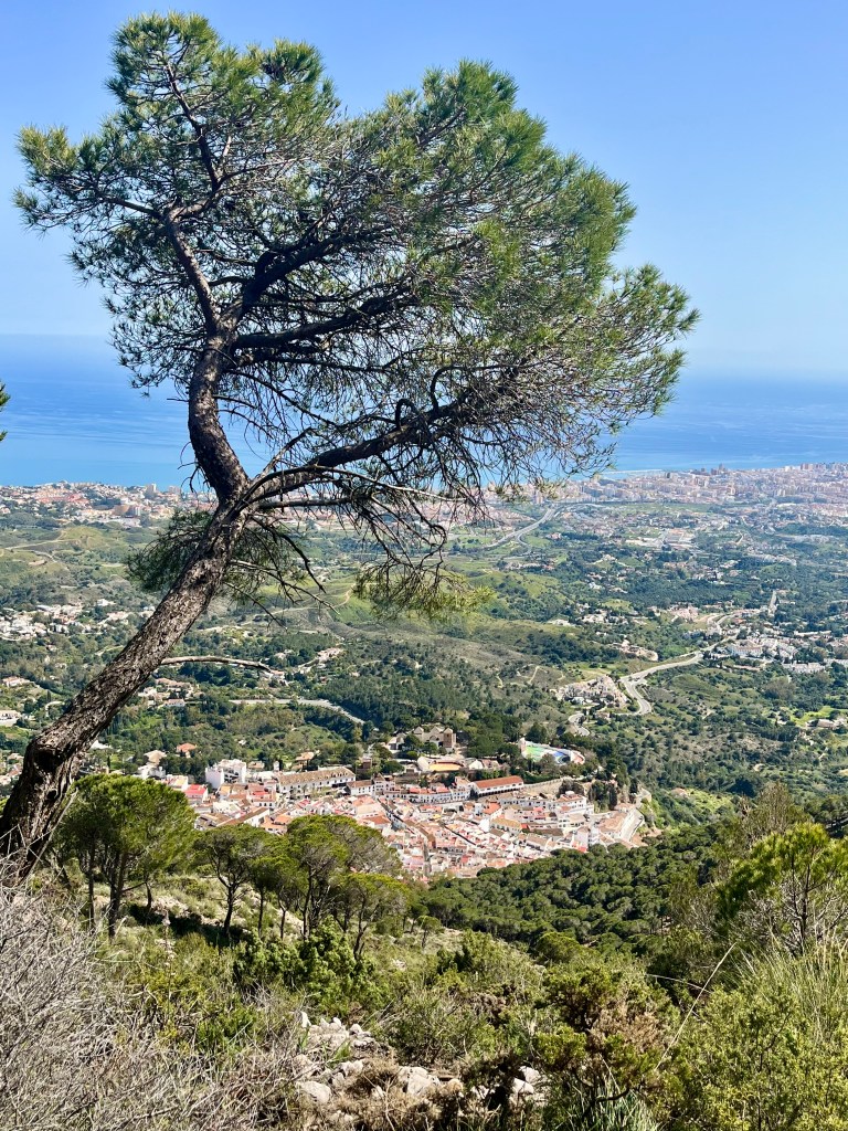
Atop the peak are two cement platforms that provide a perfect perch to sit on and take in the extensive views. The most difficult part is deciding which direction to gaze out at. We chose the Mediterranean views for our official lunch spot. Ham and cheese sandwiches with a side of strawberries today.
Oddly enough, though we had run into no one thus far, we were joined atop the peak by two other groups. Go figure. Two trail runners who were “working remotely” that day. Two rather unfriendly hikers from Belgium seemed to delight in walking directly in front of us, despite a rather wide path behind us. And they say Americans are rude. The latter group seemed to be a couple. The woman was loud and had a lot to say. The gentleman didn’t say much, it seemed as if he’d rather rest in the shade. He was wearing jeans. They had come up from Mijas. That trail is mostly all exposed and quite steep. I can’t imagine how miserably hot he was. Regardless, it’s funny how you’ll see no one on a trail, then meet all the people when at the peak.
Hitting the trail again, we had a lot of downhill ahead of us. While the total elevation gain on this route was over 4K feet, the total descent was a whopping 3,737 feet. And the vast majority was in this small section. Parts were quite steep.

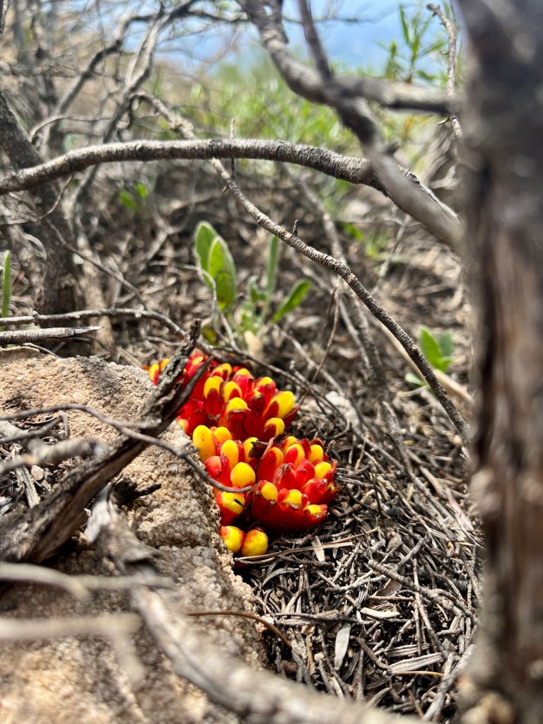
The trail itself winds around a sharp slope. There are junctions. Do take heed of which trail you take. You could wind up rather far out in the middle of no where. That being said, there are a bunch of interconnecting trails and consequently quiet a few ways into Mijas Pueblo. Somewhere in here, I kept seeing these bizarre fungus/mushroom growths. Brilliant orange, red and yellow. Quite pretty actually. Though I had no desire to touch them. I hunkered down to snap a photo and managed to stick my behind into one of the many thorny plants in the area. Yeowza. The dumb thing attached itself to my rear end and had to be plucked from my pants. Ah well, I guess both of us “sat” on thorns today. Seriously though, who designed these nasty plants? And why are they all sharp?
We basically followed signs for the Pueblo and wound up taking a longer than needed route. It wound around the backside of the mountain and once again had us looking at that old quarry we had seen miles ago. Granted it was in the distance.
Should you like loose rocks of all shapes and sizes, then this is the trail for you. If not, too bad. You’ll likely take an unexpected slide via rock. Kind of like boarding down a sand dune, except you never know when you’re about to take off. Makes it kind of exhilarating.
Way downhill, as Mijas Pueblo slowly visibly drew nearer, the sounds of civilization returned. Vehicles, honking horns, shrieking children, dogs barking and the random bray of a donkey. Apparently donkey cart rides are a thing in Mijas.
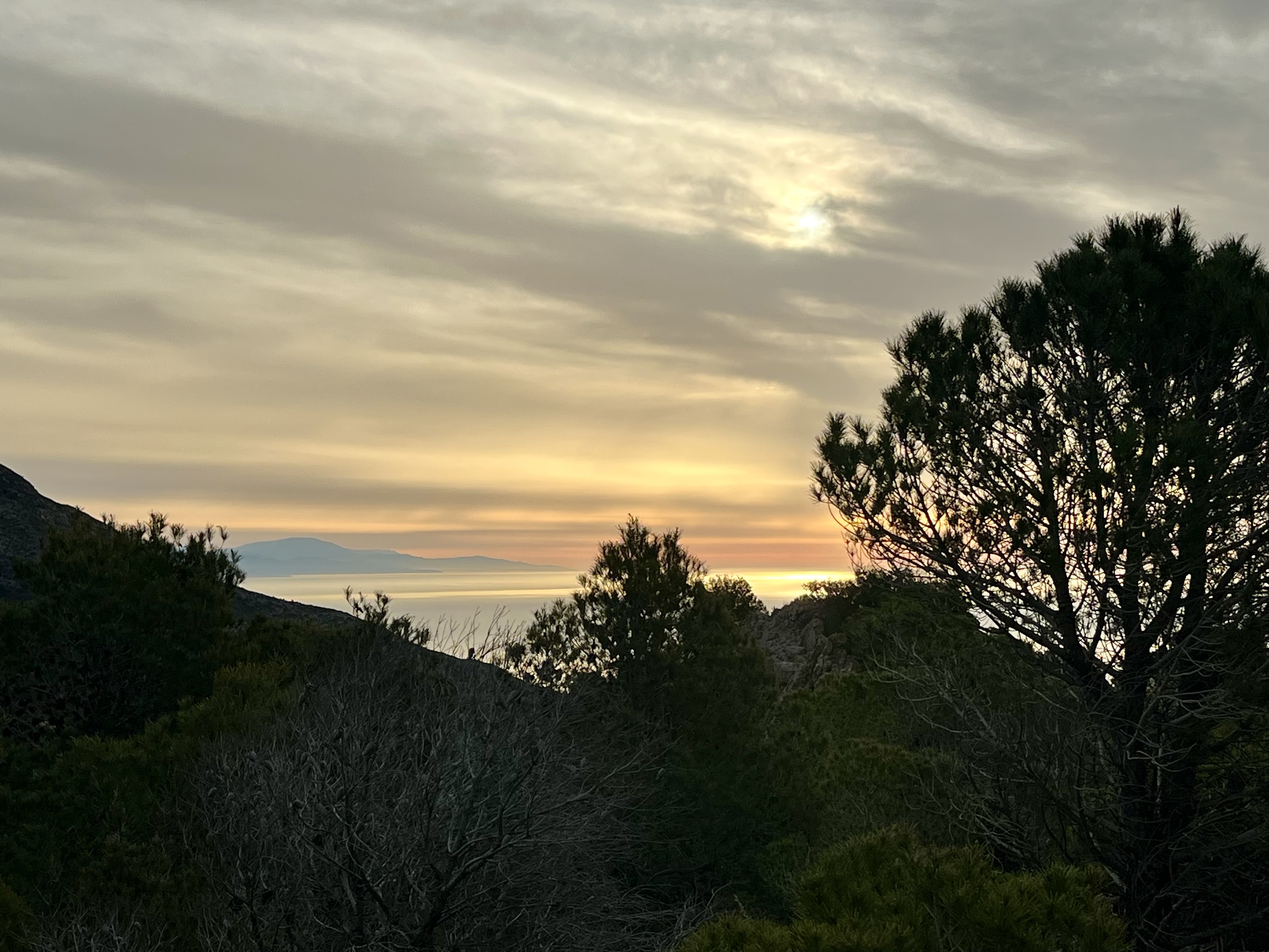
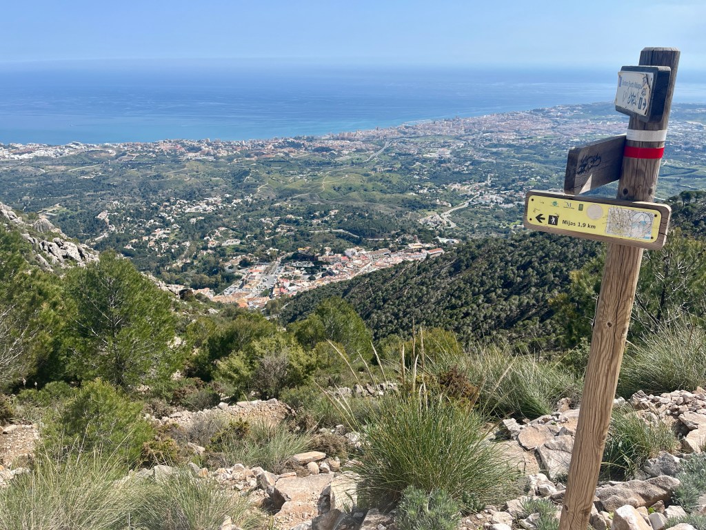
Prior to entering the town, Elmira Del Calvario, sits nestled into the hillside. It’s an adorable small white chapel. There’s a small rock paver filled open area in front of it. Here you’ll find stunning views overlooking Mijas, out to the coastal town of Fuengirola and the Mediterranean Sea. On a clear day you might even glimpse Africa.
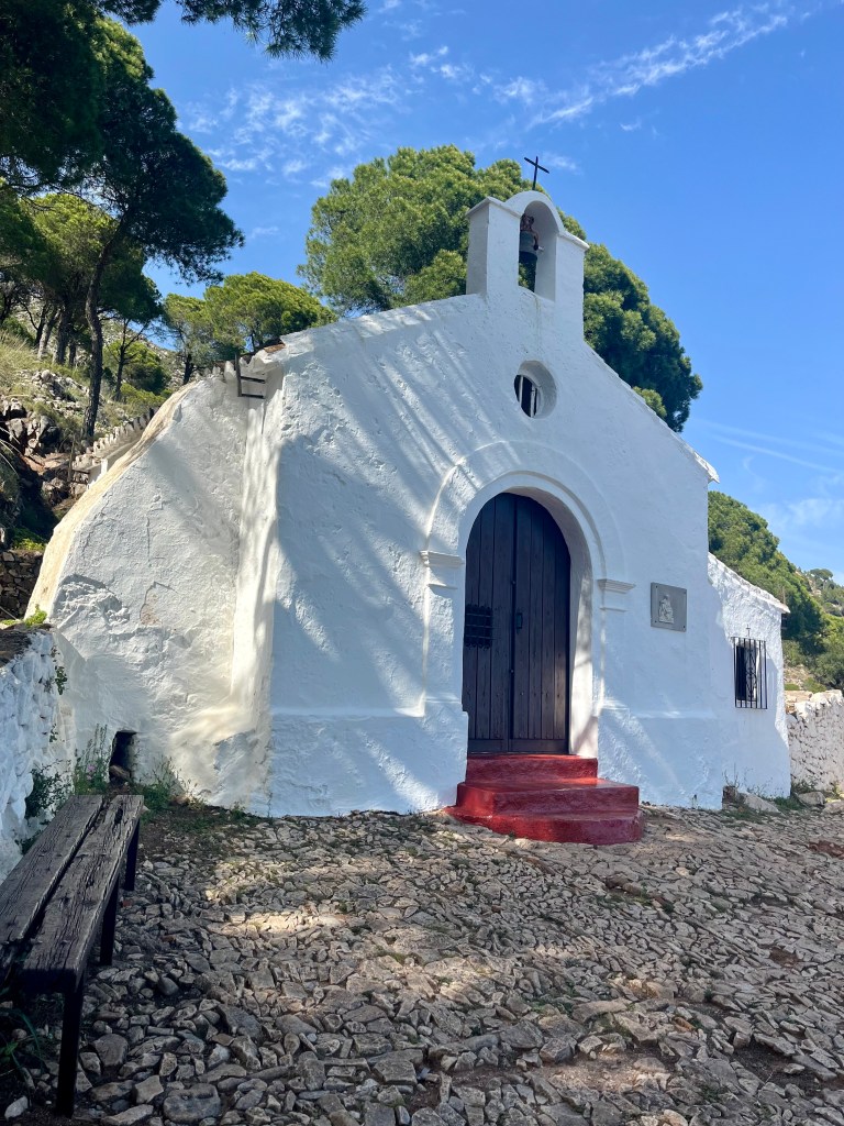
We met a very pleasant Canadian gentleman here. Chatted for a few minutes about his travels in Portugal as well as Spain. He and his wife were also escaping the weather back home. Have met a lot of Canadians in Spain thus far. I like Canadians. Such nice people up there. Not sure they love us at the present moment but oh well.
The rest of the trail is simply rocky and steep. There are a few benches here and there. It’s in the tree’s. You’ll pop out at a road. This is where we stopped our trip meters.
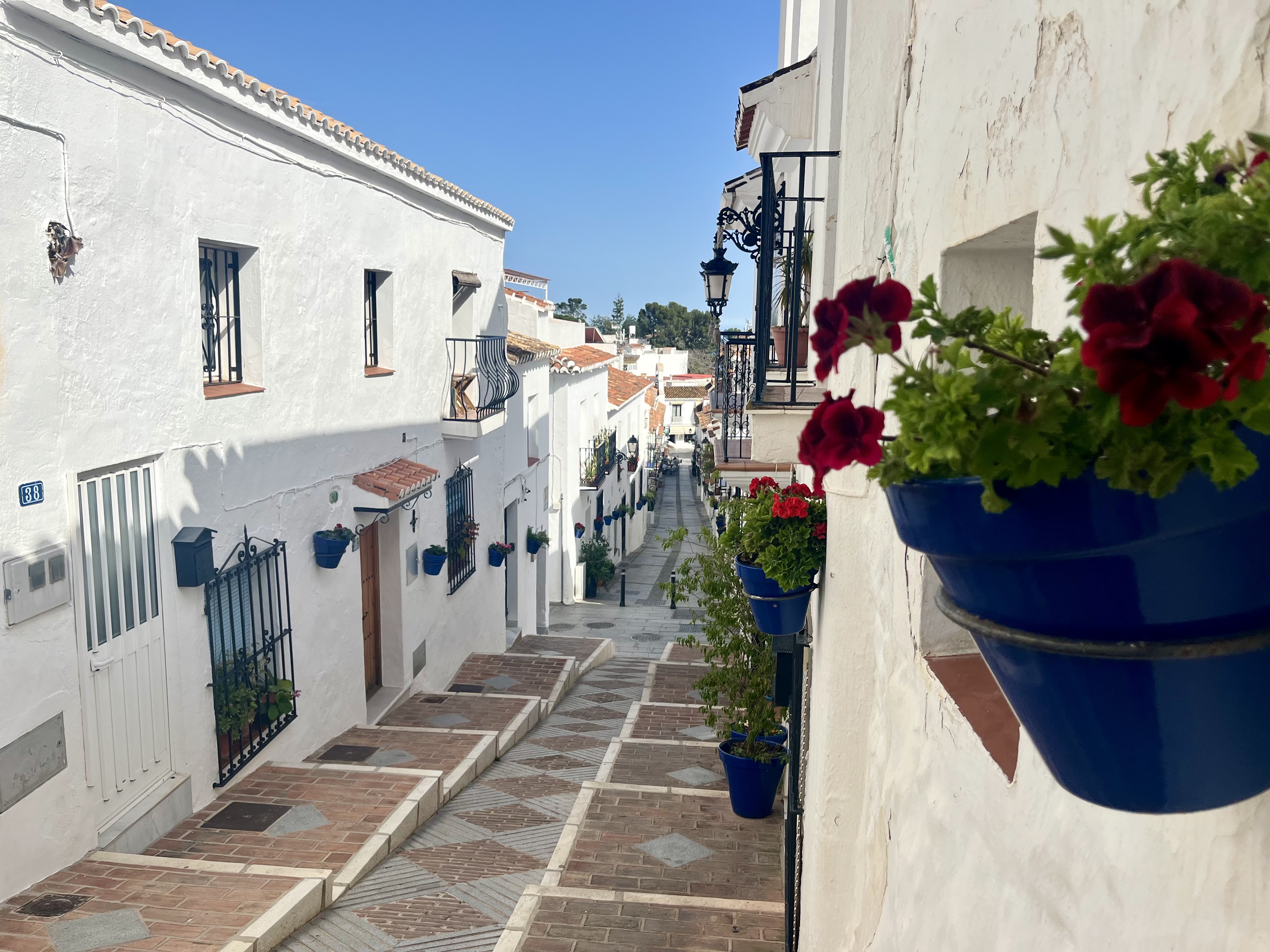
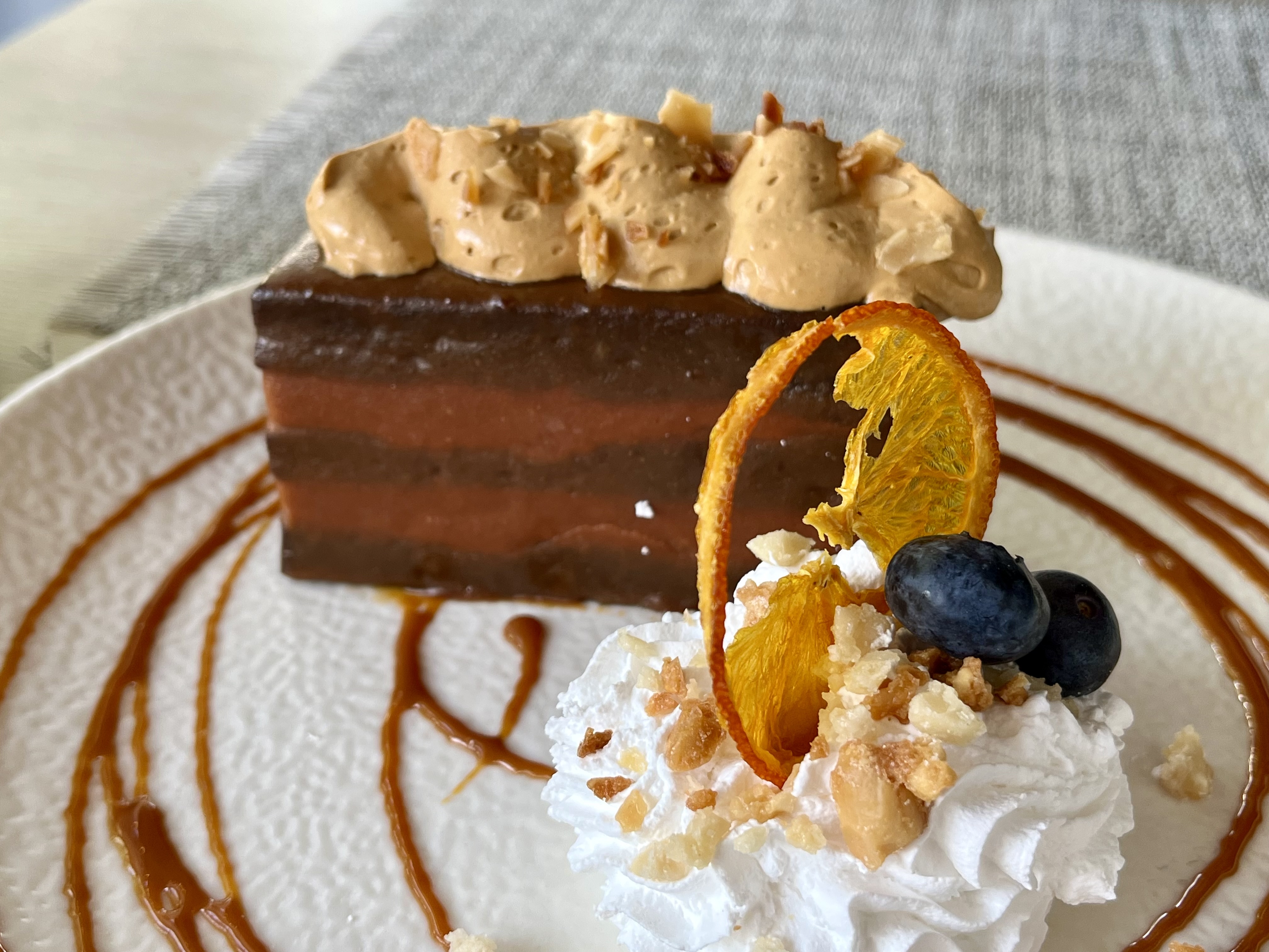
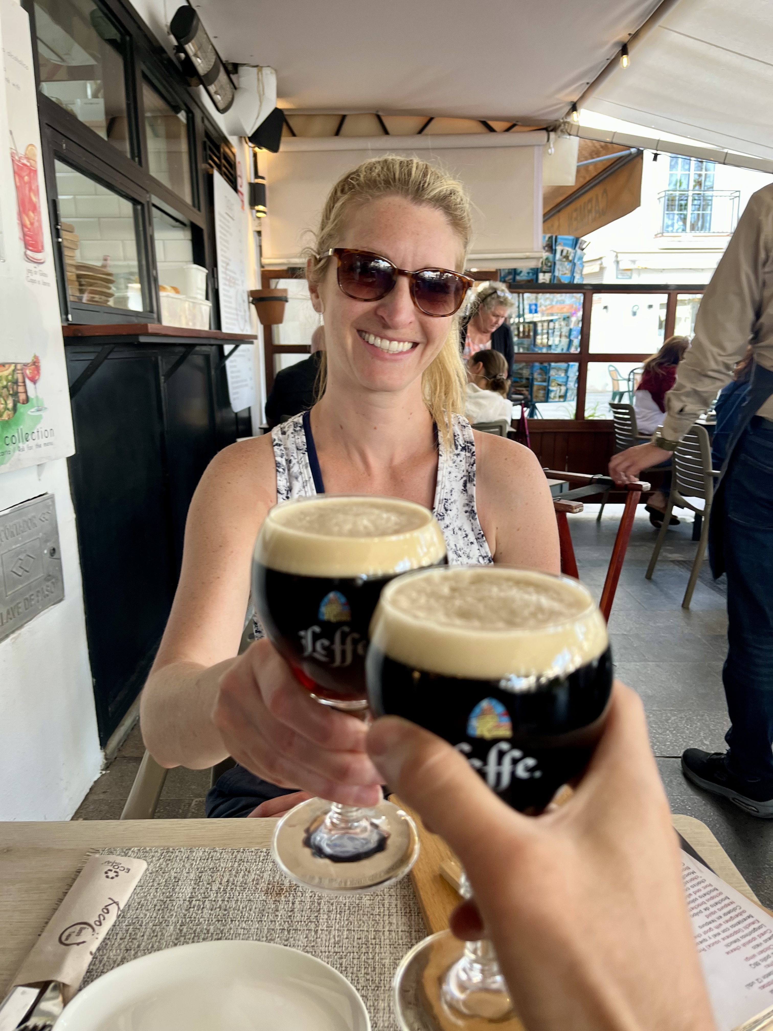
Crossing the road there’s a set of stairs that’ll take you into Mijas Pueblo. It’s an adorable picture perfect white village in the hills. Looks like it belongs on a post card. Stroll around the streets and enjoy. We did a bit of exploring prior to finding a spot for a beer and tapas. And a chocolate dessert type thing that they called a brownie. Very much not a brownie. More of a chocolate layered brownie cake with Carmel mousse in between thin layers of the cake. Regardless it was amazing.
After those tasty bites it was a short wait for the bus back to Benalmadena Pueblo. Via road, it’s only 3-4 miles away, granted on a narrow twisting road with no sidewalk. Wouldn’t want to walk on that one.

Leave a comment