WESTERN WASHINGTON
Summary
One of my all time favorite hikes along the Snoqualmie Pass corridor. This towering peak offers superb views of the surrounding Cascade mountains.
Trail Stats
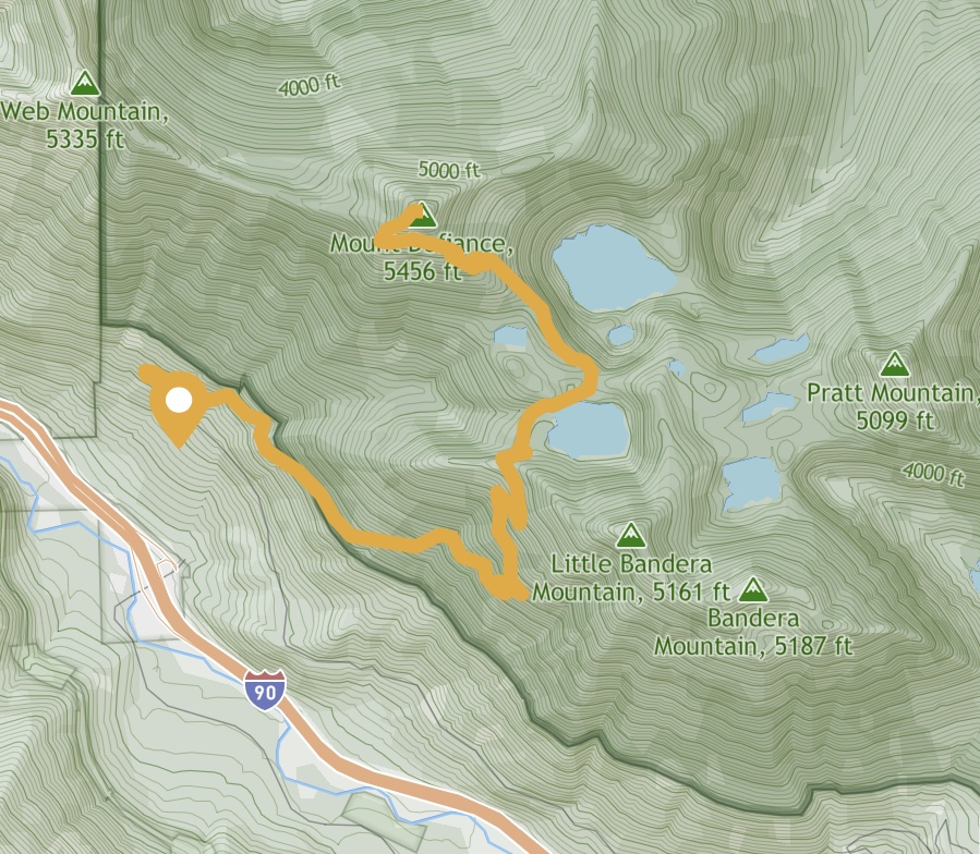
Mileage: 11 miles RT
Total Elevation Gain: 3,584 feet
Toilet at trailhead: Yes
Sandwich Spots: Yes
Parking: Designated Lot
Mileage/EG from WTA.com
Trail Details
Mt Defiance sits between Bandera and Web Mountains along the I90 corridor, west of Snoqualmie Pass. It shares a trailhead for hikers going to Bandera and Mason Lake. One can even head out through the connecting trails to Pratt Lake (very lovely). It is also relatively close to the madness that is Seattle. Meaning it’s relatively easy to reach. And thus a VERY popular parking destination for hiking. It’s prudent to arrive at the lot early to avoid the crowds and to actually park. Please park well. So many park with half a car width between them and the next vehicle. So rude. Park like you’re in a compact lot so others can fit. Parking like a jerk wont stop them from joining you on the mountain. People will park along the road for well over a mile to hike here. And the more along the road, the bigger pain it is to navigate around and squeeze through all the vehicles when leaving. There. I said it. Don’t park like a jerk. Oh, and don’t forget to display your NW Forest Pass. They are required to park here.
Heading to the trail, you’ll walk along an old logging road for quite awhile. It begins as the same route to Bandera Mountain. For the sake of not repeating myself one can look at the post on Bandera on the off chance you’re dying to know what this part of the trail is like. Otherwise, just head uphill as if you’re headed to Bandera. Except, when you hit the wooden sign where the trail splits, head toward Mason Lake, not Bandera.

From here you’ll walk along the hillside on a surprisingly flat trail. Enjoy the valley views in this relatively open section. You wont see them again for a while. Dropping over the ridge you’ll make the descent to Mason Lake. I’m fairly certain this bit of trail never see’s the sun. Ever. It’s always damp and dark. Snow lingers here. And mud. Depending on the time of year and the day (it’s the Seattle area, you’re never guaranteed pleasant weather, even in summer) the shade is nice when you’re making your way back to the trailhead.
Mason Lake is a rather small alpine lake. That being said, I was vastly spoiled with alpine lakes while living in Western Washington. They don’t call it the Alpine Lakes Wilderness for nothing. Anyhow, the trail dumps you to the northeast section of the lake, resulting in a pretty good view back toward Bandera Mountain.
From here I have found the trail to be a bit dicey. Not steep or sketchy dicey, just where is the trail dicey. I wind up loosing it and traipsing around the woods half lost for a bit before randomly popping out of the bushes or snowdrifts, depending on the season, onto the trail again. Luckily it’s pretty flat down there. If you are better at navigation, follow the trail until it splits. You want to go left or north(ish) to continue on to Mt Defiance. To the right you’ll pass many lakes and can even get to Granite mountain if I’m not mistaken. But it would be a much longer hike. And that’s a different trailhead. Going to the left, the trail rapidly ascends, following a ridge line up. While relatively easy to follow, do be aware you can still get lost. Once you leave Mason Lake the hoards of people seem to fade away. At least last time I went, it’s been a hot minute.

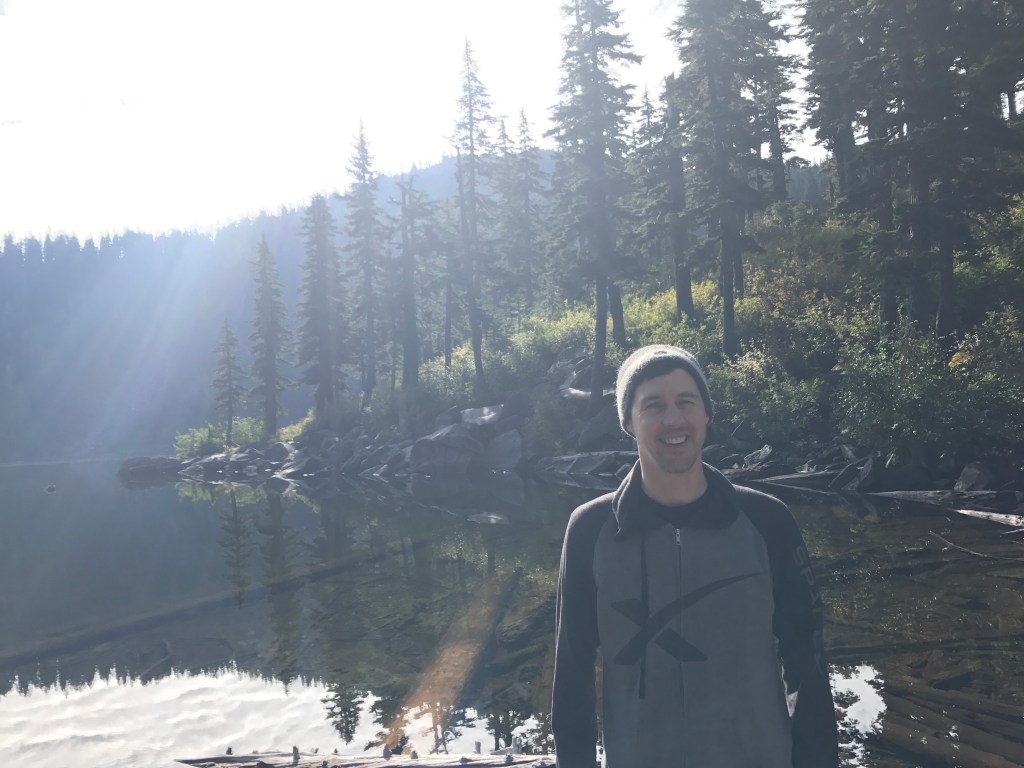
Twice, while hiking by myself, I did not make it to Mt Defiance. Once I lost the trail on the ridge and had promised Doug I wouldn’t get lost or die out there. What a spoilsport. He’s always certain I’m going to die. I mean I’m clumsy AF, but sheesh. Should have seen him when I went off camping by myself in Montana. I had a grand time. I do tell him where I’m headed. And take my phone. Out there you have service for the majority of the hike. Not so much in Montana. Zero service where I camped. It was glorious. The second time I turned around I simply didn’t want to continue slogging through a foot of slushy slop. I’m sure it was less than a foot but at one point I did sink past my knee. Gross and no thank you. The dog wasn’t even having a grand time. That says something.
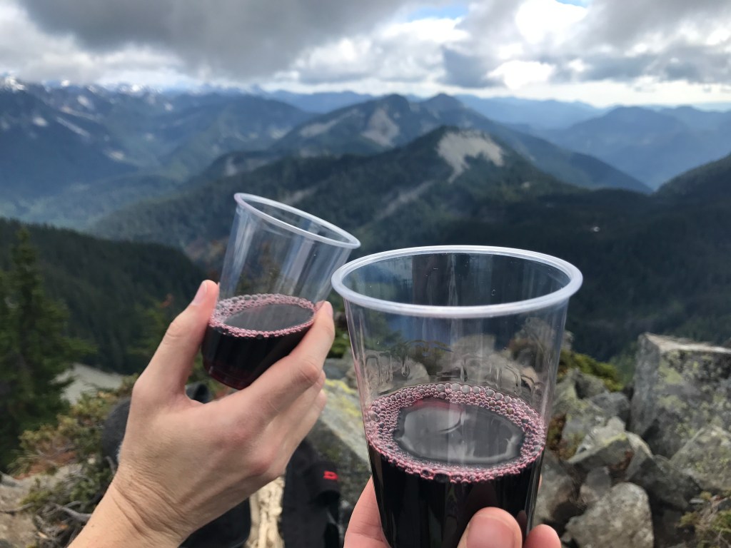
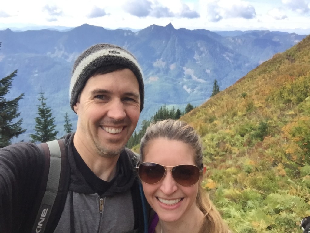
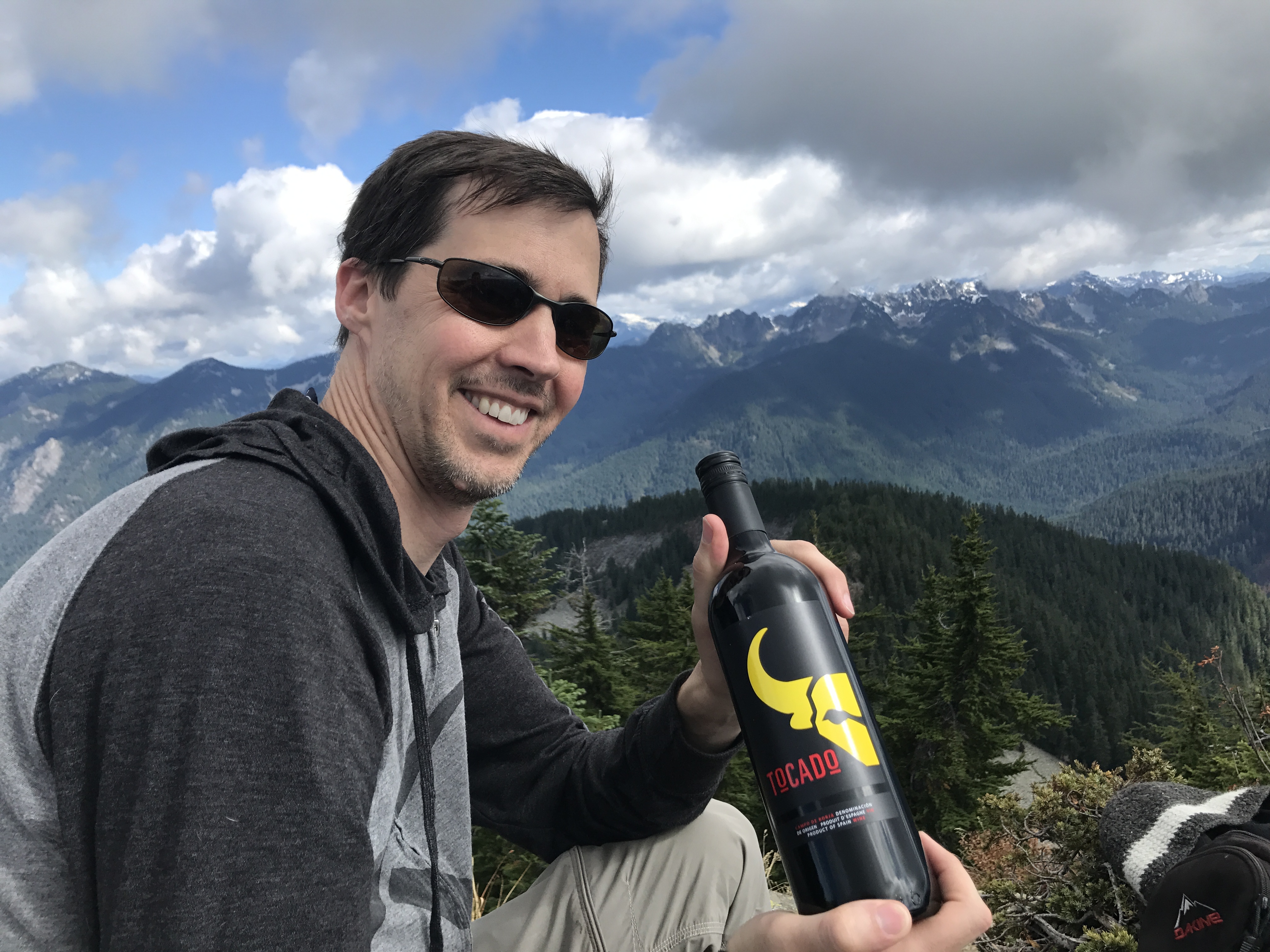
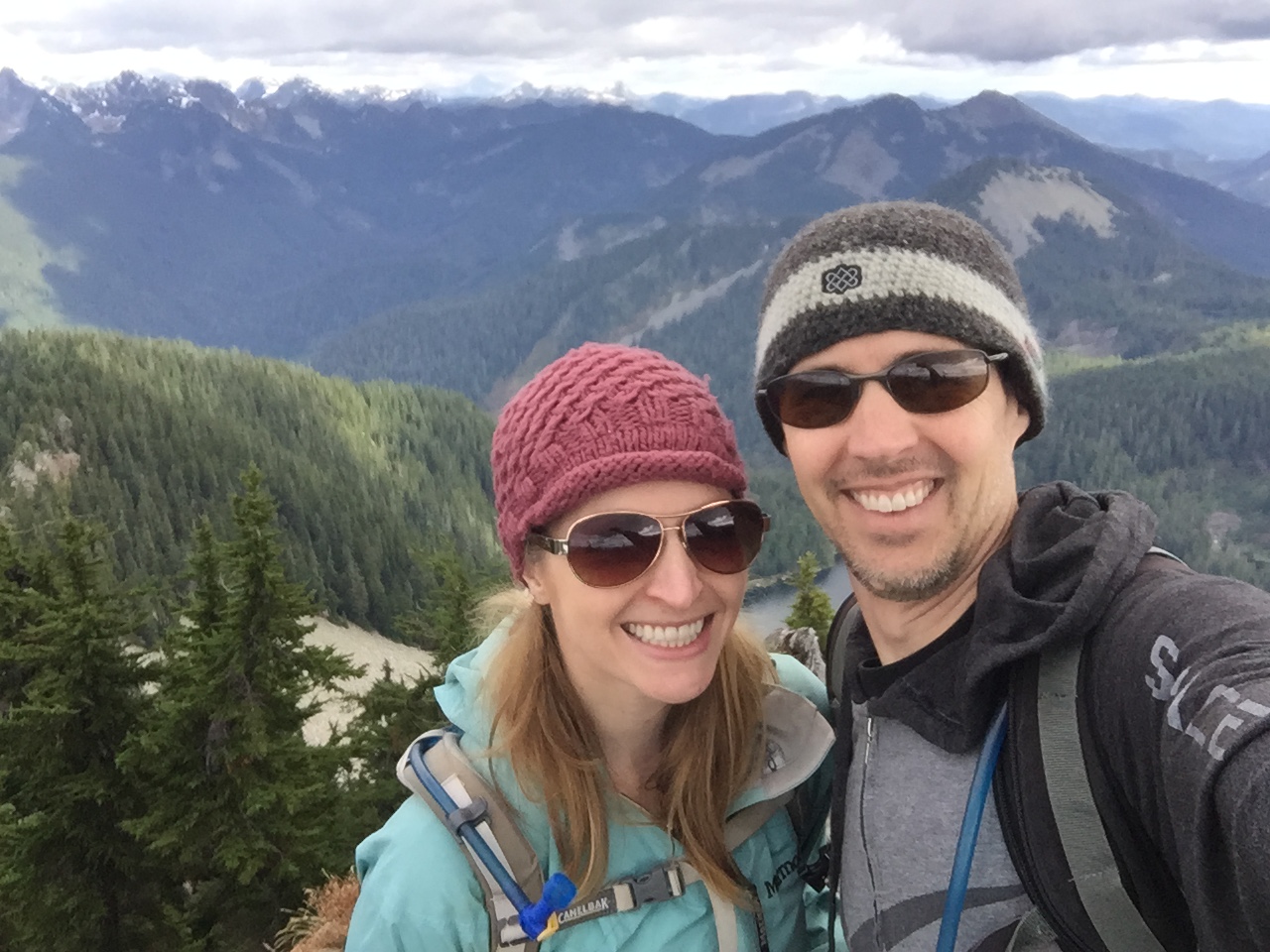
Doug and I climbed to the top once. We had this brilliant idea to hike European style. So we lugged up a bottle of wine, cheeses, crackers, chocolate and most likely grapes. They hike so well. We were excited to summit and enjoy our haul.
One minor problem on that day. I was still recovering from being sick. Not my brightest idea. Luckily I’m stubborn. My already taxed lungs did not appreciate me huffing my way uphill. They were on fire, and not just the I’m out of breath from going uphill. This was a wheezing and gasping with that weird death rattle in the chest you get when sick. It was painful and my body protested hard core. I thought I was going to pass out. So much fun. Still was not willing to turn around.

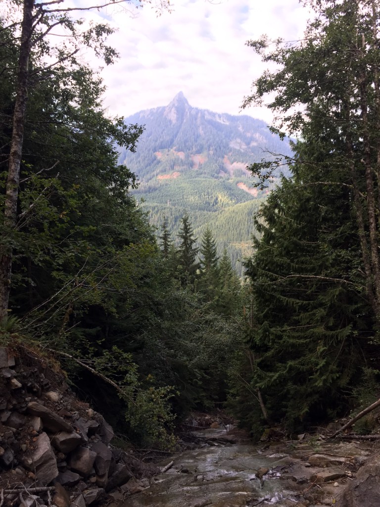
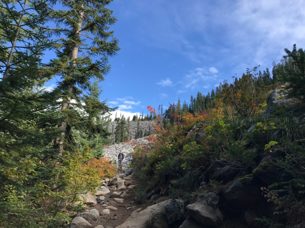
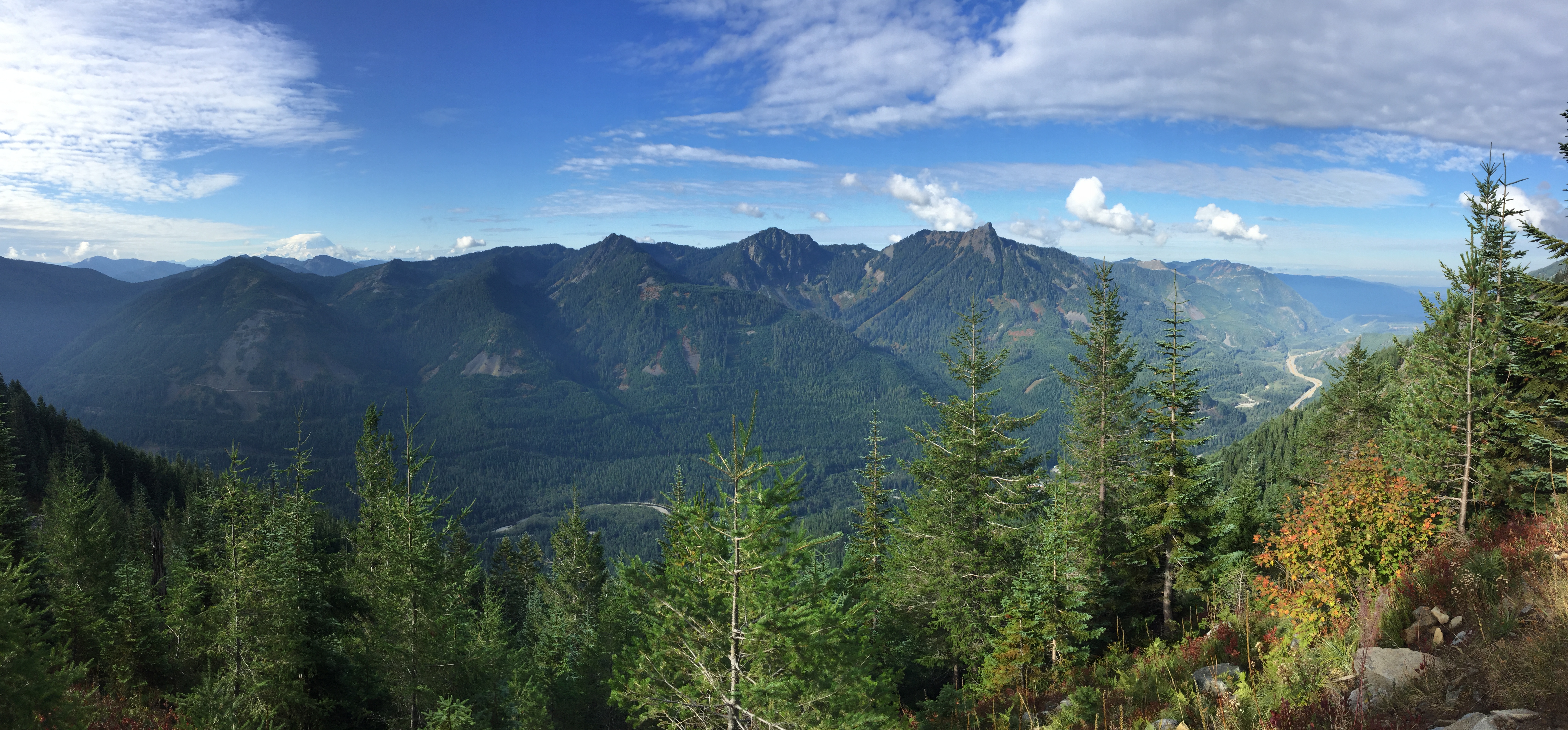
The trail eventually opens up into a large talus field, where the views return. If you can stop gasping and enjoy them. I love a good talus field. So pretty. But I love rocks. Somewhere along the further end of the field we started hearing people in the distance behind us. OH NO! We had been the only ones on this section. I was definitely holding us up. Told Doug to go on ahead to the top and stake a claim on a picnic spot. Off he went, leaving me to freely wheeze my way uphill.

The last bit before the summit is, in typical fashion, straight up. That felt great. I can’t remember if I was passed by fellow outdoor enthusiasts or not but it’s highly likely. I was only able to take a very slow pace and still had to stop to relieve my lungs. But I did make it and found Doug.

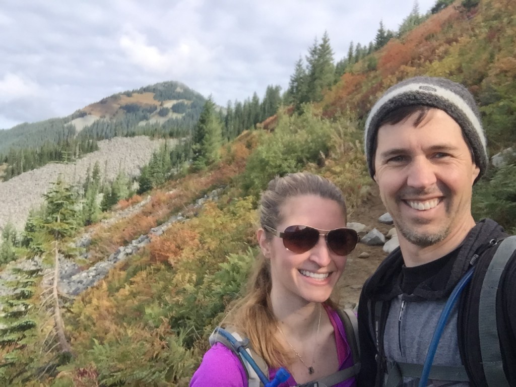
I know I felt like garbage because I didn’t immediately dig into our snack bag. It took a bit of sitting to recover enough to think about wanting to do anything. Just gave me plenty of time to absorb the splendor around us. As I said, it’s one of my favorite places. 360 degree views that, on a clear day, include Mt Baker, Rainier and Adam’s. It does not get much more gorgeous than mountain tops as far as the eye can see.
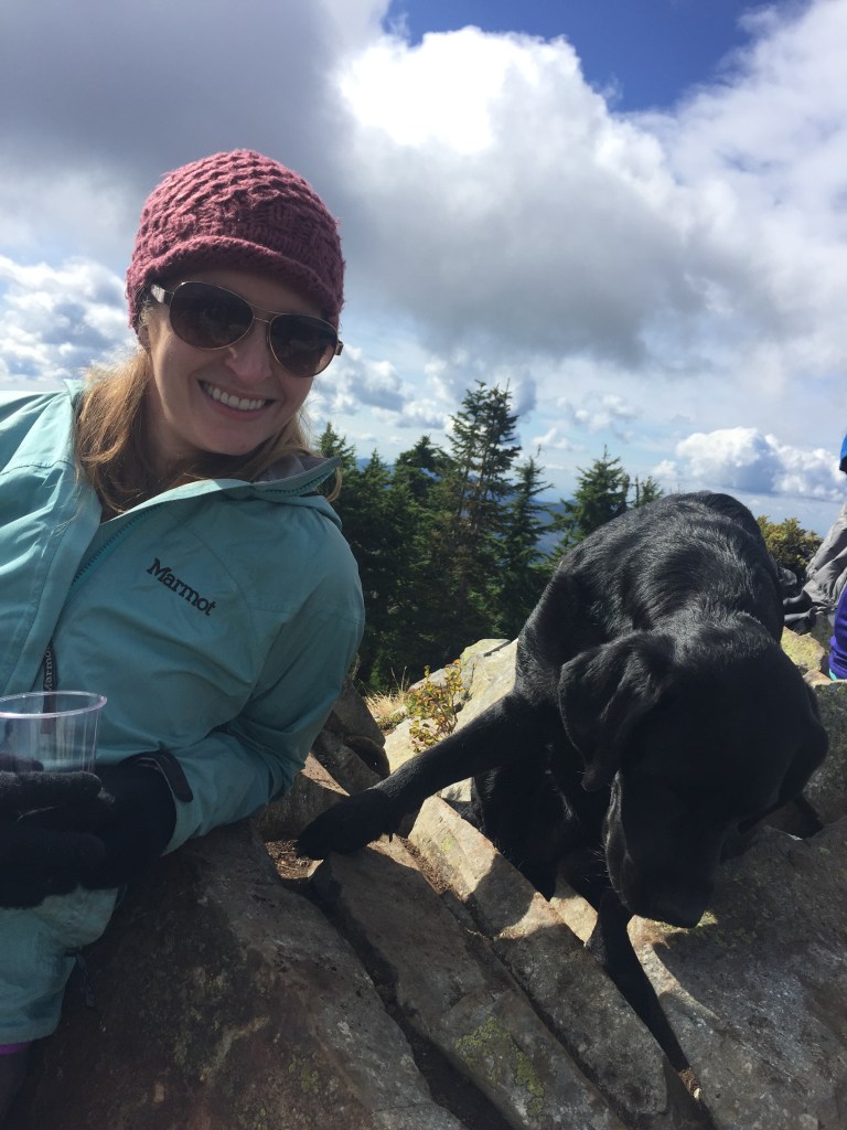
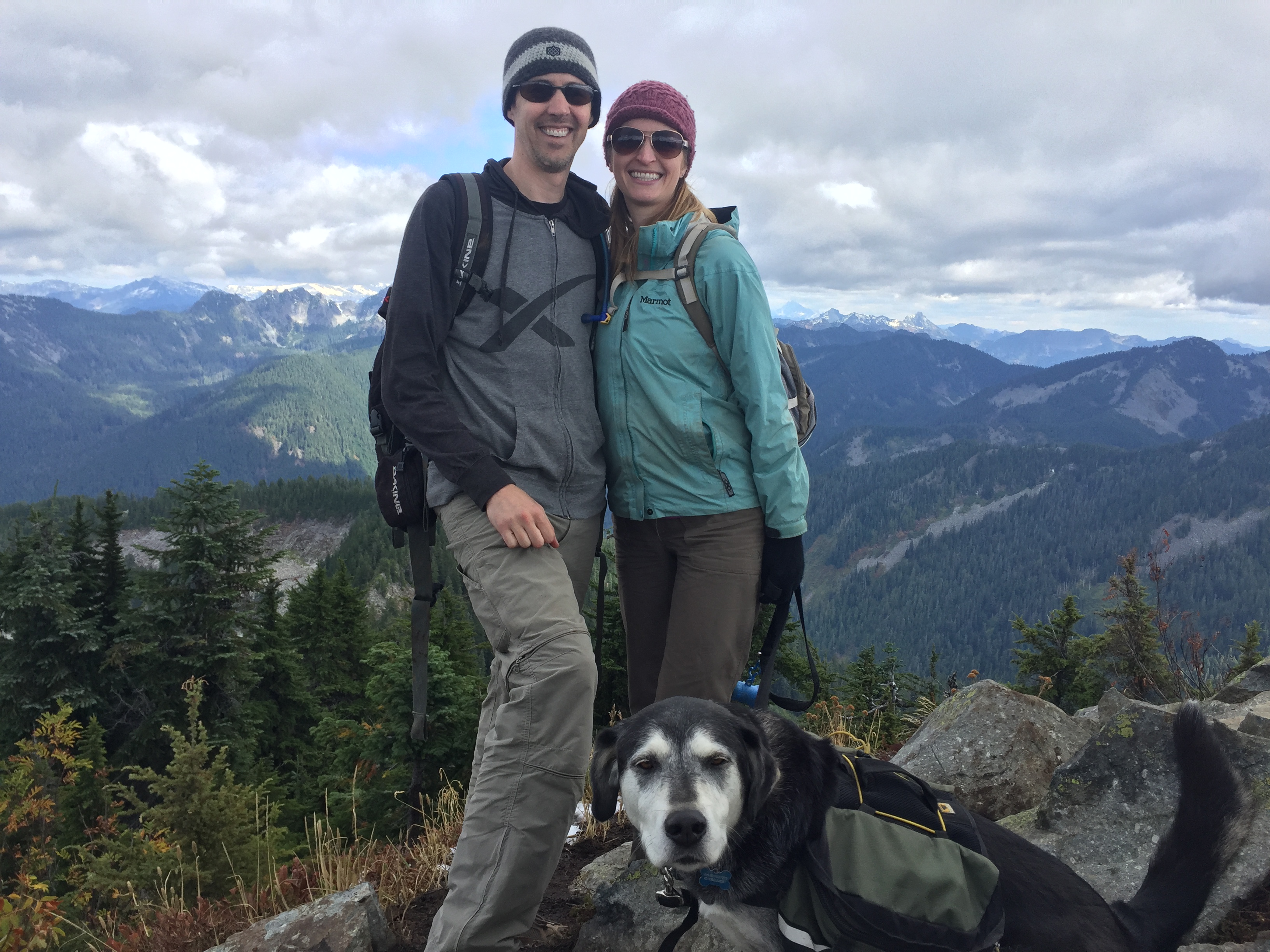
Doug had found a fairly sheltered nook to settle into. It’s breezy up on those mountain tops. We had a most excellent spot, complete with rocky backrest. The dog was tied off on a nearby bush. A few reasons for that. One, she knew she was supposed to chill when that happened. Two, I can’t stand begging and she was the worst if you let her. Three, she was unreliable around other dogs. I do remember some random black dog, most likely a lab mix, snuffling the back of my head and saying hi.
That day I found people are very judgy. And envious. As we settled in with our bottle of wine and mountain top charcuterie, there were many comments. From just about everyone else who came trudging up. “Is that WINE?!?!” Uhh, yes. Certainly didn’t carry up an empty bottle. Our spread looked much better than the regular sandwich.
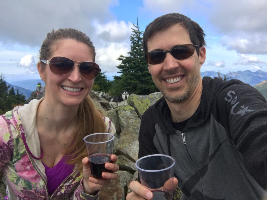
A few murmured “That’s awesome” and honestly, it was. Good wine, great hike, stellar view. And yes, we drank the whole bottle. We were up there for quite a while. I’ll admit, the way down was much less painful than expected and I no longer cared about my lungs. Must have been the wine.

While I can’t say I recommend hiking while recovering from influenza, I fully recommend this hike in general. Just make sure it’s a clear day, otherwise you’ll have a great view of the inside of a cloud. Though, you should experience that disappointment at least once. Makes one appreciate the clear days all the more.

Leave a comment