SOUTHEASTERN CALIFORNIA
Summary
This combination of hiking trails offers a fantastic immersion into Death Valley’s many wonders, combining canyons, badlands and views.
Trail Stats
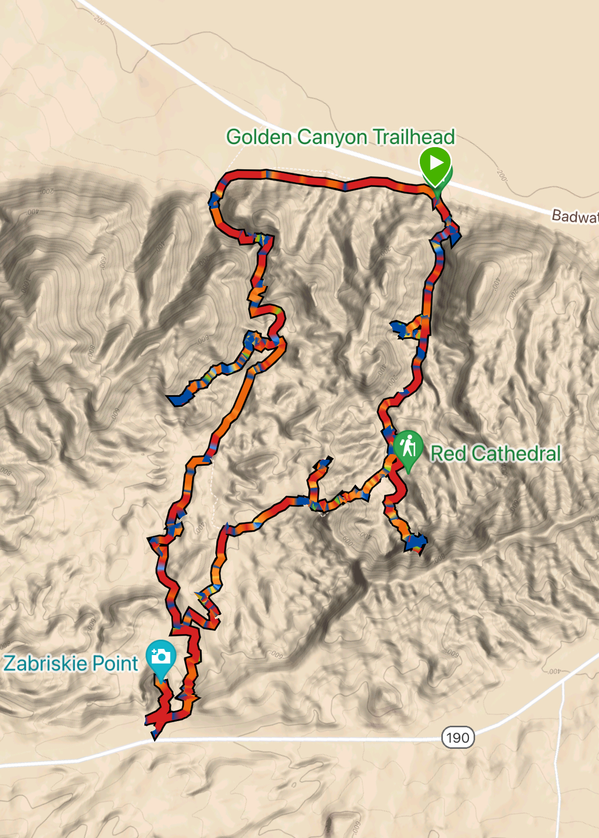
Mileage: 11.2 Miles (with offshoots)
Total Elevation Gain: 2,060 ft
Toilet at trailhead: Yes
Sandwich Spots: Yes
Parking: Designated Lot
Mileage/EG from Garmin Watch
Trail Details
Beginning at the small, well marked, Golden Canyon trailhead we began our longest hike in Death Valley. Being a more popular hike, this one sports a toilet at the trailhead. Though this particular one was quite fragrant and permeated the air in a most gag worthy manner. There are also toilets at Zabriskie Point, these were much nicer.

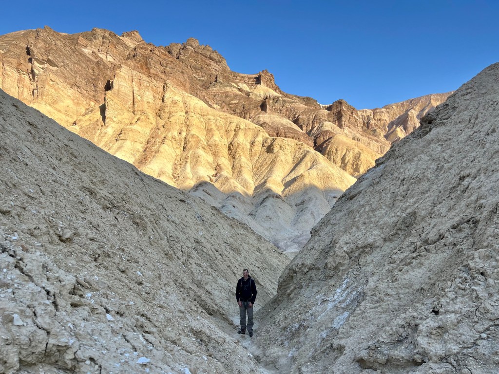
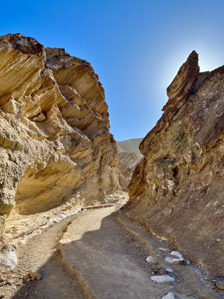
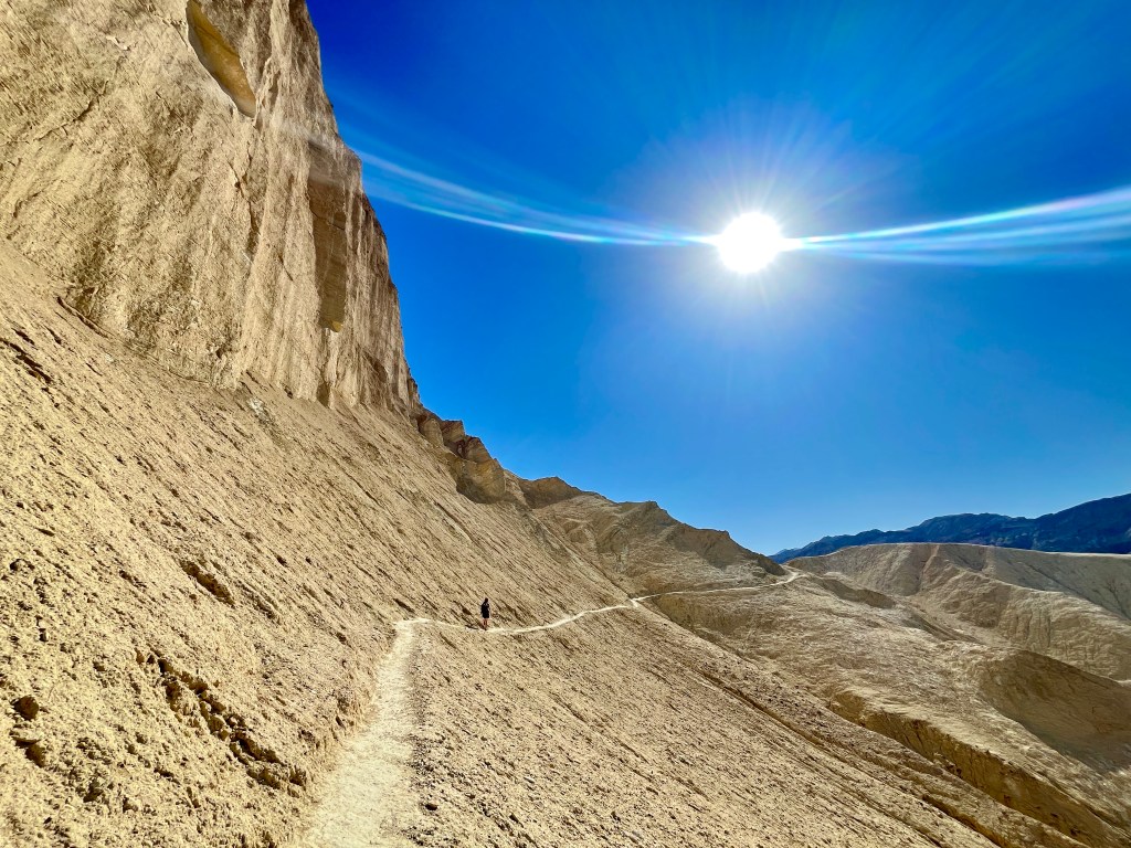
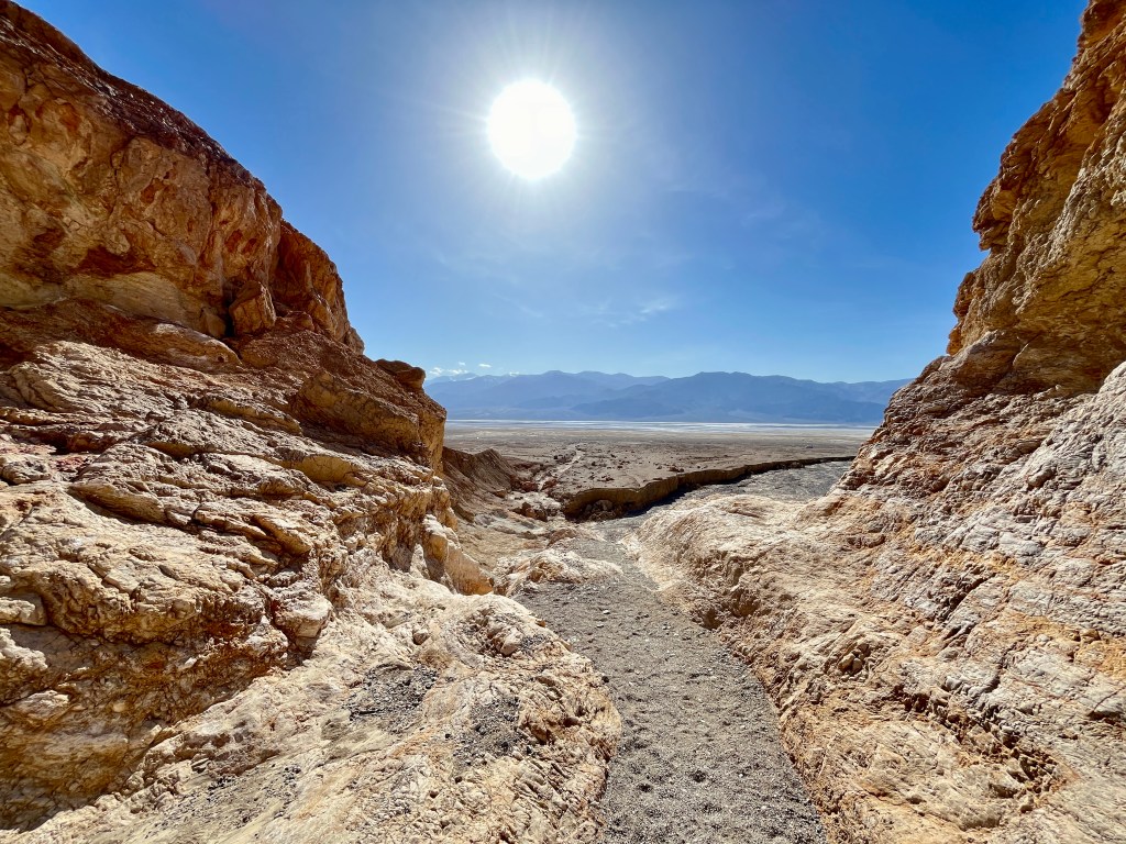
As the name suggests, Golden Canyon is rather golden in color. Beautiful when the morning sun hits the walls just right. Throughout this section there are small offshoots you may explore. We went up one and wound up on a miserable crumbling, steep ridge with no real view to speak of. Save your energy for a different canyon as this soil does not like to hold together.
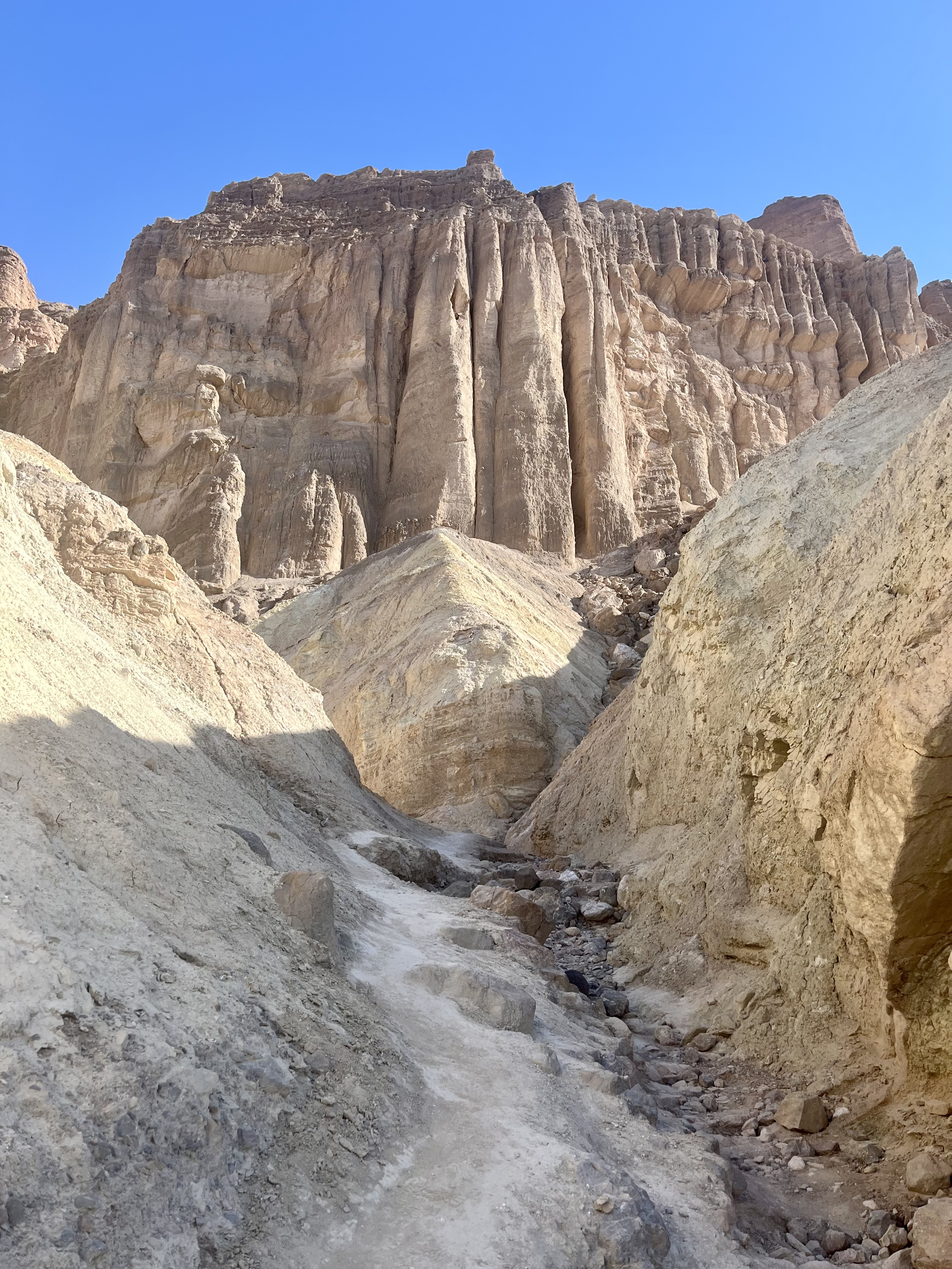
A mile into the official trail you may jump off course to hit up Red Cathedral. This will add a whopping 1 mile round trip to your total hiking mileage. There is one small rock fall to climb over. Red Cathedral itself proved impossible to take a photo of. Towering red rocks formed a gently curving concave cliff side that reminded me of a giant organ in the back of a church. At the end of the cathedral there’s a small path leading upward. Originally I headed up hoping for a better vantage point for photos, but in the end wound up with views of Golden Canyon. There would be plenty of views looking back on the Cathedral as we sauntered on.
Leaving Red Cathedral we ran into a lovely older couple (he’s 80!) at the rock fall. Doug took their photo as we all chatted about hiking and our mutual love for the great outdoors. Awe inspiring couple, exactly what I want to be. Still very much in love with each other and out exploring the world. We ran into them again up at Zabriskie Point. They are amazing.
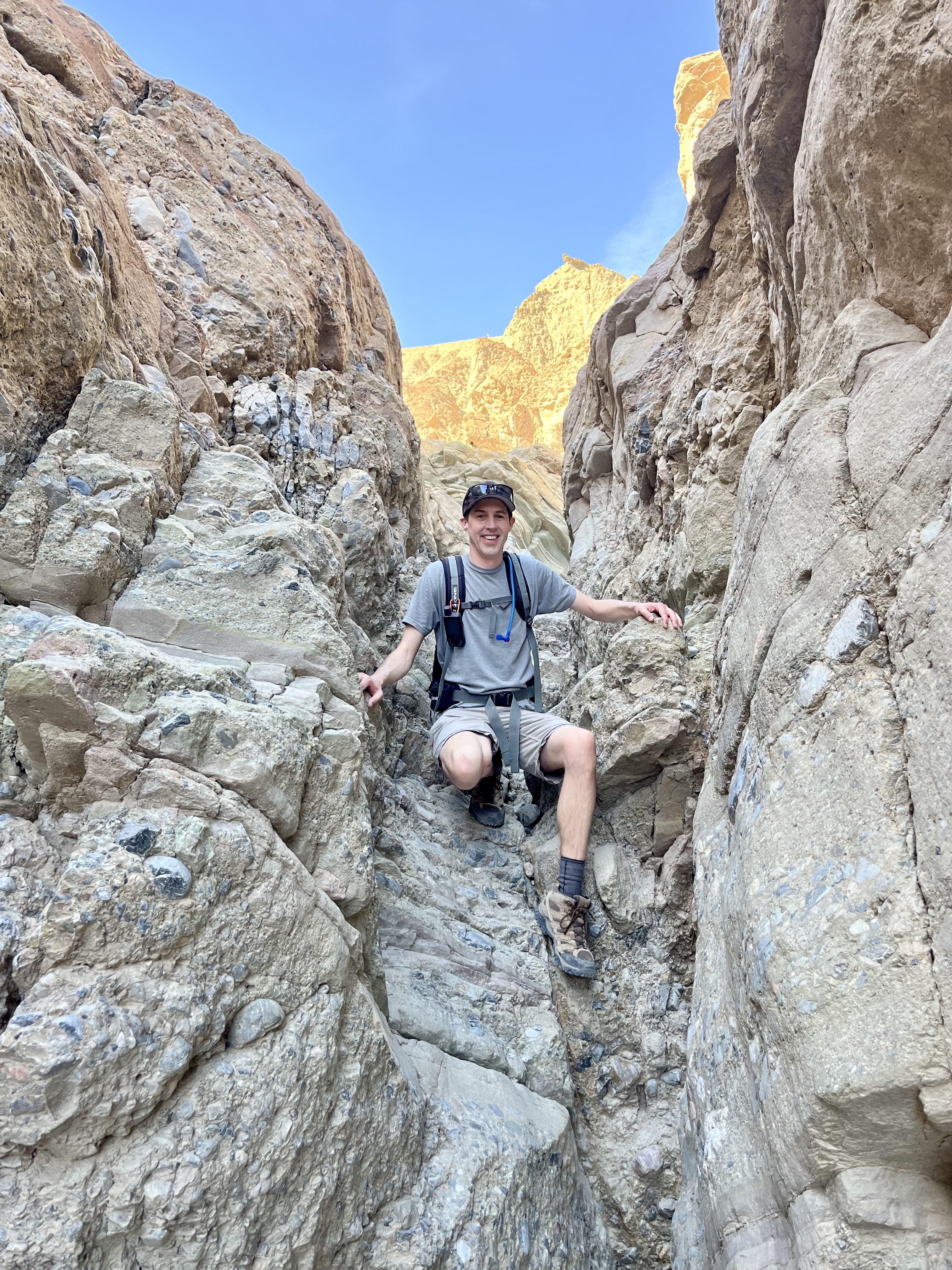
Back on the main trail Manly Beacon (as opposed to… what exactly? Distressed Damsel? Seriously these names make me laugh) looms ahead. The trail heads upward along its lower slope. Probably the narrowest section of the trail, it did show some wear and light damage from, or at least I assume, previous rain storms and subsequent water damage.

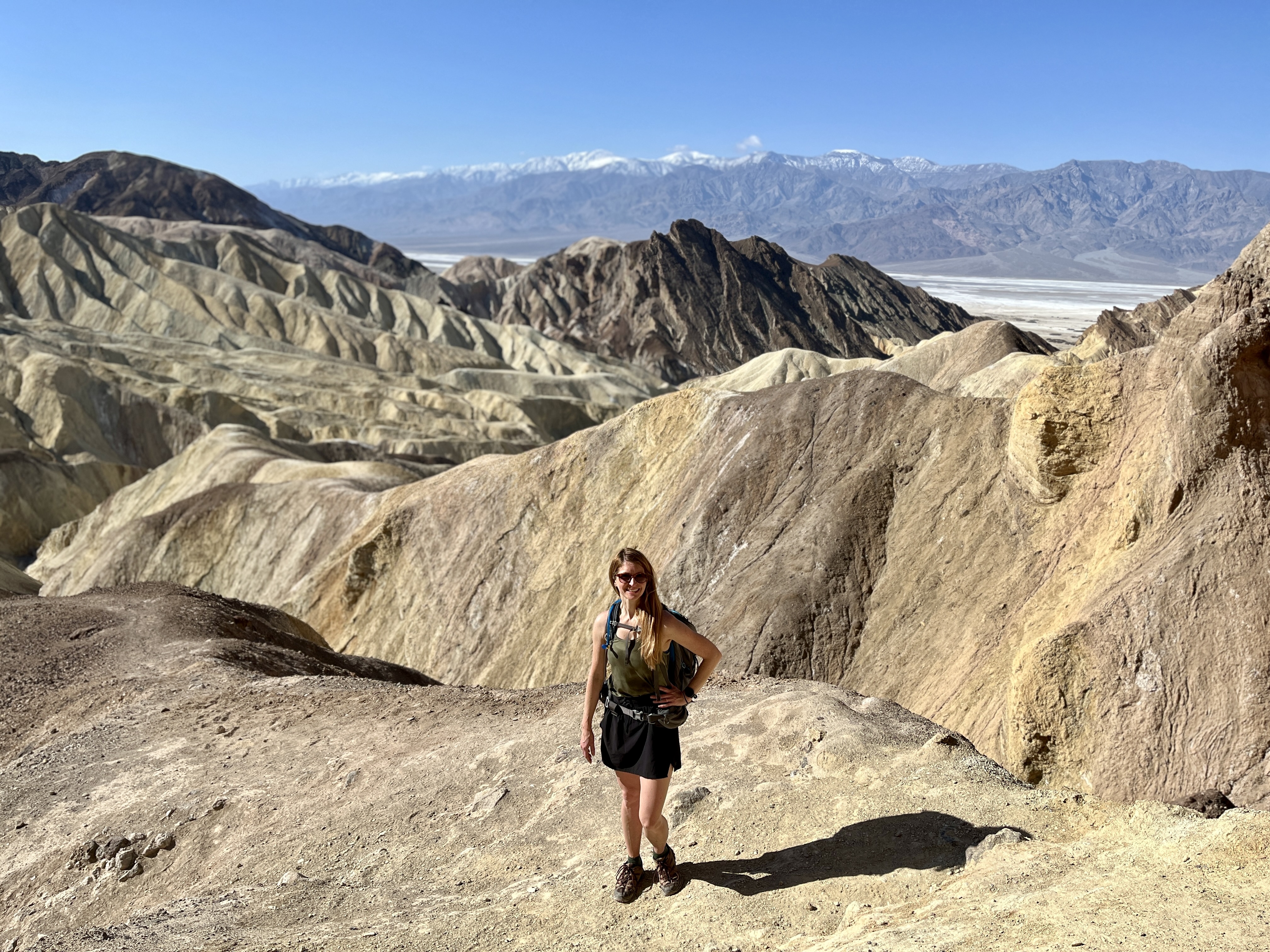
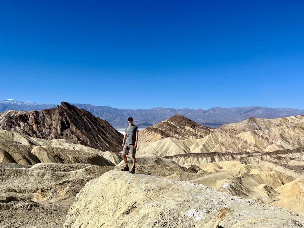
When you’ve crested the hill there’s a path leading off to the right that I highly suggest taking. Most people seemed to skip, though it’s obviously well traveled enough to be a distinct path. It leads to a little knoll with killer views of everything traveled thus far. And far better views overlooking Red Cathedral than at the Cathedral itself.
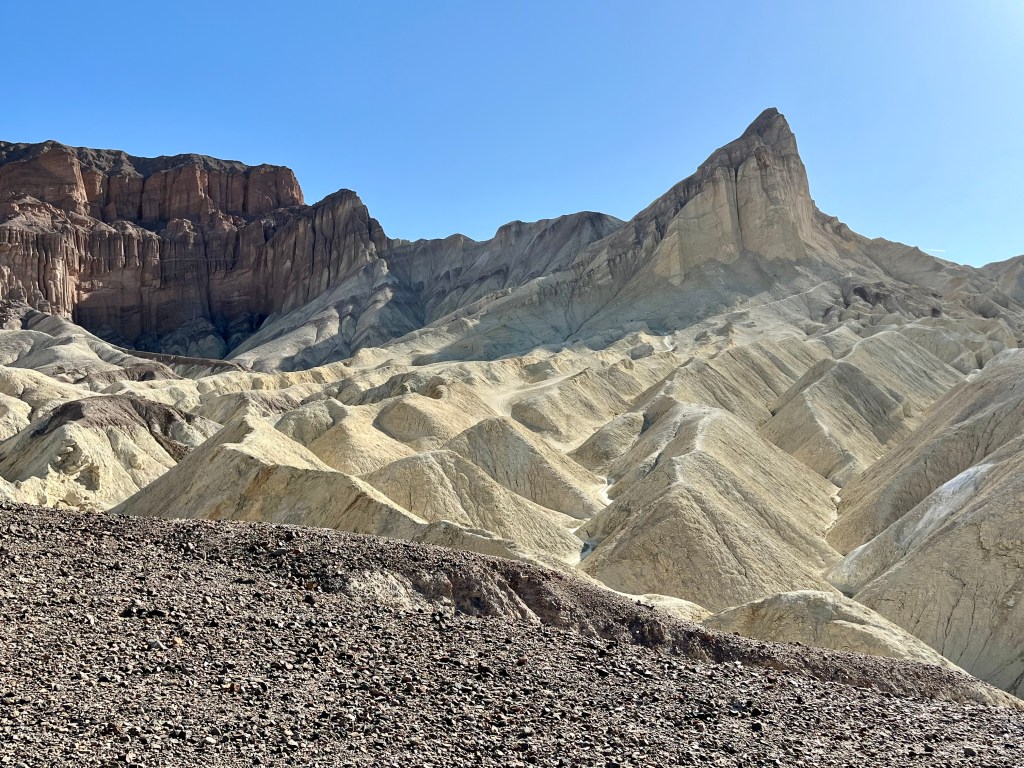
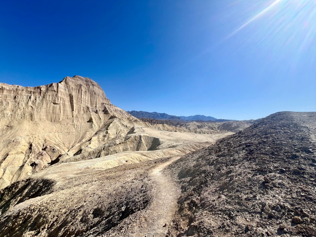
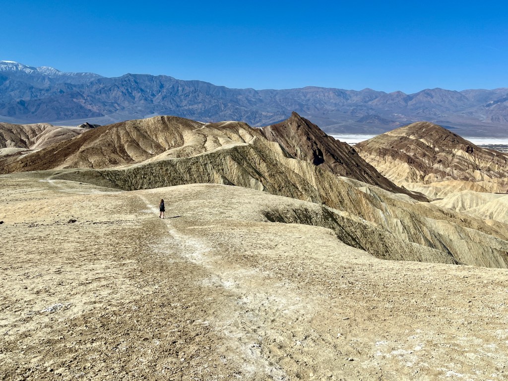
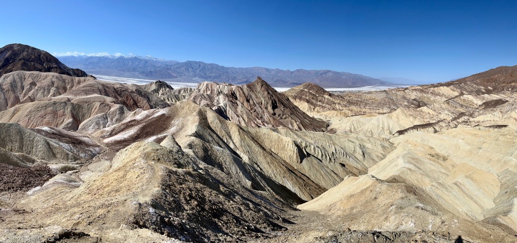
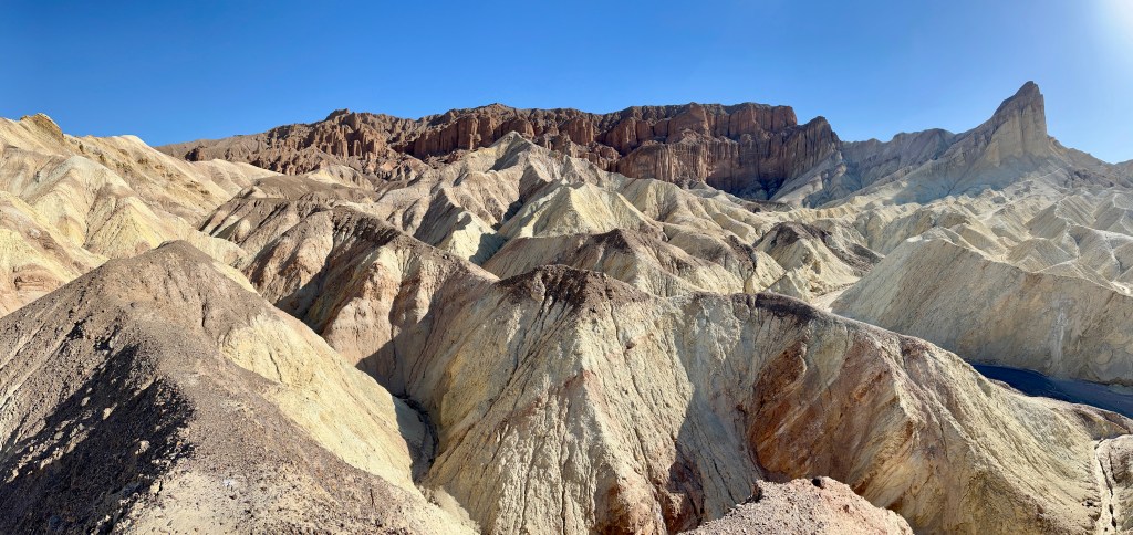
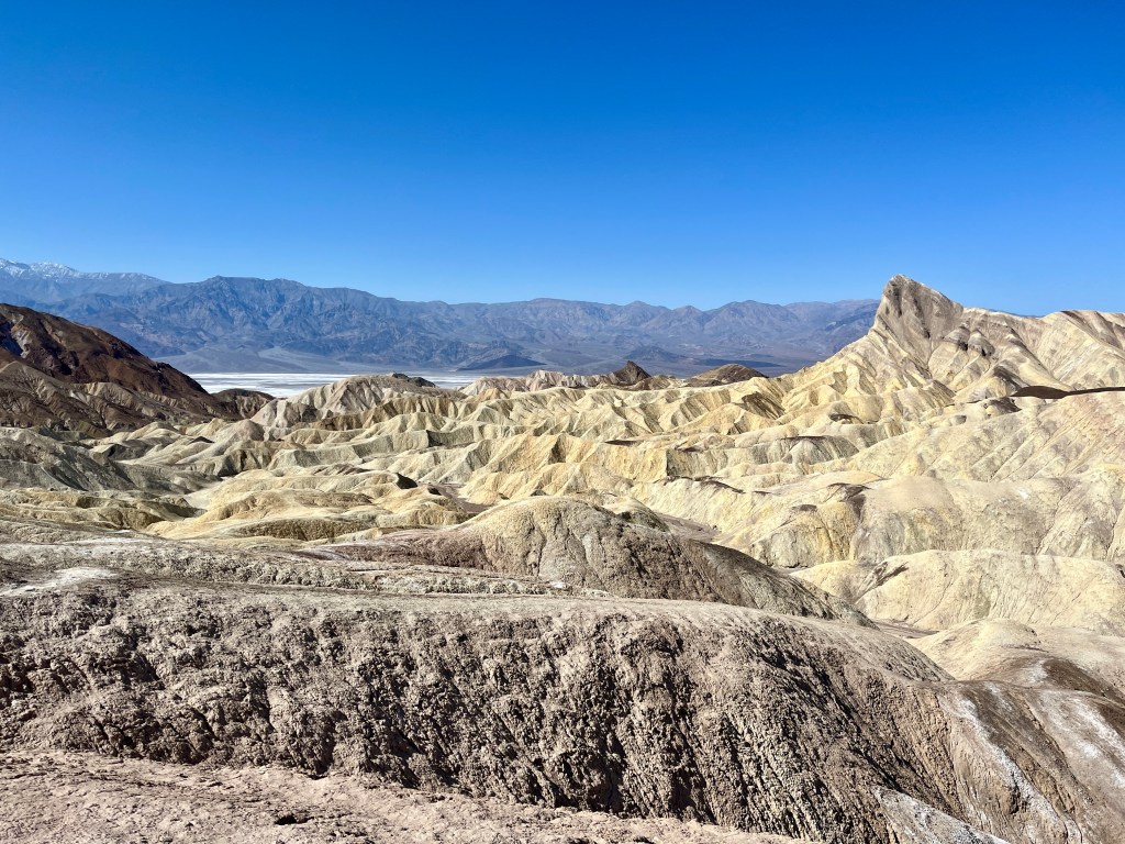
After this point the trail winds up over and around the badlands, a lot of brown and gold hills, getting ever closer to Zabriskie, which is visible in the distance. There is a connector trail leading straight to Gower Gulch if one wishes to bypass Zabriskie or simply shorten your mileage. We forged ahead instead. The last portion up to Zabriskie has you turn into a small wash and pops you out near the parking lot and happily, the bathrooms. It’s a short walk up the paved hill to the actual point.
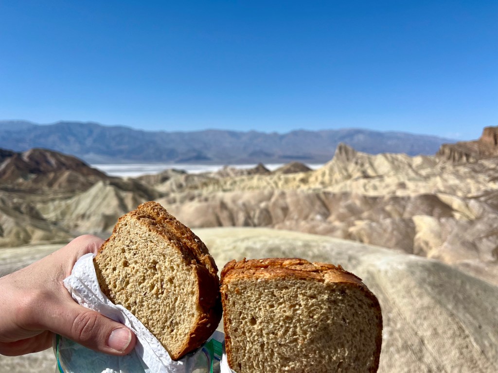
At the top we plopped down on the rock wall, enjoying the view with the masses while munching on our sandwiches and snacks. By now I was getting a wee bit tired of peanut butter and honey. Not such a fan of eating the same thing over and over. At least it was good honey. From somewhere in Utah I believe.
Heading down we hoped to connect in through a small side canyon but were convinced this was not wise as the canyon walls were unstable from all those dastardly storms. So back out the small wash we went. Bummer. The other way looked so much more exciting.
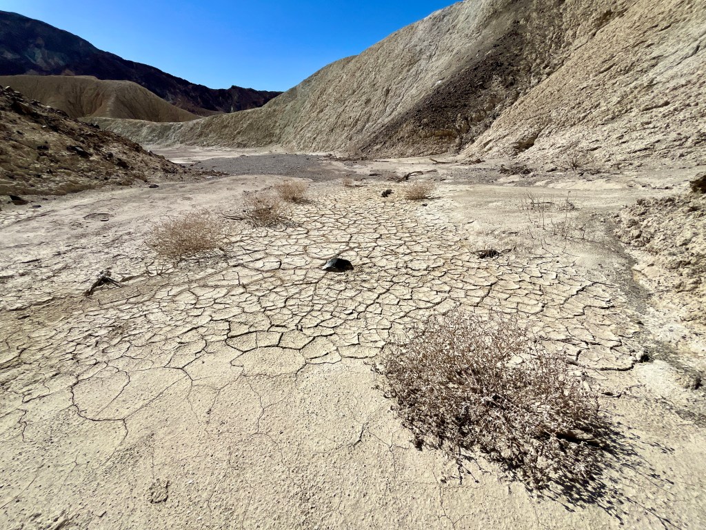
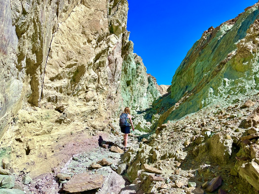
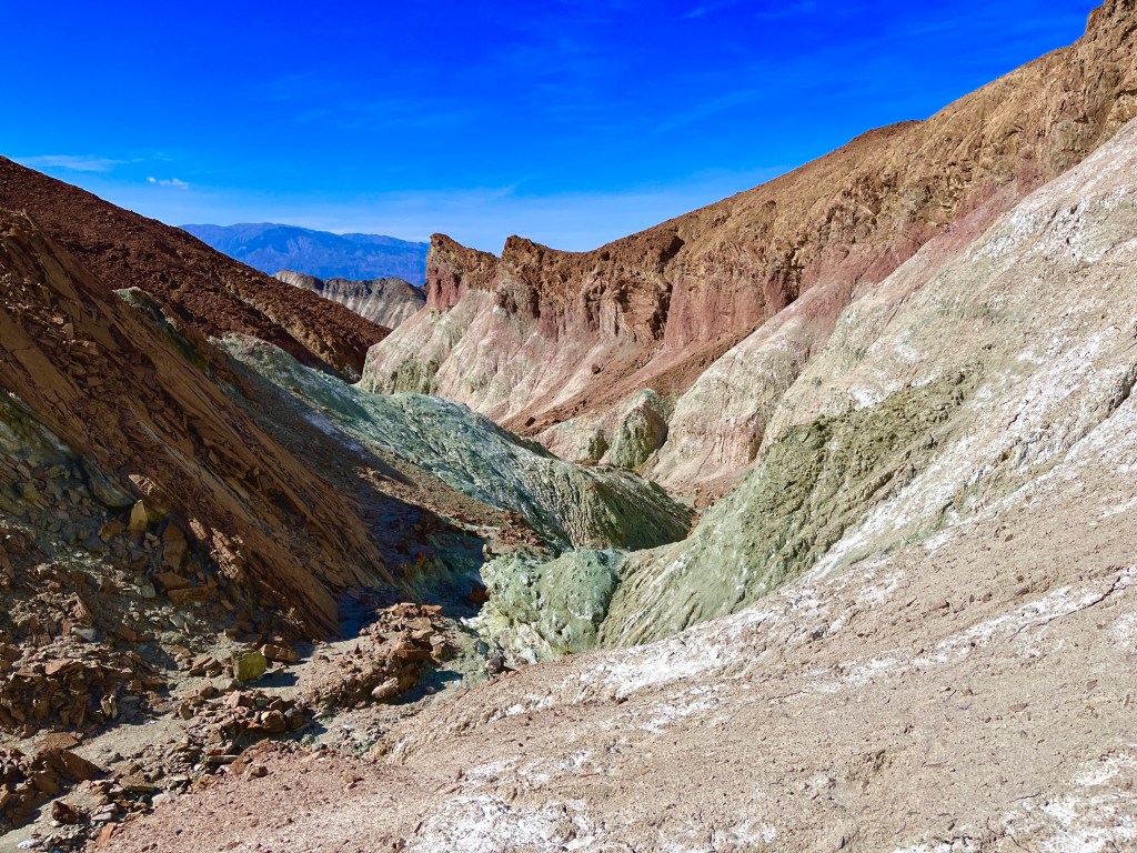
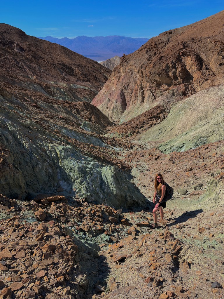
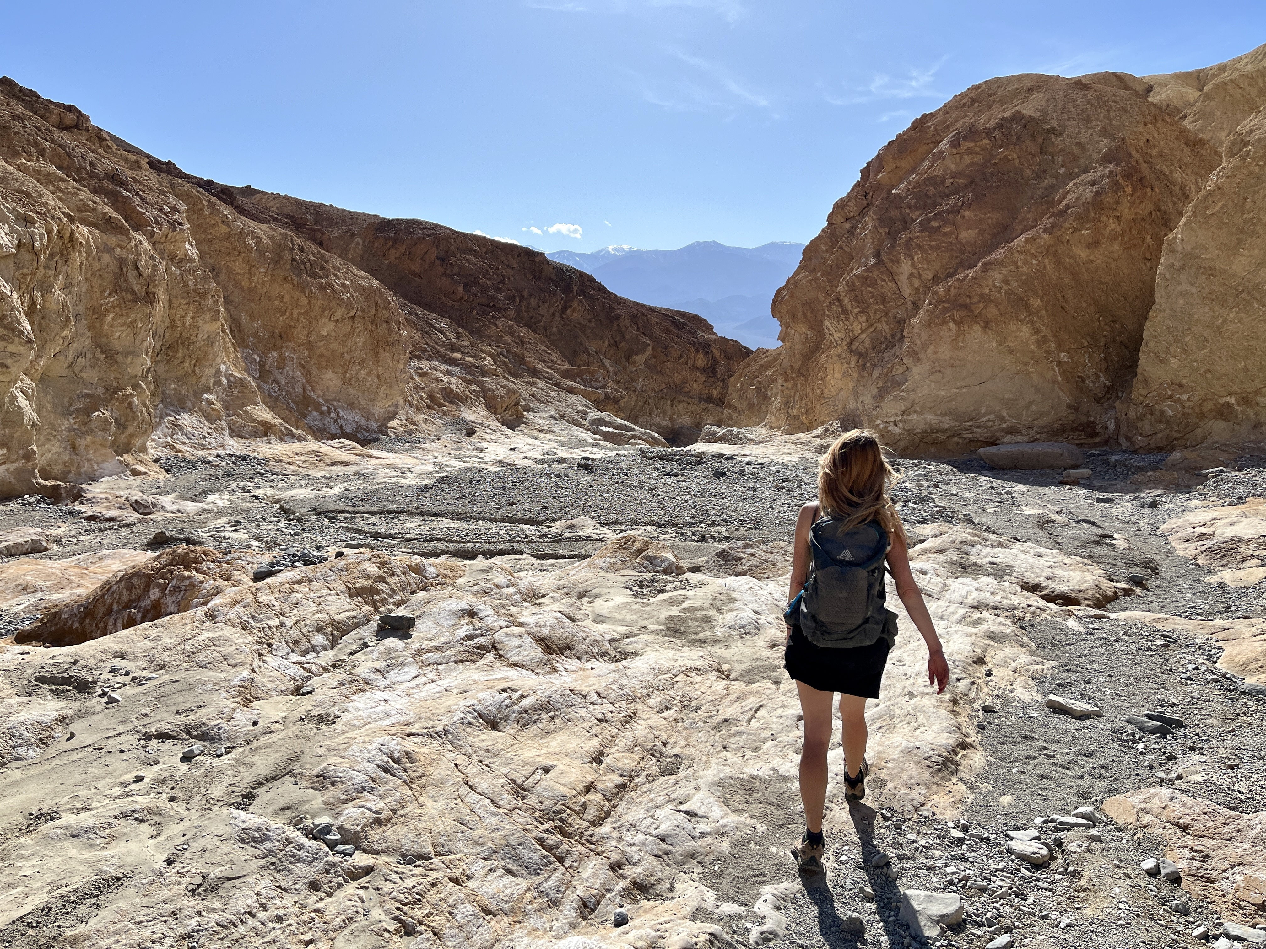
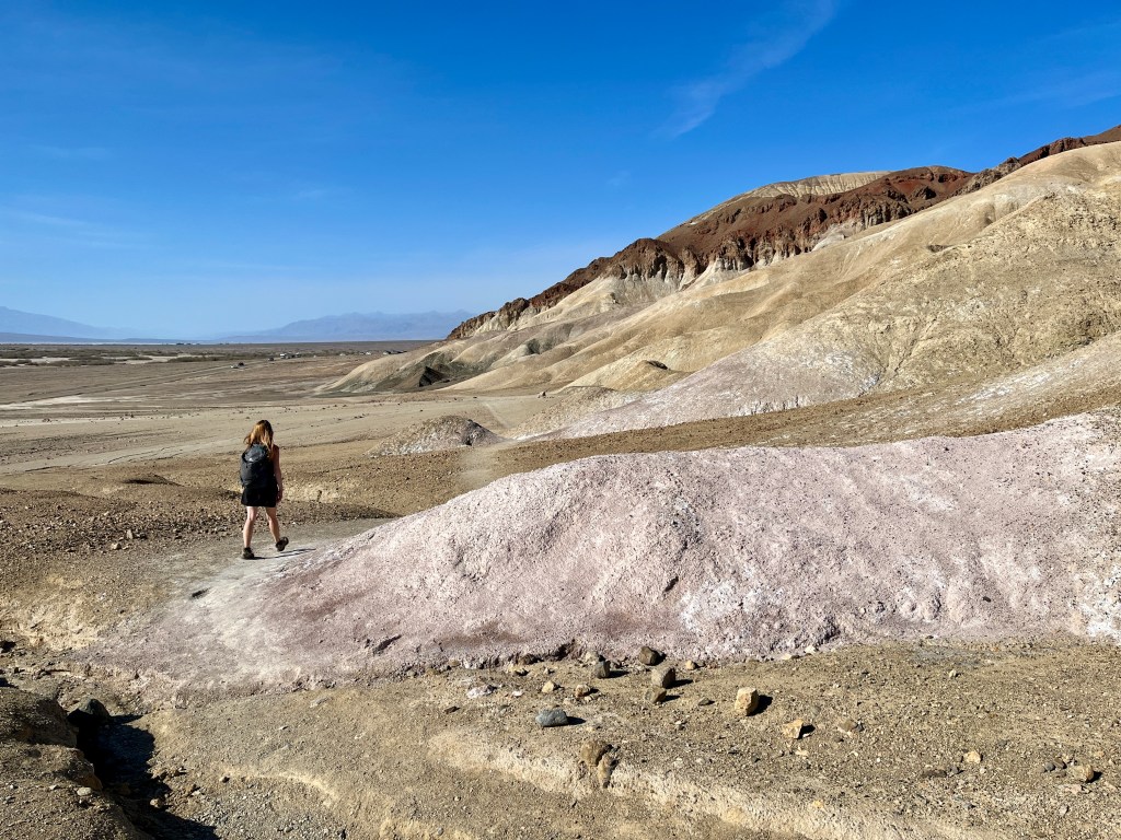
Gower Gulch itself is basically a large wash that stays a large wash for most of the mileage. So if walking through pea gravel is your thing, you are in luck. If not, well, too bad. Honestly this part was mostly hot and boring. But we did sneak off into an offshoot that was probably the highlight of our hike.
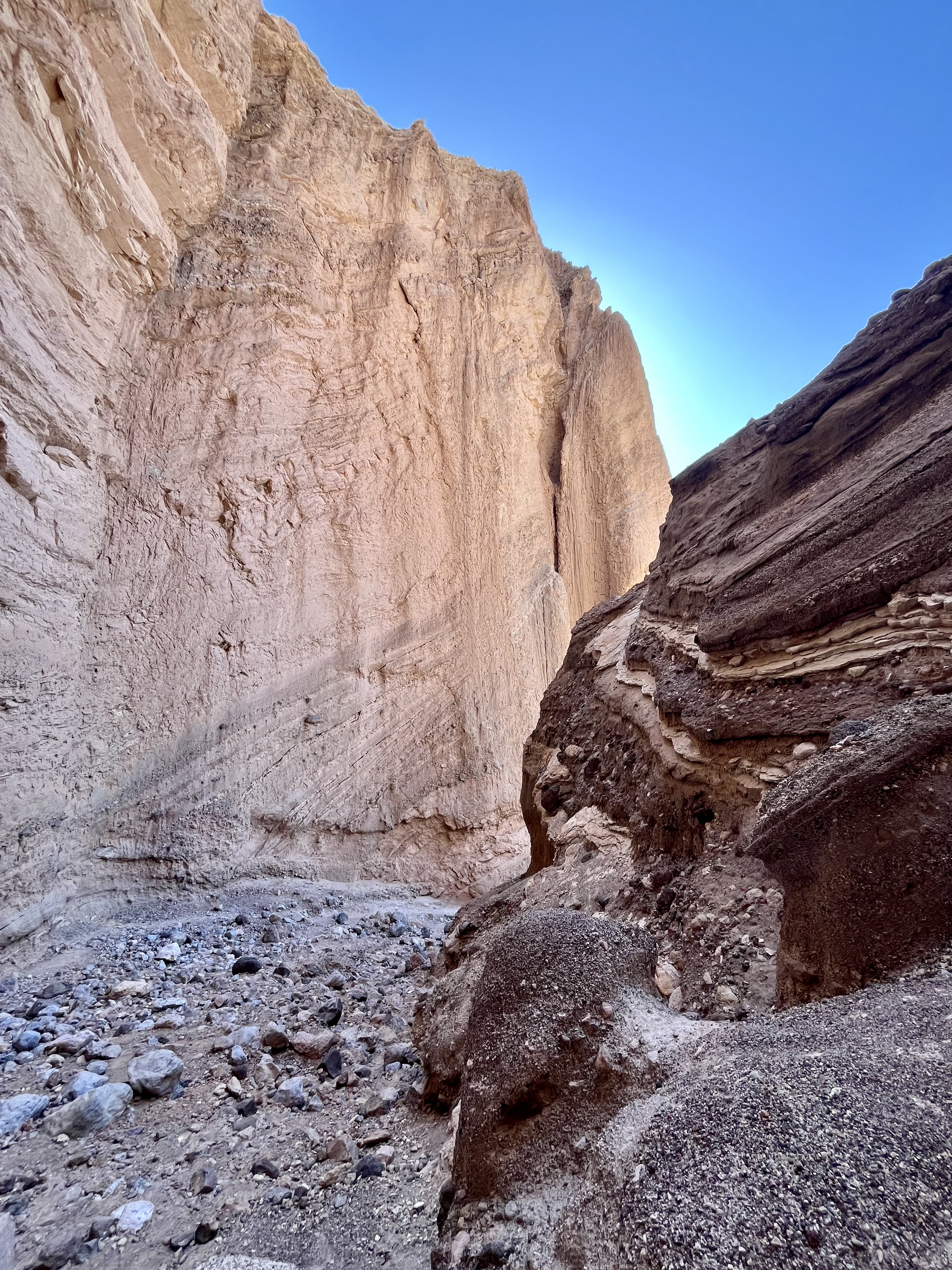
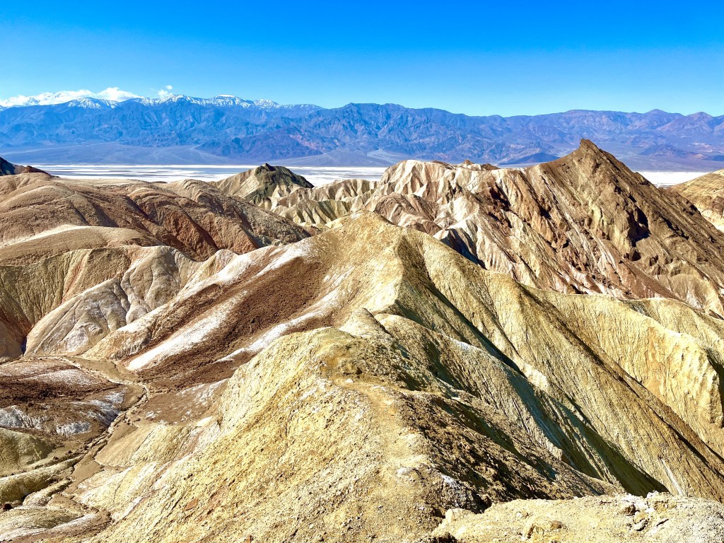
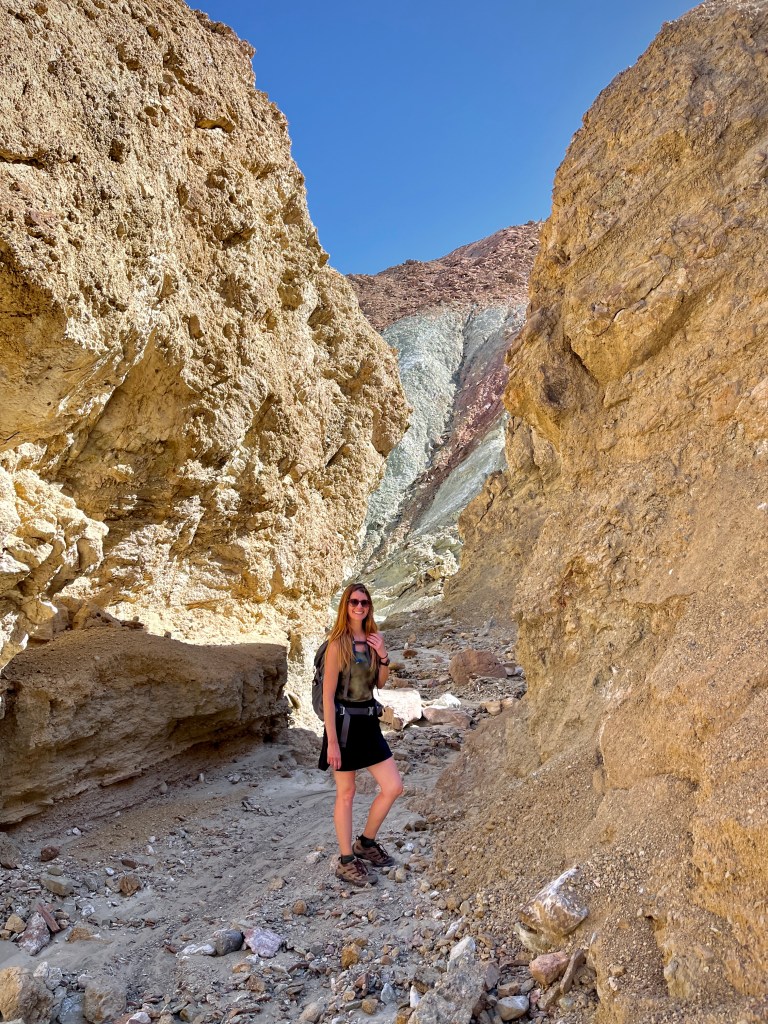
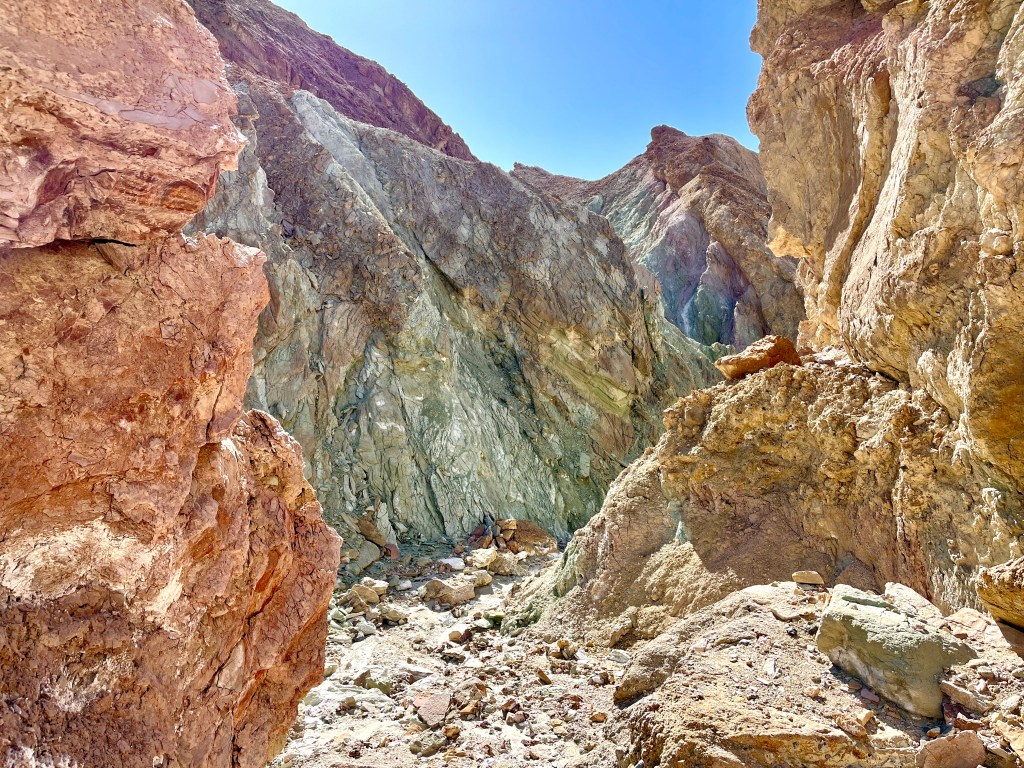
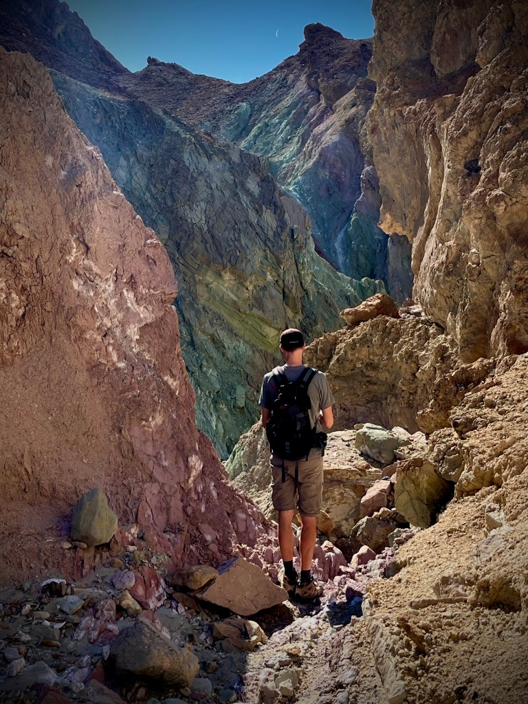
A few paces in and awe struck. Forget Artists Palette, this place was far better. The canyon walls came in shades of green, rose and gold. A feast for the eyes! We followed every twist and turn, eyes big as we took in the splendor. Some places take your breath away. This was one of them. At the end of the canyon we climbed up a rocky slope to the top where Zabriskie Point loomed in the distance.
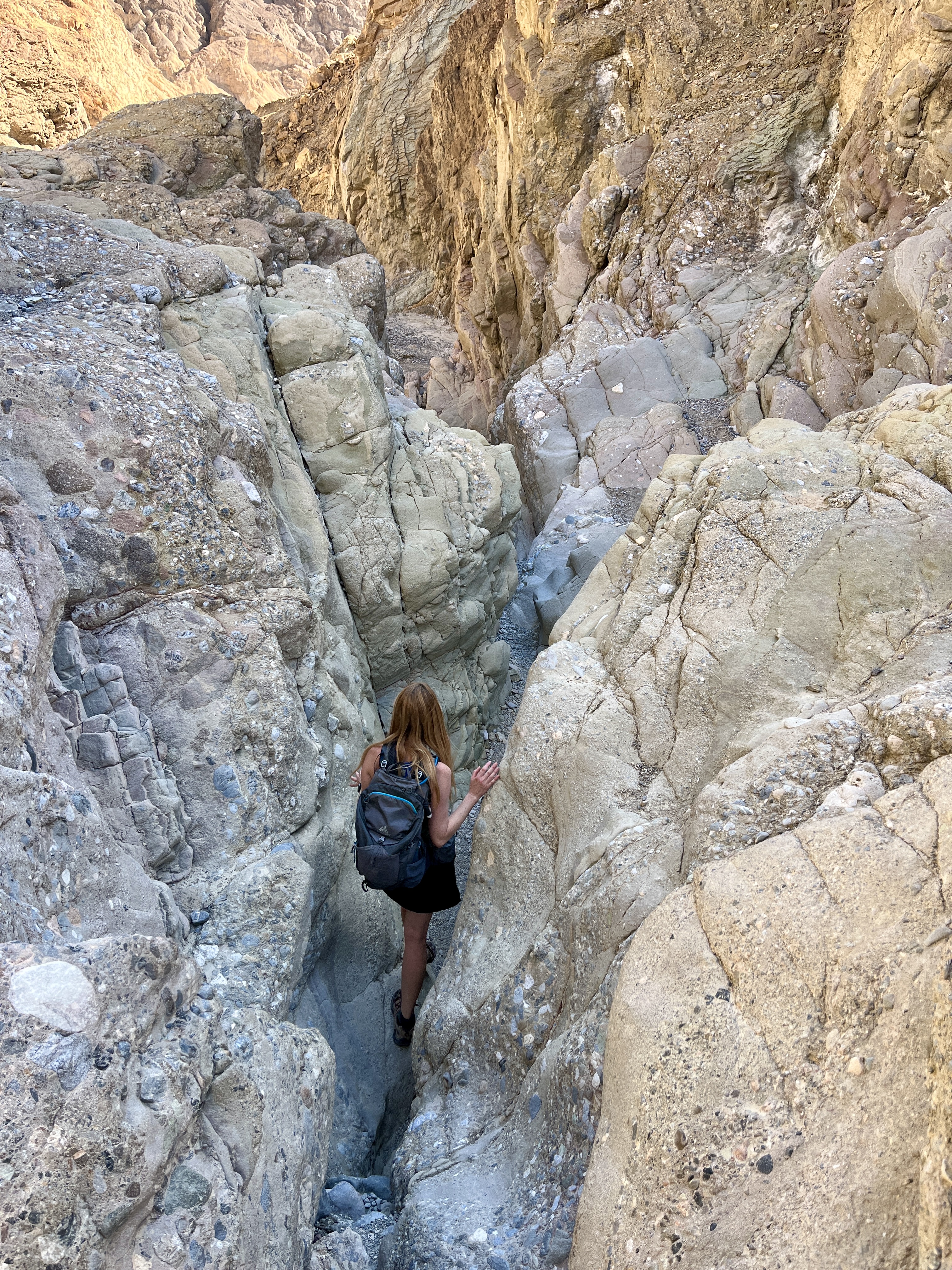
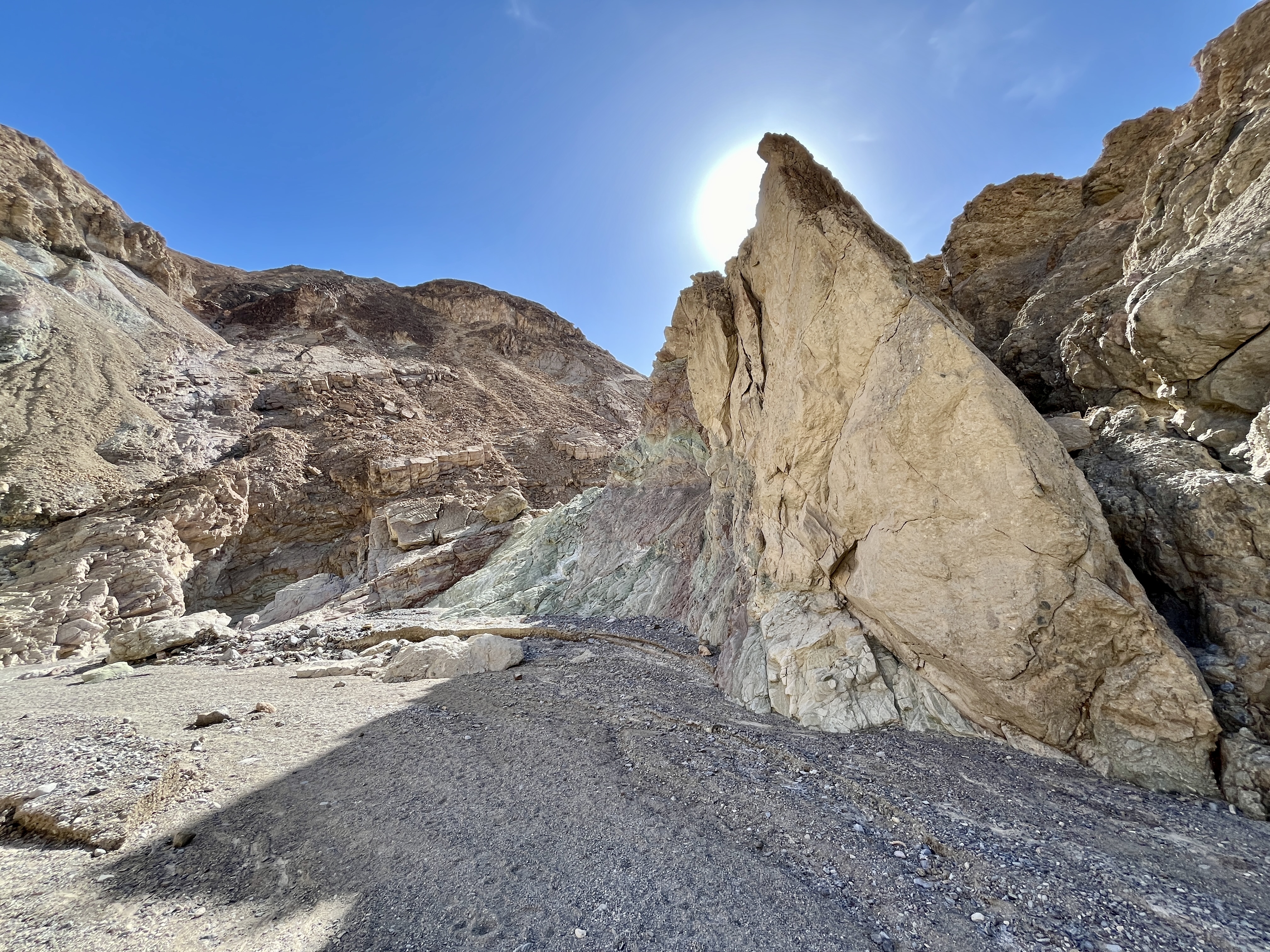
Returning to Gower gulch, we slogged on through the gravel, generally sticking to the shade along the rock walls. Doug ran out of water. Seriously, that boy sucks down water like none other when we hike. After awhile the trail finally got interesting. The wide wash disappeared and the walls closed inward. One could imagine this is where a raging torrent of water gushed, complete with cascading waterfalls. As the passage is presently dry the “falls” were easily navigated on foot.

Gower gulch eventually spit us out about a half mile down from our starting point at Golden Canyon. This last bit has you paralleling the hillside and Badwater Road. It’s also not nearly as flat as it looks from the road. No significant hills but certainly not flat. Those with weary legs will certainly notice.
Both of us agree this was our favorite hike in the park. The sheer diversity of what you will see is impressive. Hiking through canyons, along the towering walls of Red Cathedral and Manly Beacon, views overlooking the winding canyons and into Badwater Basin. It gives an excellent taste of what Death Valley has to offer. We loved it, weary feet and all.

Leave a comment