WESTERN WASHINGTON
Summary
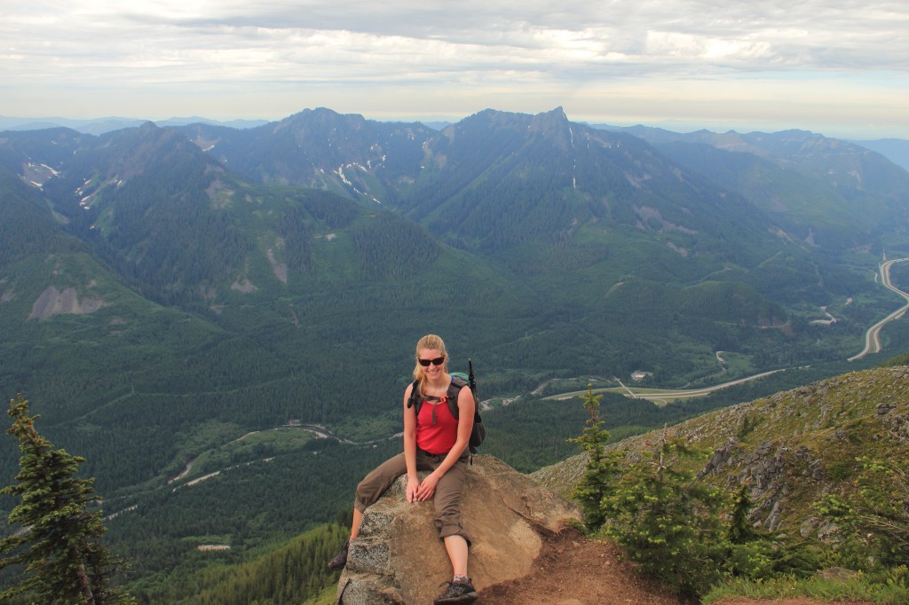
Bandera Mountain is a popular choice among Seattle area hikers, and for good reason. Along with easy access off the freeway, Bandera offers sweeping views, plenty of wildflowers and just enough difficulty to feel you earned a good snack.
Trail Stats
Mileage: 7 miles Round Trip
(to little Bandera)
Total Elevation Gain: 2,850 feet
Toilet at trailhead: Yes
Sandwich Spots: Yes
Parking: Designated Lot
Pass: NW Forest Pass
Mileage/EG from WTA.org

Trail Details
How early are you willing to wake up to hike? Really early? As in at the trailhead no later than 7am? Perfect if you have your heart set on Bandera.
The trailhead for Bandera is a relatively short distance off I-90. And you start off the Ira Springs Train, which essentially connects a lot of trails. In other words, there’s a LOT of competition for parking spaces. I’ve seen people parked along the road clear back to the freeway. Better to go on a weekday or if all you have is the weekend, go early. Super early if possible. And guaranteed, there will already be people on the trail no matter how early you arrive. People like to watch sunrise from the top.
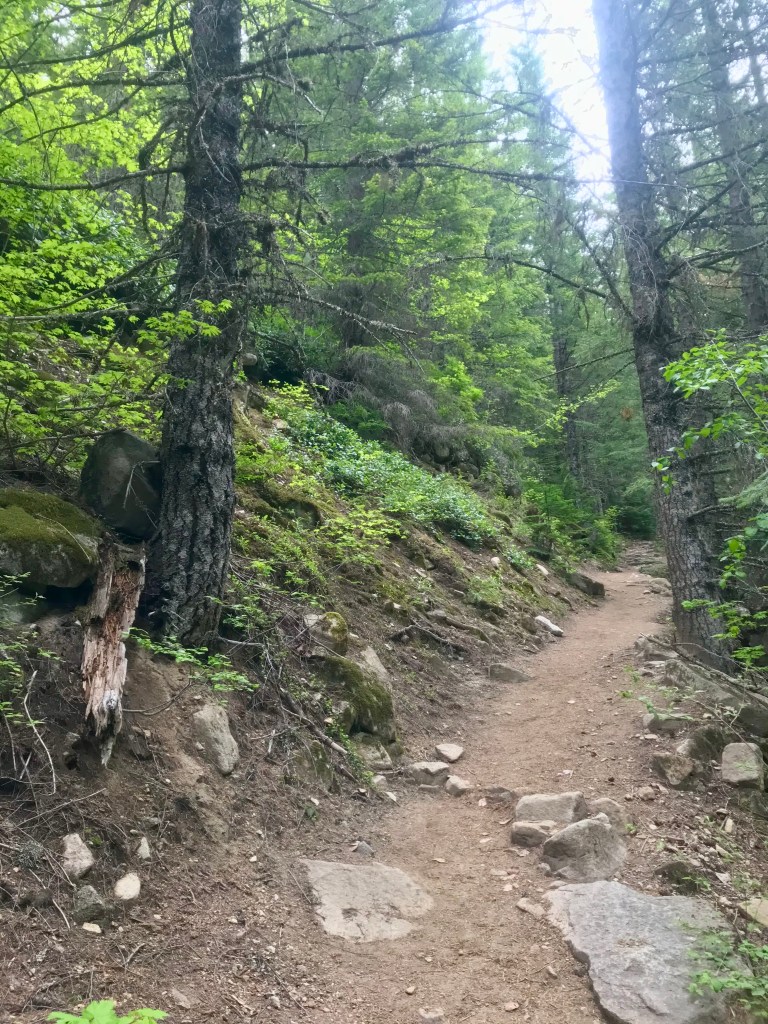
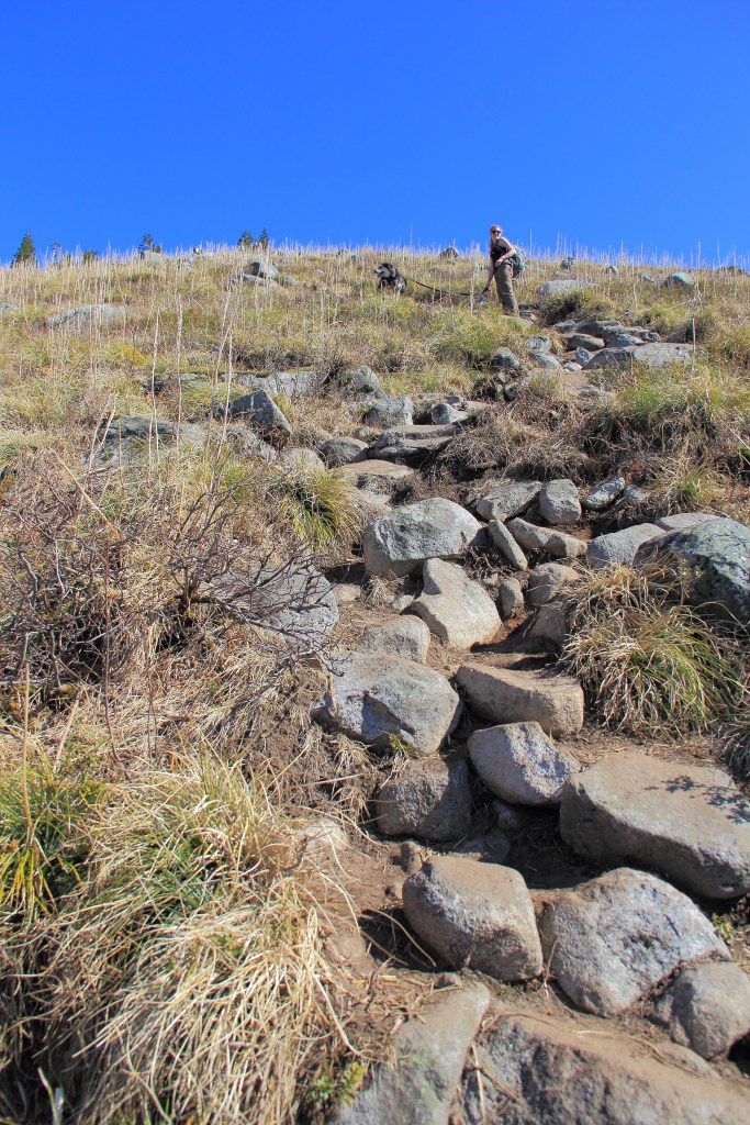
This is one of those sneaky trails. It starts off mellow. A gentle slope thru the trees along an old logging road. The trail leaves the road, turning into a single track (you really can’t miss it) and that’s where you’ll begin your ascent. And up you go.

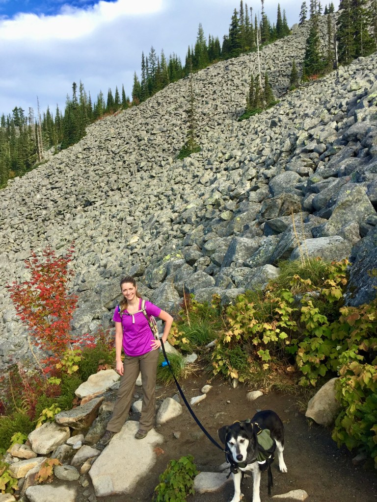
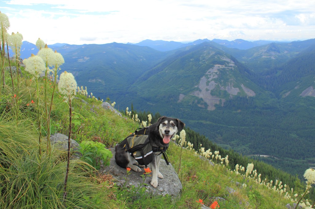
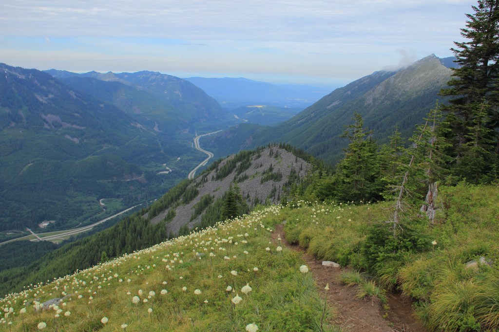
Eventually you’ll enter into rock fields where the view’s begin. If your timing is right, the entire hillside will have blooming bear grass. These are spectacular flowers and when you’re walking through hundreds of them it’s just a bit magical and breathtakingly beautiful.
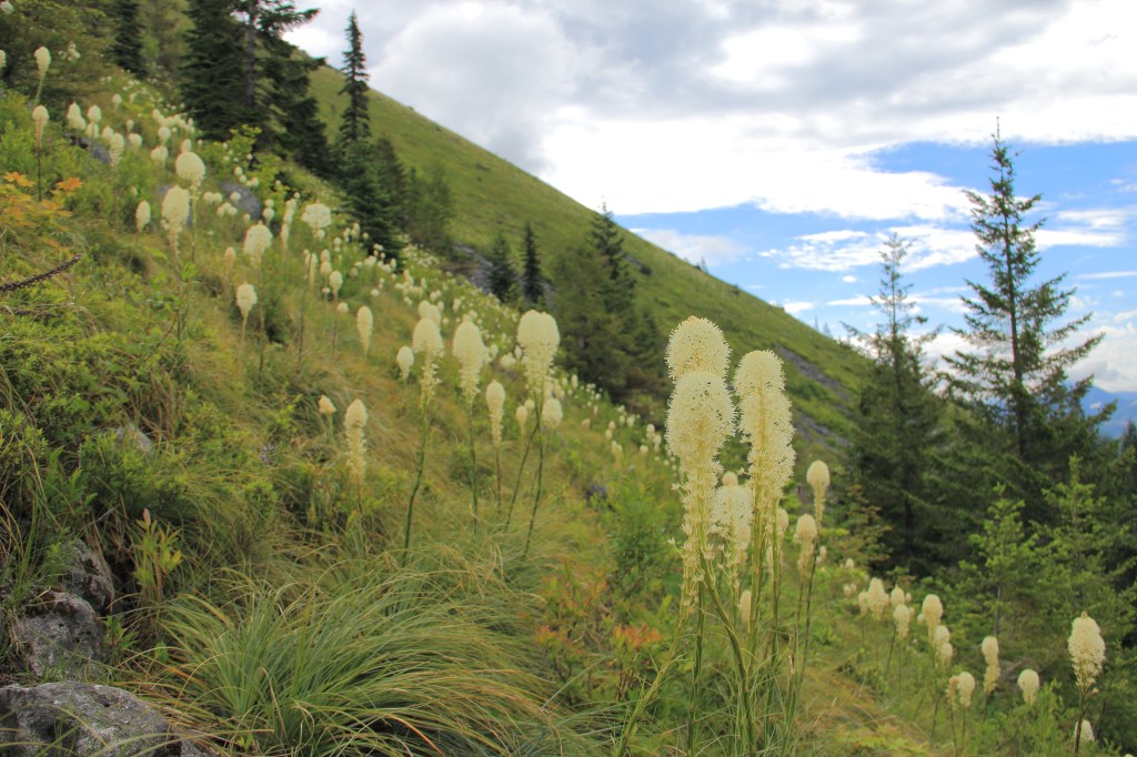
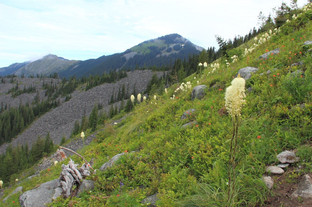
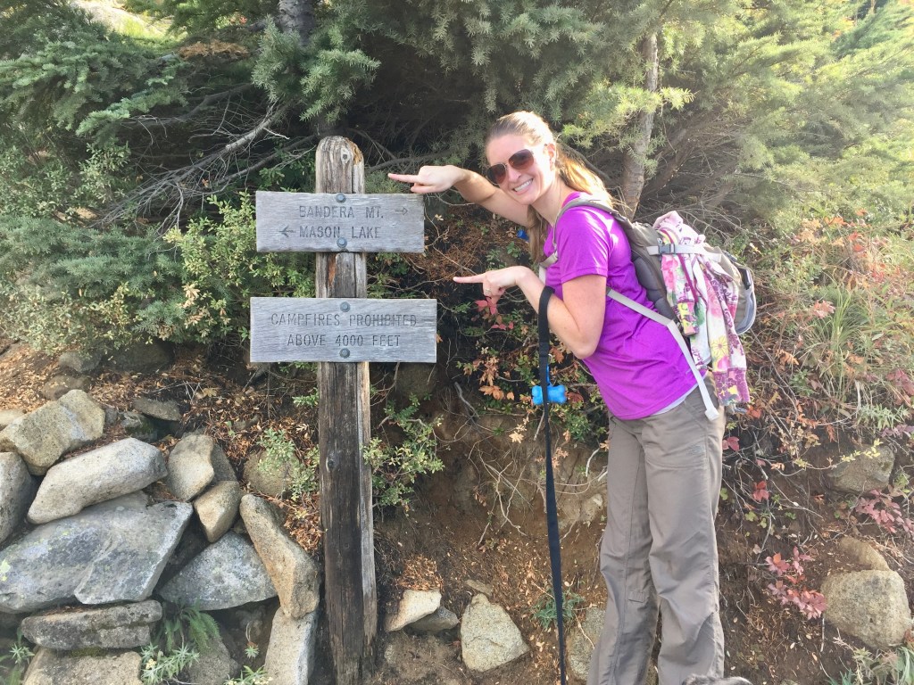
When you’re near the top, the trail once again splits. Left takes you to Mason Lake and beyond (remember a bunch of trails are linked together out here). But you’ll want to head up. So do not go left. From here on is the worst part of the trail. Sometimes it feels more like crawling up a rocky hillside and it certainly feels like you’re getting all your elevation in one shot. It’s steep. But the views as you ascend continue to improve. It’s here you’ll be enveloped by wildflowers if you timed it right.
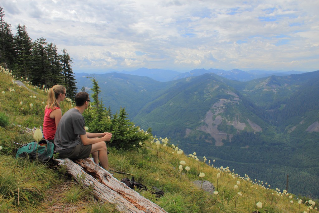
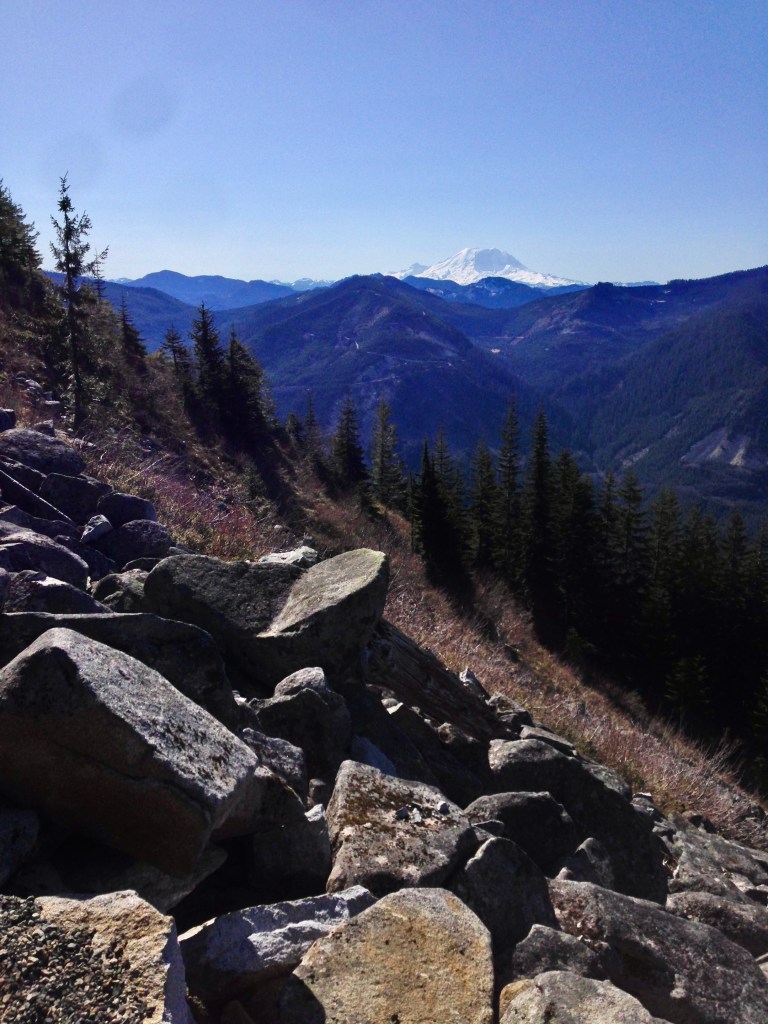
From the top (not actually the real summit but honestly, don’t bother with the real summit, it’s disappointing and you can’t really see anything from it) take in the stunning views of surrounding peaks and valleys. Rainier looms in the distance, visible on a clear day. There are plenty of rocks and logs to choose from when looking for the perfect sandwich spot. Sit for a while. Enjoy the view. If you’re lonely talk to someone. There’s always fellow hikers up there. And the top of a mountain is one of the best places to make a temporary best friend. Because everyone’s happy and this is the Pacific Northwest. We’re friendly, especially when out doing what we love. There will be lots of smiles and “hello’s” on the trail.
Bandera’s only marring feature is the I-90 corridor on full display below. And maybe the hoards of people that swarm up and down the trail, making it feel more like a highway than a hike. Again, the earlier you go the better on this one.
For specific trail details, visit my favorite hiking website, WTA.org


Leave a comment