EASTERN WASHINGTON
Summary
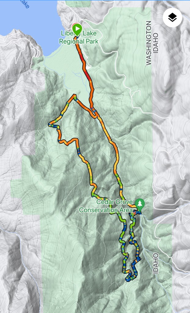
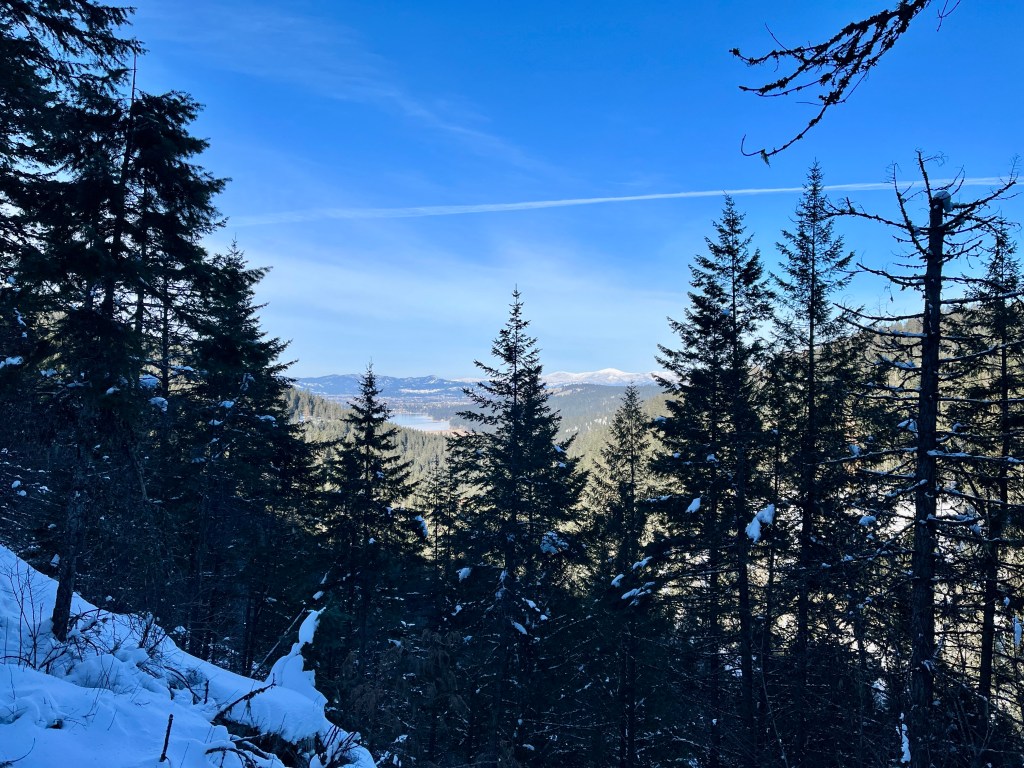
This loop style hike follows Liberty Creek into the surrounding hills. Its mostly forested trails offer occasional views of the surrounding mountains, peaks and Liberty Lake.
Trail Stats
Mileage: 8.9 miles Total
Total Elevation Gain: 1,348 feet
Toilet at trailhead: Yes
(at first parking lot)
Sandwich Spots: Yes
Parking: In Designated Lots
Mileage/EG from Garmin Watch
Trail Details
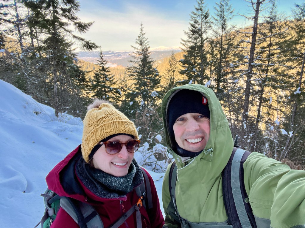
In desperate need to get outside, Doug and I chose to hike Liberty Lake Loop today. We have been cooped up inside due flat out cold weather. If it’s below zero I’m not interested. But I don’t like being stuck inside either. Always the dilemma.
Sadly, Lucille had to stay home. As it was a balmy 5 degrees when we started out, we thought it best she take a day off and do cat things at home. But Doug and I bundled up in thermals, fleece jackets, winter coats, beanies, rain pants (leftover from our Seattle days, but excellent for keeping out the wet and wind), snow boots, mittens, hand and toe warmers. Good grief. Gotta love winter in a cold climate.

The trail starts out at Liberty Lake Regional Park. We started in the first parking lot by the playground where we were the only vehicle in the lot today. Same park as if you’re going to Liberty Lake Waterfall, which I’ve mentioned previously. Except this time we get to keep going!
For the sake of not repeating myself I’ll be brief up until the waterfall. Follow the shoreline path past a campground, by a marsh and into the woods where you’ll follow Liberty Creek off and on for quite awhile. Around where the main trail splits (you can go either way for the loop) I realized my toes were frozen. As in they hurt frozen and walking is not warming them up despite having toe warmers on. Welp. On went a second pair. Nothing like a perfect toe sandwich with warmers on top and below! I even had on my crazy warm wool socks. You’d think those toes would be warm. They still felt cold half the time. To be fair my circulation in my feet and hands is abysmal at best thanks to having Raynauds. So be it and on we went toward the waterfall.
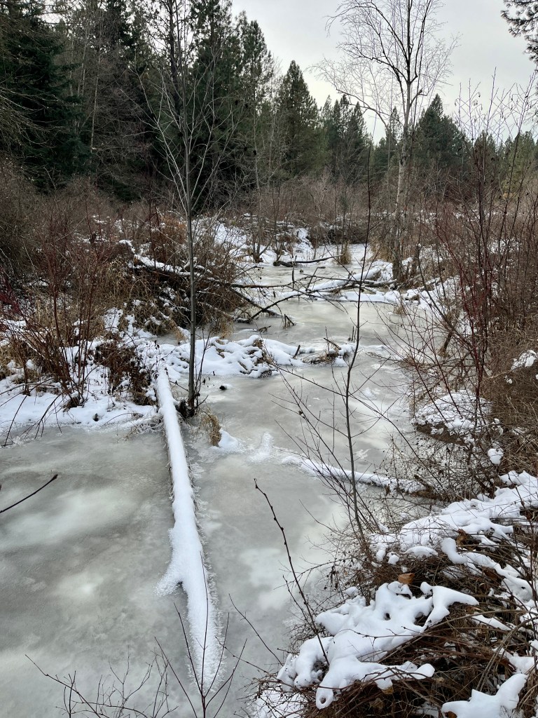
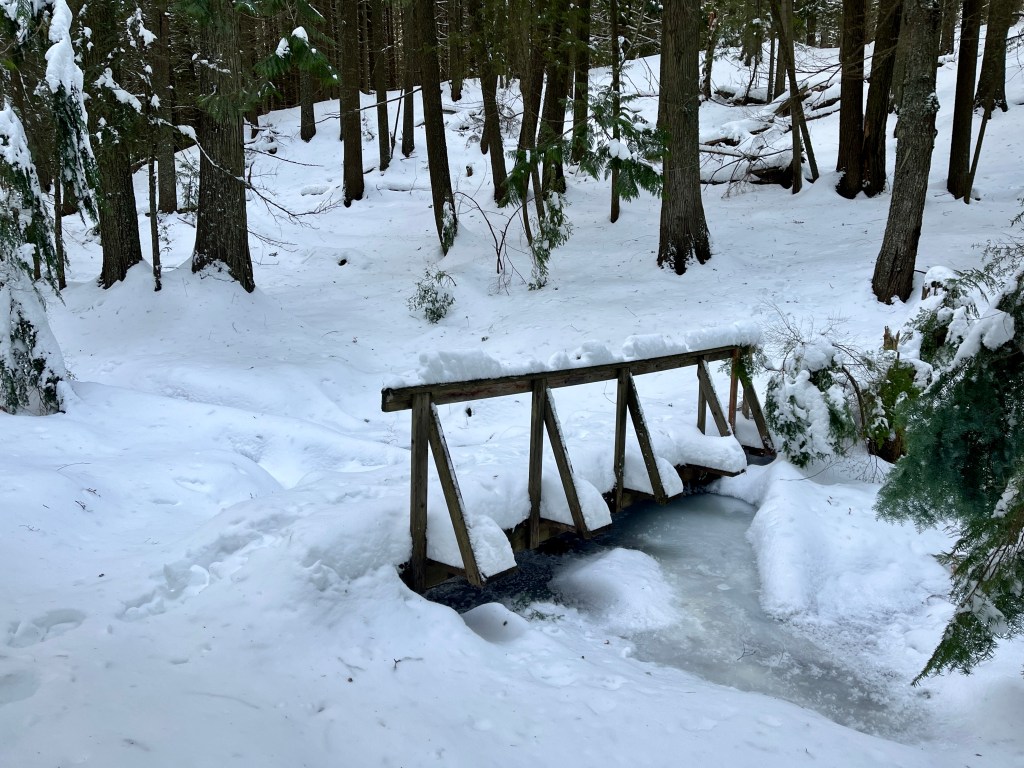
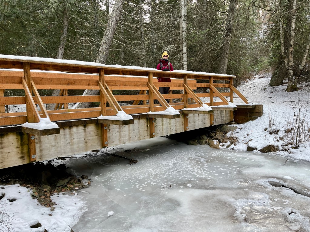
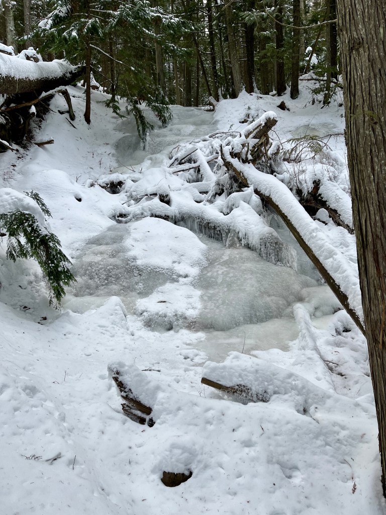
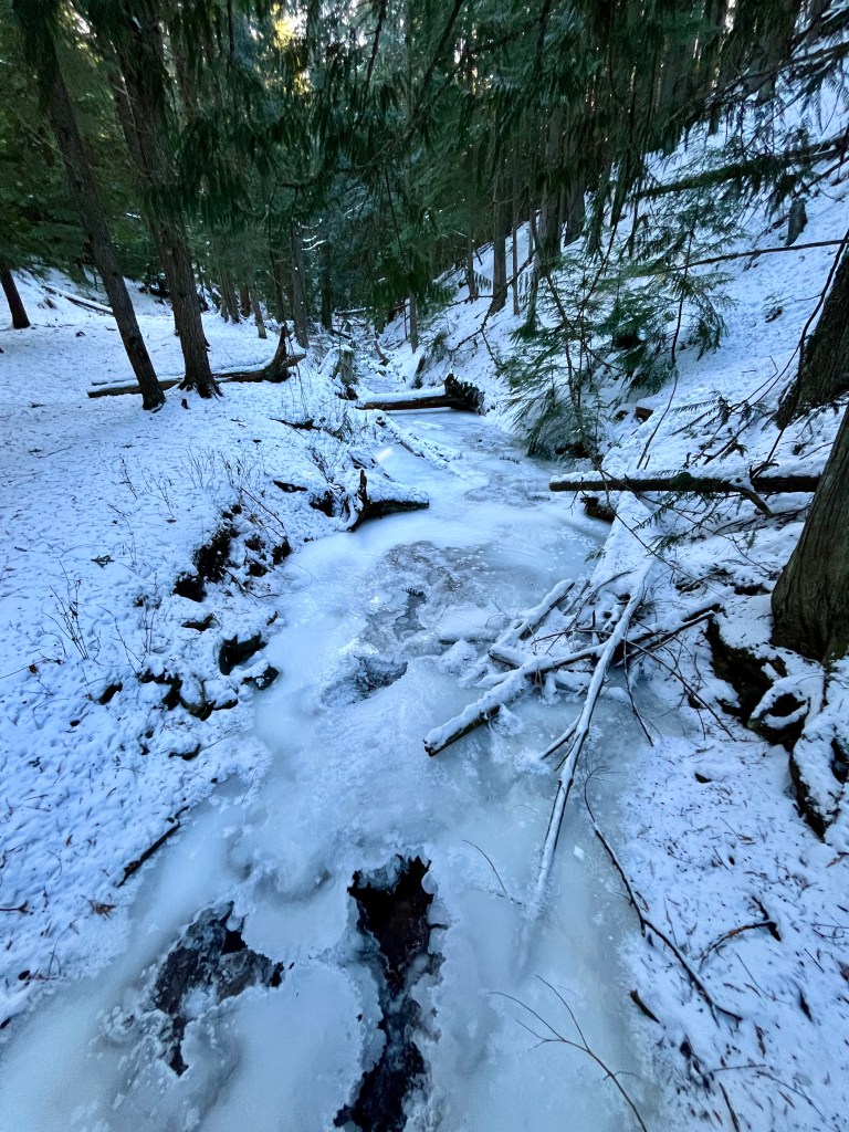
Up until we reached the Cedar Grove there was minimal snow on the trail. The creek was delightfully frozen. We could hear water rushing through and there were big chasms in the ice where you could see the water off and on.
The switchbacks after the grove were much more manageable today, being covered in crunchy snow we could easily walk right on up. Much better than the icy slip n slide winter normally provides.
Just before reaching the waterfall I slipped on my gaiters as the snow was just deep enough to reach the top of my boots. Let’s not add wet to the cold feet. The waterfall itself was more like an ice flow.
Just after the ice flow the trail turns to the right and once again we head uphill, mostly following the creek. The woods are peaceful up here. It’s amazing that we’re still so close to town and yet I feel so far removed from it all when I’m out here. Not too many people head up this way in winter as evidenced by us following a single set of footprints in the snow. Nice not to have to post hole the entire way. Can’t say that my stride length matched whomever had previously climbed their way up but it was nice nonetheless.
At the junction in the trail we headed right. To the left there’s a sign that simply say’s “More Hiking”. From here on the trail is mostly on an old road. Off and on there was evidence of a large animal, which based on the droppings I believe was an Elk and not a Moose. Could be wrong. Whatever it was also liked the trail and made a mess of hoof prints all over. There were also about a million bunny tracks, though I never saw anything more than a few birds.


This section is fairly flat initially. There’s an offshoot to see the cabin if you like. Today we did not care to visit. I will note there are quite a few tree’s and branches down up there. Everything was simple enough to climb over or through.
The trail up (or down) from Mica Peak joins the loop and shortly afterward you’ll divert off the nice flat road and head down. Some of these sections are remarkably steep and both of us stopped to put on our ice cleats/yak tracks. Or as Doug called them, our strap on’s (maybe not the best name, which he fairly quickly realized). Albeit all this came after Doug nearly slid out and ate it on the ice.
Once down the hill, the trail turns right. You head back along the creek for about a quarter mile prior to meeting back up with the original trail in. From there it’s back along the Marsh, thru the park and to the car. Followed by peeling off backpacks and turning on heated seats to thaw out.
We only saw one other person on our trek today, a fat tire biker when we were already back down by the marsh. There were maybe 6 cars in the parking lot when we returned. It looked as if most people headed out to the lake. Always fun to have a trail to yourself!


Leave a comment