IDAHO PANHANDLE
Summary
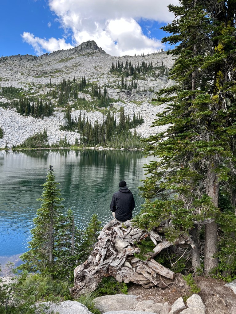
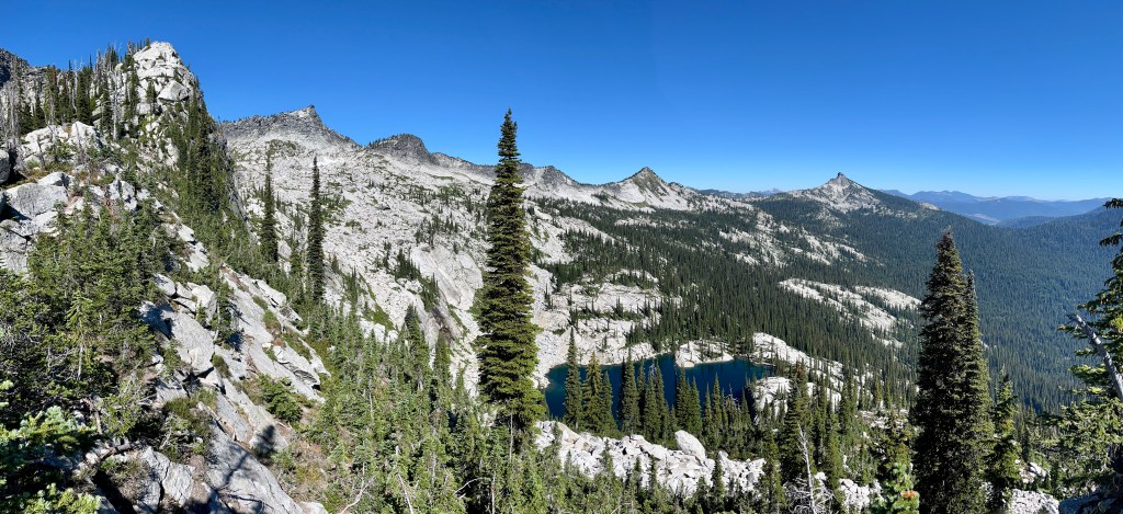
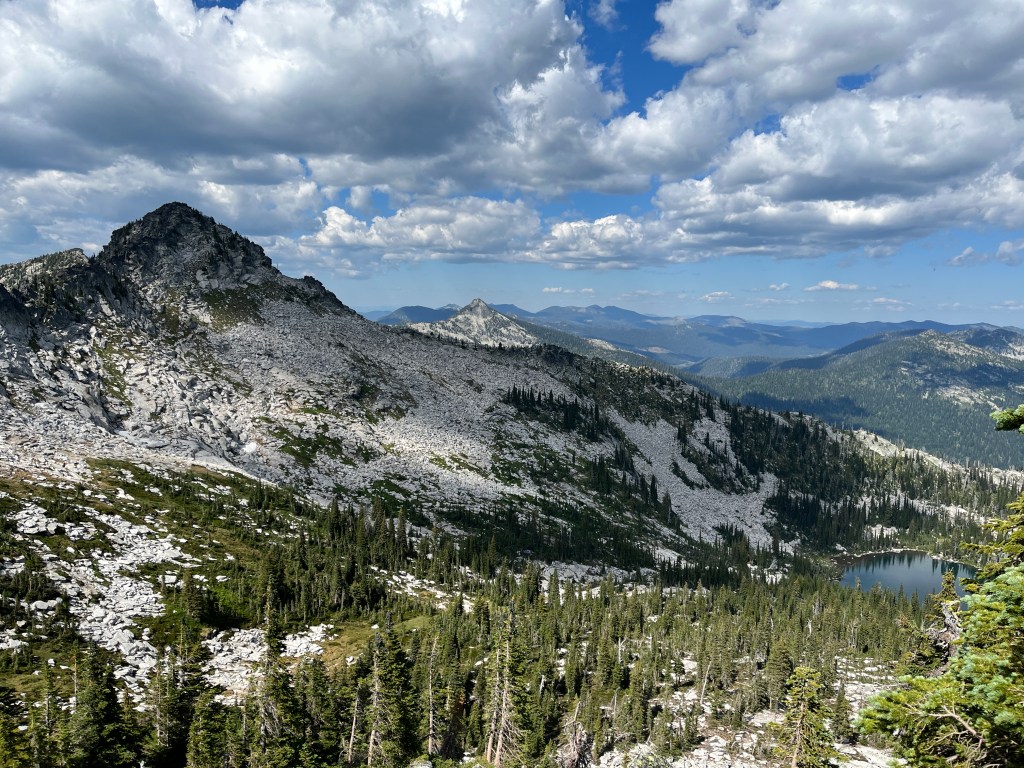
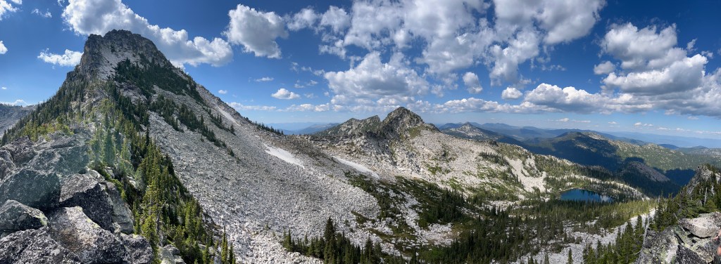
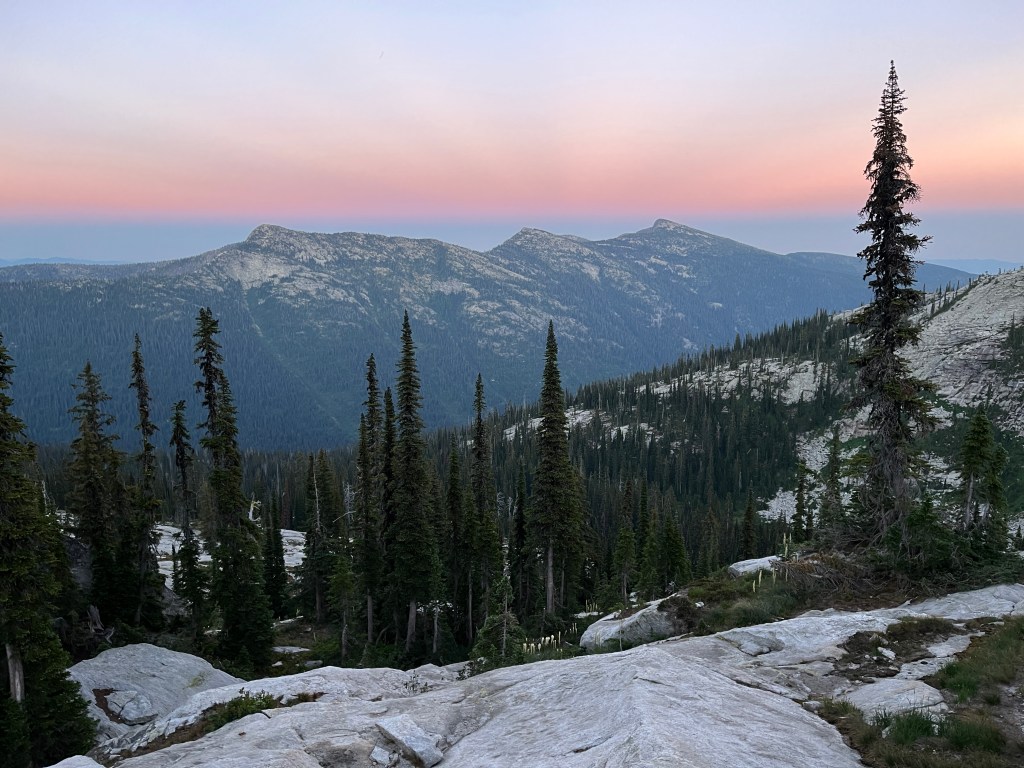
Nestled in the Selkirk Mountains of Northern Idaho, Beehive Lake is stunning. This gorgeous lake is picture perfect in a bowl of granite with views of the surrounding mountains, including Harrison and Twin Peaks. Simply enjoy the lake or continue on to the crest following a loose trail for added enjoyment. The views along the top are phenomenal, this is one of my personal favorites.
Trail Stats
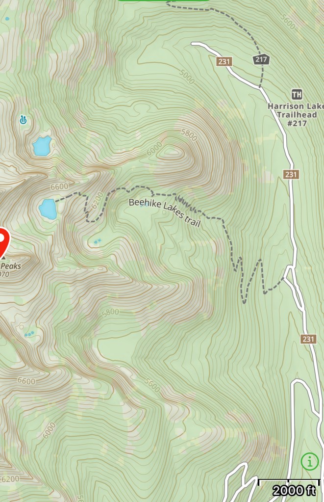
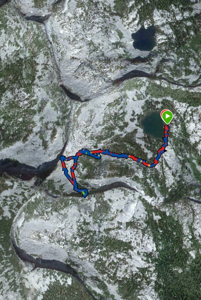
Mileage: about 3.41 miles one way (to the lake)
Total Elevation Gain: 3,878 feet (to the lake only)
Toilet at Trailhead: Just the trees
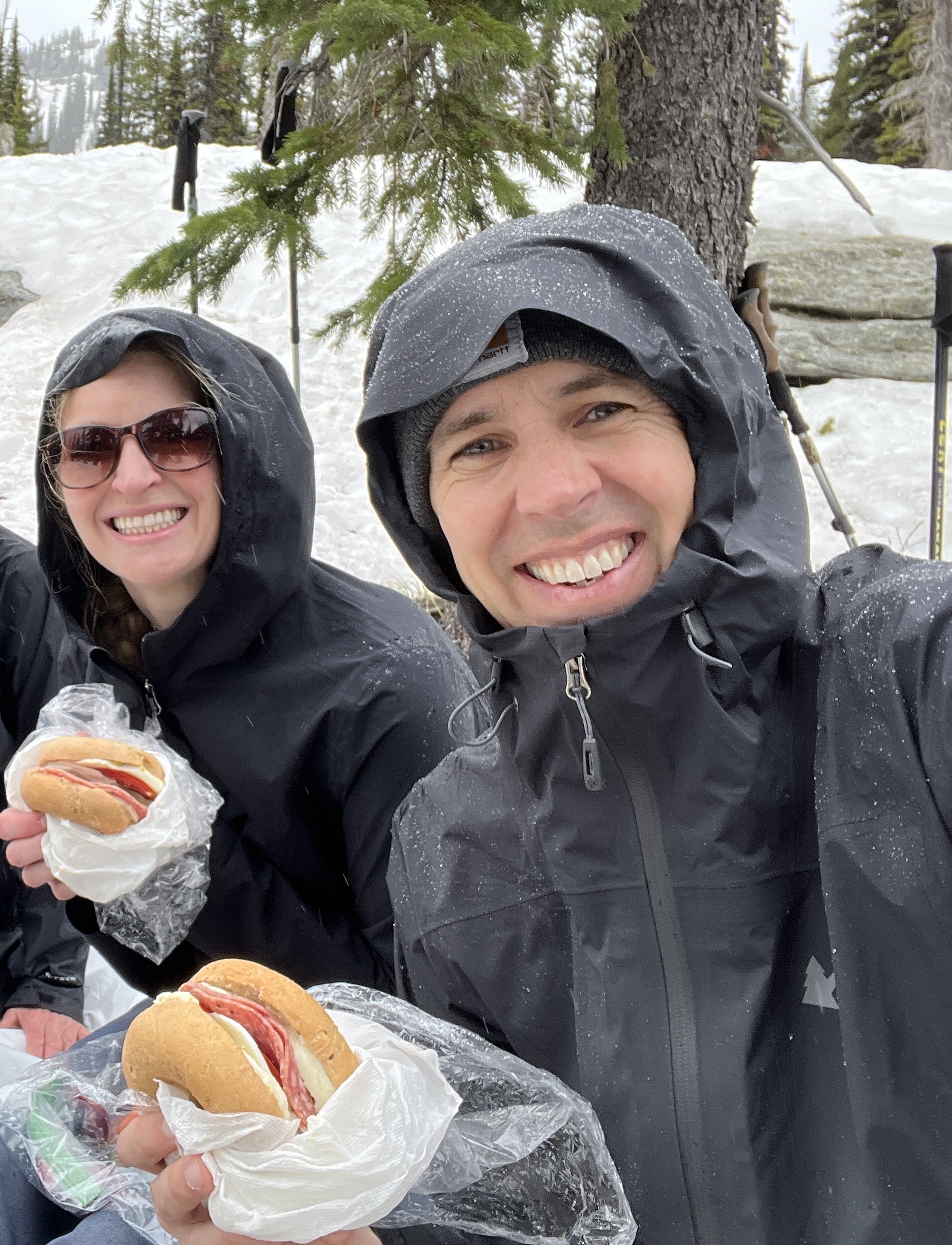
Sandwich spots: Absolutely!
Parking: Mainly along the road with a few pullouts
Miles/EG from Garmin watch
Trail Details
After driving about 19 miles off the highway you’ll arrive at Beehive Lake Trailhead. Well worth the often bumpy and dust ridden drive. Just make sure you brought everything you need, it’s a long drive back into town. As always, secure your keys. We’ve found keys up at the top and I would be willing to bet someone had a bad day once they returned to their car. Cell service can be spotty. And again, it’s 19 miles to the highway. Just saying. You’ve been reminded.
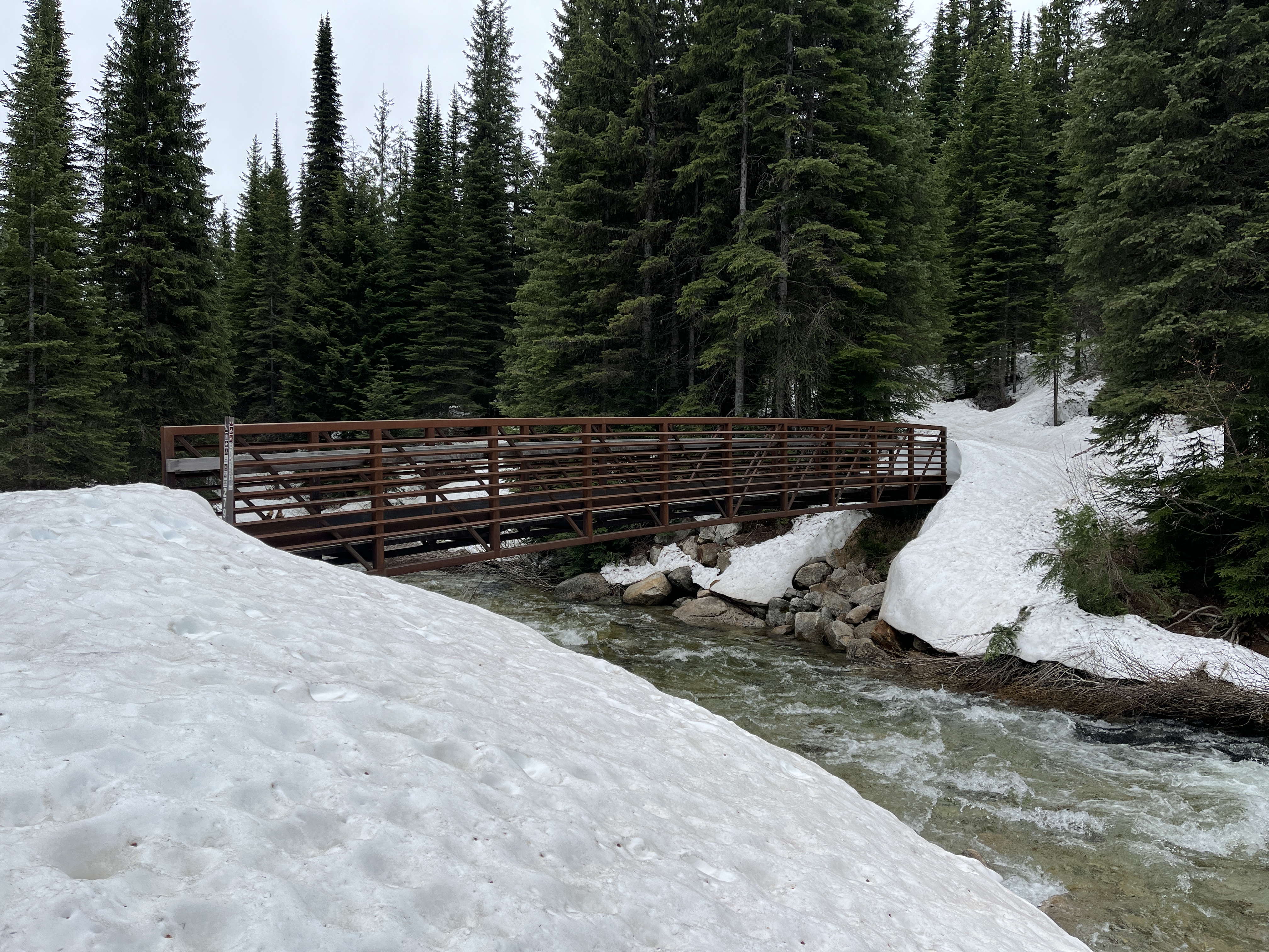
The trail pretty much immediately takes you across the Pack River, which really looks more like an oversized creek at this site. There’s a bridge so no need to ford the “river,” though it’s refreshing to soak your feet in when you return to the car.
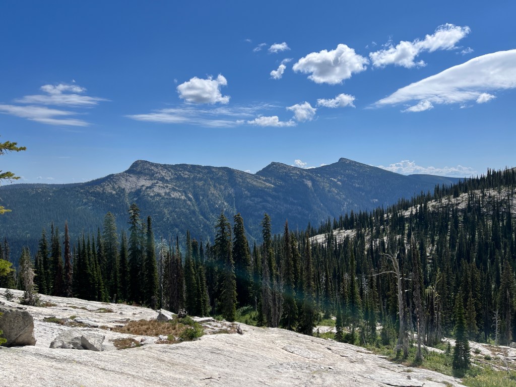
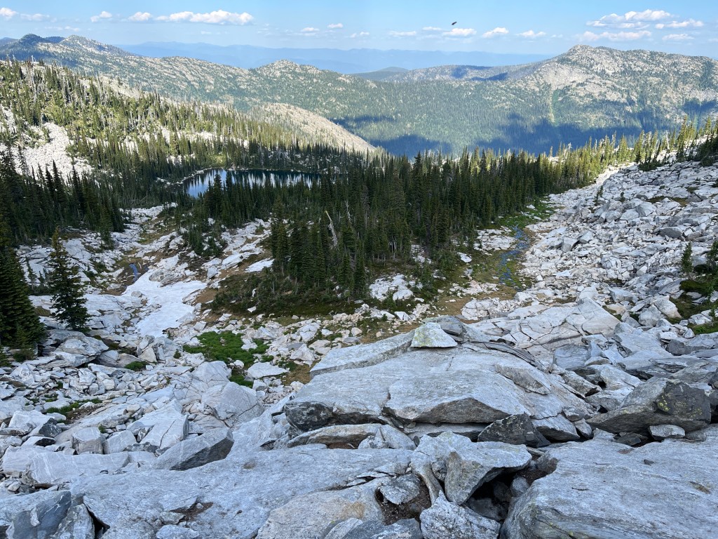
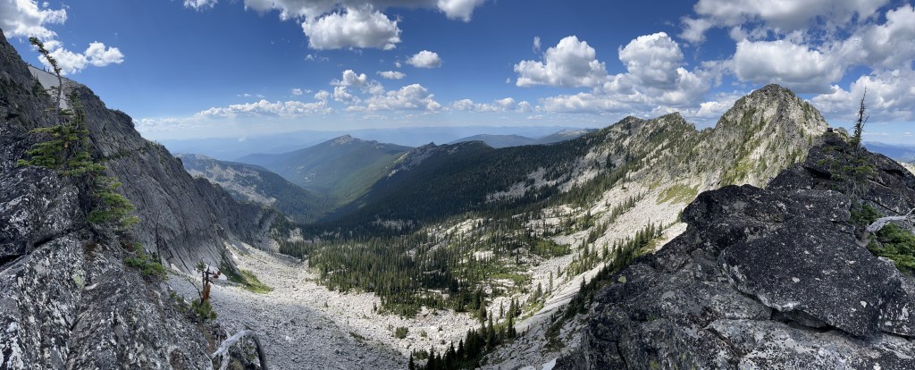
The trail is fairly wide and very easy to follow most of the way up. Views include the surrounding mountains and are quite lovely. The higher you get the better the views. It’s mostly thru the tree’s and consequently there’s plenty of shade. There are switchbacks. Nothing horrific.
Once you get closer to the top there is one section that has the potential to be tricky. You’ll climb up and through a granite face/slope following many haphazard and often not particularly helpful rock cairns. Going up is not bad. Coming back down I loose the trail. EVERY. SINGLE. TIME. But alas, if you paid any attention at all to where you were going on the way up, there’s really only one way down. But it’s still annoying that I manage to follow the wrong cairns down each time. Quit building those already!
From there, simply continue to the lake. You can’t miss it. Along the lake rest plenty of overnight spots if you wish to backpack. There’s technically a food locker but when I was there, in 2022, it looked like a grizzly or moose had battled the locker and won the fight. We hung our bags in a tree instead for the night. Grizzlies are known to frequent this area and have ripped through a tent or two. Luckily never mine, but we follow general precautions as a rule of thumb.
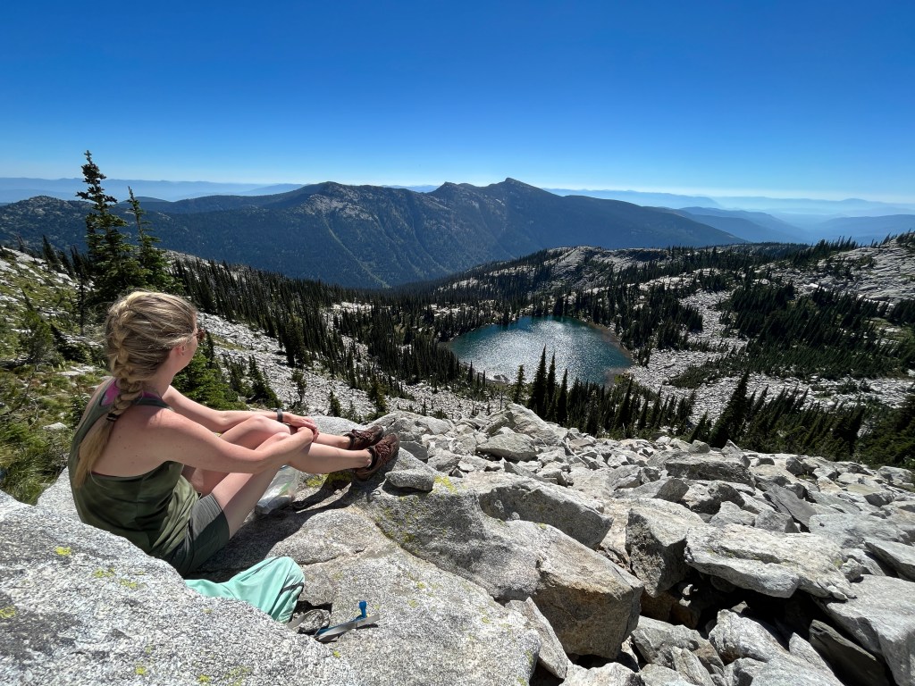
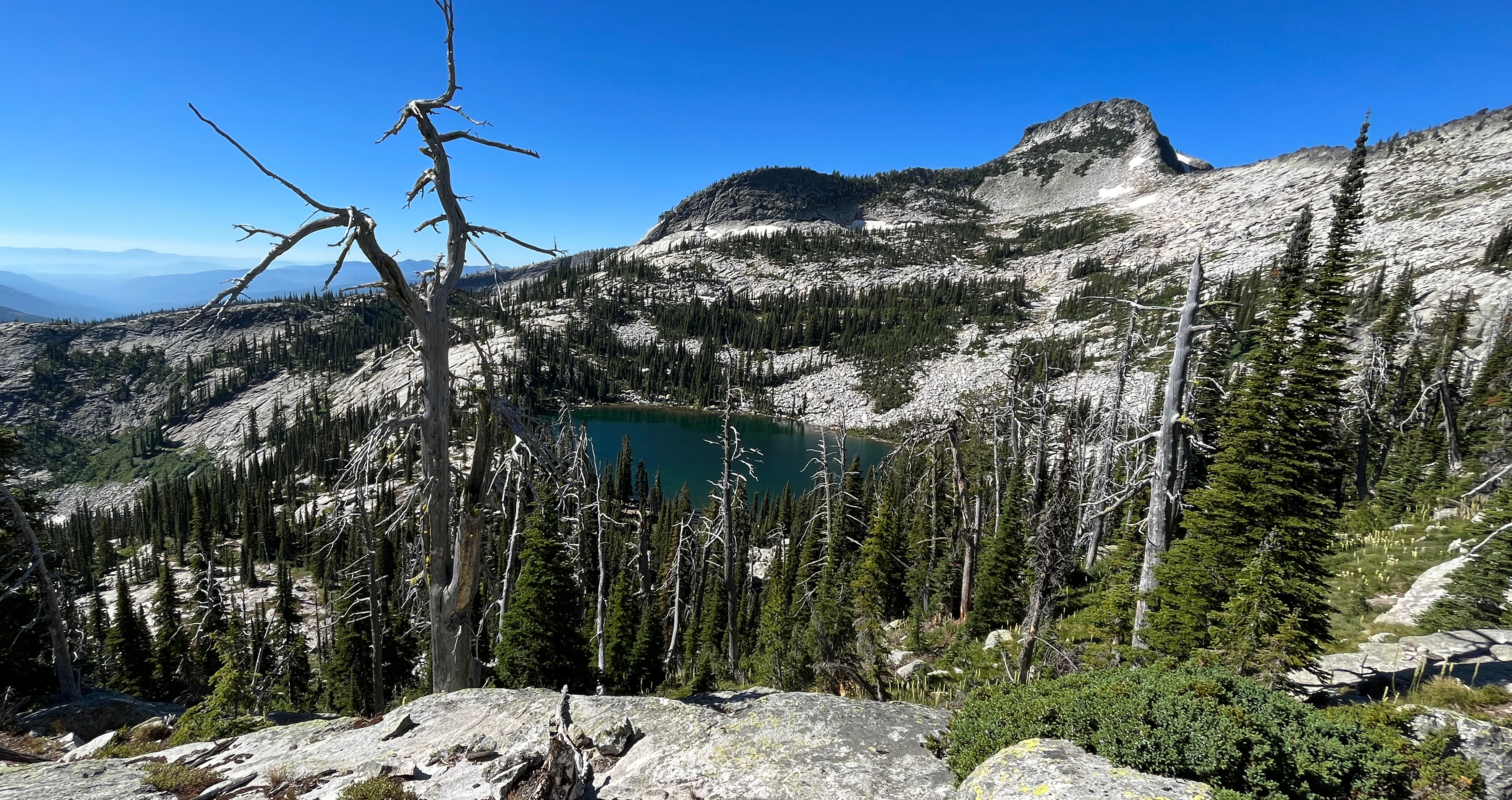
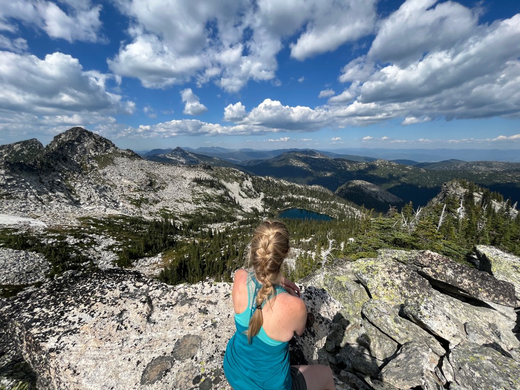
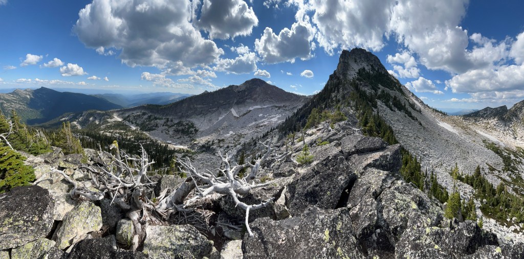
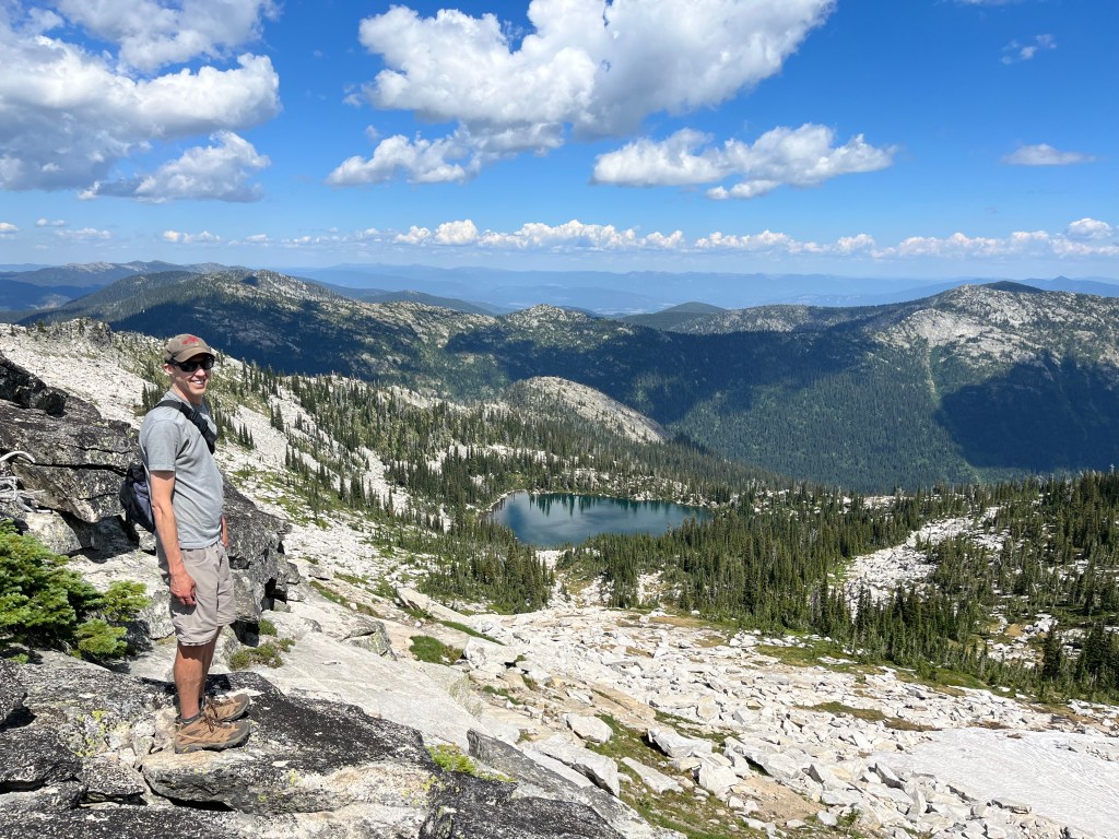
Once at the lake you can continue on if you like. To the right you can follow a quasi trail up along the ridge. People do. I have seen them often. However, if like me, you don’t appreciate heights and narrow ledges with death drops off the side it may not be best for you to go all the way up and around the rim. However, I do suggest going as high as you are comfortable. There gets to be a pretty obvious point where you’ll have to start climbing big boulders and the such. Before that, there’s a lovely view over the ridge to the other lake. Quite pretty, and a steep looking unofficial trail down to it that I have never done if you like. I always run out of time.
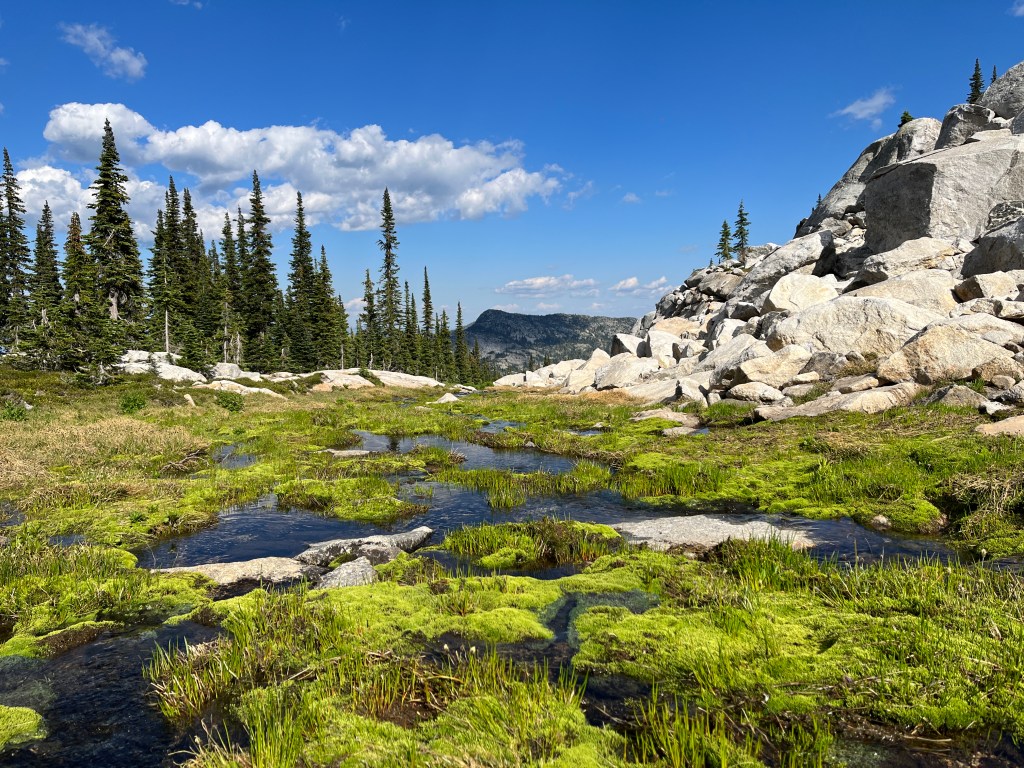
Back at the lake, you can choose to head up and around to the left. This is my favorite route as it’s quite scenic. You’ll mosey up and around and up into a little green space that has a bubbling creek running thru.
Again, no official trail but a fairly clear path to follow. You just go up. You’ll get to cross over big boulders and the like. (This is where we found those unfortunate keys).

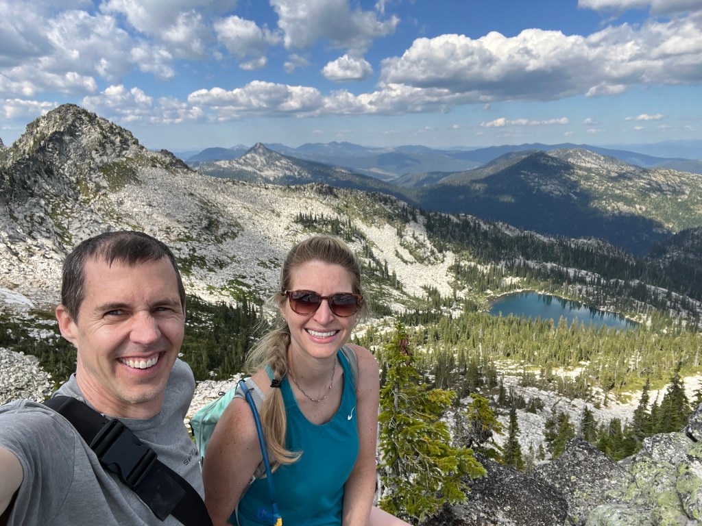
Eventually, you’ll sit atop the spine. Views in all directions. There are many spots to just sit and soak it all in. And have a snack. Yum.
In 2022, Doug and I had the pleasure to take my baby sister and her other half on their first ever backpacking trip. I wanted it to be spectacular. Somewhere to draw them in. To share something that I love with the people I love. Beehive was our choice. Not to far in but still a good hike with respectable elevation. Gorgeous and peaceful setting. Not to many people. Options for something to do the next day or two. Beehive was perfect. I think we succeeded.
That second day, we did in fact go up to the left (I think, West-ish? I do left and right or landmarks. No north/south nonsense for me). There was still some snow along the way that Doug slid down on and played in. That boy loves snow. But what I really remember is the four of us just sitting on one of the ridges (we went to two) and taking it in. The magnificence of the area. That quiet peaceful feeling that settles over me, and only really happens when I’ve found such a spot. It was magical. And dang, did we have fun. And laugh. Especially when my sister’s feet slid out from under her and she abruptly sat in that soggy old snow. That was hilarious. I laughed as only a truly supportive and loving older sister can. What can I say?
The most unfortunate part of the trip was for my brother in law. Poor guy. I’m not sure I’ve ever seen that many mosquito bites on anyone and holy smokes did they welt up. Looked miserable. Normally the evil little blood suckers attack me. In the end I had maybe 25 bites (not bad for me) and he had more than I can count. Just on his head and shoulders. Yikes.
The other unfortunate part was the trash. I did find a whole mess of trash, even an old broken tent up there. We packed out as much as we could. Please people. Don’t ruin it. That’s so tacky. Pack out what you pack in.
Winter Months and into Spring Thaw
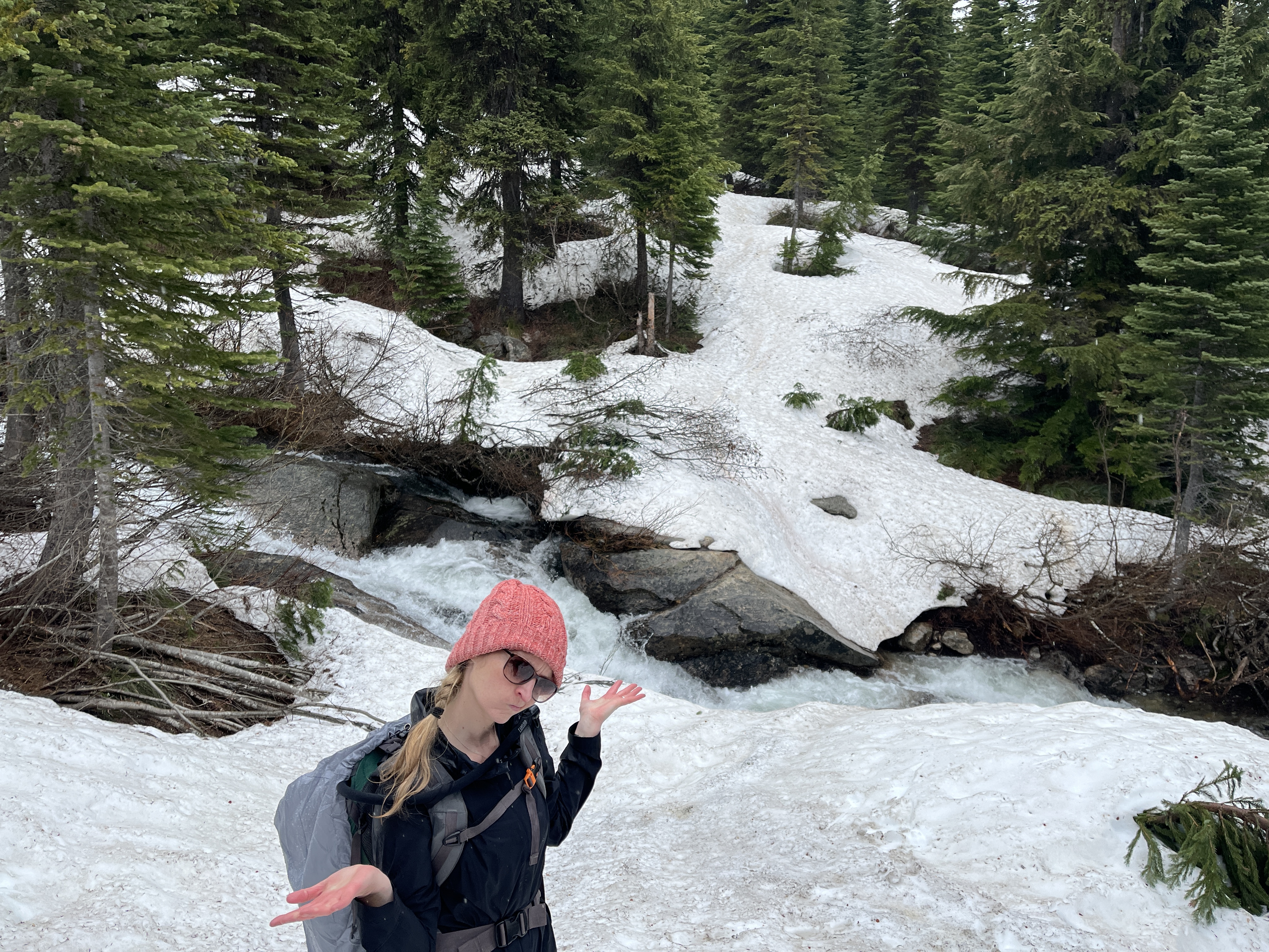
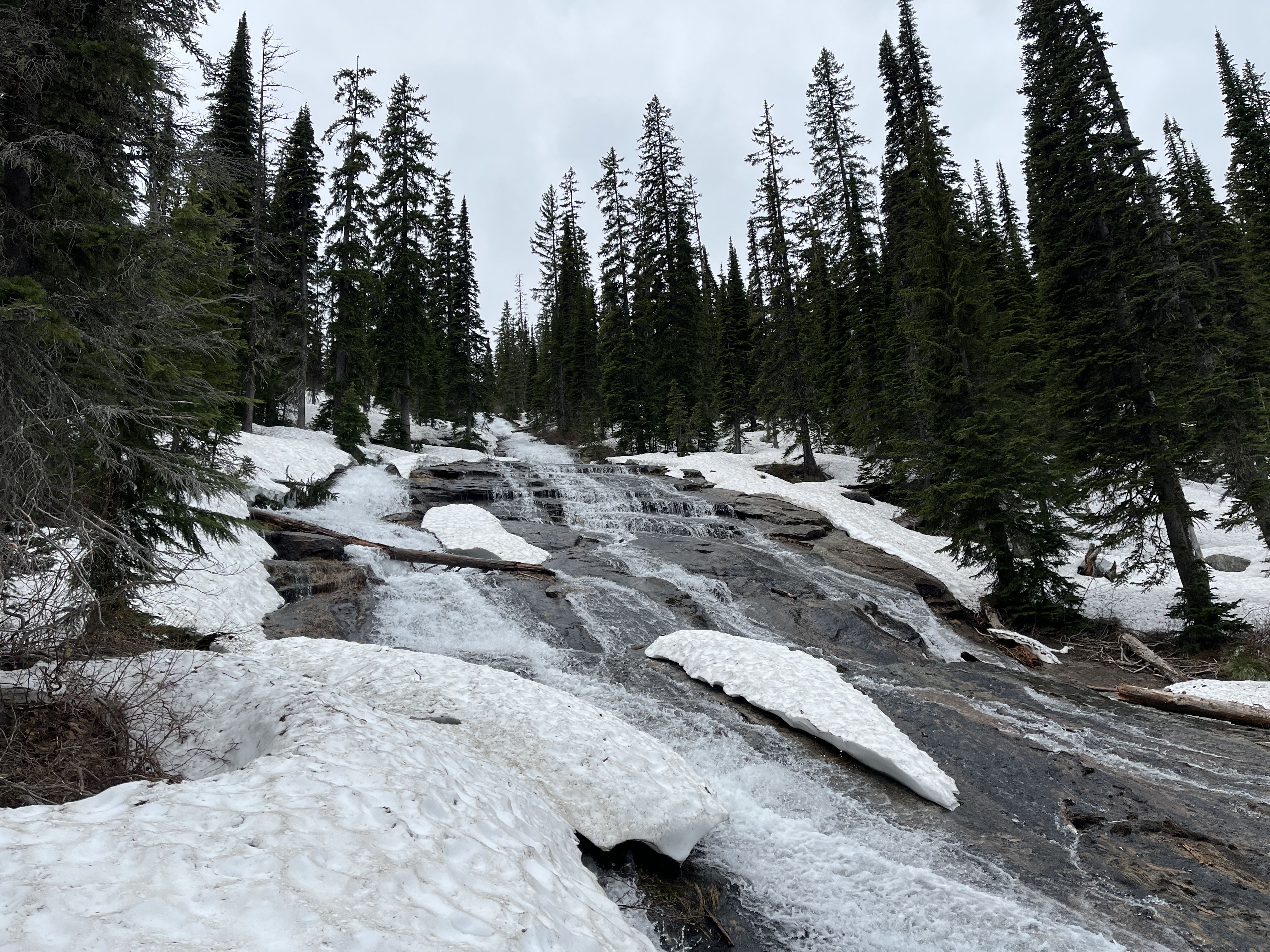
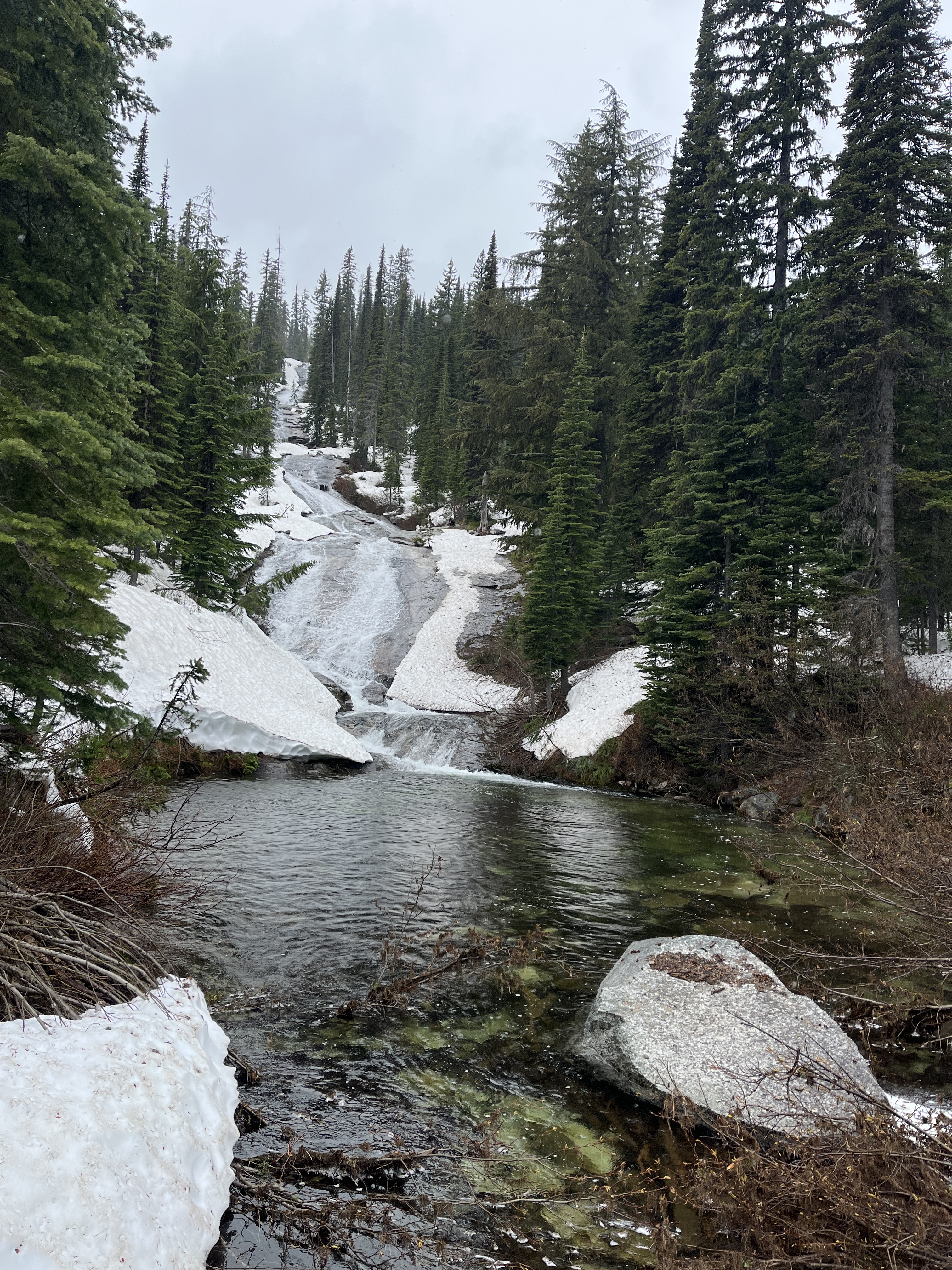
A few years ago we attempted to hike Beehive in the beginning of June. It had been a huge snowpack year. As a warning, we had to hike into the trailhead by about 2 miles as the road was not passable. From there we trekked up a little ways before going off trail due to an impassable water crossing that is simply not around in the summer. While it was beautiful, it was not what we had planned. We never made it to the top that day but did find a lovely cascading waterfall and a pool of ice cold water. Crossed a little snow bridge to get to some amazing views for a late lunch (where it promptly started raining on us) and at that point decided to head down as we were damp and did not care to slog thru the snow any further.
Overall, Beehive is truly a gem and is well worth both the drive and the effort. (Ha! See what I did there? Idaho is the gem state… Never mind. At least I amuse myself.)


Leave a comment